- Annapurna Circuit: Part 1, Trekking 101
- Annapurna Circuit: Part 2, Gorge-ous
- Annapurna Circuit: Part 3, High Valley of Manang
- Annapurna Circuit: Part 4, Up & Over
- Annapurna Circuit: Part 5, Kali Gandaki
- Annapurna Circuit: Part 6, Hot Springs and Pink Mountains
- Annapurna Circuit: Should You Hire A Guide
- Annapurna Circuit: How Much Does Trekking the Annapurna Circuit Cost?
Day 6: Chame to Pisang – 22 Mar 2010
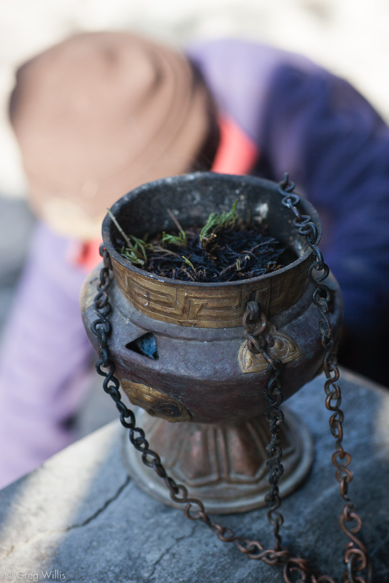
Heading out of Chame we encountered shopkeepers opening their shops. In addition to sweeping and setting out goods, most lit sprigs of juniper in small burners. We encountered this natural incense of smoldering juniper sprigs all along the Buddhist part of the AC.
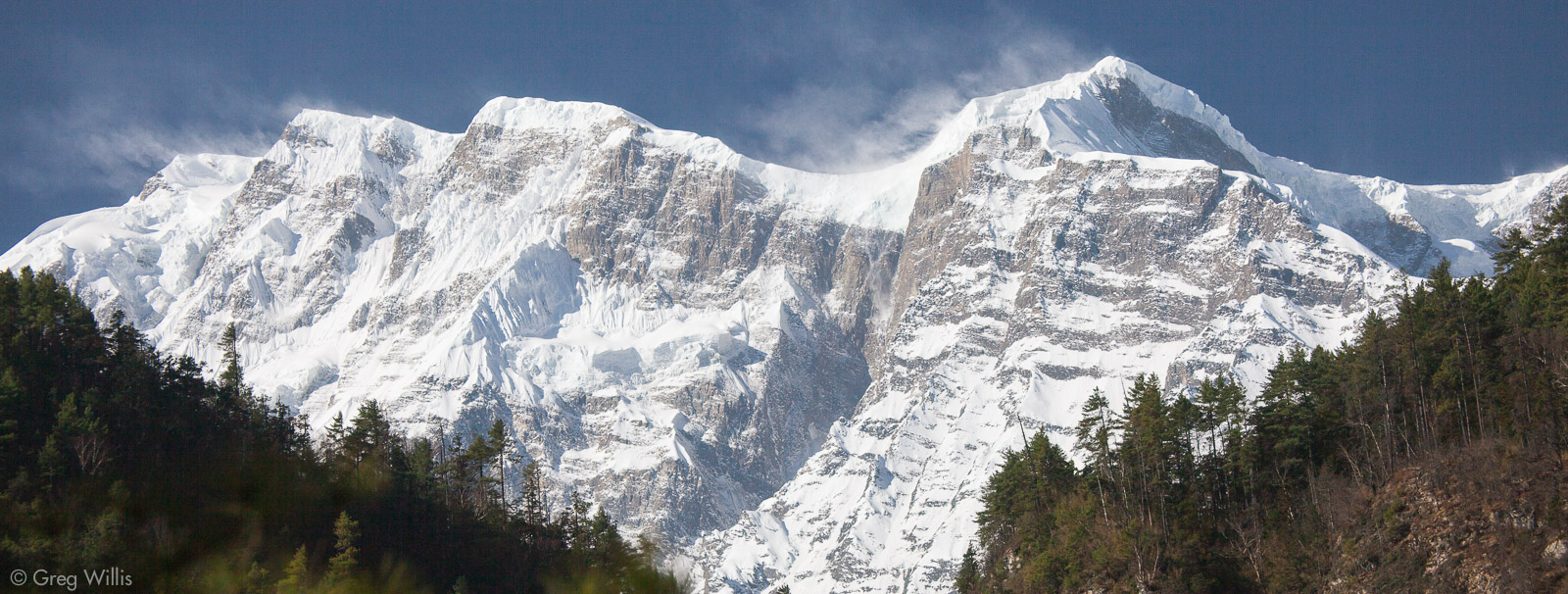
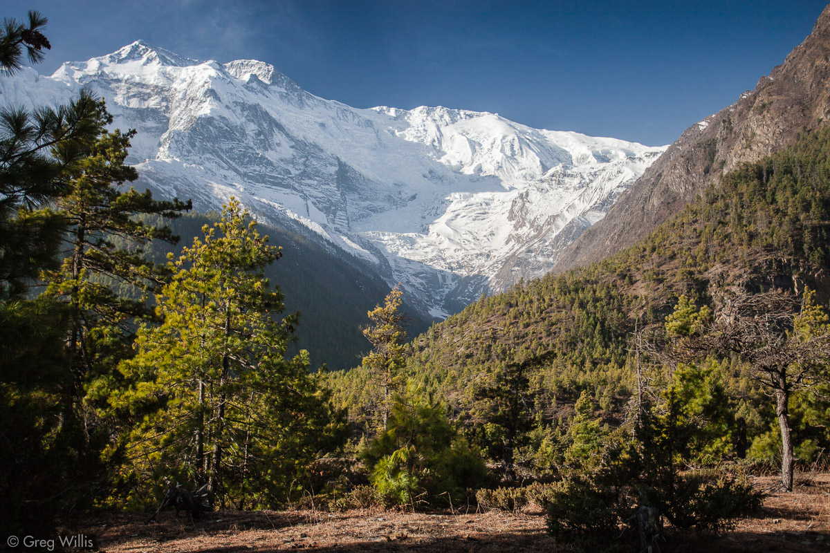
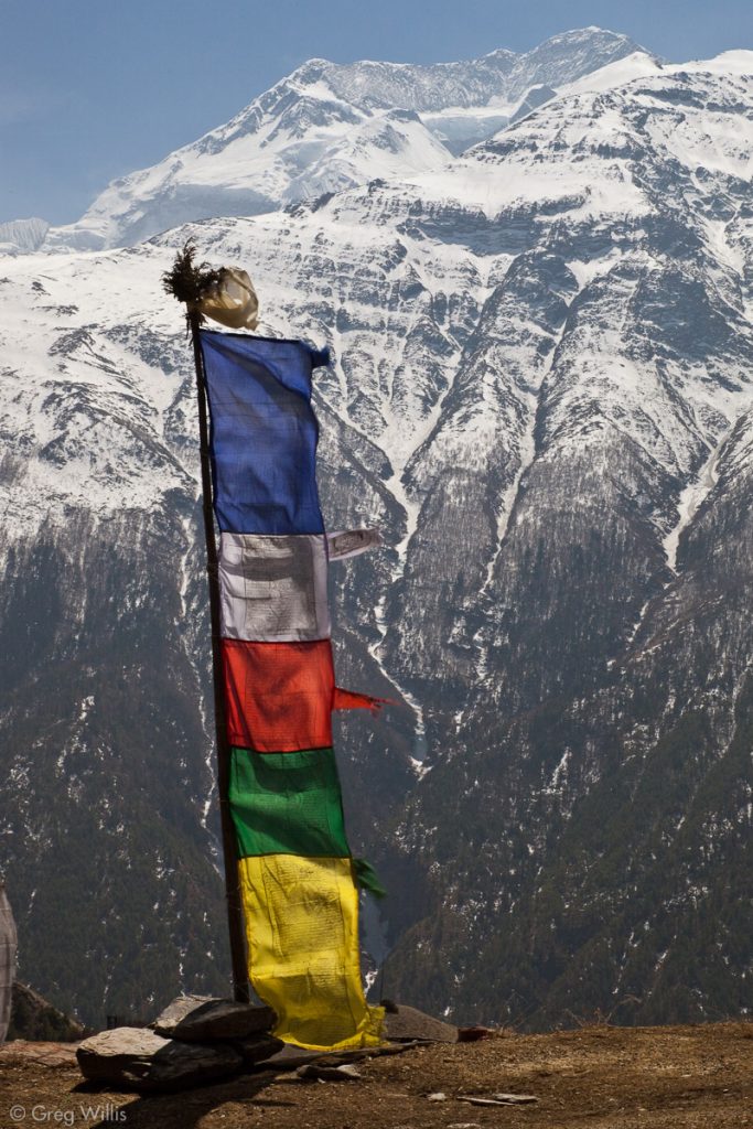
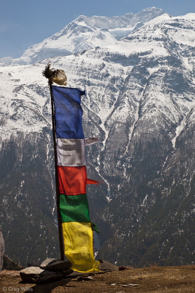
Early on the trail we got a stunning view of the summit of Annapurna 2
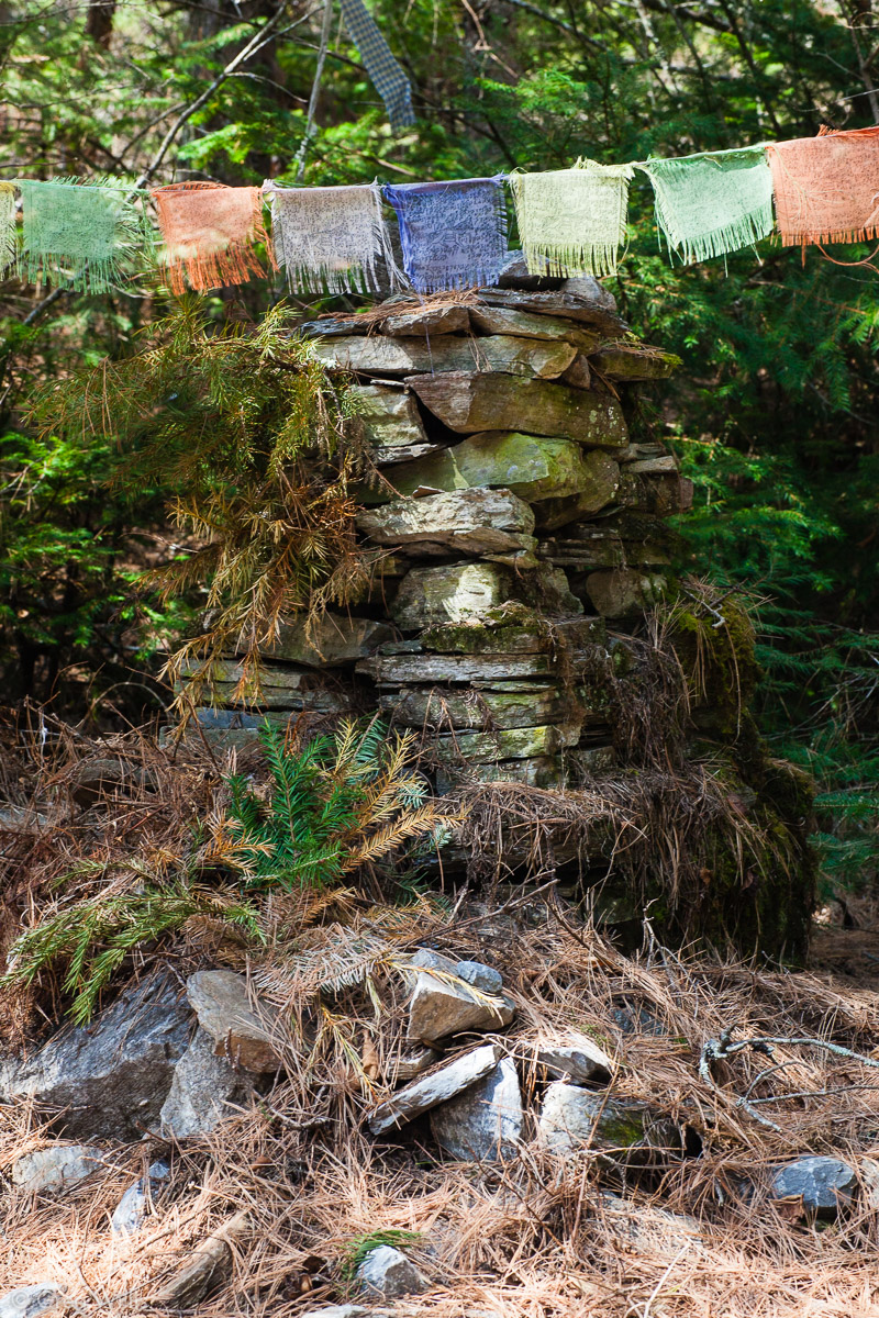
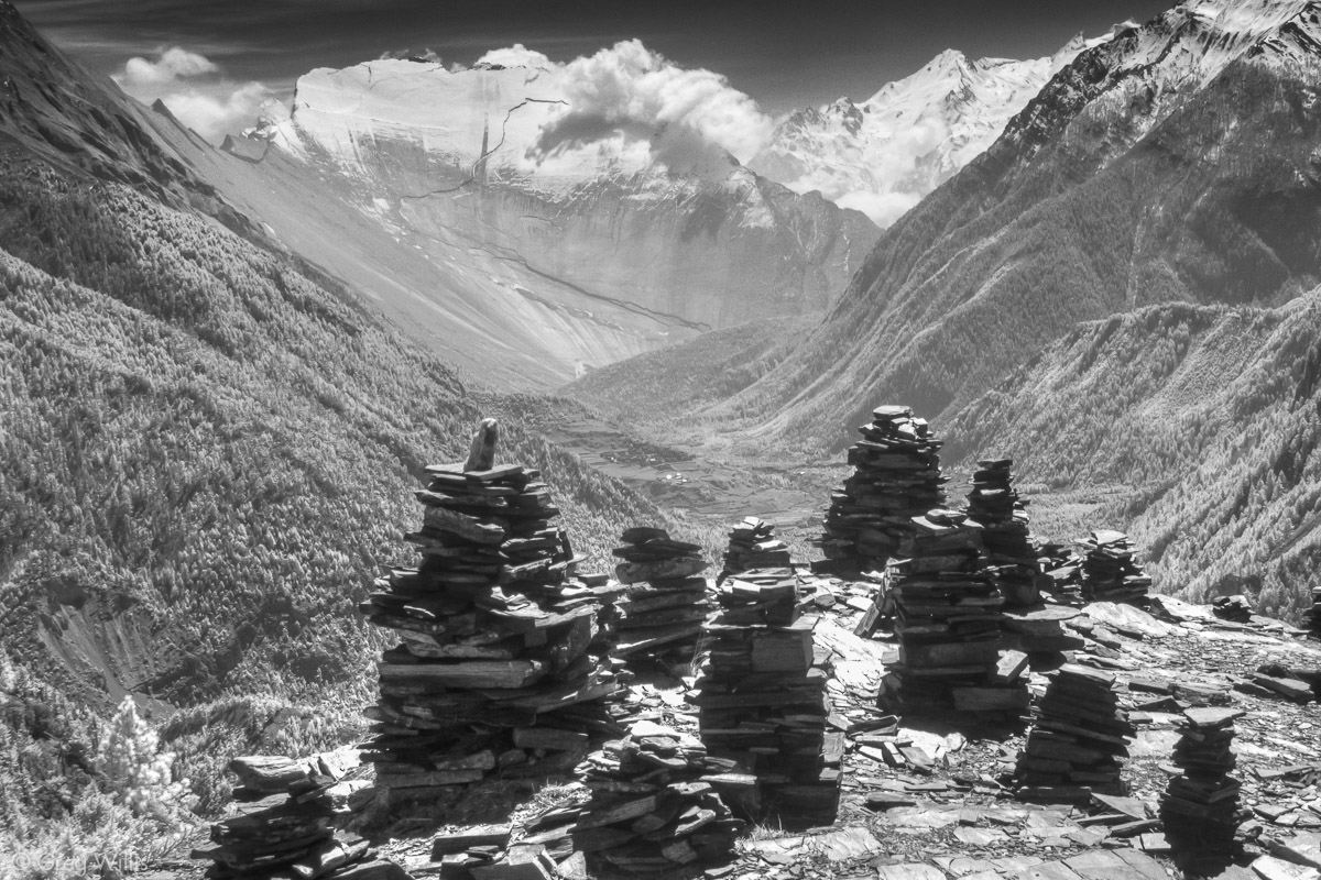
The hike for today passed through lush pine forest. Once section in particular was beautifully lined with roughly-made stone shorten and cairns onto which the devout had sweetly lain branches of pine.
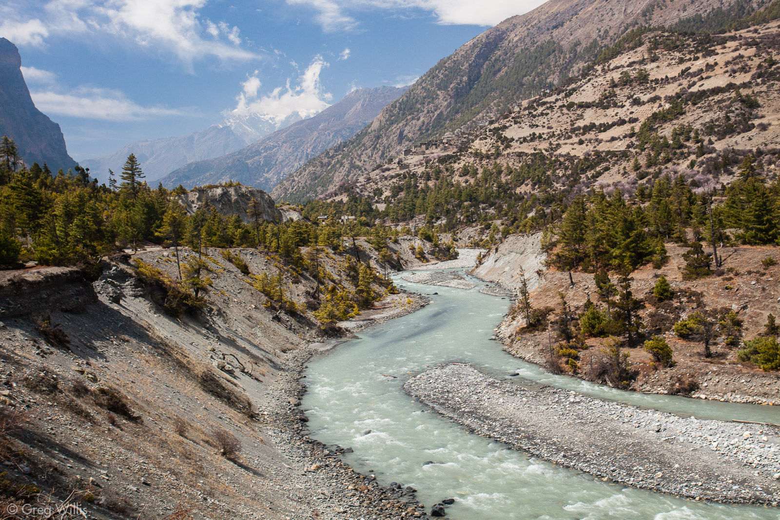
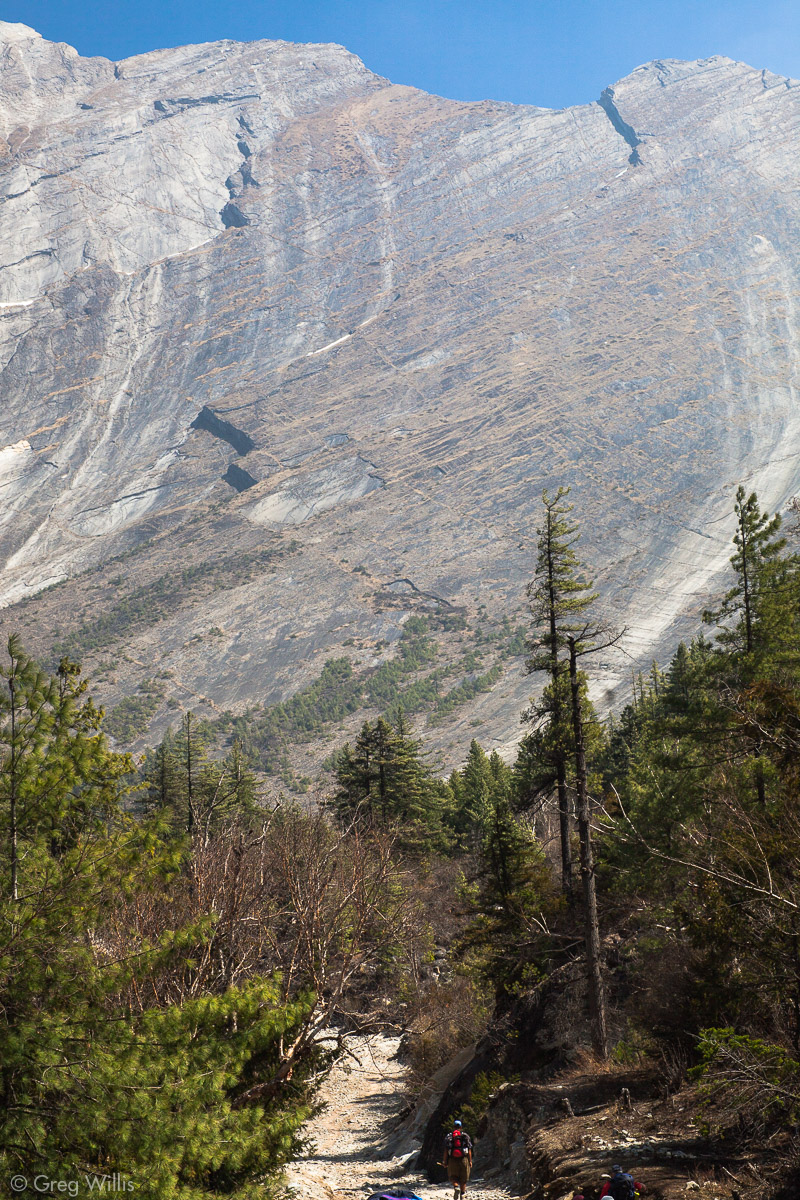
We came to the steepest part of the Marsyandi Valley, so steep that the trail is carved into the vertical rock. And on the opposing bank, the bank looked ripe for a landslide.
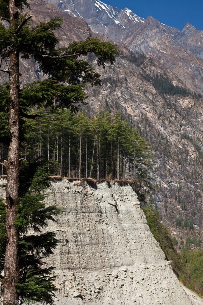
Steep slope 
Steep drop from trail

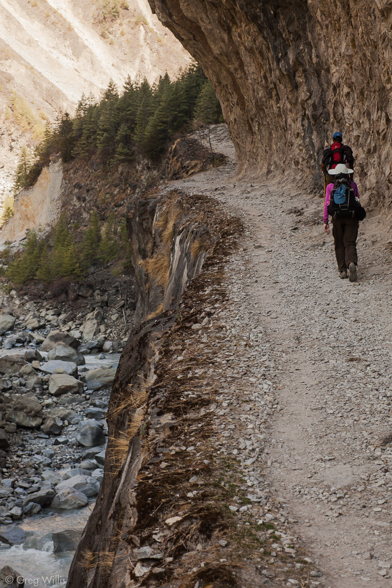
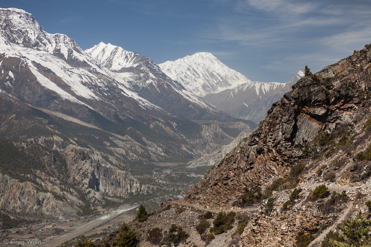
But once past this last bit of metamorphic rock, the valley opens, with majestic vistas where for the previous days the hemmed-in valley prevented any distant views.
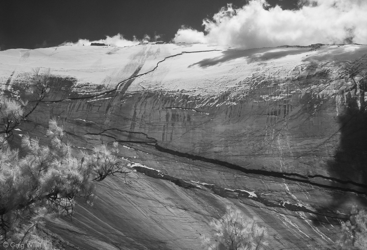
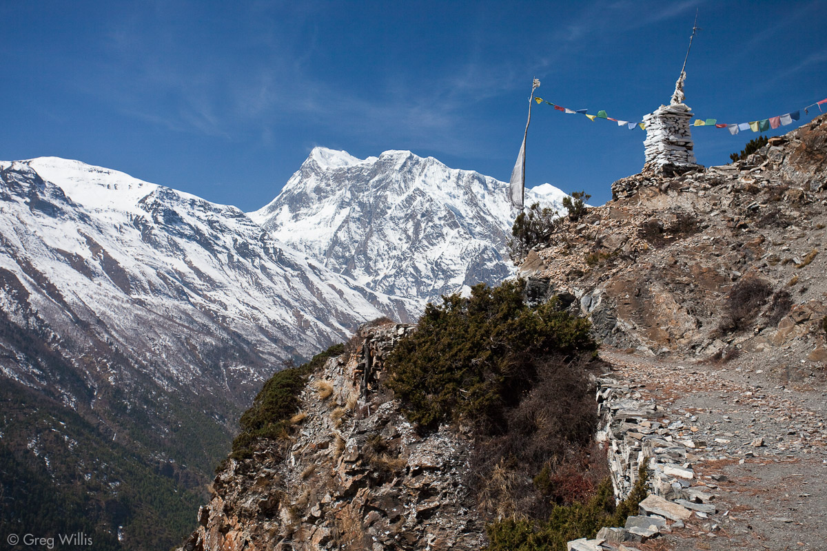
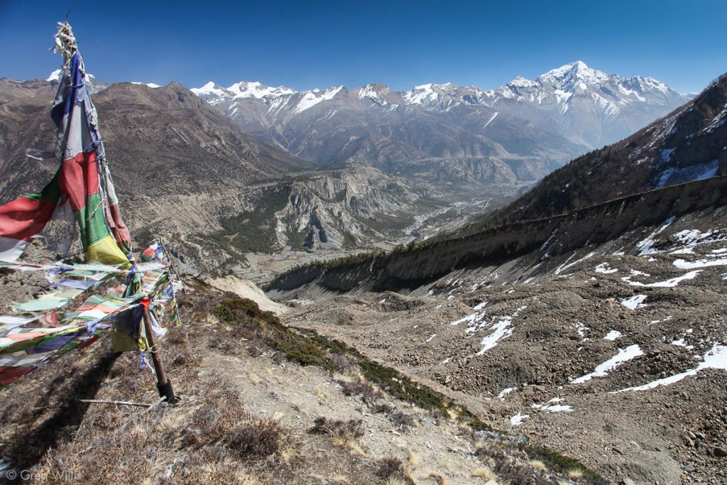
And right where the valley widens stands the Paungda Danda, a massive sloping rock face that rises over 5,000ft (1500m) above the trail. Overnight snow had dusted the upper elevations, and by the time we approached long streaks of snowmelt streamed down. The immensity and smoothness of face is stunning. And its no surprise that this awesome geological feature has an important place in the local culture’s beliefs. For the Gurung locals, after death the soul begins its journey to the afterlife by following the Marsyandi, then up the rock face of Paungda Danda or Swarga Dwar, the local name for that means ‘Gateway to Heaven’. Atop the Swarga Dwar sits two rock forms: the gateway to heaven itself (the larger rock) and beside it a smaller rock to which the guard dog for the gateway is tied.

Valley near Dhukur Pokhari 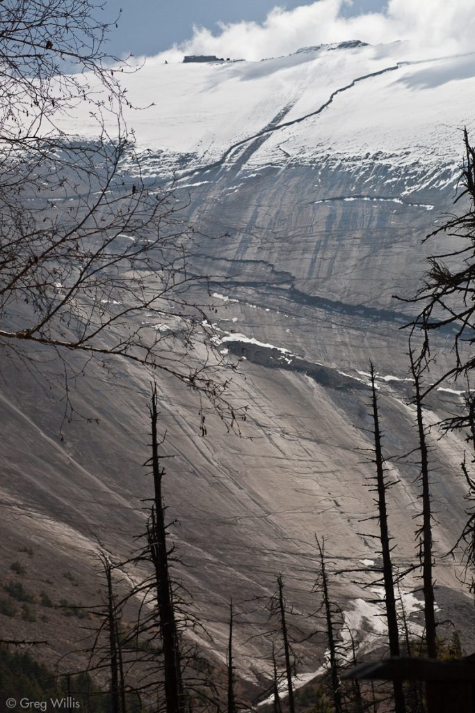
Paungda Danda rock face 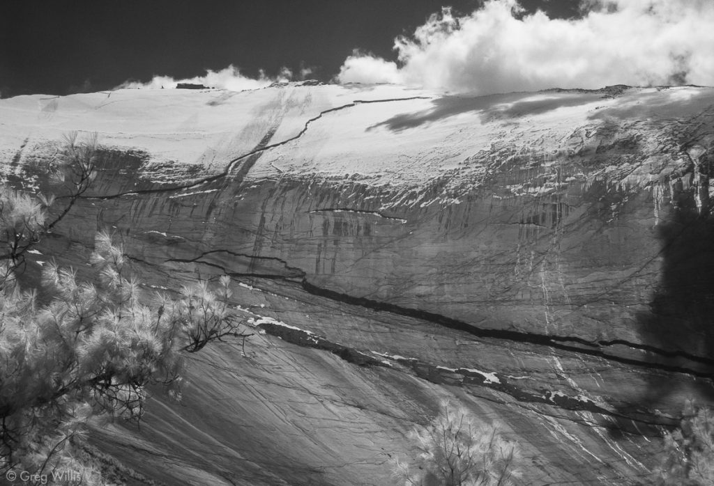
Paungda Danda rock face 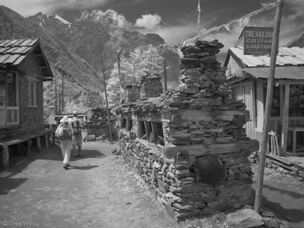
Mani wall in Dhukur Pokhari 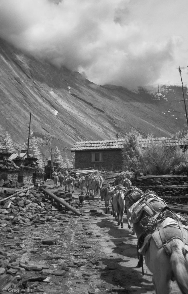
Paungda Danda and donkey train in Dhukur Pokhari


Truth be told, I could have stayed in Dhukur Pokhari, the village that overlooks the Paungda Danda, watching the light move over the sloping rock for the rest of the day. But at this part of the AC every village has something to recommend it; every photograph could have better light in an hour of two. Indeed, for the Manang valley, as with the Jhong later on, the trek perhaps should be measured in weeks rather than days. But return tickets and advanced bookings don’t allow for such luxuries.
We arrived in Lower Pisang around 14:00, a serviceable tourist town by the river. We unpacked, knocked about the town for a couple of hours, then Devendra led us up to Upper Pisang, the original town without many tourist services. The hike to the upper town was as much about acclimatization as about sightseeing. “Climb high, sleep low” is the operative phrase for getting your body used to the thinner air. And for the first time in the trip, we were feeling the effects of the altitude with a general fatigue and occasional headaches.
Marsyangdi valley near Pisang 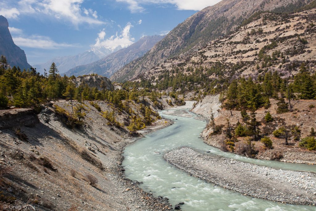
Marsyangdi valley near Pisang 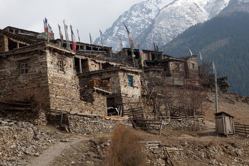
Upper Pisang


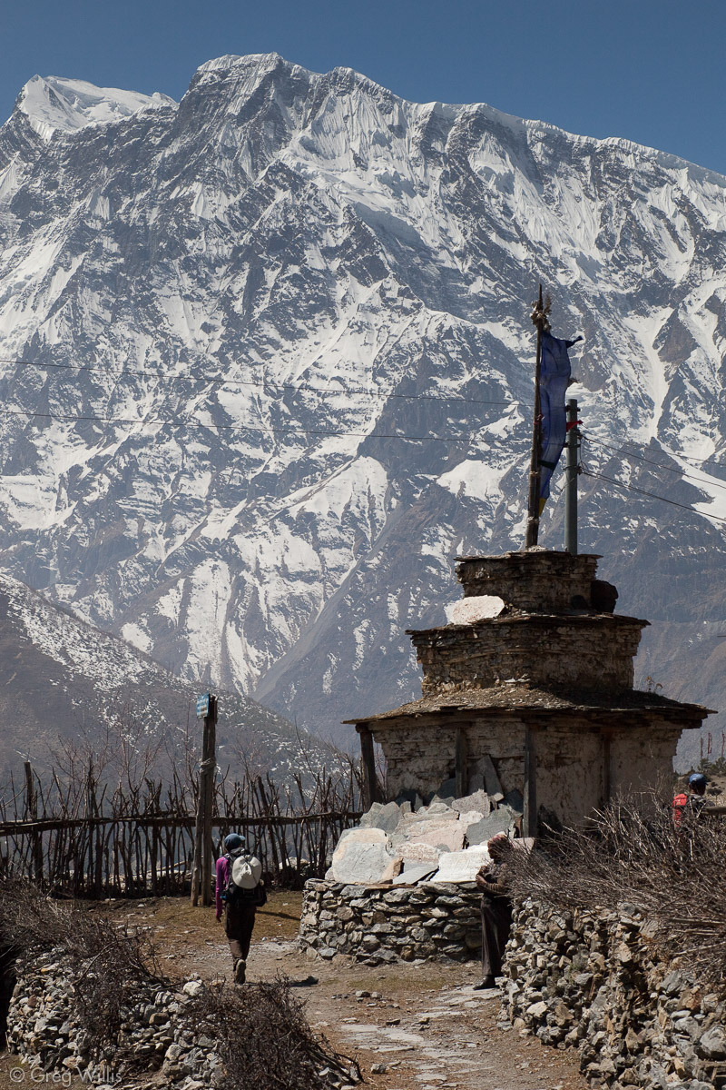
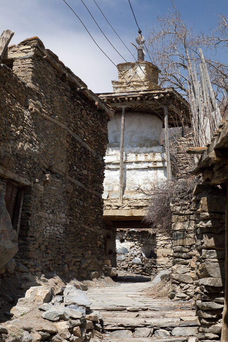
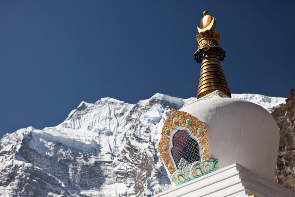
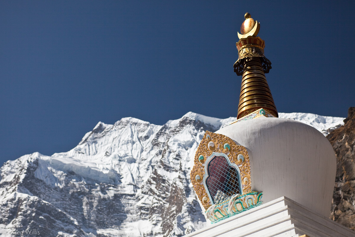
The gompa at the top of the town had a commanding view of the valley.
Gompa in Upper Pisang 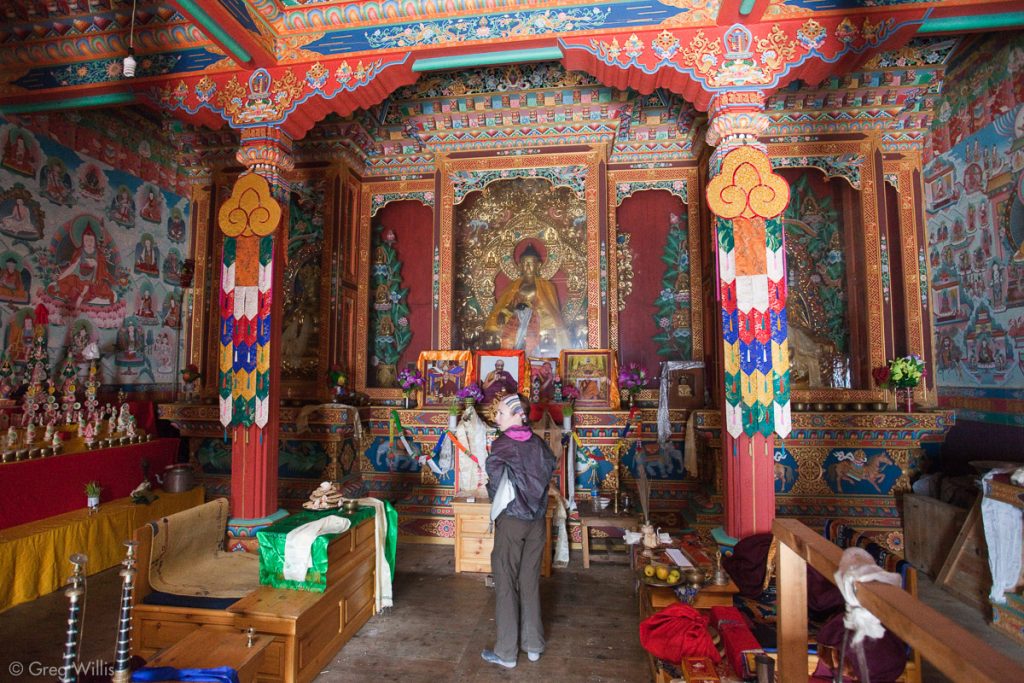
Inside Gompa in Upper Pisang 
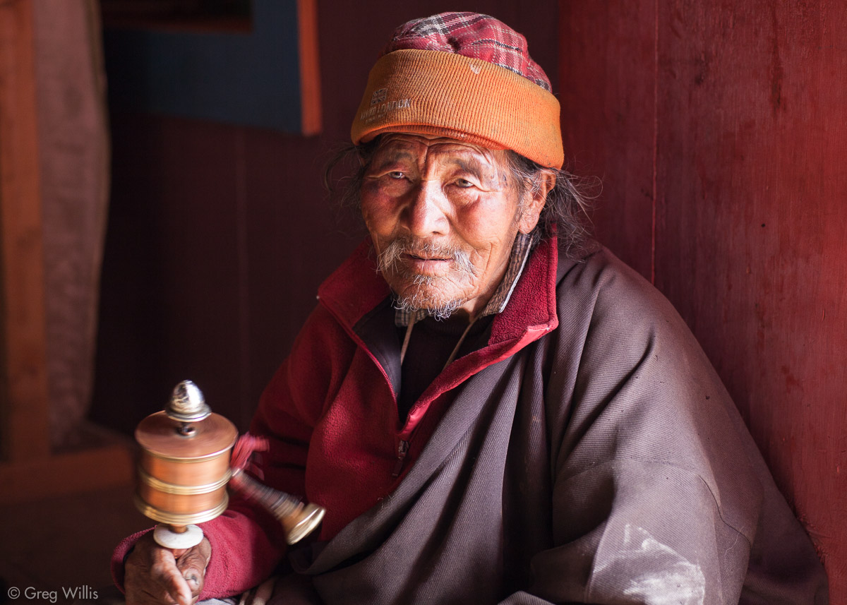
Mendicant in Upper Pisang Gompa

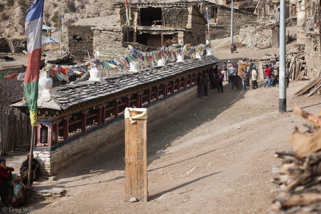
We stumbled upon an archery contest, which took place besides a long wall of prayer wheels. The target was a juniper branch surrounded by a small metal ring, both of which were mounted on a rough-hewn board 6 feet high and a foot and a half wide having a white cloth at the top.
Archery Contest 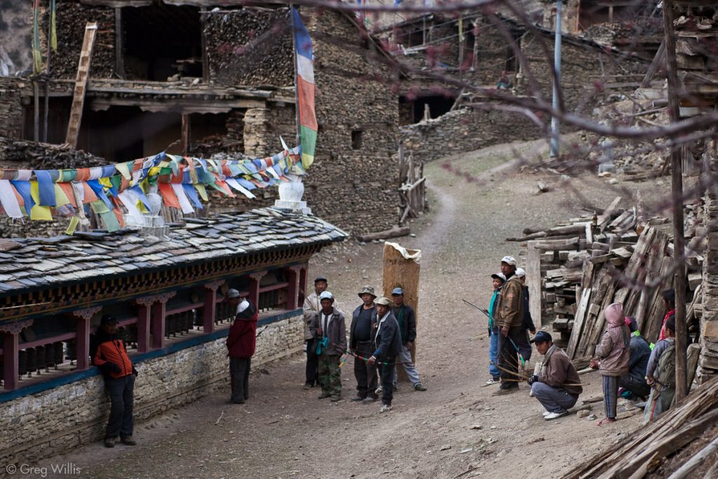
Archery Contest 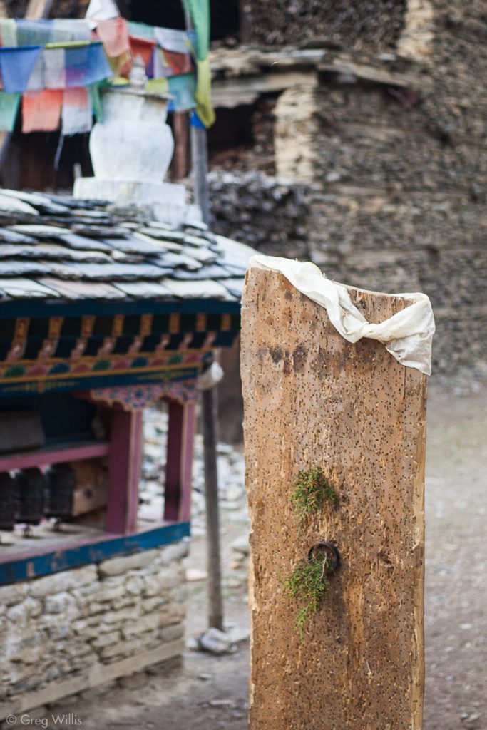
Archery Target, a ring with juniper


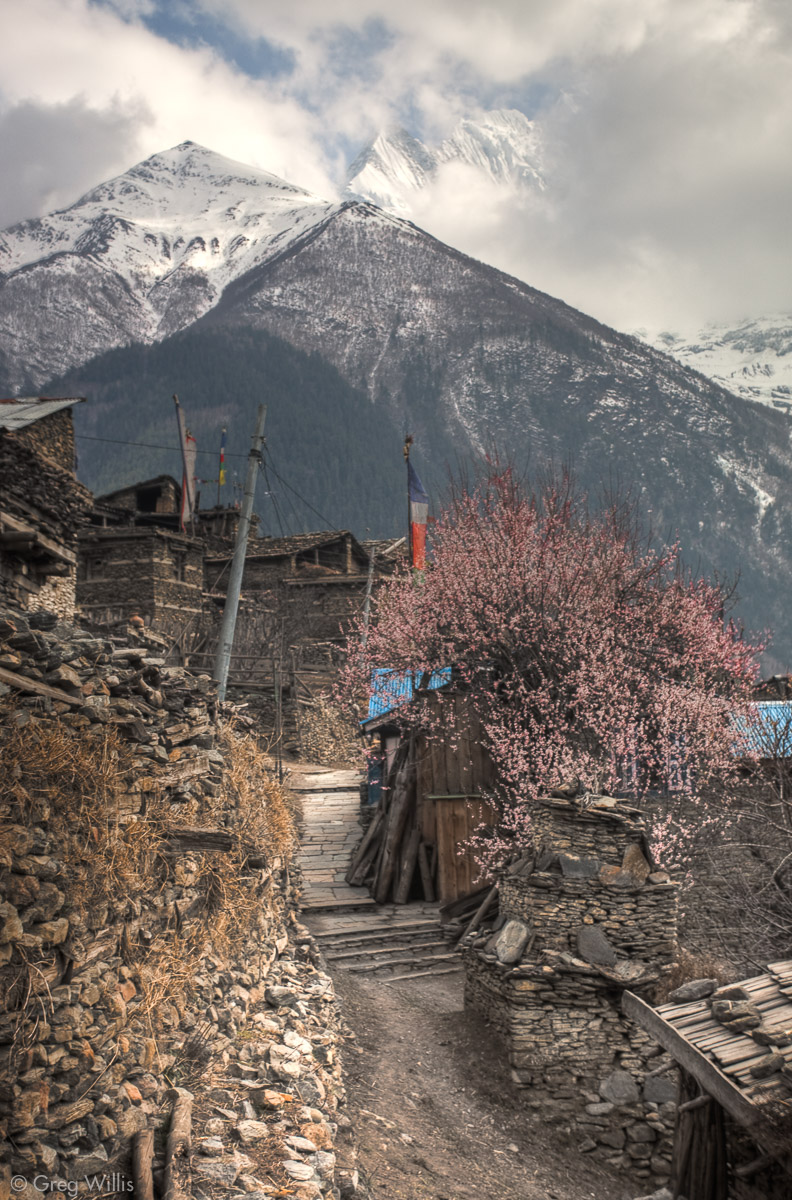
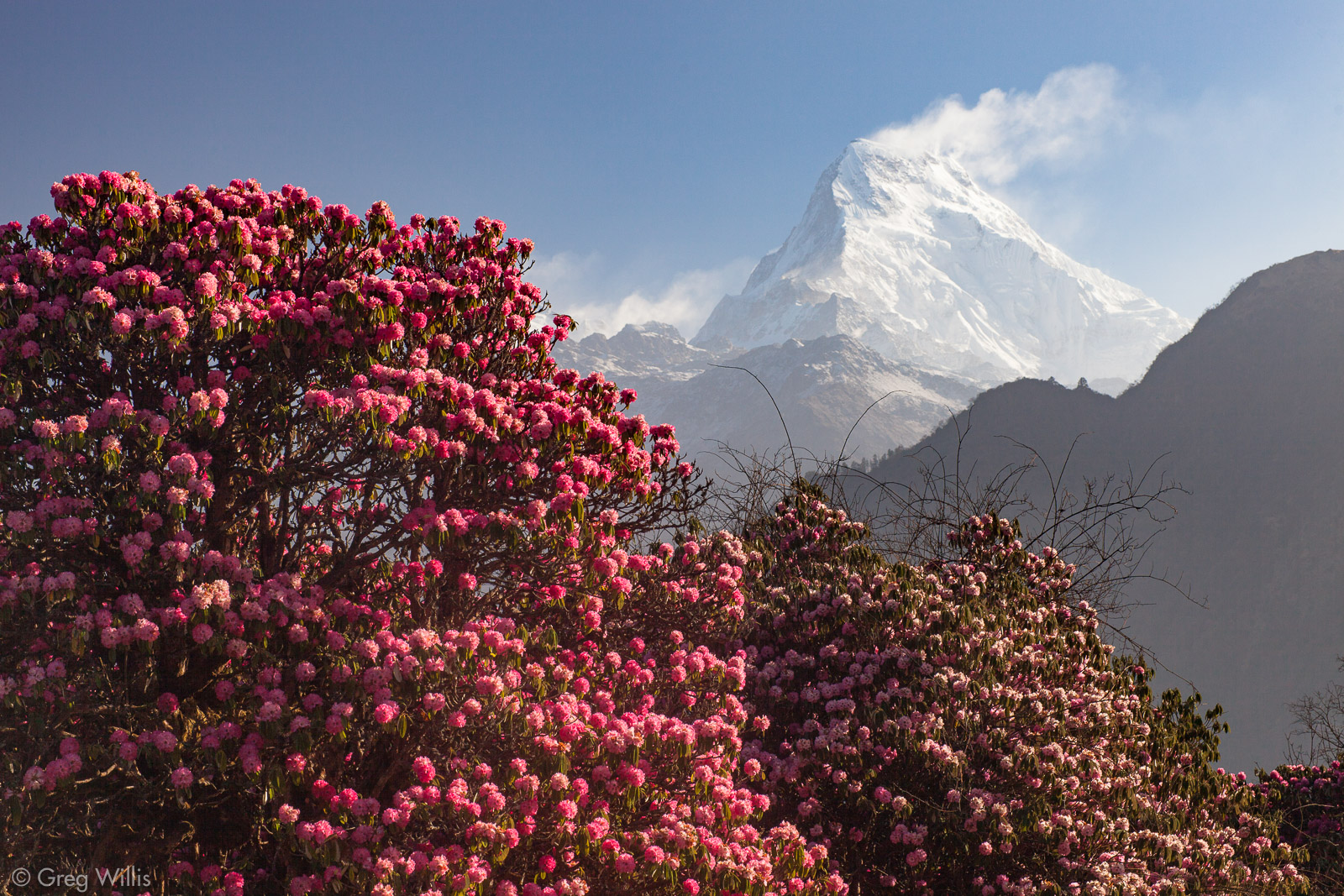
Clouds were rolling in and the chilly wind kicked up, so we headed back down. But even in the fading light, the blooming plum trees with Pisang Peak in back looked simply beautiful.
Lower Pisang sits at 10,630 ft, which is right around the highest towns in the US — and there were four more days of trekking upwards before we made the pass and started to descend.
- Places: Bhratang – Pisang – Upper Pisang
- Time walking: 6:00
- Temperature: low of 47°F
- Elevation gain: 1,970 ft
- Lodging: Eco Lodge, Pisang
Day 7: Pisang to Bragha, via the High Route – 23 Mar 2010
High route = hard day.
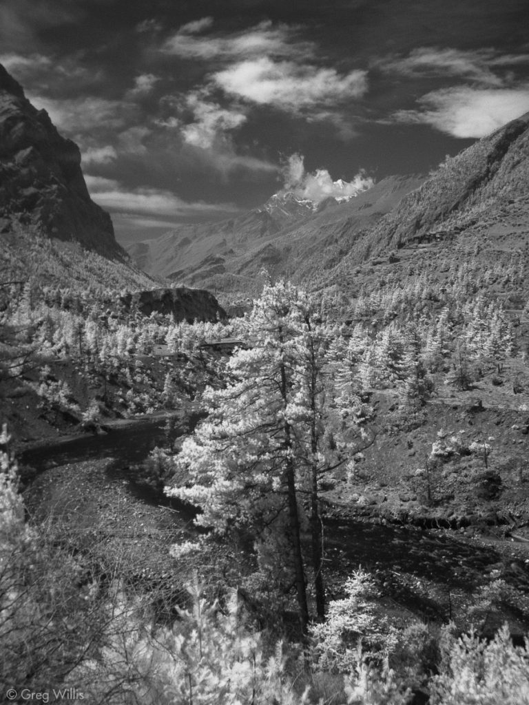
Since we visited Upper Pisang the previous day, there was no need to retrace our steps for today. The morning’s start was a very pleasant stroll through the forest north and west of Lower Pisang with peerless views of Annapurna II and III.
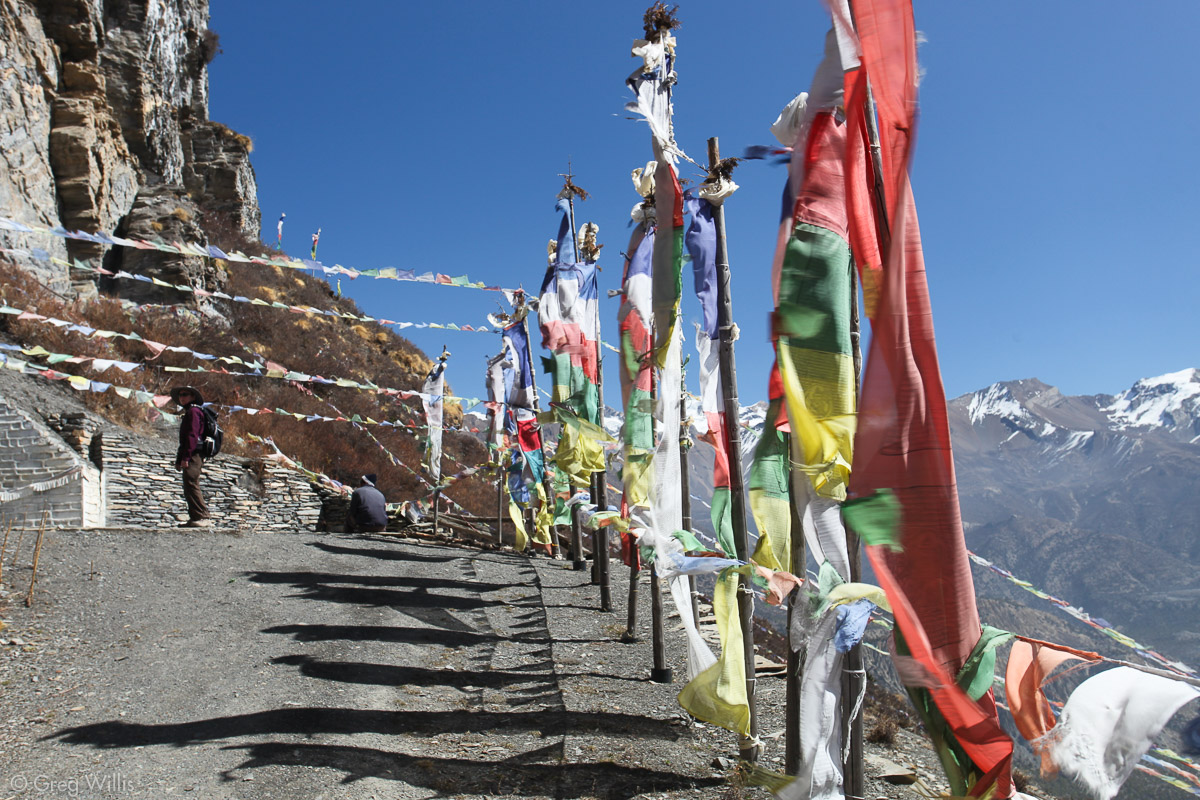
But right after this lonely and isolated mani wall,
The trail climbed upwards towards Ghyaru — like really upwards. Usually it’d be at the end of the day when I felt the altitude — after eight hours of walking I’d be more tired than I usually be. Nope, not today. After halfway up the strenuous climb up to Ghyaru I was resting at the bottom of every switchback, huffing & puffing like a two-pack-a-day smoker. And it was only 9:20 in the morning.
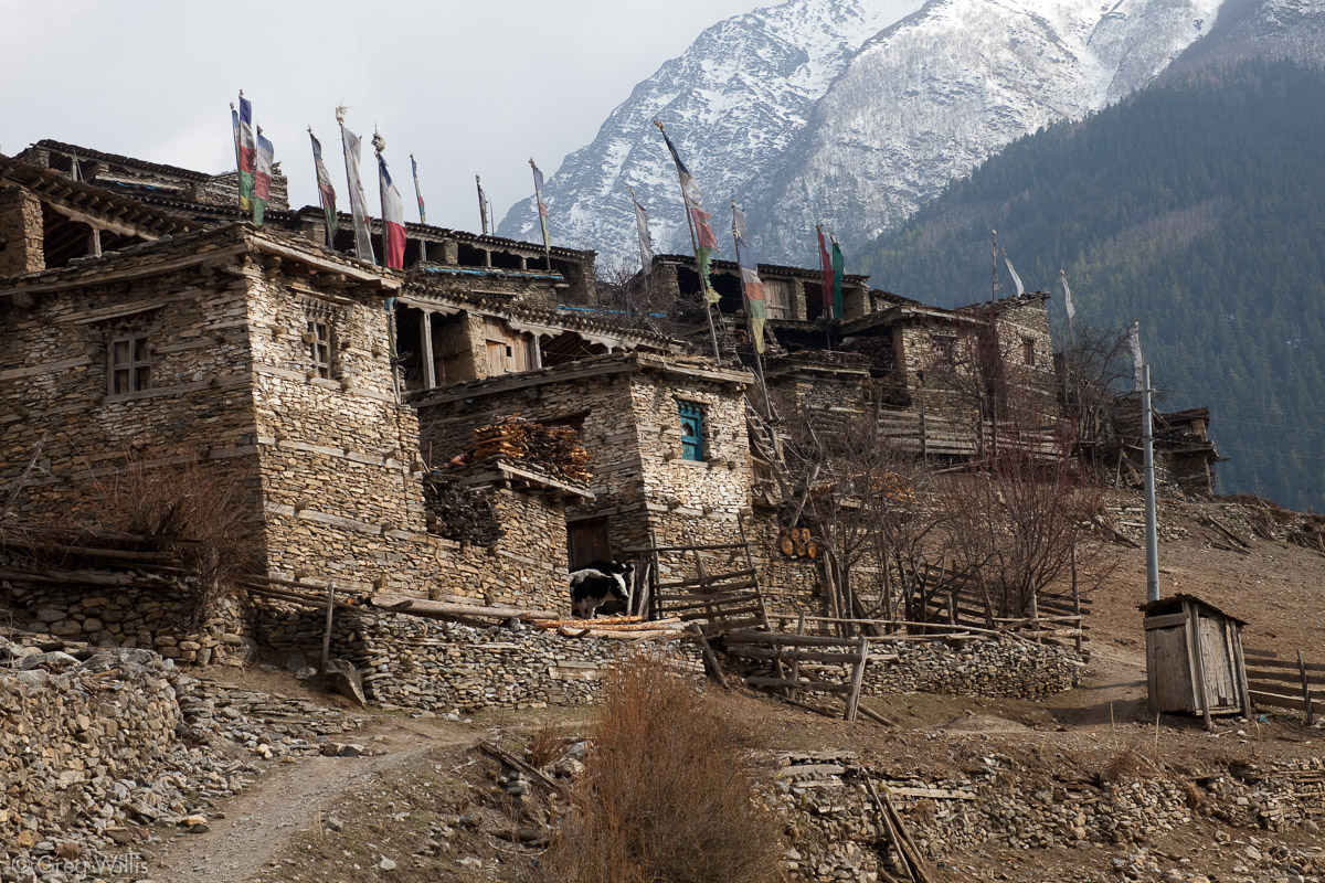
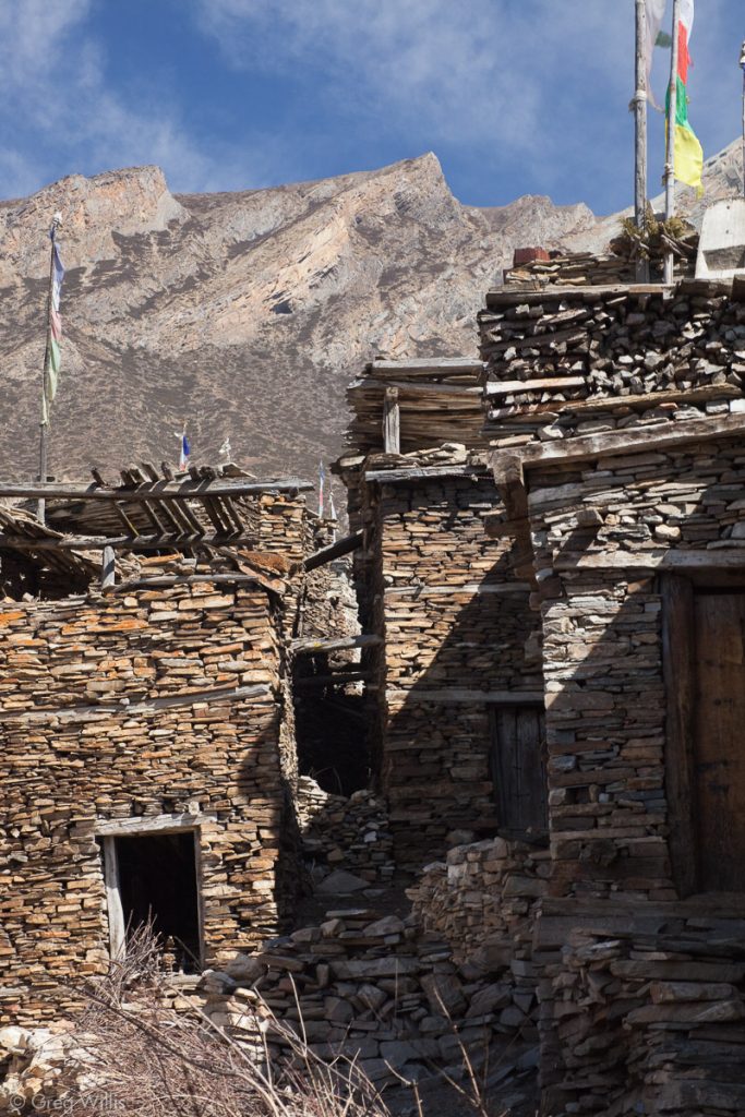
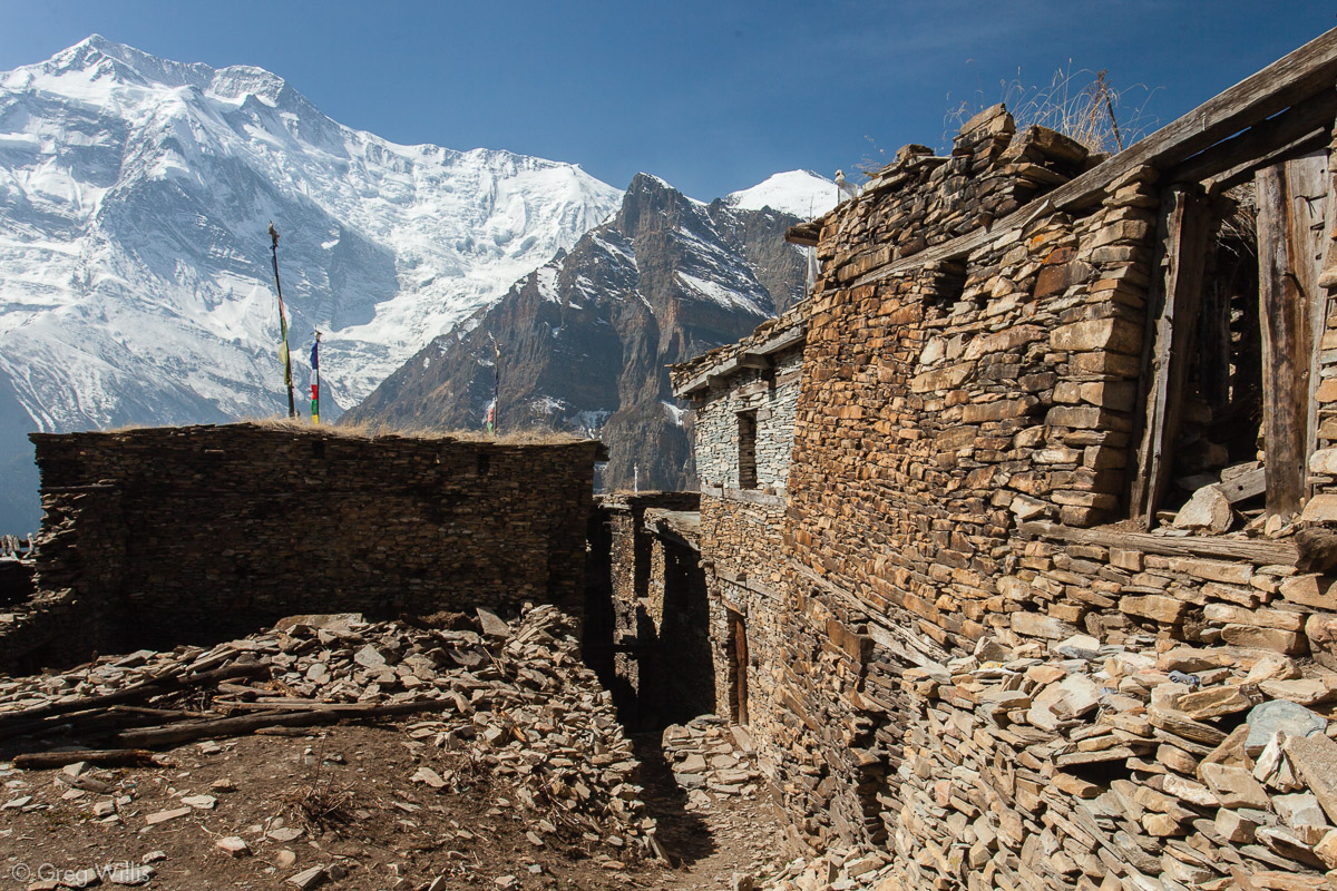
Like Upper Pisang from yesterday and Ngawal later this day, Ghyaru is an old village with building stacked layer upon layer on a steep hillside. Every step brings another small dark alleyway leading deeper into the town. But the time constraints of trekking means these alleyways remain a mystery.
Ghyaru 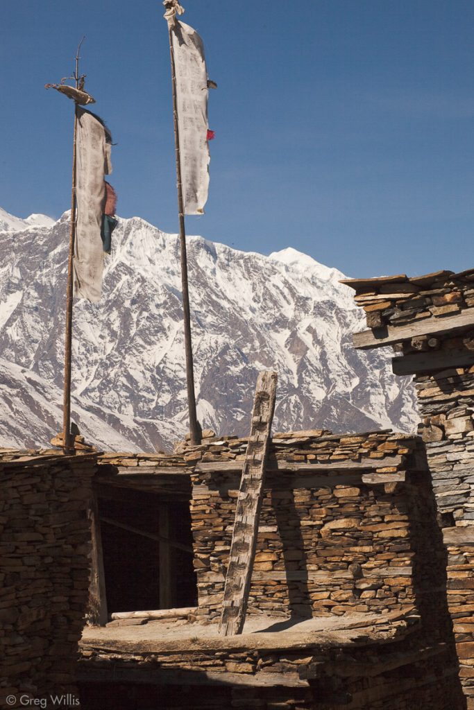
Ghyaru 
Ghyaru


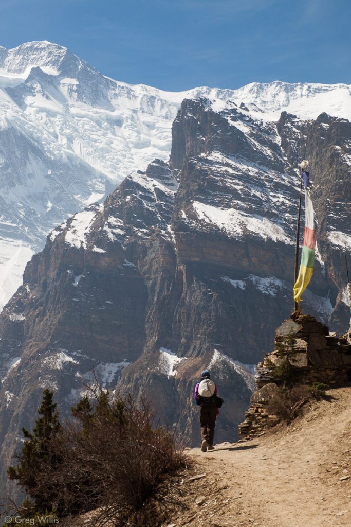
Almost as a reward for not further exploring the dark passages of the village, the high mountains on both sides of the valley revealed themselves, not just in glimpses, but for hours, as the valley widened and as we climbed higher. And we could see all the way to yesterday’s highlight, the Paungda Danda
Heather, mani wall – High route trail near Ghyaru 
Annapurna 3 & chorten – High route trail between Ghyaru & Ngawal 
Marsyangdi valley, looking east – High route trail between Ghyaru & Ngawal 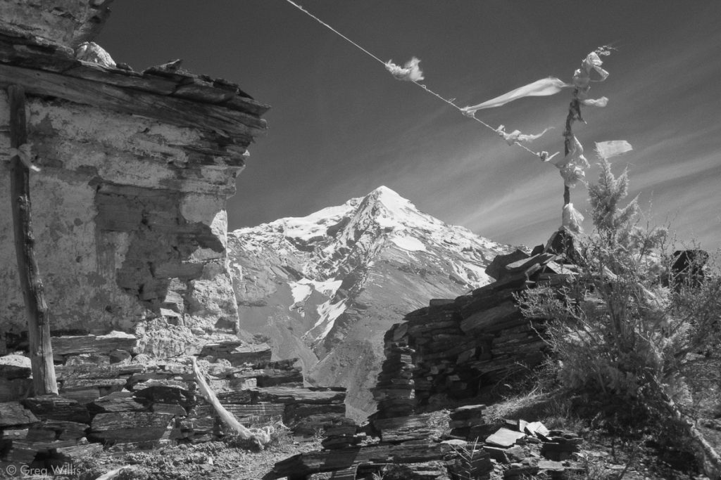
Chorten & Pisang Peak – High route trail between Ghyaru & Ngawal 
Marsyangdi valley, looking west 
High Mountains
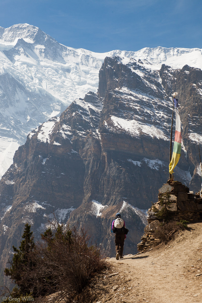

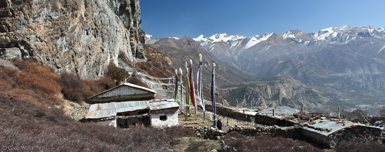
I felt the altitude on the High Route, I was frequently lightheaded enough to stop walking and catch my breath. For Heather, not so much — she was fine except a bit of a headache. Lunch was in Ngawal, and the view from our outside table may have been the best for any lunch we’ve had:
Prayer flags & Annapurna 2 – Ngawal 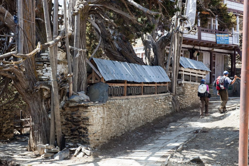
Ngawal Mani wall and old trees 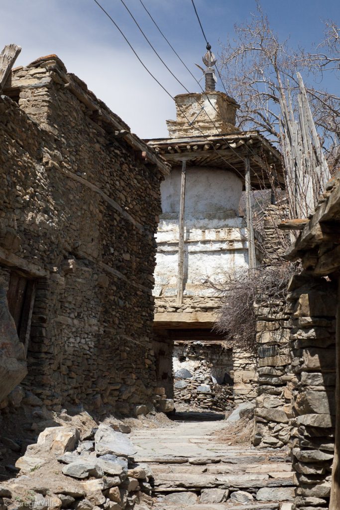
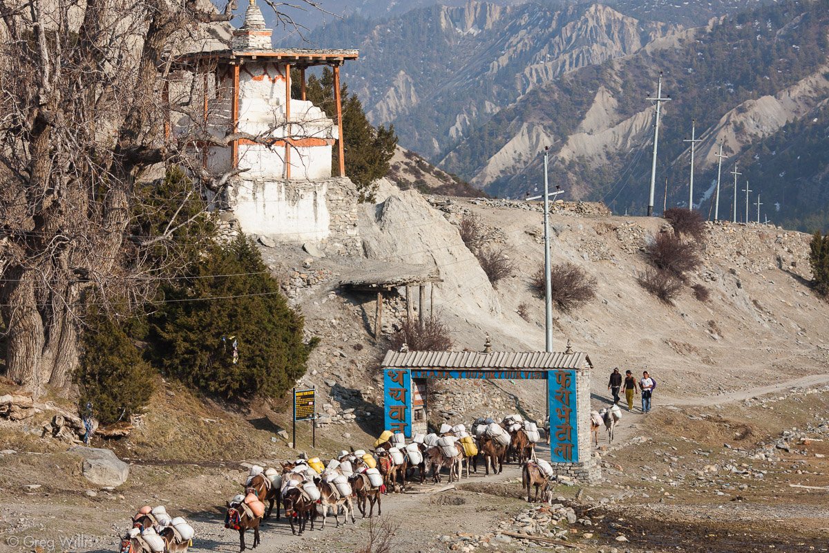
Ngawal kani, entrance gate

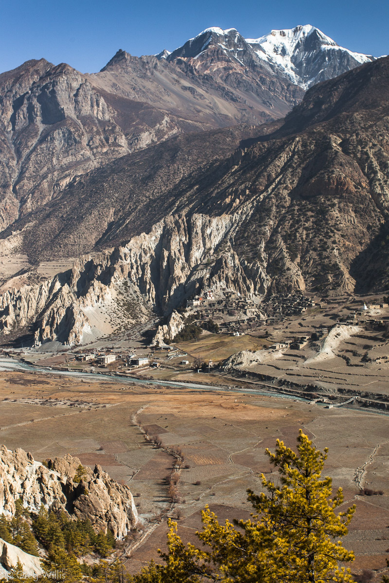
After Ngawal the trail heads back down to the valley floor, eventually meeting up with the lower trail at collection of buildings called Mungji. Do yourself a favor — stop here and get a glass of seabuckthorn juice. It’s tart and refreshing. And another 30 minutes or so and we arrived at Bragha, our stay for the next two nights. Bragha sits at 11,384ft, higher than any US city. We unpacked, got some tea, and attempted a bit of clothes washing before darkness fell.
This is the difficulty of the AC: the fatigue. As beautiful as the scenery is and as interesting as each town is, when you hit the teahouse you don’t really feel like doing much else that sitting and drinking tea. And it’s not like you have all that much spare time. Trekking is a job, usually 8 hours of it: from 08:00 to 16:00. So you get to the teahouse at 16:00 in the afternoon. Unpack and shower, then it’s 17:30. Head to the common room, eat dinner at 19:00, back to room by 20:00, get clothes and gear ready for tomorrow, and to bed by 21:00.
Although difficult, taking the High Route between Pisang and Manang was one of the highlights of our trek. And in addition to the stunning mountain views and ancient villages, the higher elevation helped with our acclimatization — it was the last time I had any elevation related issues. So for the Annapurna Circuit as well as your life in general, take the High Route.
- Places: Ghyaru – Ngawal – Mungji – Bragha
- Time walking: 8:20
- Temperature: low of 54°F
- Elevation gain: 1,410 ft
- Lodging: Hotel New Yak (yes, yak), Bragha
Day 8: Bragha – 24 Mar 2010
Some trekkers called this their rest day. But any day I hike up and down 2,600 ft I refuse to call a ‘rest day.’ Lets call it our acclimatization day — the day you take a side-trip to some sight up in the thinner air of the mountains, only to come back down again in the relatively un-thinner air of Bragha or Manang to sleep. “Climb high, sleep low,” doncha know.
There’s no shortage of high sights to be had in this part of the valley: a half dozen historic gompas, the Chongar Viewpoint, or the strenuous path to Ice Lake. We opted for Milarepa’s Cave — a challenging 2,600 ft to a religious & historic site. Here’s the description from a sign on the trail:
Milerepa an ascetic Tibetan monk lived during the 11th century A.D. He possessed black magic power and spent most of his life meditating in various caves in the Himalayas. While meditating he lived on stinging nettles which is said to have turned his body green. One will find stinging nettles growing outside the cave. A hunter named Kera Gompa Dorjee (was) highly influenced by Milerepa teachings and gave up hunting and became his disciple. His bow is still hanging on the cliff above the cave. Visit the gompa to get more information from the monk.
So up we went. There was still snow on the steep trail, so we had to be more careful with our footing than than on the AC proper. The view of Bragha and the now small Marsyandi river showed the looming peak of Chulu behind it.
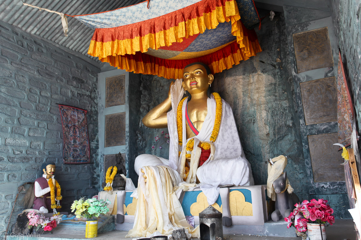
In a little less than 2 hours we arrived at the gompa. No monks were to be found, alas. So the exact location of the cave with its hunter’s bow eluded us. But we did see a buddha in the temple complex.
Chorten at Milarepa’s Cave 
Buddha at Milarepa’s Cave 
Milarepa’s Cave
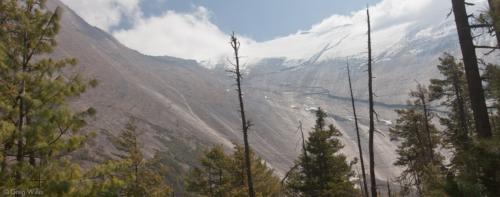
We went up a bit further and peeked over a huge lateral moraine abandoned by its retreating glacier. And all during our ascent and descent we would hear the distant rumbling of avalanches coming down Annapurna IV – not surprising considering the steepness of its slopes.
Lateral moraines from a receeding glacier, Pisang Peak in back 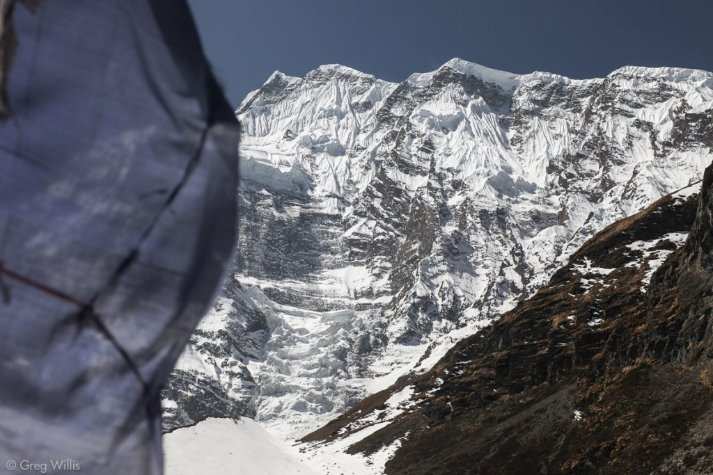
Annapurna IV


On the way back down the snow had begun to melt, making it a precipitous muddy mess and not much fun at all. But by noon we had finished and were drinking tea awaiting lunch. Taking advantage of the lighter day, after lunch we napped, read, and lazed about. Later in the afternoon we walked over to the village of Bragha.
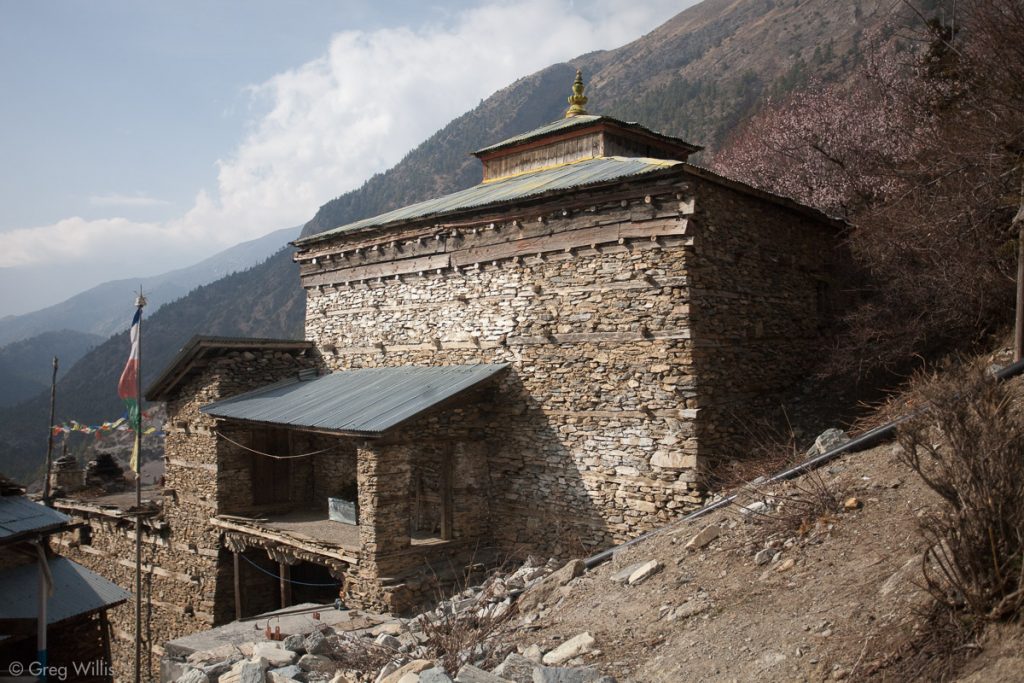
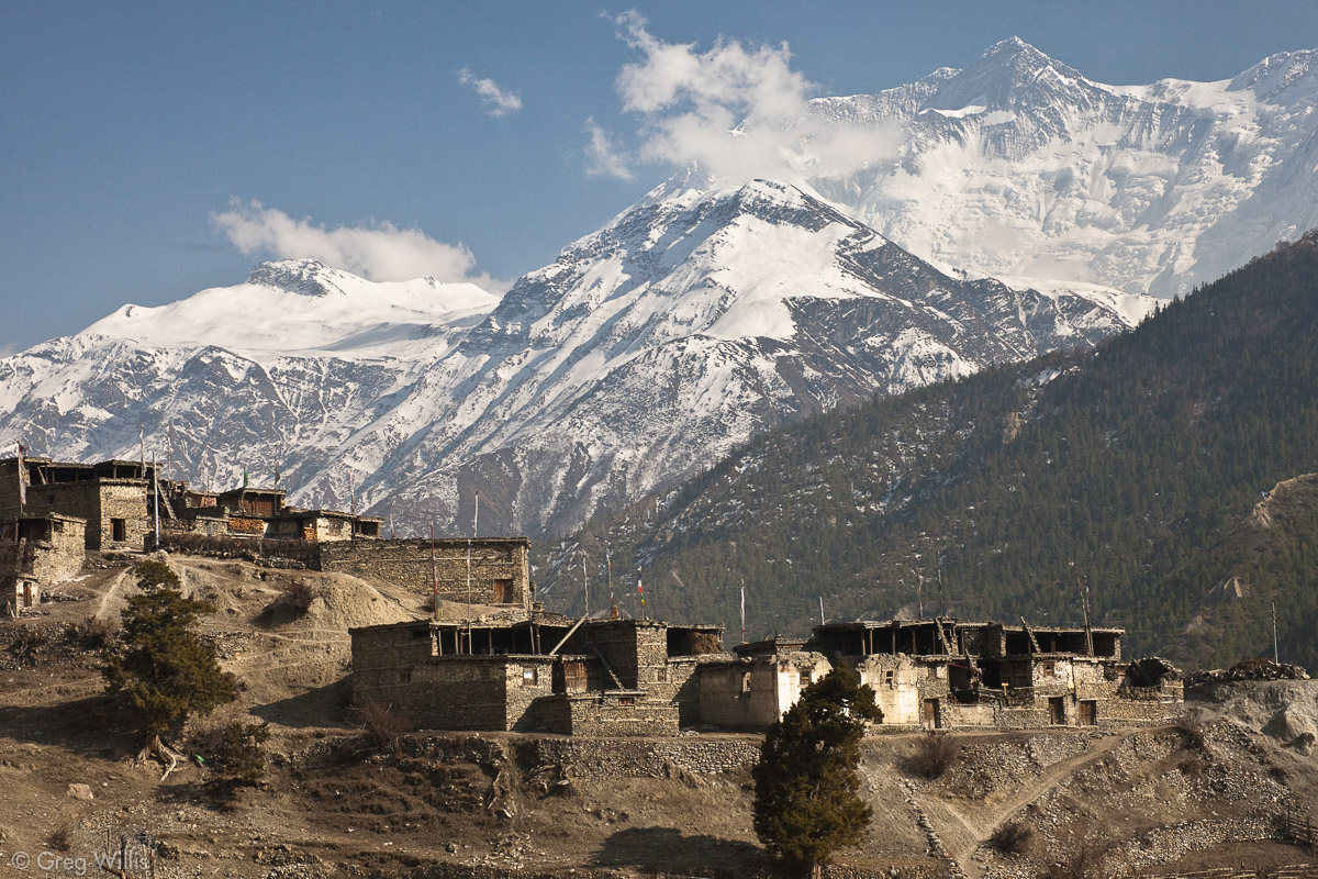
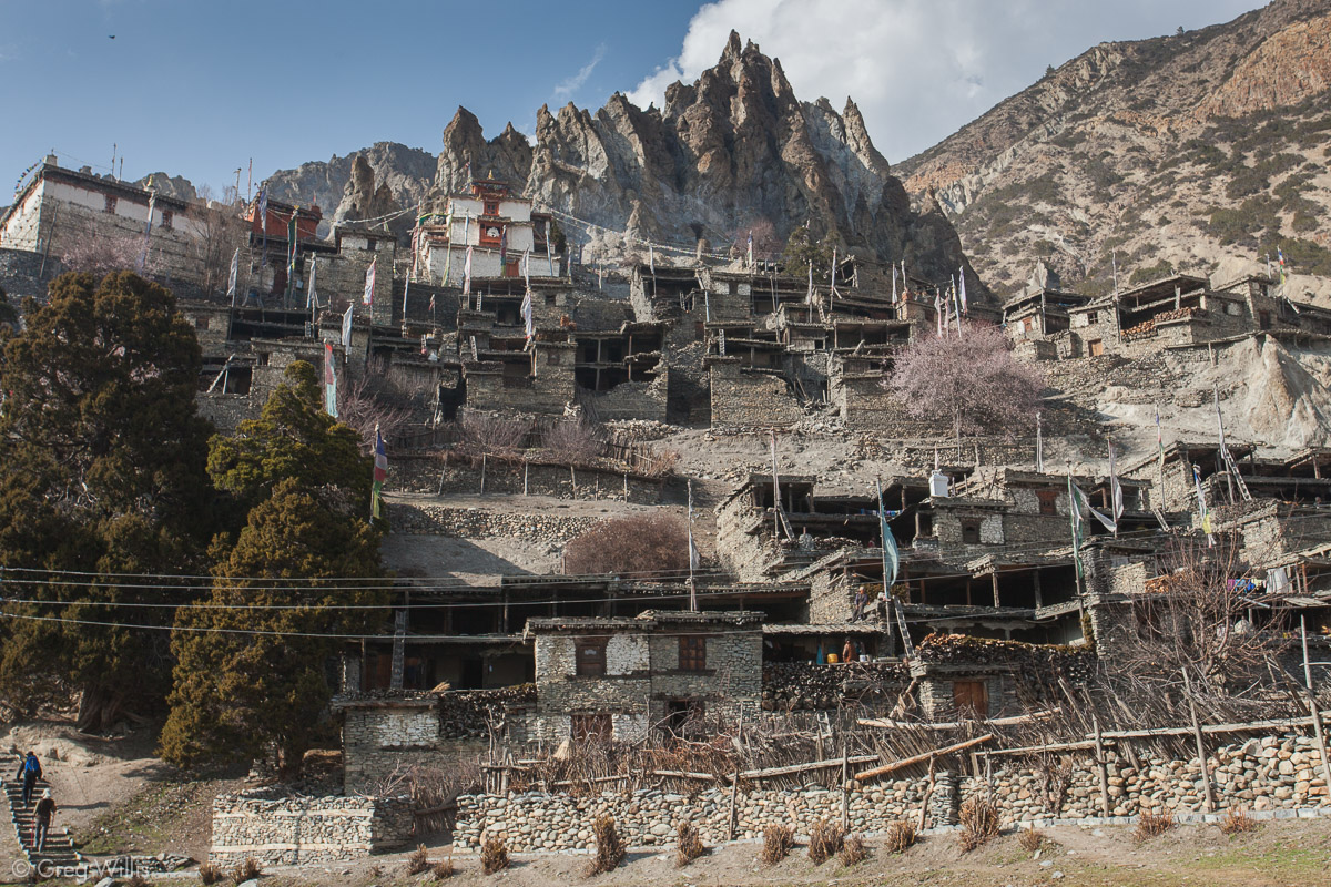
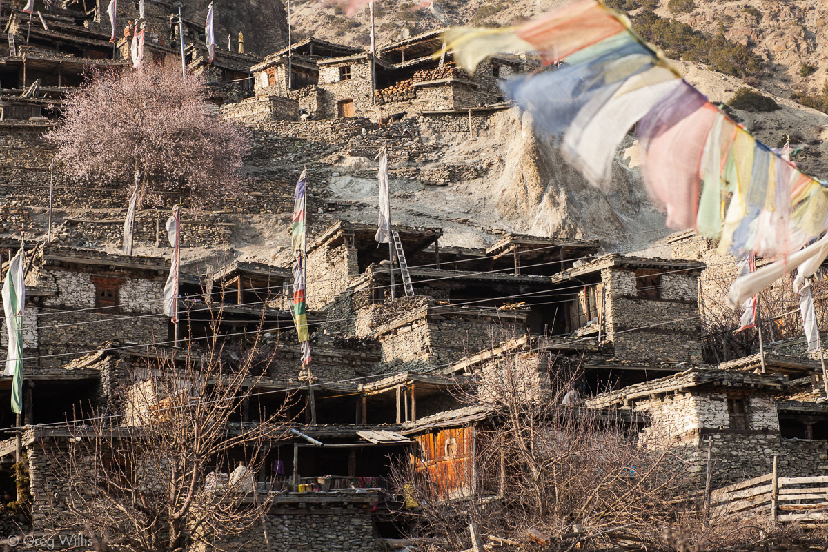
The town itself is huddled on a hillside overlooking the river. The houses are steeply stacked up the hillside, making every roof a terrace to the house behind it. And at the very top of it all is the white and red gompa.

Bragha, Annapurna II 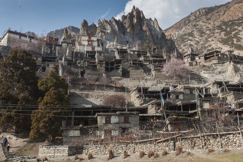
Bragha 
Bragha
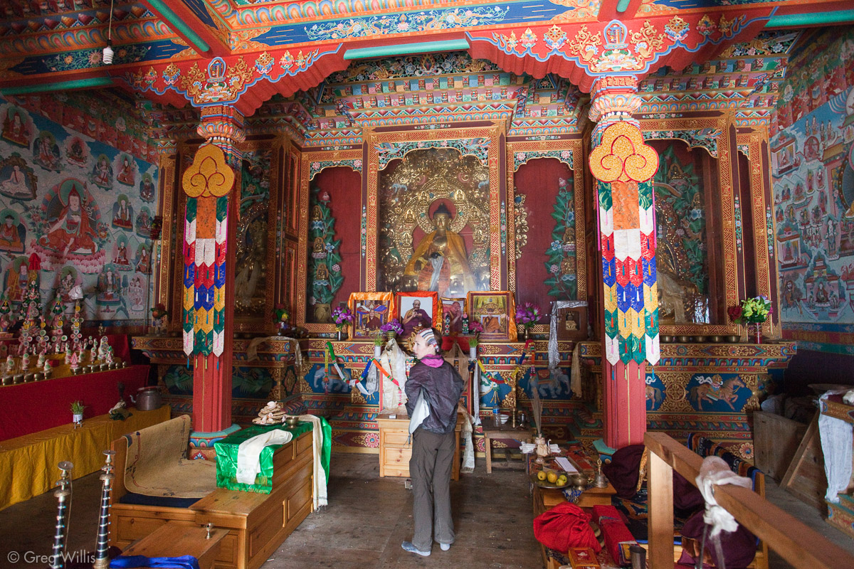
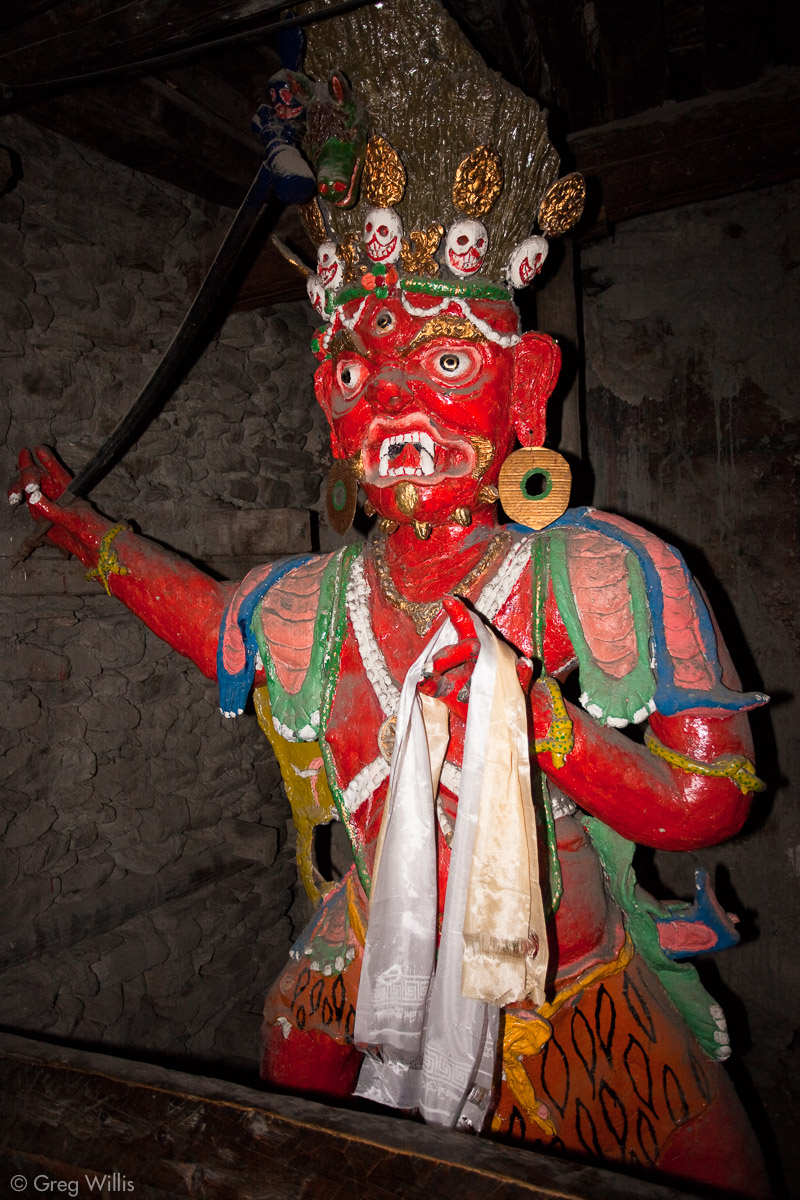
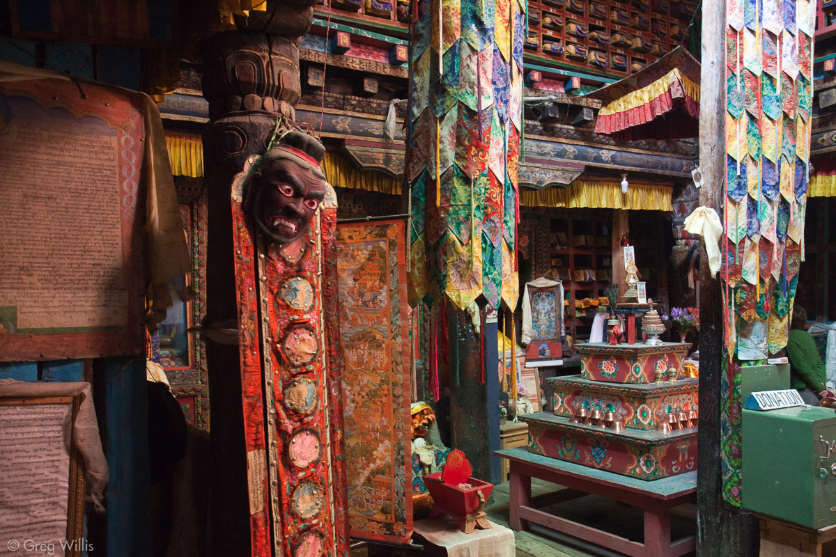
Even though we passed other gompas, this was the first we got the chance to visit. Inside was dark. Again, no monks – just other tourists. This is culturally insensitive, I know, but it felt like a cross between a carnival fun-house and the props room of a theater. We found a fine red fellow who greeted you right inside the main entrance. And the main ceremonial room was richly decorated with brightly colored objects:
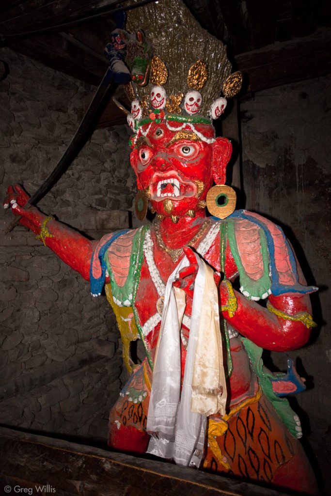
Demon in the Bragha gompa 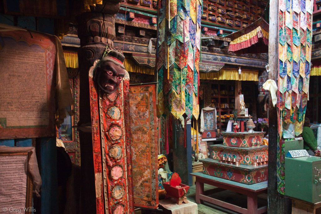
Inside the Bragha gompa 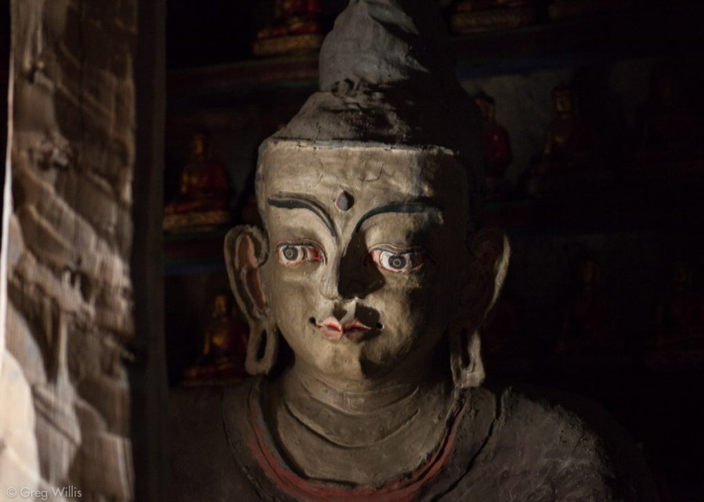
Buddha in the Bragha gompa

So by no means should you pass this by. Even if you’re going to Manang, make the stop for the gompa of Bragha.
- Places: Milarepa’s Cave – Bragha
- Time walking: 4:00
- Temperature: low of 47°F
- Elevation gain: 2,000 ft
- Lodging: Hotel New Yak, Bragha

1 Comment