Table of contents
Day 9: Bragha to Yak Kharka – 25 Mar 2010
Most folks stay in Manang for their acclimatization day – it’s a bigger town with more trekkers, shops, and a number of German bakeries (yes, German bakeries). We stayed in Bragha, preferring the proximity of the Milarepa’s Cave trail and the old village. But Manang does have its charms. I’d be hard-pressed to choose between the two villages again. We passed through Manang about thirty minutes after leaving Bragha, so they’re actually pretty close together.
Manang
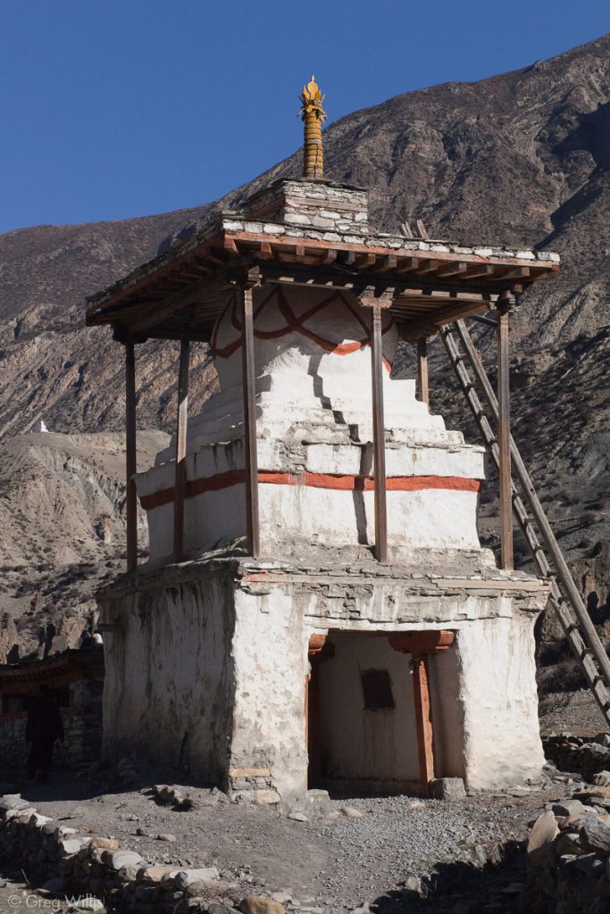
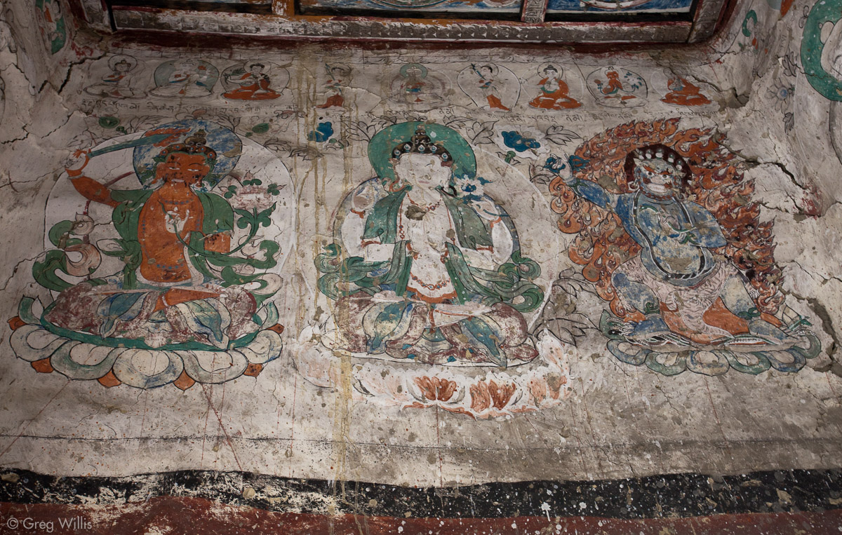
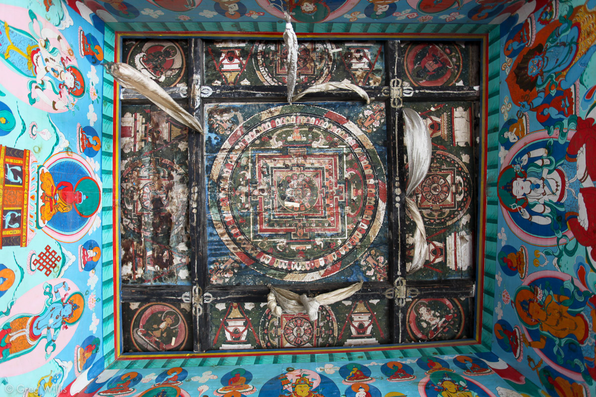
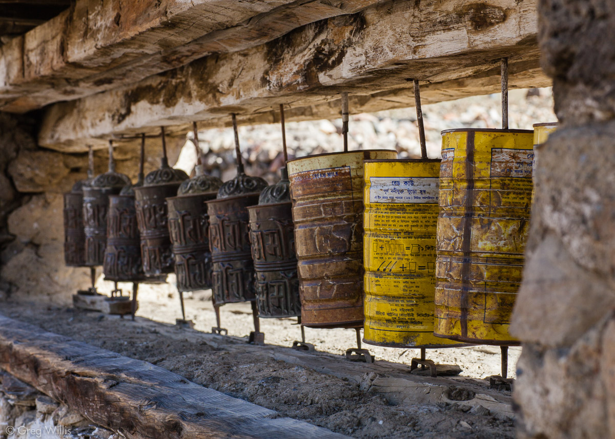
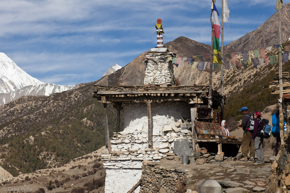
Manang has a number of old chortens, or stupas. The ones lower in the valley looked much newer than these. They often had prayer wheels inside and well as painted walls & ceilings.
Kani between Bragha and Manage 
Paintings inside a kani 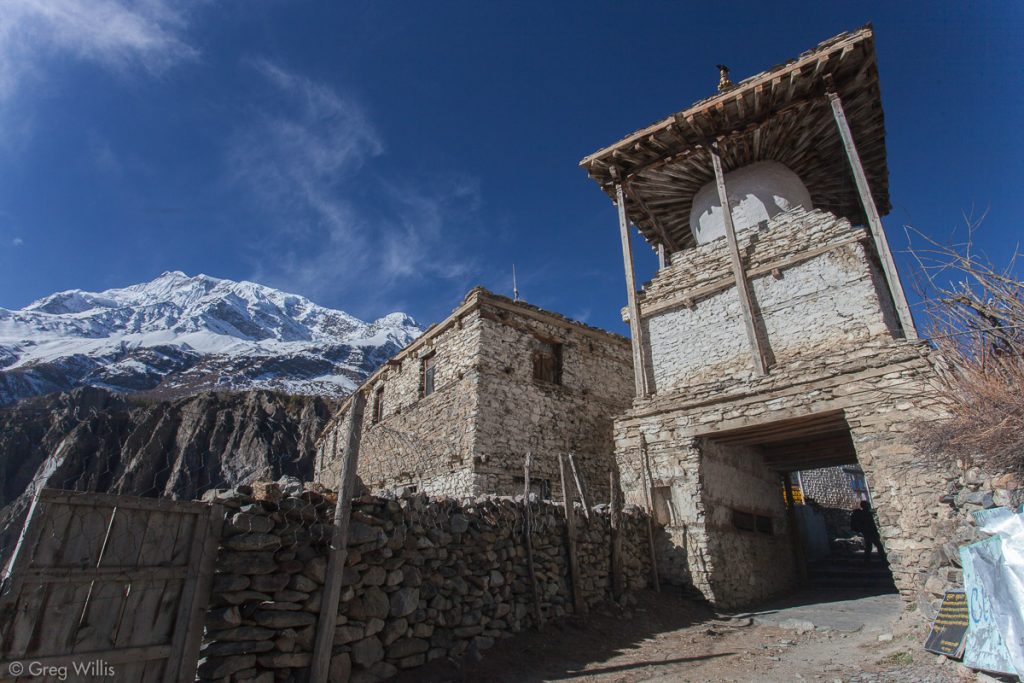
Kani (entrance gate) in Manang 
Newly painted ceiling in a kani 
Prayer wheels (prayers on the inside)


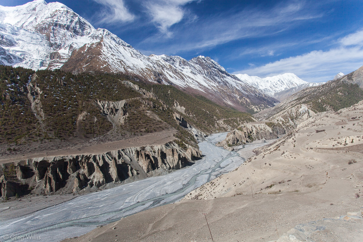
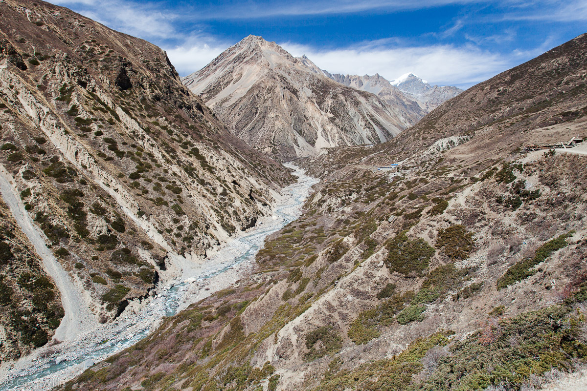
After leaving Manang, the AC began to climb once again out of the valley. The Jharsang Khola and the Kangsar Khola (both rivers or streams) meet near Manang to form the Marsyandi river. For our direction of travel, however, the river splits. And the higher vantage shows the confluence.
The AC takes the northern path of Jharsang Khola to the Thorung La Pass. After Tengi, last permanent settlement, the trail leaves behind the normal local traffic of porters and donkeys — leaving the trekkers to themselves. You also leave behind any trees. The rain shadow of the mountains turns the landscape dry, scrubby, and inhospitable. In truth, the trail becomes lonely without the buzz of the small villages.

Woman selling items at a chorten 
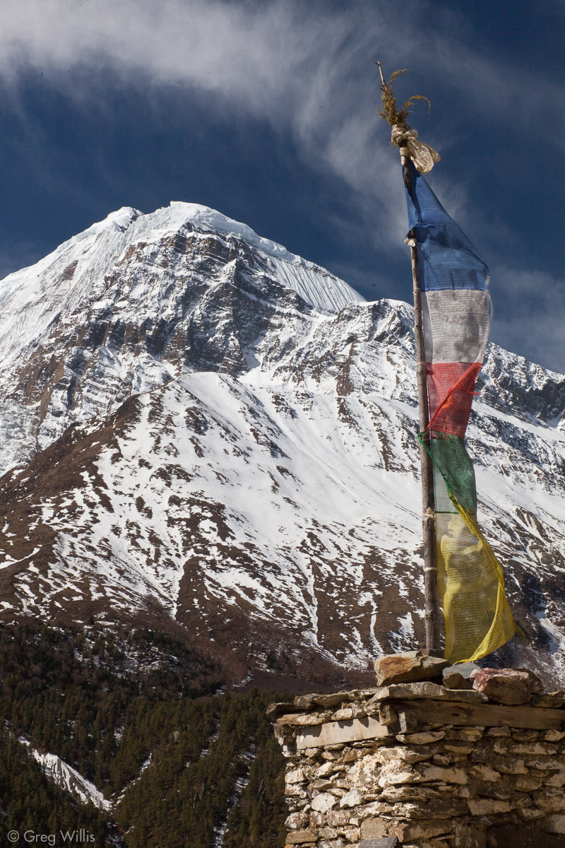
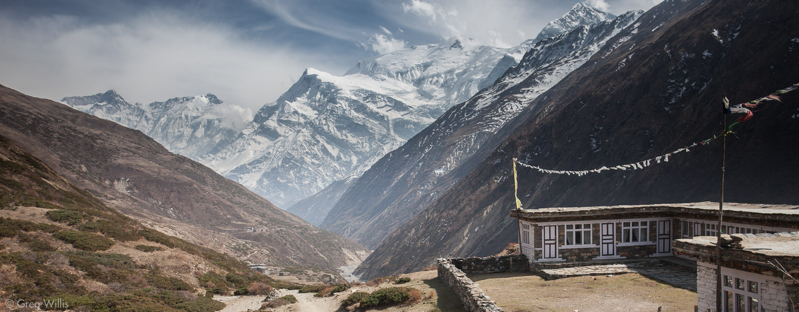
Prayer flags and Gangapurna 
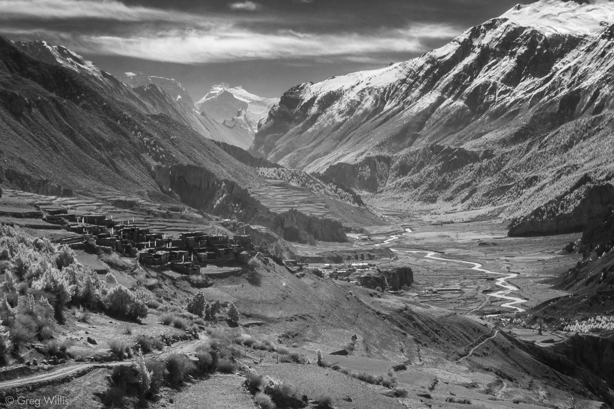
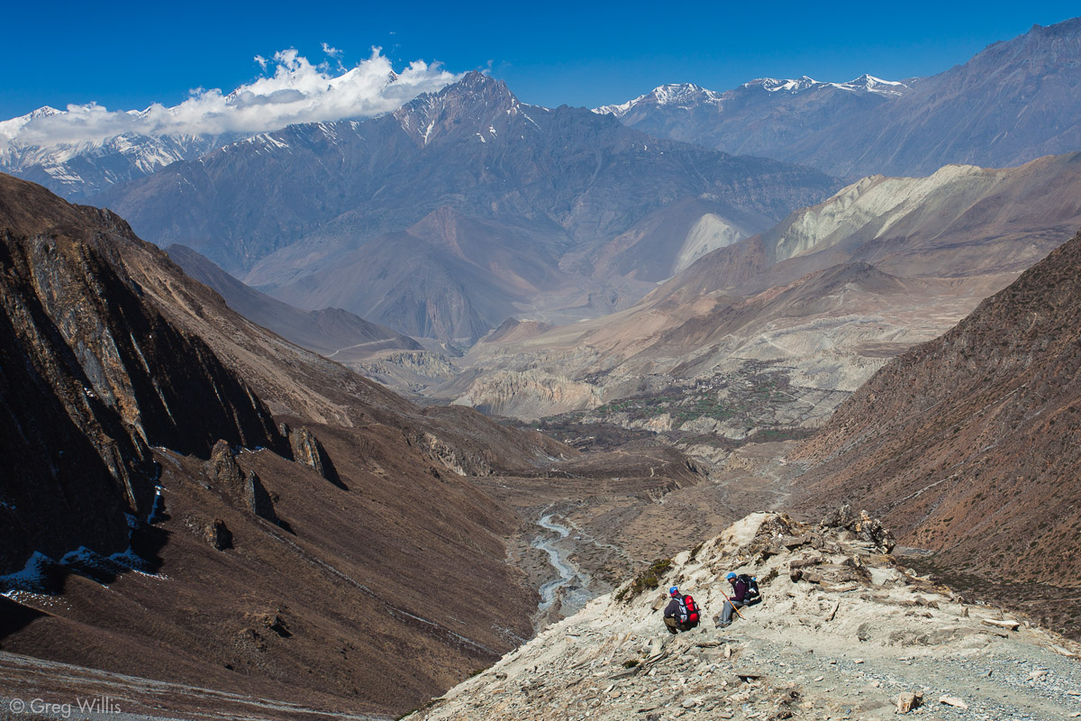
The Marsyandi Valley 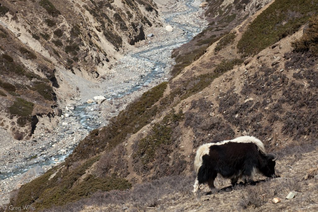
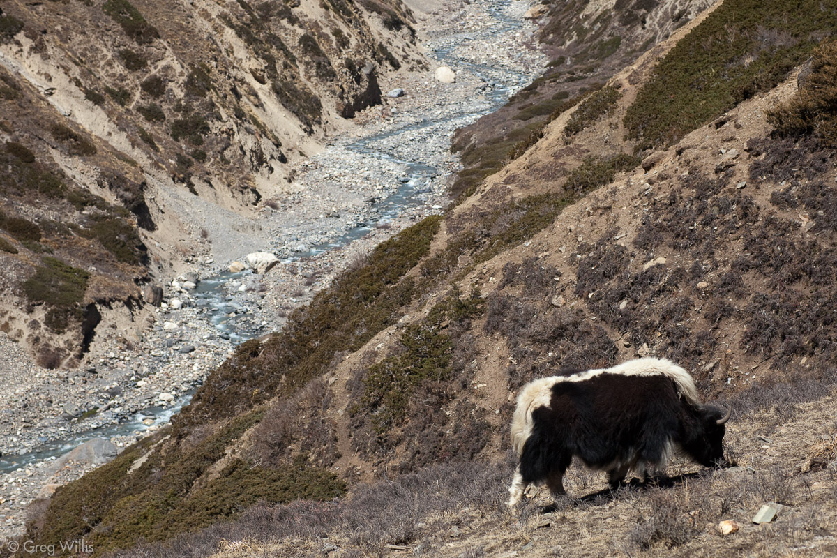
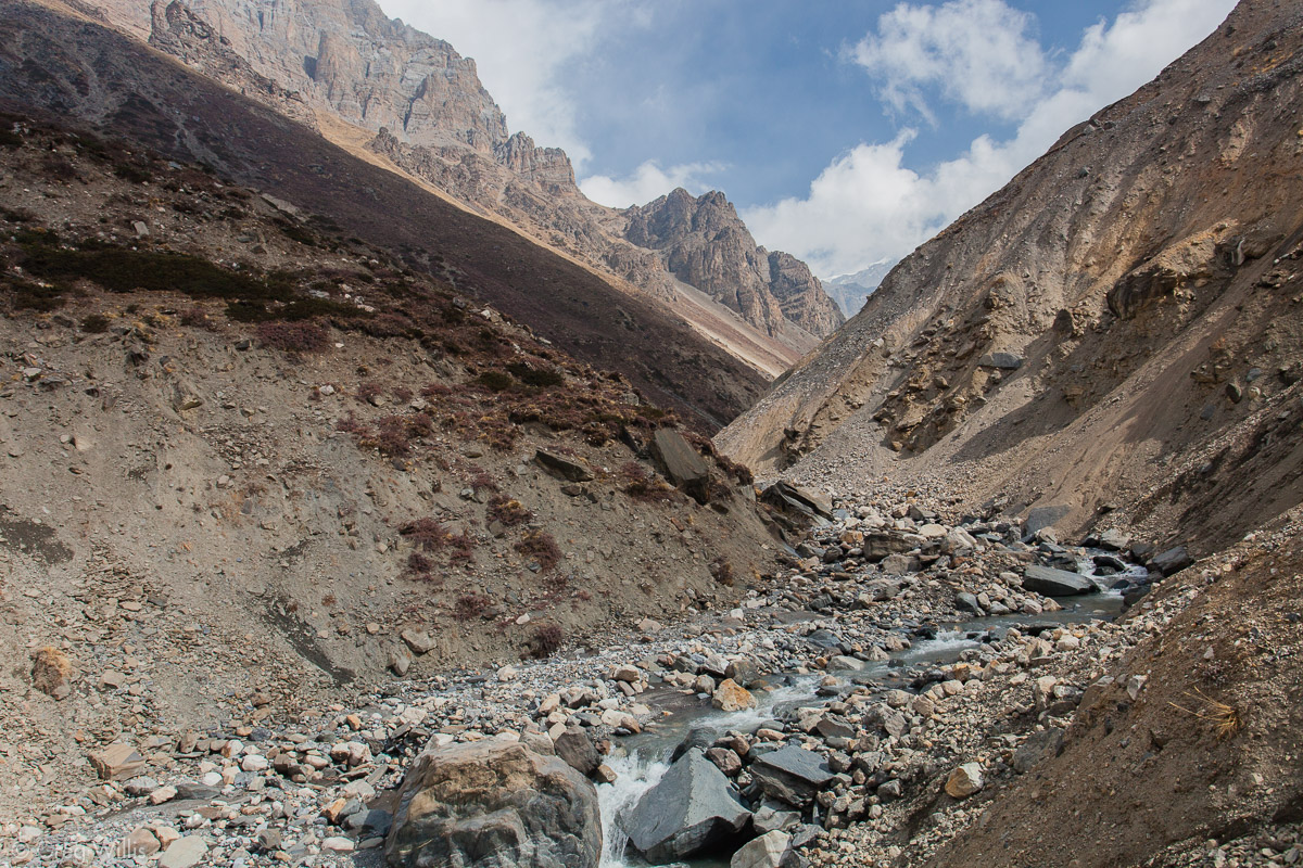
Yak and Kone Khola River 
Kone Khola River
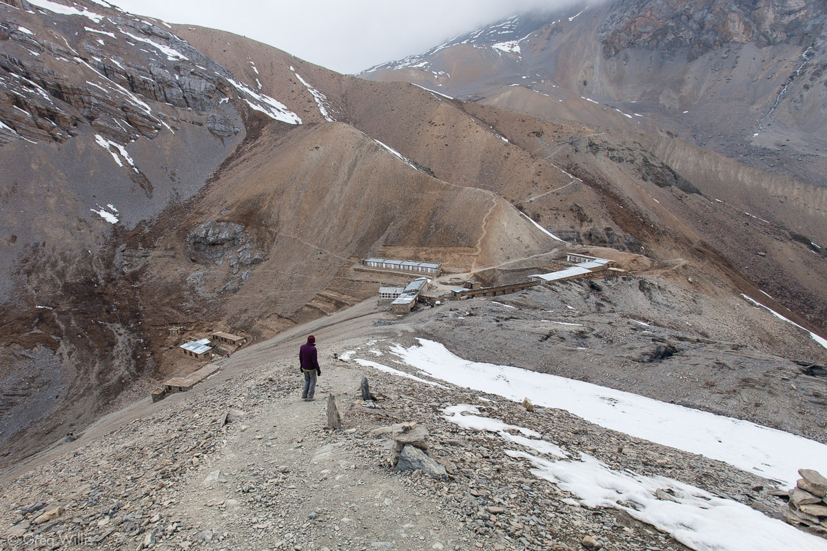
Yak Kharka
By the time we arrived in Yak Kharka, the clouds had begun to move in. With the absence of sun, the wind proved much more chilling. Eagles rode the winds in the air above, but the lighting was too disappointing for any photos.
But even the eagles could not really distract us. The Thorung La Pass is now the focus. Previously, the passing villages or anticipation of our upcoming night’s stay would occupy my thoughts. But after Manang, there were no real villages and there was really only one destination that mattered — the Thorung La Pass. After Bragha, the night’s lodgings had nothing to recommend – the food was just fuel and the rooms were uniformly cold. But you don’t stop at these lodges for their amenities. You stop because if you kept on going you’d get dizzy and fall off the mountain.
Yak Kharka sits at Oops. which is higher than any city in the US, and not at an elevation from which tumbling down sounds appealing.
Stats
- Places: Manang – Tengi – Yak Kharka
- Time walking: 7:00
- Elevation gain: convert units=”feet”]1800[/convert]
- Lodging: Himalayan View Hotel and Restaurant
Day 10: Yak Kharka to High Camp – 26 Mar 2010
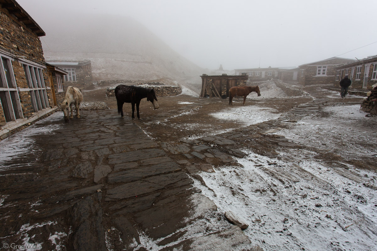
The eagle should have warned me. If there are eagles, many eagles, they must be eating something in plentiful supply. Their meals, turns out, were the plentiful mice: who, in turn, made meals of our own food supply. Repeatedly. All the other folks we talked with had similar nocturnal visitors. We renamed Yak Kharka to the more fitting Mouse Kharka.
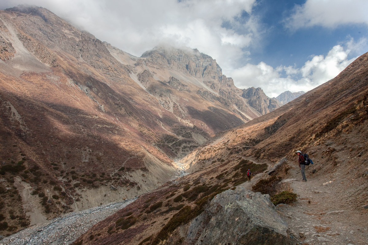
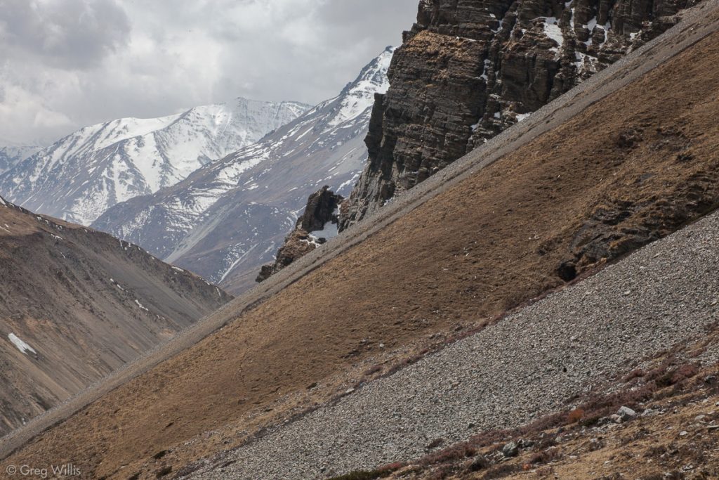
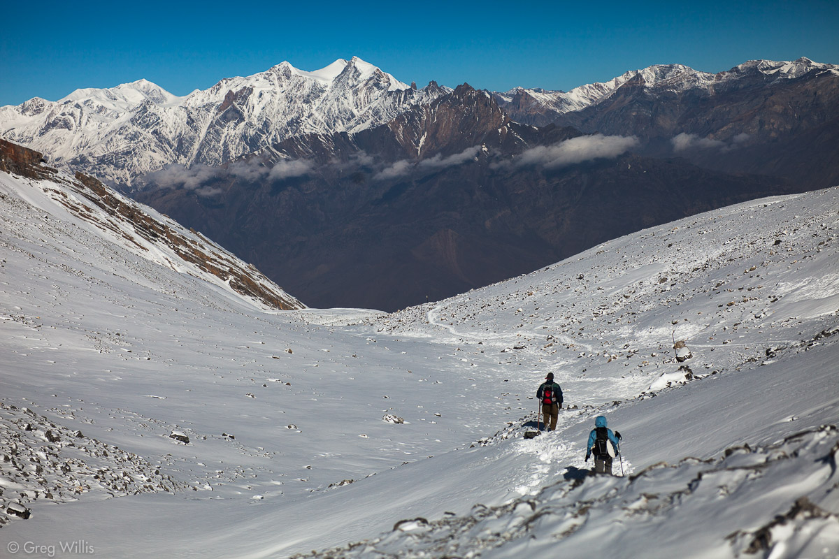
Of course, I wouldn’t want to say that this part of the trail is boring, because the landscape is wondrous. But in the steep Jharsang Khola valley, the higher Annapurna Range becomes once more obscured by lower, steep hillsides. And the more closed-in mountains hold none of the Annapurna’s glacial majesty. But then again, maybe it was the many clouds. The AC trail itself, because of the lack of local commercial traffic, became a narrow hiking trail. It clung to the steep, dirt-bare valley sides, zig-zagging its way down one side and up another of the Jharsang valley.

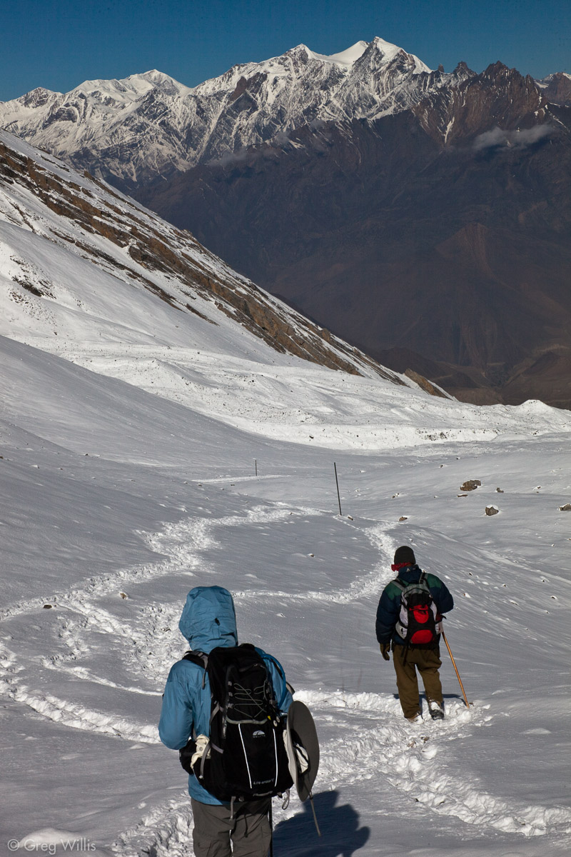
Kone Khola valley 
Kone Khola valley, near bridge
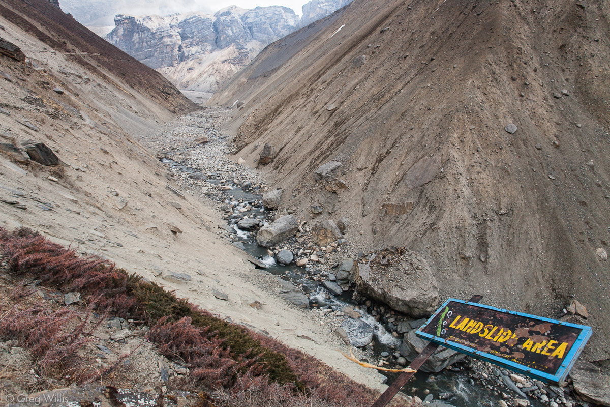
Then there was the landslide area. For about a mile the path cut through a slate strewn slope. The traverse wasn’t dangerous to walk on, but if anything above slipped there wasn’t much place to hide.
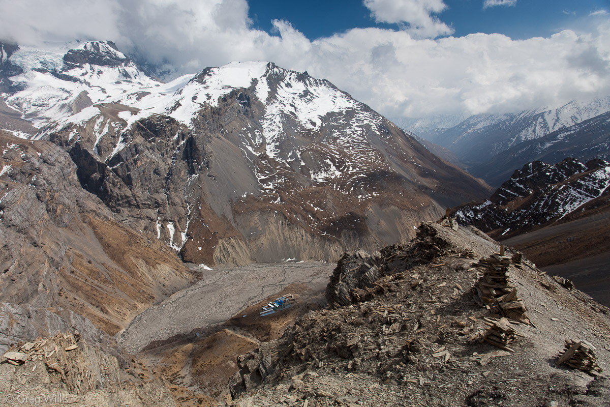
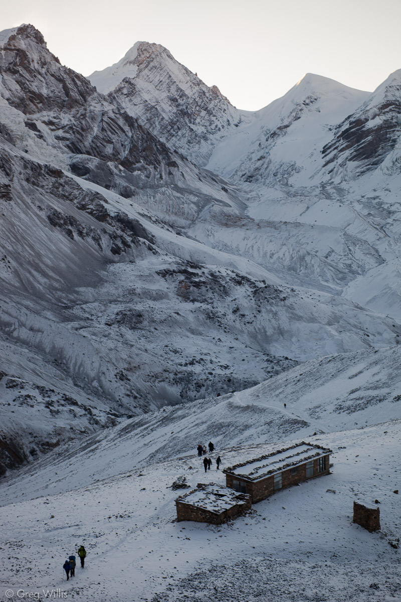
Thorung Phedi
Our early lunch was at Thorung Phedi, nestled in the bowl-like head of the Jharsang Khola and nearly surrounded by cliffs. Some trekkers stay the night here rather than going the additional Oops. up to sleep at High Camp. It could be that a lower elevation night might make for better sleeping, but we’d already slept poorly in Yak Kharka so I doubt it would have made much difference to us. Both Thorung Phedi and High Camp are just expanded lodges, existing only for the trekkers. The Oops. climb up to High Camp took us about an hour. The switchbacks on this steep trail reminded me of the initial ascent to Ghyaru on the High Route of Day 7. But the relentless steepness of the trail made it the toughest of the AC.
Between Thorung Phedi and High Camp 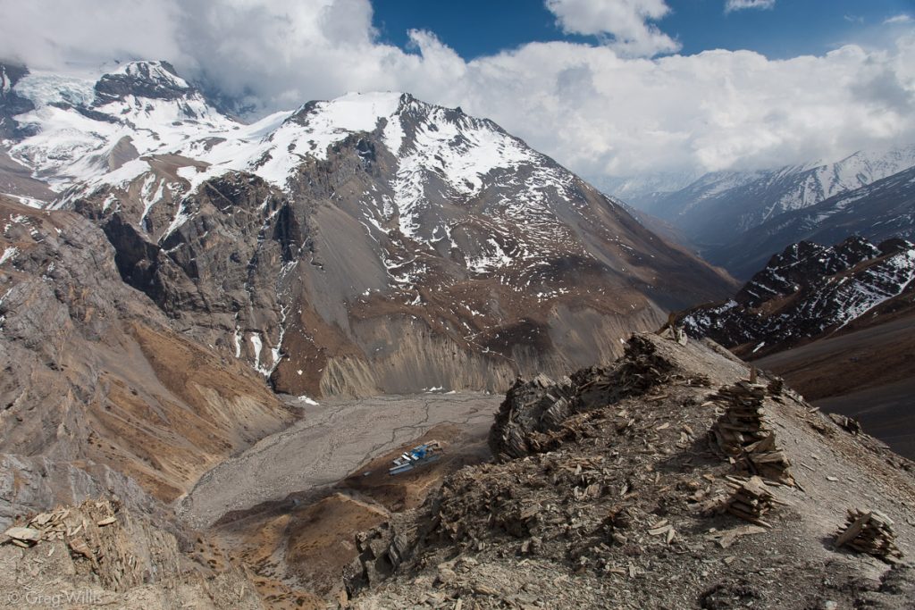
Looking down on Thorung Phedi

We keenly felt the altitude — frequent stops and labored breathing. But even as such we were a bit better than the other folks on the trail. We gasped into High Camp at 13:00.
High Camp
At 14:30 our guide Devendra wanted us to go on a short hike to the top of a peak overlooking High Camp. Even though we didn’t want to go — tired and cold as we were — we gave this last bit of acclimatization a go. The view from the top did have a good view of Thorung Phedi (see above) and High Camp itself – but you do it for the red blood cells, not the vista.
So we were back by 15:00, with nothing but time to kill before going to bed. Luckily we found some folks we’d met earlier on the AC: Steve, Kim, Ann who we met in Pisang, and Aaron who we met in Yak Kharka. So we set up shop on a table and killed the time together eating, talking, and drinking thermoses of tea. Late afternoon clouds had once again obscured the sun. And as it darkened, a light snow began to settle on the ground.
High Camp had a kerosine heater, but it wasn’t in our part of the main room. The trick, so it seemed, is to just wear your sleeping bag in the common rooms. I think we packed it in before 21:00.
I’d be remiss if I didn’t mention the toilet. Nepali toilets are pretty much a ceramic hole in the ground with areas on either side to place your feet. High Camp had two outside rooms dedicated to this. Now usually, this is a good setup — easy to use, easy to clean. But the goodness of this setup, so we found, depends on temperatures above freezing. Once your Nepali toilet goes below freezing, the inevitable splash and spray of normal use renders it an icy, treacherous hazard. Suffice to say, I’ve never been more thankful of my ability to recover my balance.
High Camp is at Oops. – higher than all the mountains in Colorado.
Stats
- Places: Letdar – Thorung Phedi
- Time walking: 5:00
- Elevation gain: Oops.
- Lodging: Thorung High View Camp
Day 11: High Camp to Ranipauwa – 27 Mar 2010
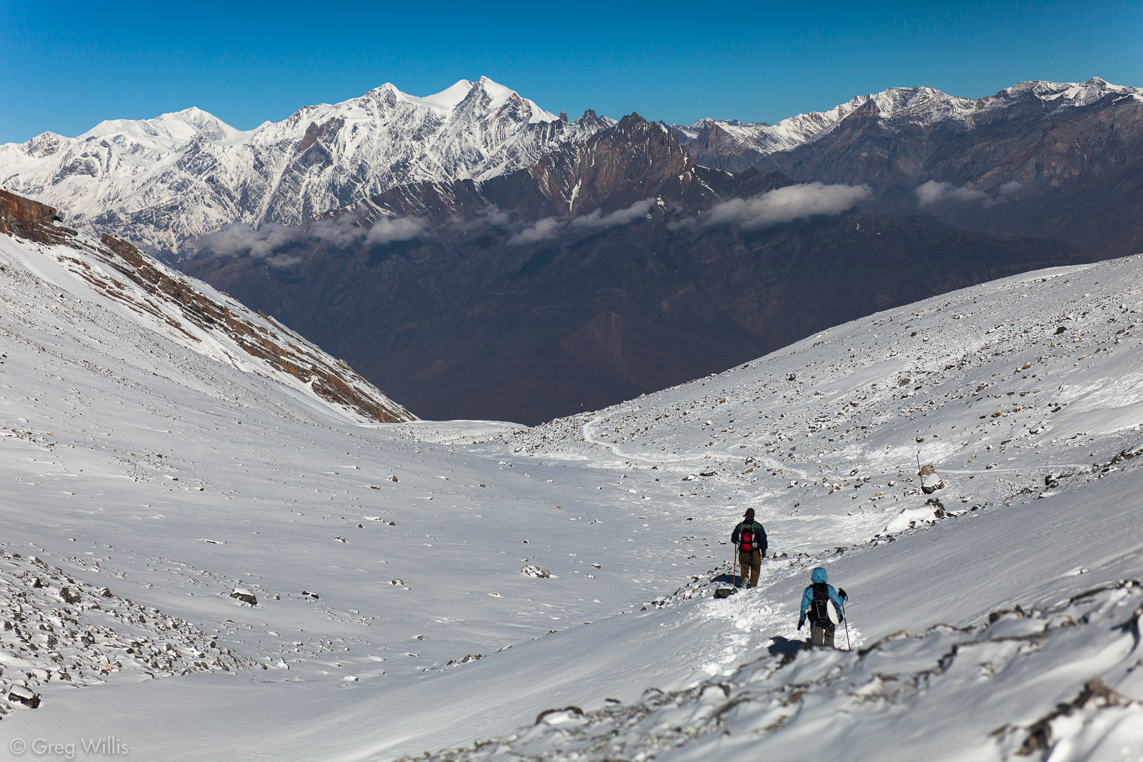
Our cold, fitful night’s sleep ended early at 04:30. Even in the dark we could tell that yesterday’s clouds brought a couple of inches of snow overnight. We had a brisk breakfast and tea. I’m not sure we really needed to be on the trail by 05:30 — but when going up a mountain, earlier is generally better. Plus, all the kids were doing it. So we strapped on our headlamps and set out.
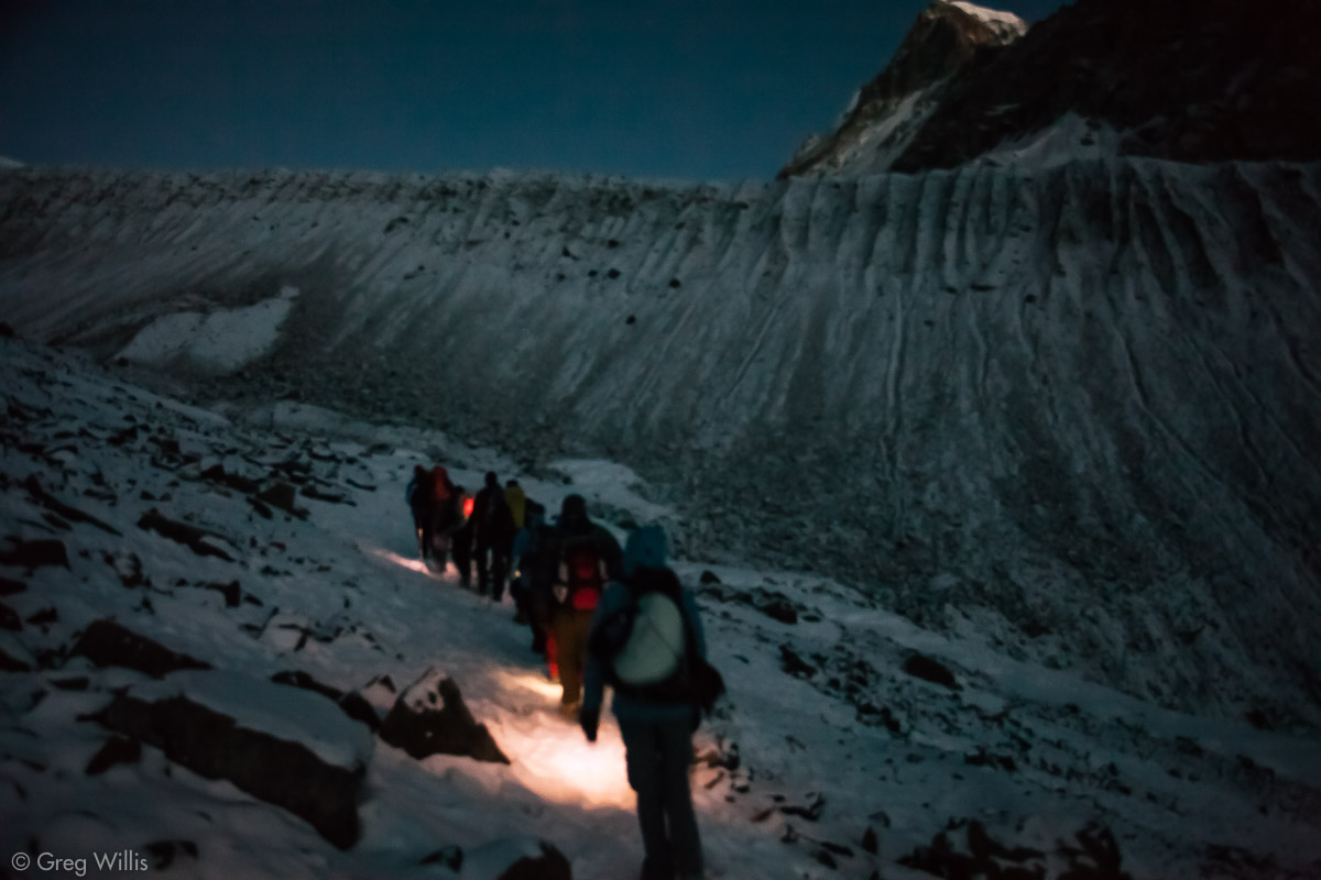
Make no mistake, going up to the pass was a slog. It’s not the kind of difficulty that requires physical strength, just one that requires putting one foot in front of the other. Although we started out in darkness, I’d turned my headlamp off after about 20 min. And by the time we reached the Rest All You Want Teahouse (06:20) the sky had been bright enough for normal vision.The next hour and a half consisted of putting one foot in front of another through the snow, hoping the next rise would finally be the Pass. And indeed, eventually one of those rises didn’t have another one behind it.
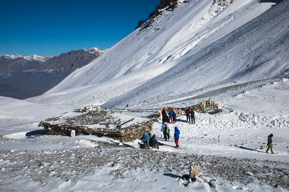
Thorong-La Pass
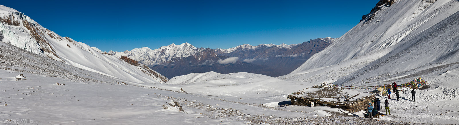
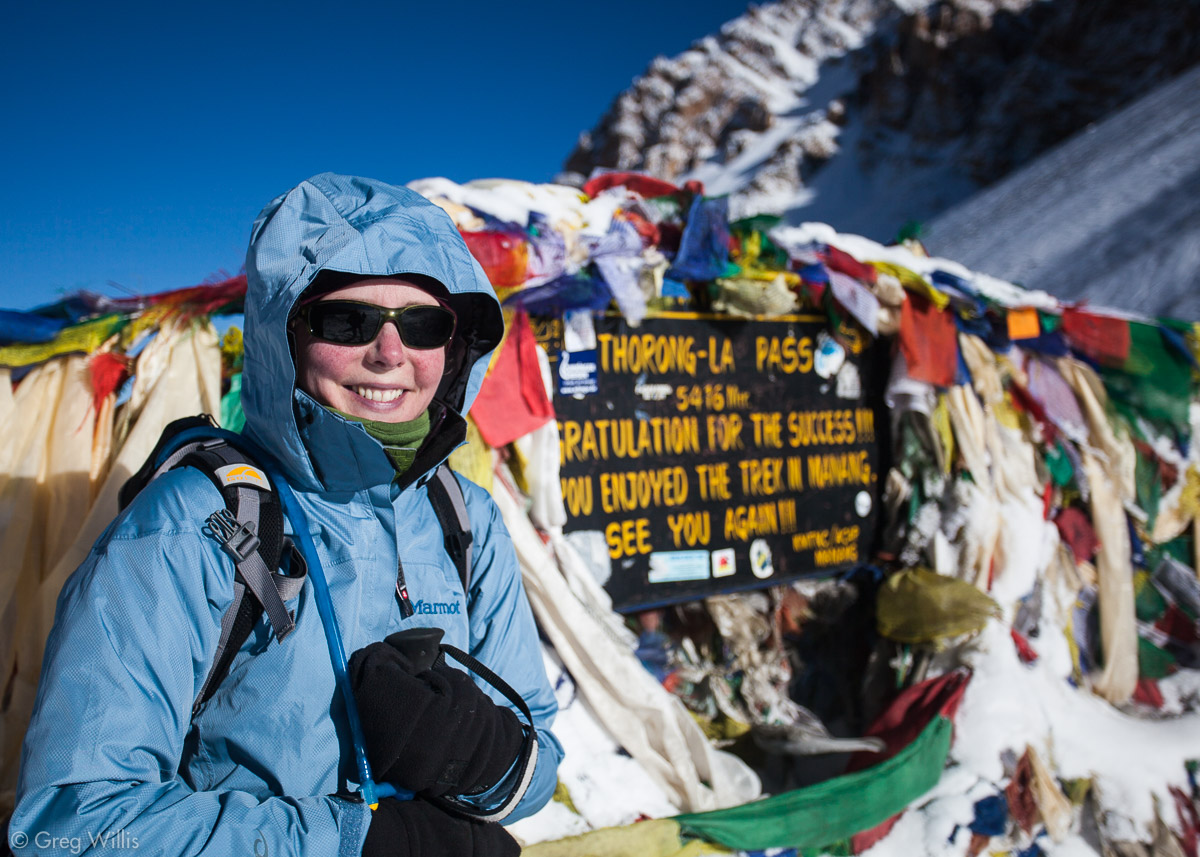
After a few false summits, we made a turn and saw the sign, festooned with prayer flags:
THORONG-LA PASS
5416 Mtr.
CONGRATULATIONS FOR THE SUCCESS!!!
HOPE YOU ENJOYED THE TREK IN MANANG.
SEE YOU AGAIN!!!
The pass itself is quite broad — flanked by the gentle slopes of Khatung Kang and Yakgawa Kang. At 17,769 ft / 5,416 m the pass is about a half mile above any mountain peak in lower 48 and higher than all but four mountains in North America. We felt the elevation — we both were a bit light-headed. We had some black tea from the improbable teahouse that sits in the saddle of the pass, and rested for just a bit before heading down the other side.

Rest All You Want Teahouse 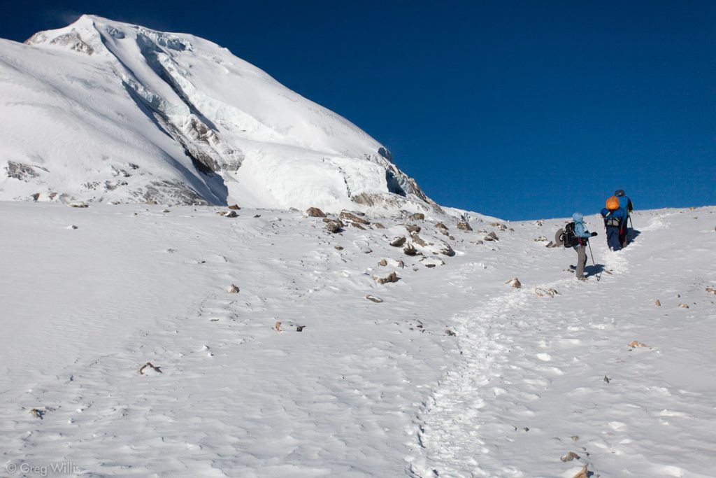
Nearing the Thorung La Pass 
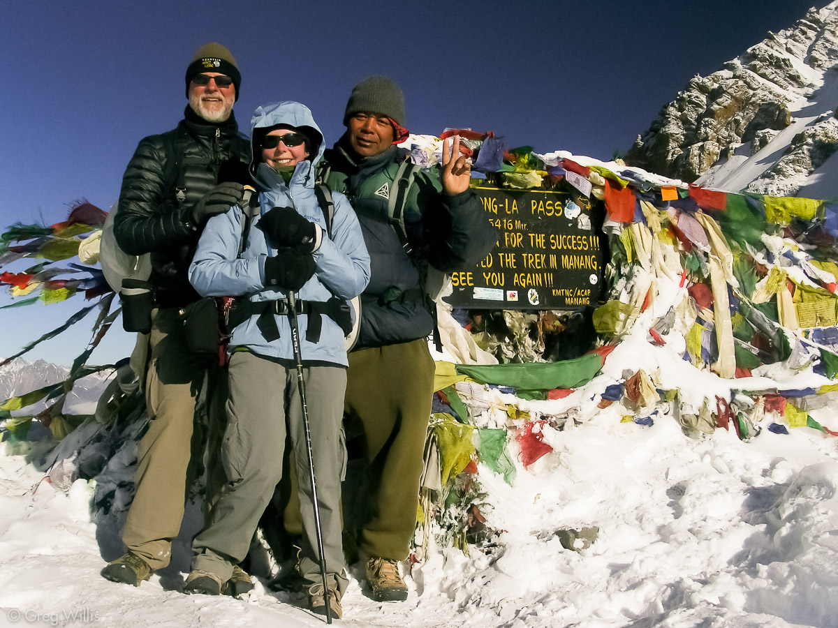
Greg, Heather, & Devendra on the Thorung La Pass 
Thorung La pass teahouse and marker (17,769 ft) 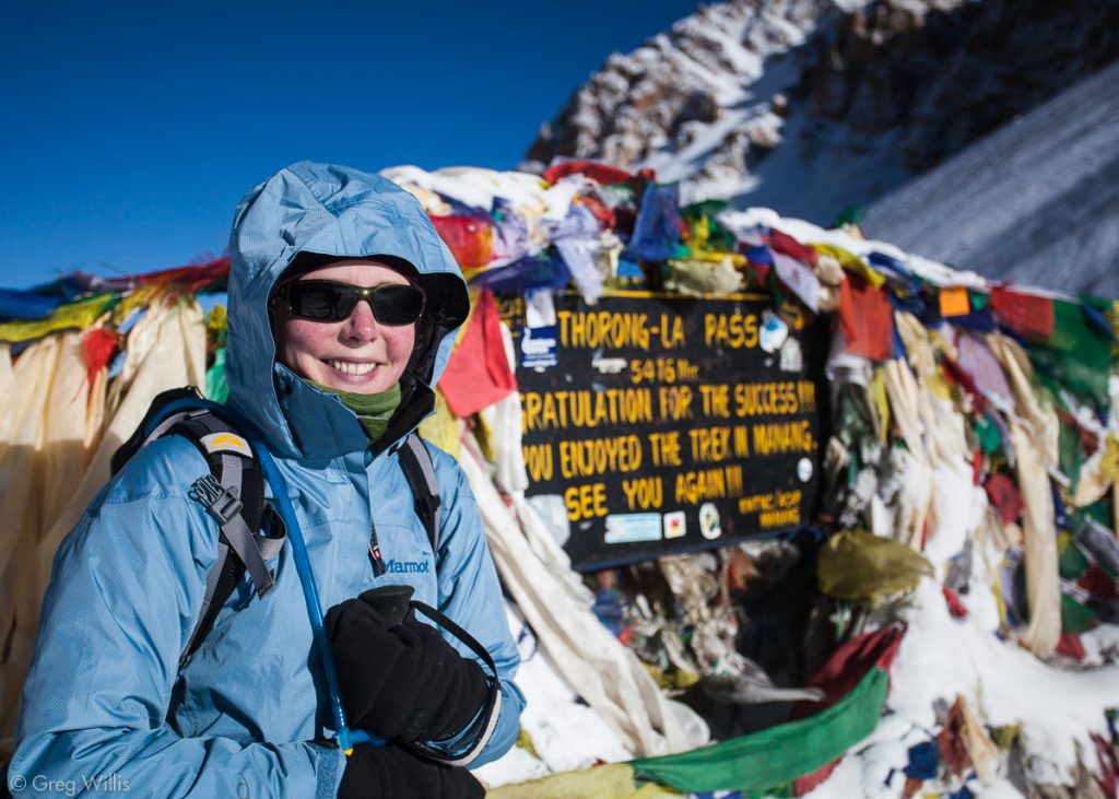
Heather at Thorung La pass (17,769 ft)

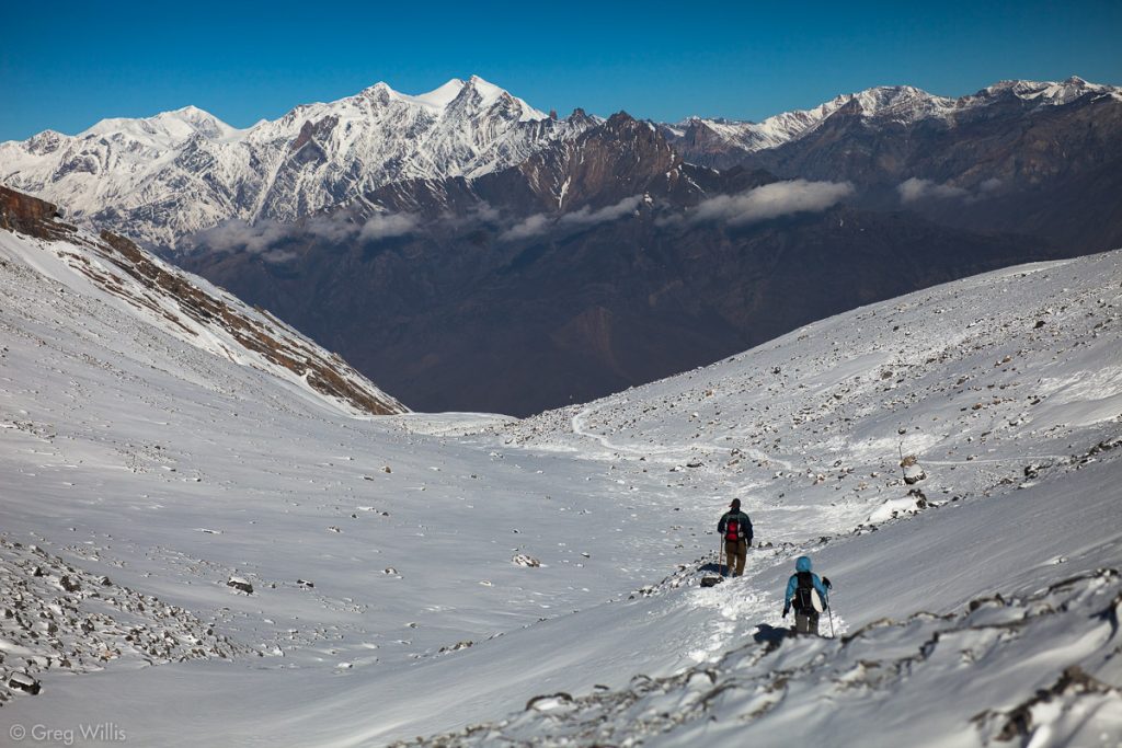
We’d made it to the pass by 08:00 and were anxious to get to thicker air. In contrast to the convoluted and circuitous trail we just climbed, the trail down to the Jhong Valley just seemed to drop straight off the mountain. This explains the counter-clockwise direction trekkers usually take for the AC.
The 2-3″ of snow east of the pass became 4-5″ on the west, and made for a slippery mudfest on the way down. The descent is brutal. About a mile down (1,600 m) for 6.0 mi / 9.7 km of trail (4 hours). By about halfway down my left knee, despite trekking poles and a brace, decided that it had bent enough for the day. So I straight-legged it down for the rest of the way down. The scenery, however, was stunning. The wide, brown Jhong Valley spread out with the snowcapped high mountains of Upper Mustang far behind it. And every step revealed more of this huge and varied valley.
Beginning the descent to Muktinath in the fresh snow 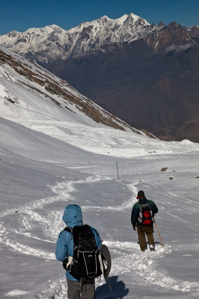
Descent to Muktinath 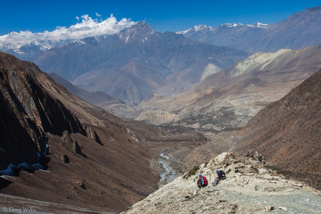
View of the Jhong Khola valley to the Kali Gandaki
The trail flattened out around Chabarbu, where we took a break. And soon we had reached the prayer flag draped slopes and the long white walls of the Muktinath temple complex. We were beat, however, so we continued for another 30 minutes to our lodging in Ranipauwa, arriving around 13:00. Lunch was some kind of odd Nepali Mexican dish, but boy it was good.
Muktinath
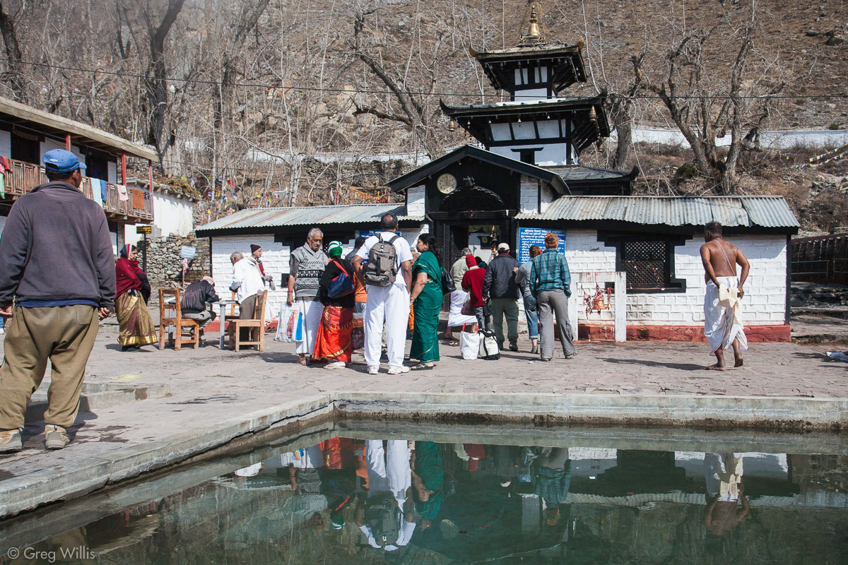
After lunch, a hot shower (hot), and a nap we reluctantly retraced our steps back up to Muktinath to visit the shrines. The complex has both Hindu & Buddhist shrines, and both faiths make the pilgrimage here. Originally one of the most ancient Hindu temples of God Vishnu, the founder of Tibetan Buddhism, Guru Rinpoche, had meditated at Muktinath (or Chumig Gyatsa for Buddhists) on his way to Tibet. Vishnu is worshipped here as Muktinath, the Lord of Salvation, while Tibetan Buddhism worship him as a bodhisattva. Why here? In the the river beds near here you can find black ammonite fossils. Hindus call these saligrams (or shaligrams) and believe that these are representations of Vishnu. Additionally, according to both Buddhist and Hindu tradition, Muktinath is the only place on earth where you can find all the five elements — fire, water, sky, earth and air — at the same place together in their own and distinct form.
In addition to sundry minor religious structures, there are three major temples. The central temple has a pagoda within which lives the god, a statue of Vishnu that you are not allowed to photograph.
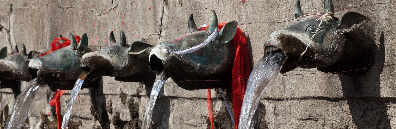
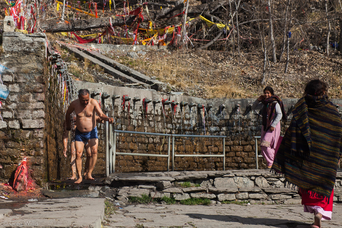
On the back wall of the temple are there are 108 brass waterspouts shaped like cows’ heads, from which cold and sacred water flows. 108 is a sacred number for Buddhists (12 zodiac * 9 planets = 108). The deal for pilgrims is to strip down and have a run underneath the falling water.
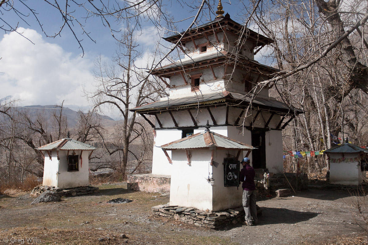
The second major temple is the Narsingh Gompa at the north end of the complex, but it was closed when we visited. Its vantage provides a wonderful view of the slopes of Khatung Kang strewn with the prayer flags we saw earlier.
The third, Dhola Mebar Gompa, or Jwalamai (Goddess of Fire) Temple, stands at the southern end. This is the temple that brings all five elements together. The geology here is one of major landslides. Landslides bury organic matter, which in turns rots and gives off methane gas. In addition to the four other element, when you light this seeping methane you get all five elements in one place naturally. And sure enough, inside and behind an iron grate the temple has a small blue flame you can visit. Once again, no photos.

Shiva Temple, Muktinath 
Small shrine. Muktinath 
Men running through the 108 waterspouts at Muktinath
We then headed back to our lodging at Ranipauwa. The day had been exhausting and had a major change of the tone of the trek. In the morning we were spartan alpinists, summiting a high pass in the lonely desolation of the mountains. Then by the afternoon we were normal tourists visiting the guidebook sights with the incessant noise of motorbikes surrounding us. I cannot express how shocking the motorbikes were. The last time we heard an internal combustion engine was the road construction near Dharpani on Day 4 – a whole week.
But having the pass behind us was a relief. Before the pass you didn’t know exactly how the elevation would take its toll, you didn’t know if you would get sick and waste a day of two to recover. But since that was literally behind us, the remainder of the trek would have one less uncertainty.
At Oops., Ranipauwa banished any affects of the altitude — headaches, lightheadedness, and fatigue were but a memory.
Stats
- Places: Thorung La Pass – Chabarbu – Muktinath – Ranipauwa
- Time walking: 7:00
- Time walking from High Camp to Thorung La Pass: 2:00
- Elevation gain: Oops.
- Elevation loss: Oops.
- Lodging: Hotel North Pole, in Ranipauwa
Map for Days 9-11
- Annapurna Circuit: Part 1, Trekking 101
- Annapurna Circuit: Part 2, Gorge-ous
- Annapurna Circuit: Part 3, High Valley of Manang
- Annapurna Circuit: Part 4, Up & Over
- Annapurna Circuit: Part 5, Kali Gandaki
- Annapurna Circuit: Part 6, Hot Springs and Pink Mountains
- Annapurna Circuit: Should You Hire A Guide
- Annapurna Circuit: How Much Does Trekking the Annapurna Circuit Cost?

Leave a Reply