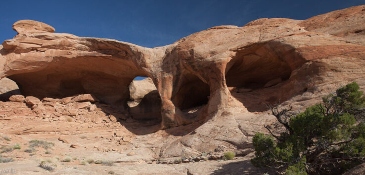
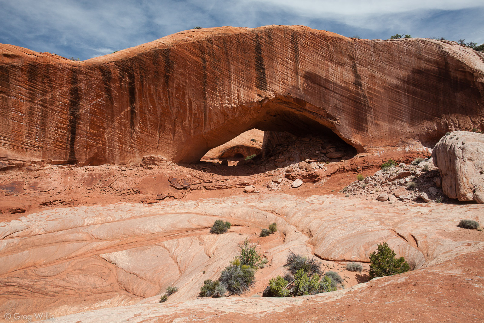
Colonnade Arch, or Five Hole Arch, is a geological formation in the San Raphael desert of Utah. Its claim to fame is the five openings — three in front & two on top — in its Navajo Sandstone. Located about 30.0 mi / 48.3 km south of the town of Green River, the arch is just to the west of the Bowknot Bend of the Green River.
Essential Facts
- Route: Colonnade Arch Trail
- Distance: 3.0 mi / 4.8 km
- Elevation: 400 ft / 122 m
- Difficulty: easy, but watch that wayfinding
- Time: 2 hours, leisurely pace & some wayfinding time
Why Go
Where else are you going to see and arch with five FIVE openings? Nowhere but here, that’s where.
When To Go
During the year: No particular flash flooding traps, so anytime would be good. Watch that sun in the summer — start early & hide in the arch.
During the Day: Morning. The whole thing faces east, so you’ll get the best light before noon.
Map & Route
Getting There
- Trailhead: Colonnade Arch Trailhead (view in Google Maps)
- Parking: Plenty
- Fees: None
- Bathrooms: No
- Campsites: Sure
Details
I have no idea why Colonnade Arch in Utah is not more widely know. Simply put, it’s the most amazing arch I’ve seen, and I’ve seen a few. It has five — count ’em — five openings: three in the front and two up top.
Driving. The most difficult part of this hike is the driving on the dirt roads to the trailhead. The 40.0 mi / 64.4 km of dirt road between the town of Green River and the start of the hike will test your patience, but it’s nothing technical. If it’s dry, that is. If wet, well, I wouldn’t. Luckily this part of Utah is pretty reliable dry. It took us about 1 1/2 hours.
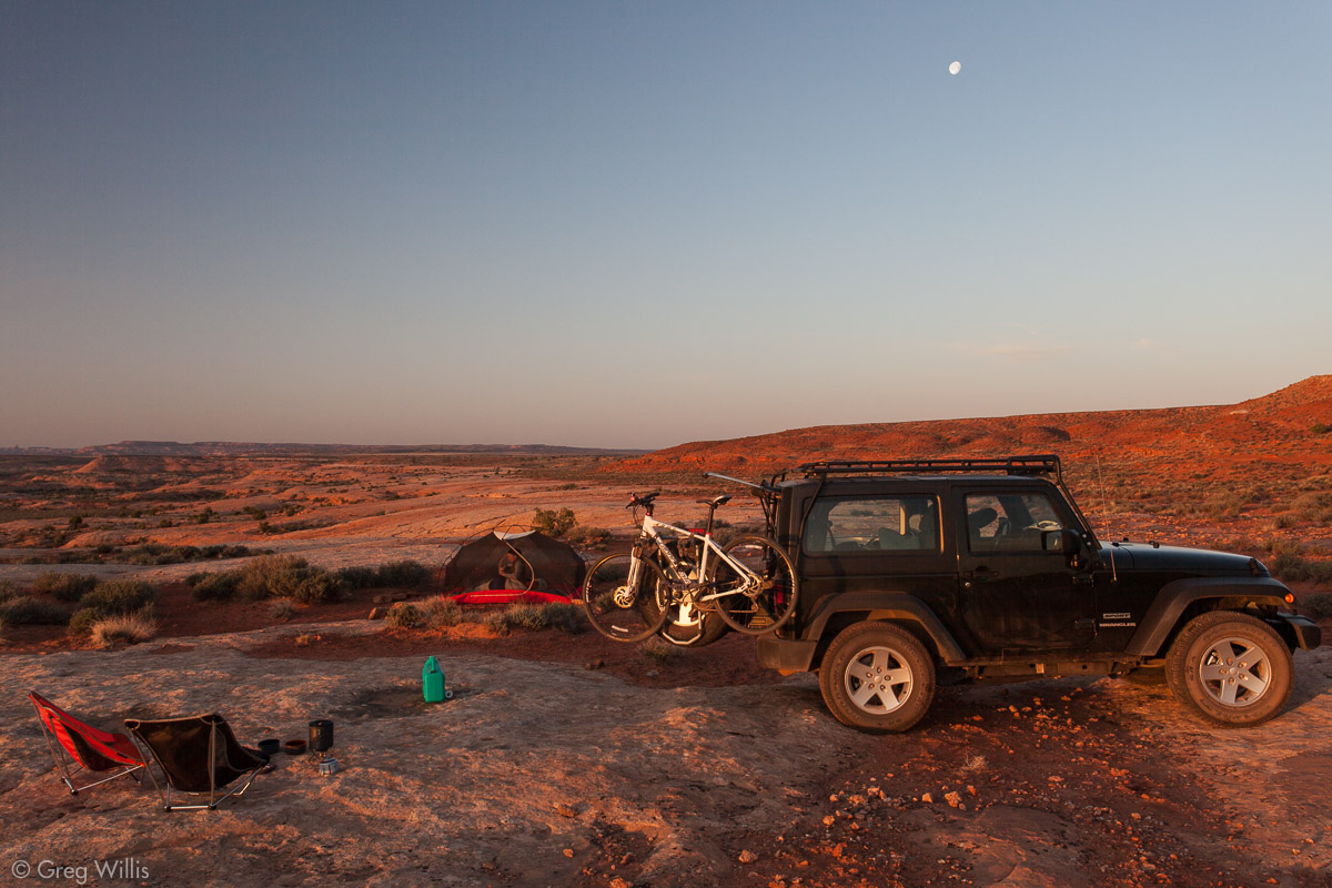
Camping. We camped, to best get that morning light. It’s BLM land, so camp anywhere you want — there’s plenty of existing sites. We were there on a weekend in late April and saw no one for the whole time.
I wouldn’t say the trail was well-cairned when we visited, so bring a map and know where you’re going.
Since you’re in the neighborhood, why not visit the Horseshoe Canyon section of Canyonlands National Park — it’s only around 11.0 mi / 17.7 km away.
Trip Report & Photos
28 Apr 2013
After burgers at Ray’s Tavern in Green River, we drove the 40.0 mi / 64.4 km of unpaved roads, taking our time & pulling off to have a look at any interesting geology. We camped right near the trailhead. Even though it was a Saturday night, we had the entire landscape to ourselves.
We set off on the hike after packing up camp. The trail isn’t difficult, but it was poorly marked — occasional cairns that have beyond-sightline gaps between them. A better marked trail would have shortened the time to the arch. I do recommend a map and a general idea of the arch location, otherwise you could spend a long day wandering in the San Raphael desert.
But man, once you get there, it doesn’t let you down.
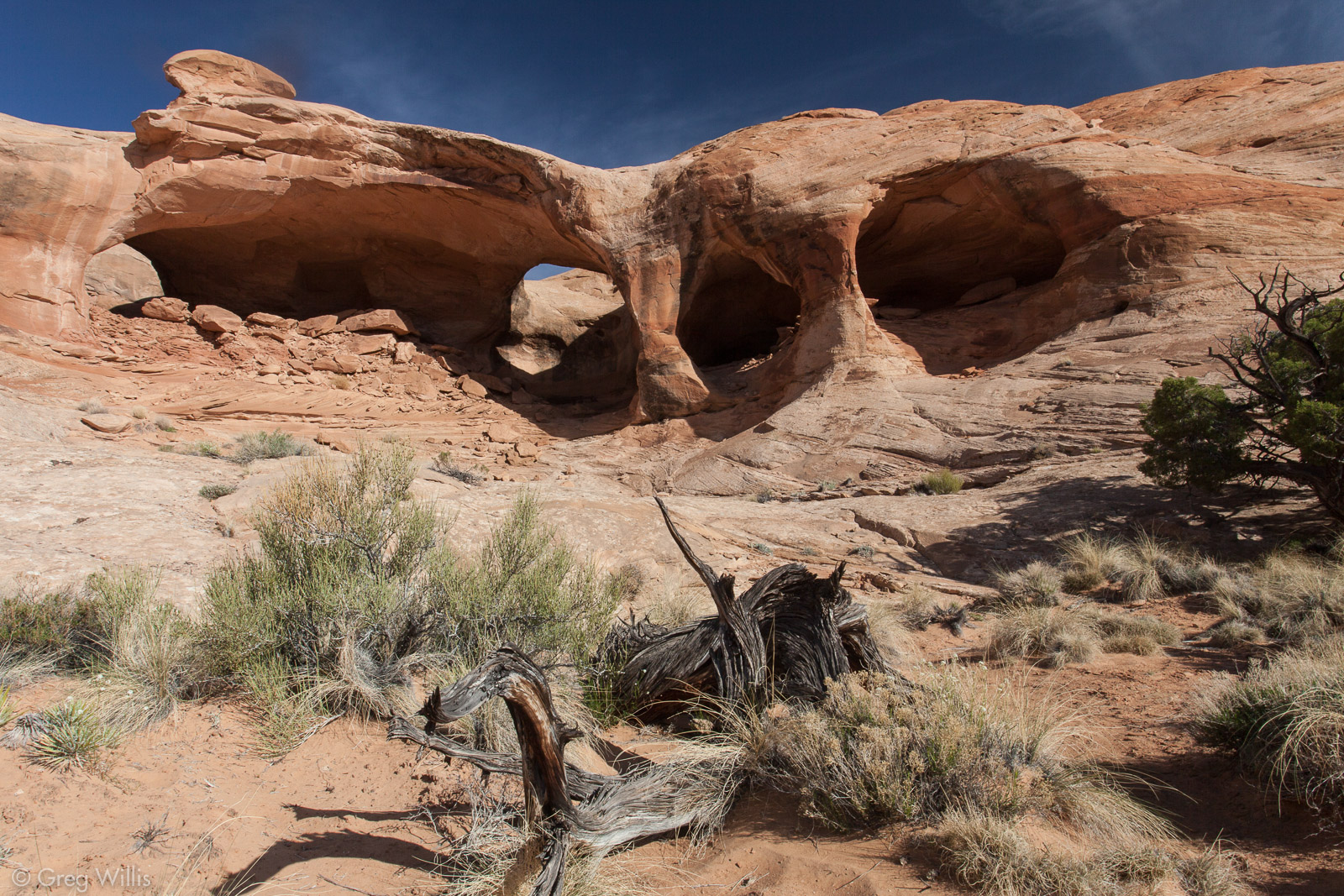
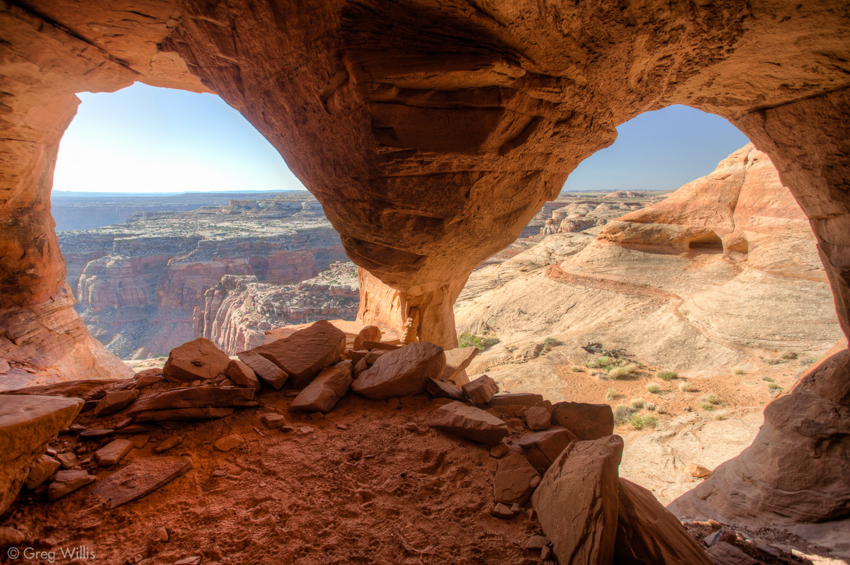
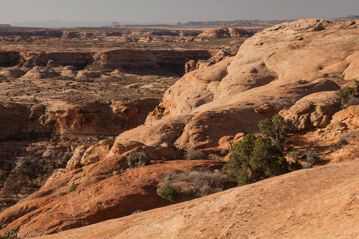
All the openings are huge. Explore the arch(es) while you’re there for the views and to see the two openings in the top. From the inside you have a remarkable view of Two Mile canyon down to the Green River.
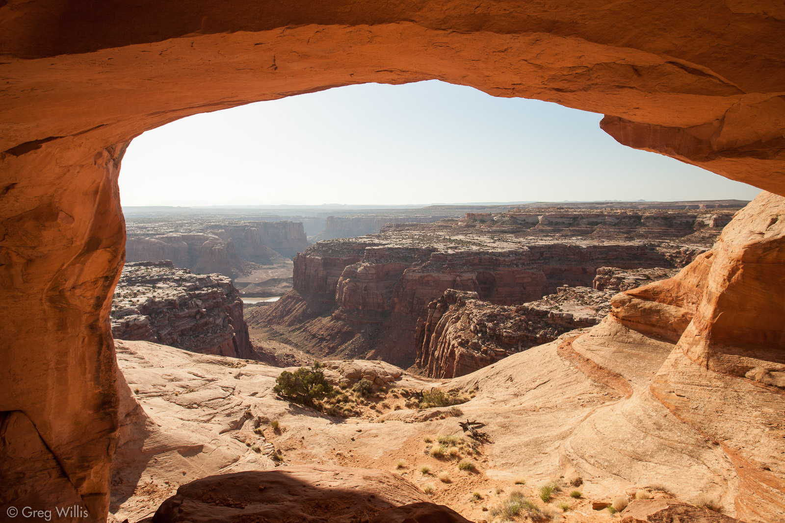
Colonnade Arch, View of Two Mile Canyon and Green River
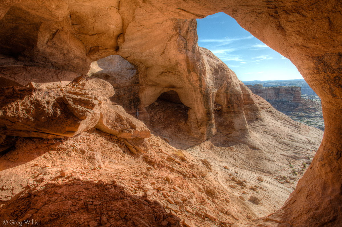
Colonnade Arch from Inside the Southmost Arch
Colonnade Arch from Inside
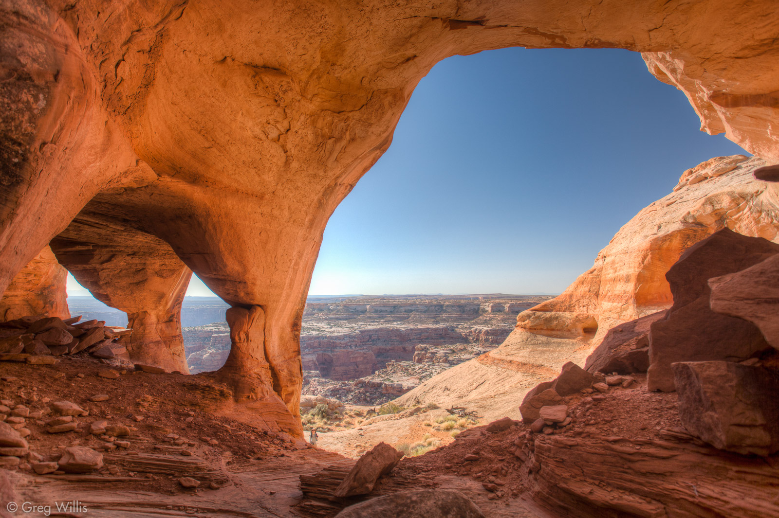
Colonnade Arch from Inside
On the way back to the jeep, we discovered some trace fossils in the Navajo sandstone. They are the burrow holes of some long ago animal that got filled up and eroded out. We also had a great view of the Henry Mountains along the slickrock trail.
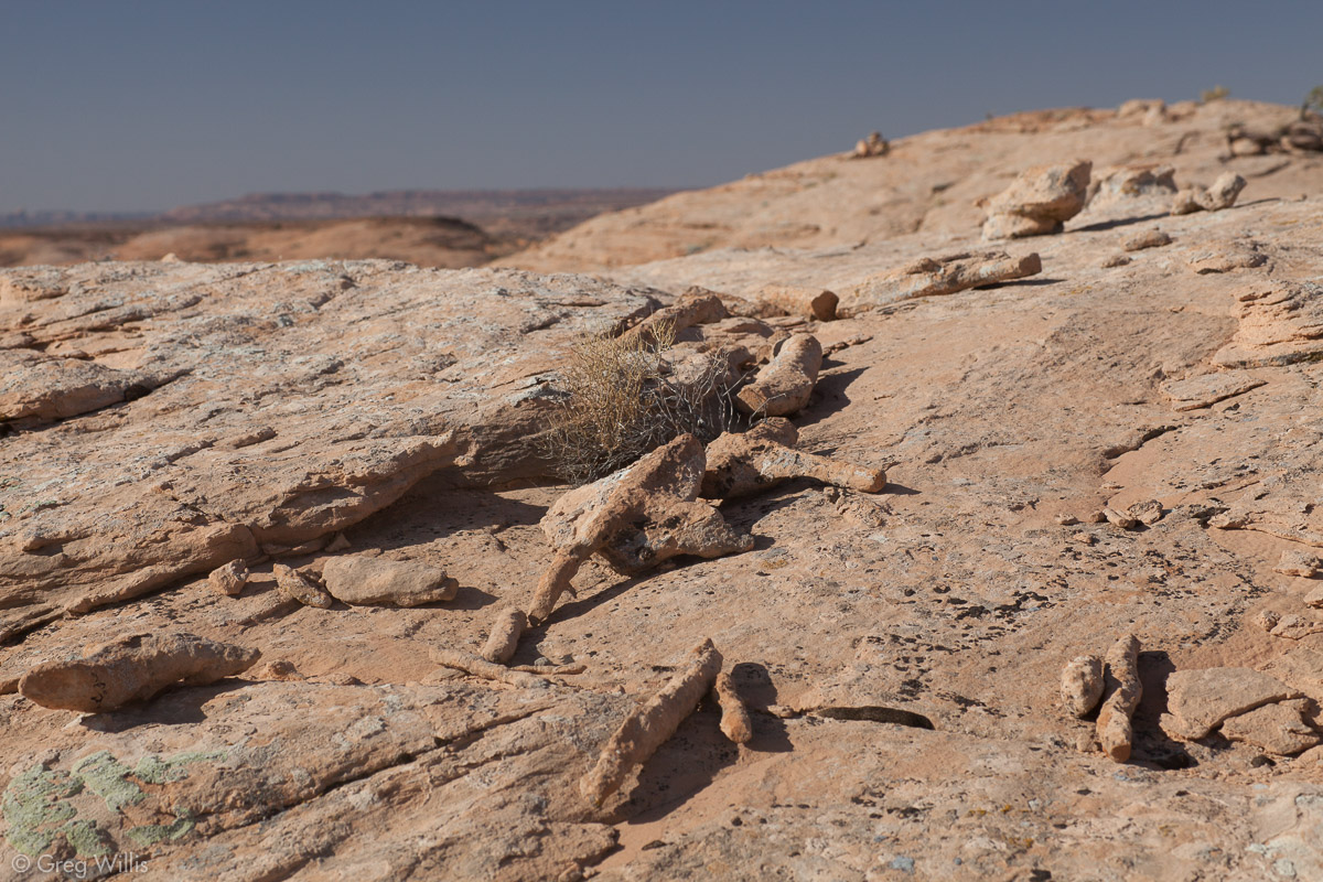
Trace Fossils on the Trail
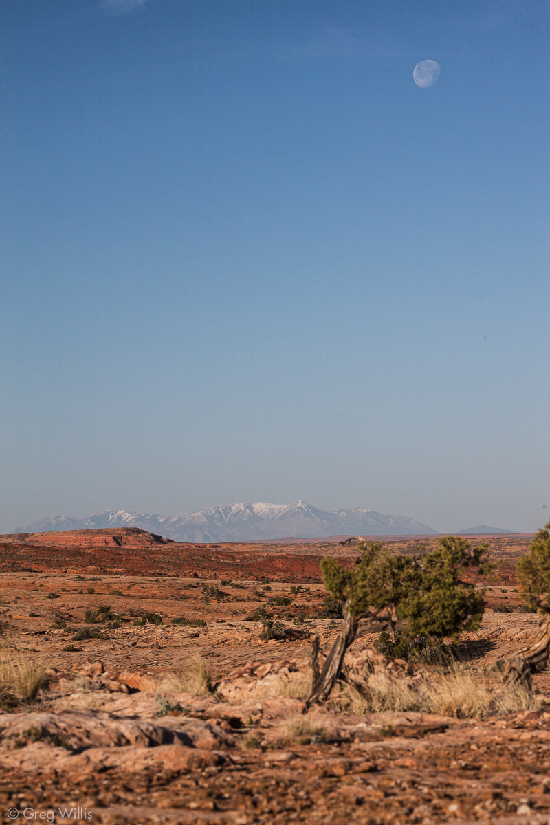
Henry Mountains
Navajo Sandstone from the Trail
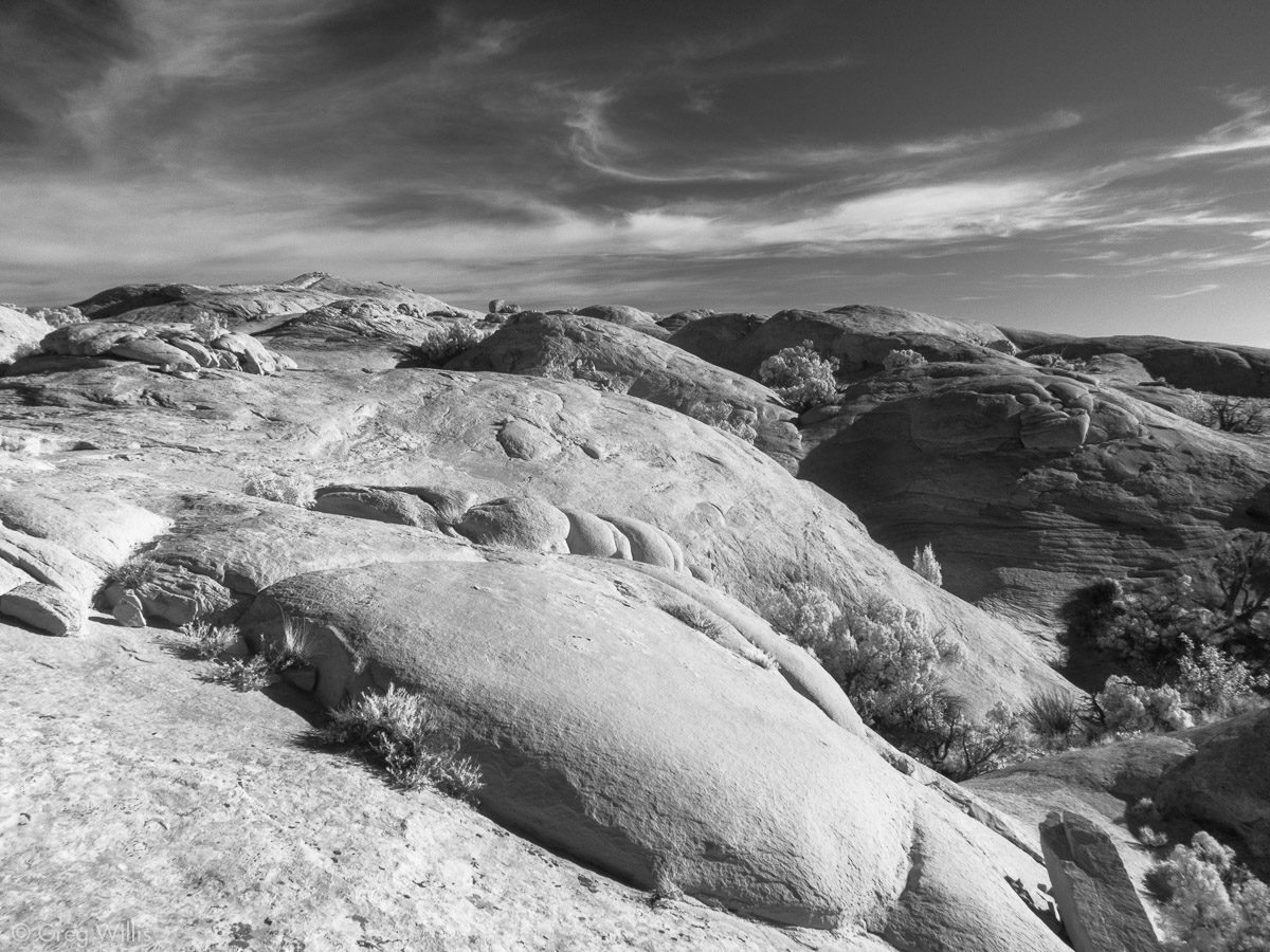
Navajo Sandstove, Cirrus Clouds
The amazing Colonnade Arch was indeed amazing, well worthy of the rough road from Green River.

Thanks, Greg! Wonderful photos, amazing scenery, great tips!