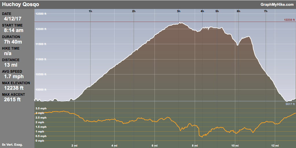
12 Apr 2017
In reading up on Inca sites in the Sacred Valley, Huchoy Qosqo was occasionally mentioned but usually as an overnight trekking option if at all. Since we would be trekking the Inca Trail a few days after, I didn’t feel like dealing with a guide — sometimes I just like to be independent. Looking on Google Earth I saw paths and ruins, all fairly obvious, so I figured it could be done as a day hike. I also found an academic paper with maps and explanations which helped me both in planning and on the trail (see below). So with both vague and detailed plans, we set out in the morning from the lovely Casa de Aida in Calca.
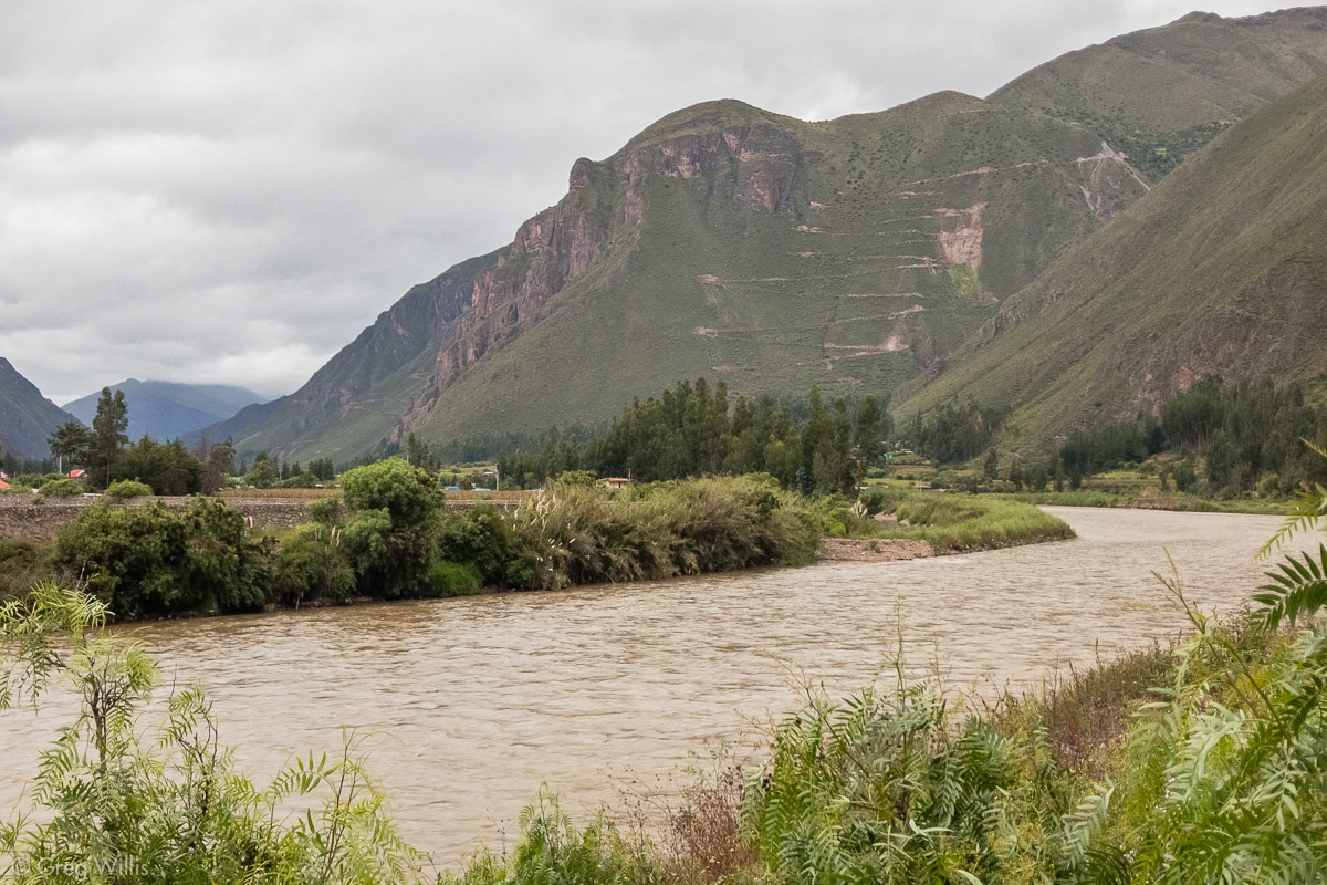
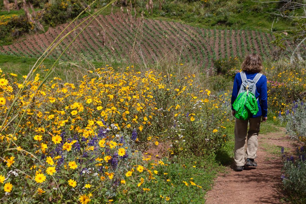
To be honest there’s not much interesting in the first couple of hours on this hike. Sure, we waved to a group of men sitting on the Calca side of the suspension bridge across the Rio Vilcanota. Of course, we could see the zig-zag road making its zig-zag way up on the mountain as we walked towards it. And yes, after passing through the small village of Sacllo we began the switchbacks that took us up and made look Calca smaller and smaller.
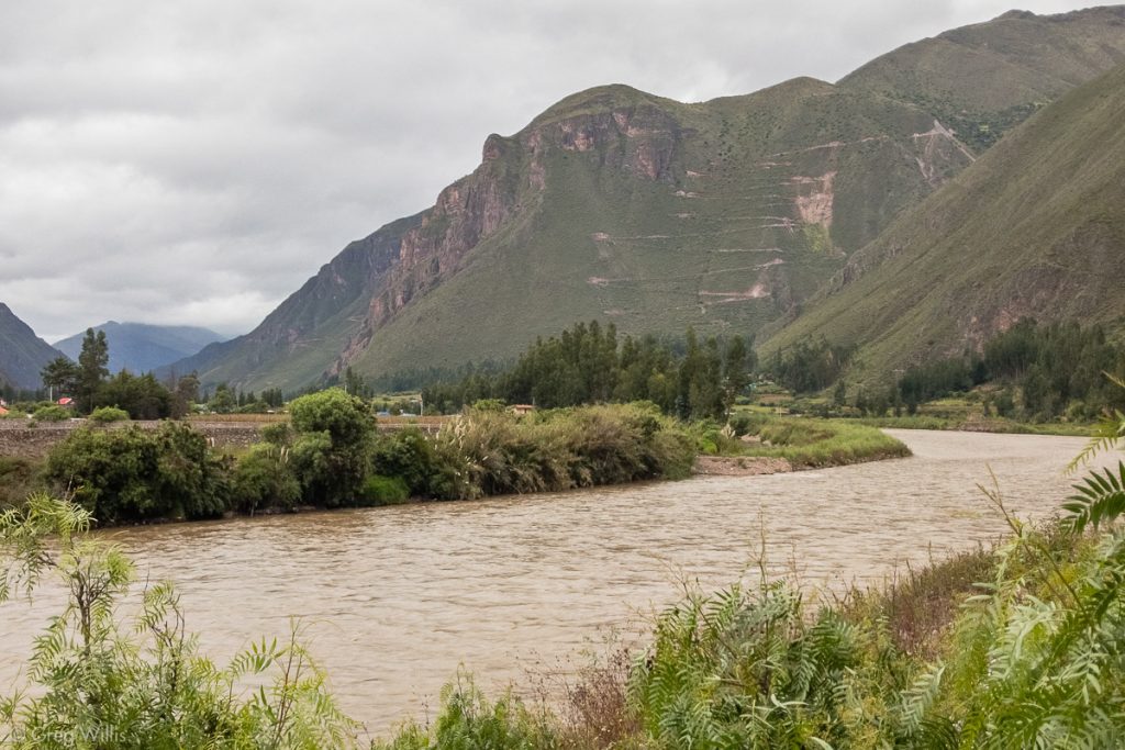
Rio Vilcanota and the Huchoy Qosqo Trail Up the Mountain 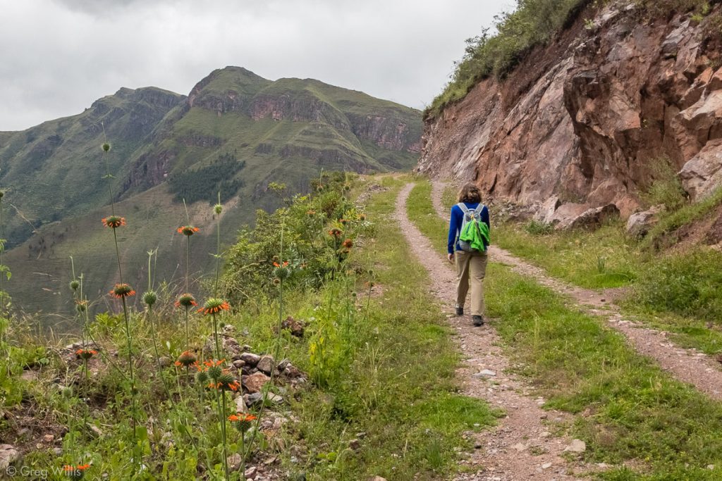
Trail from Calca to Huchoy Qosqo 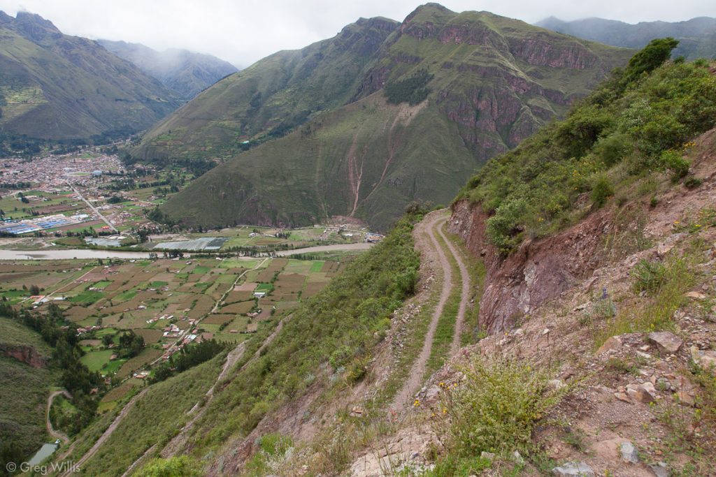
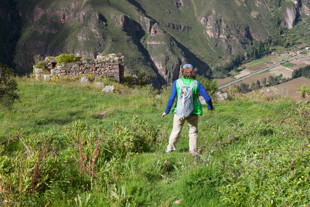
Huchoy Qosqo Trail and Calca 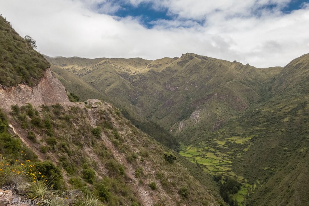
Huchoy Qosqo Trail and Mountains to the South

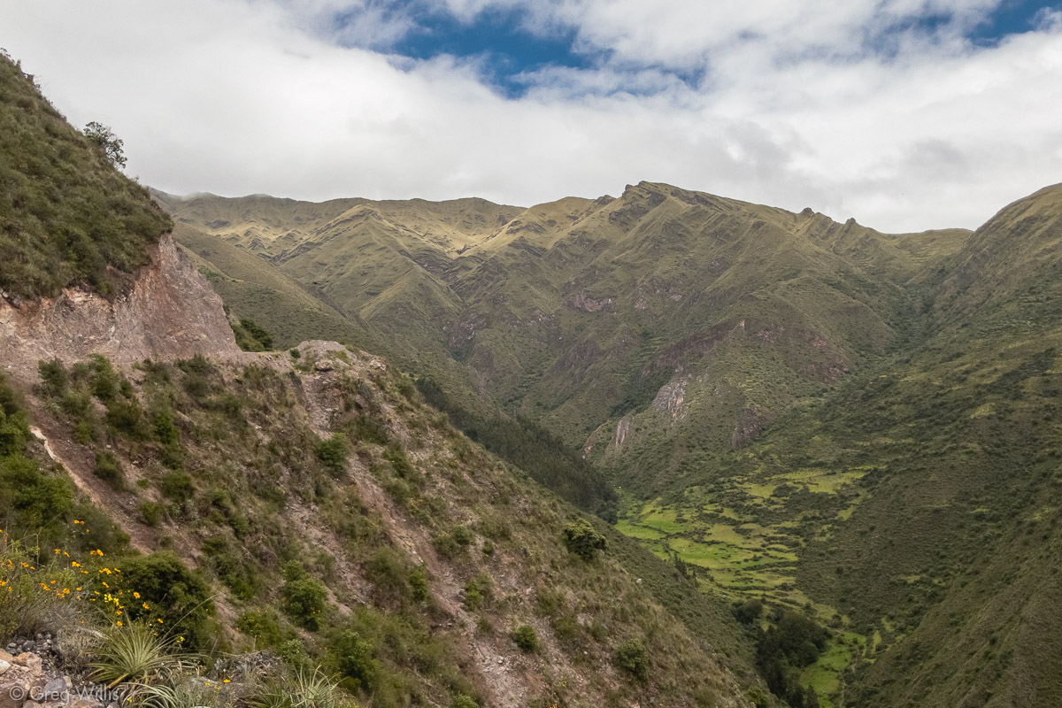
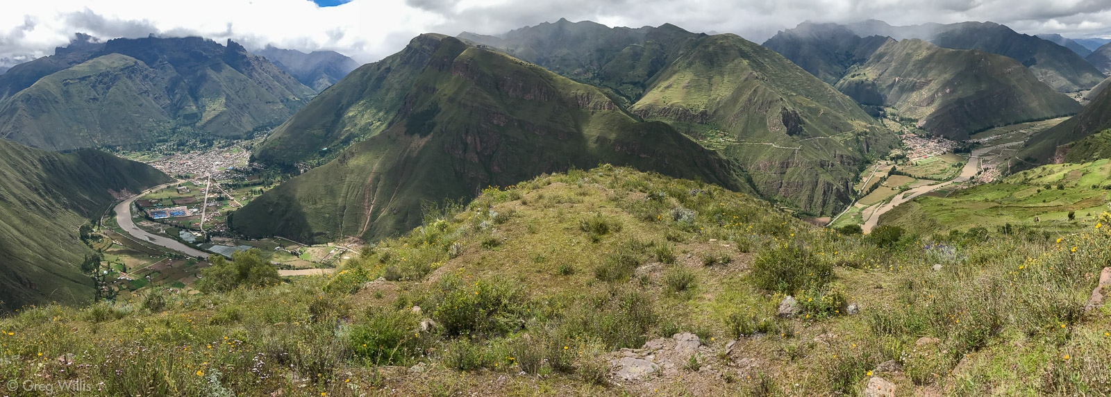
But the flat road by the river was boring and the 19 switchbacks in 5 miles with a 2,500 foot ascent was tedious. It wasn’t fun and the 2:15 hours to the top seemed painfully slow. Once up, however, our effort was well rewarded with splendid views, extensive ruins, and blissful solitude.

Warq’ana
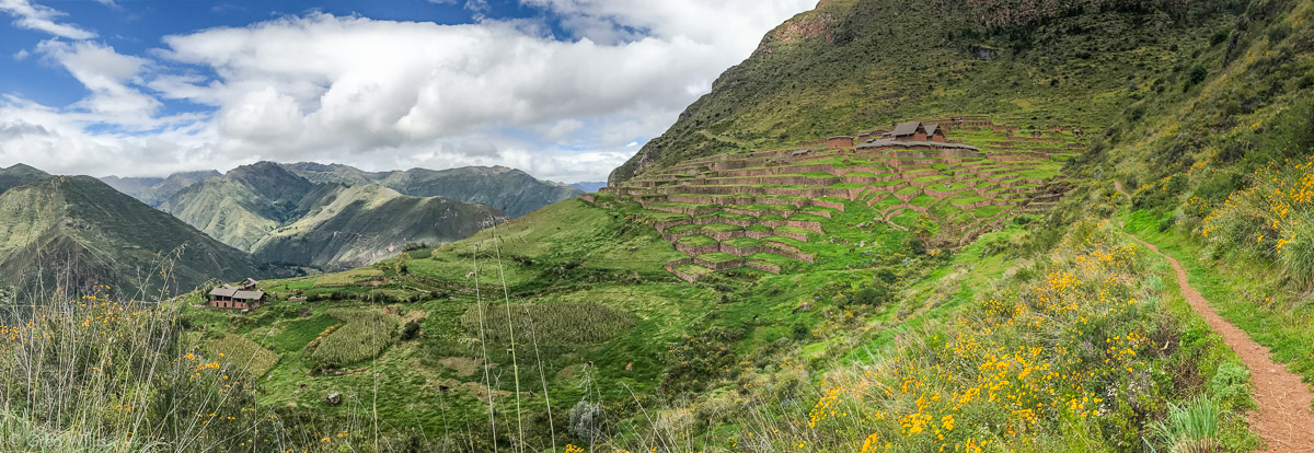
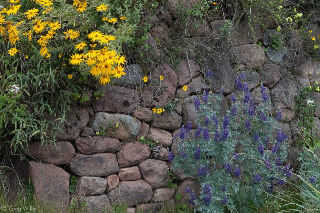
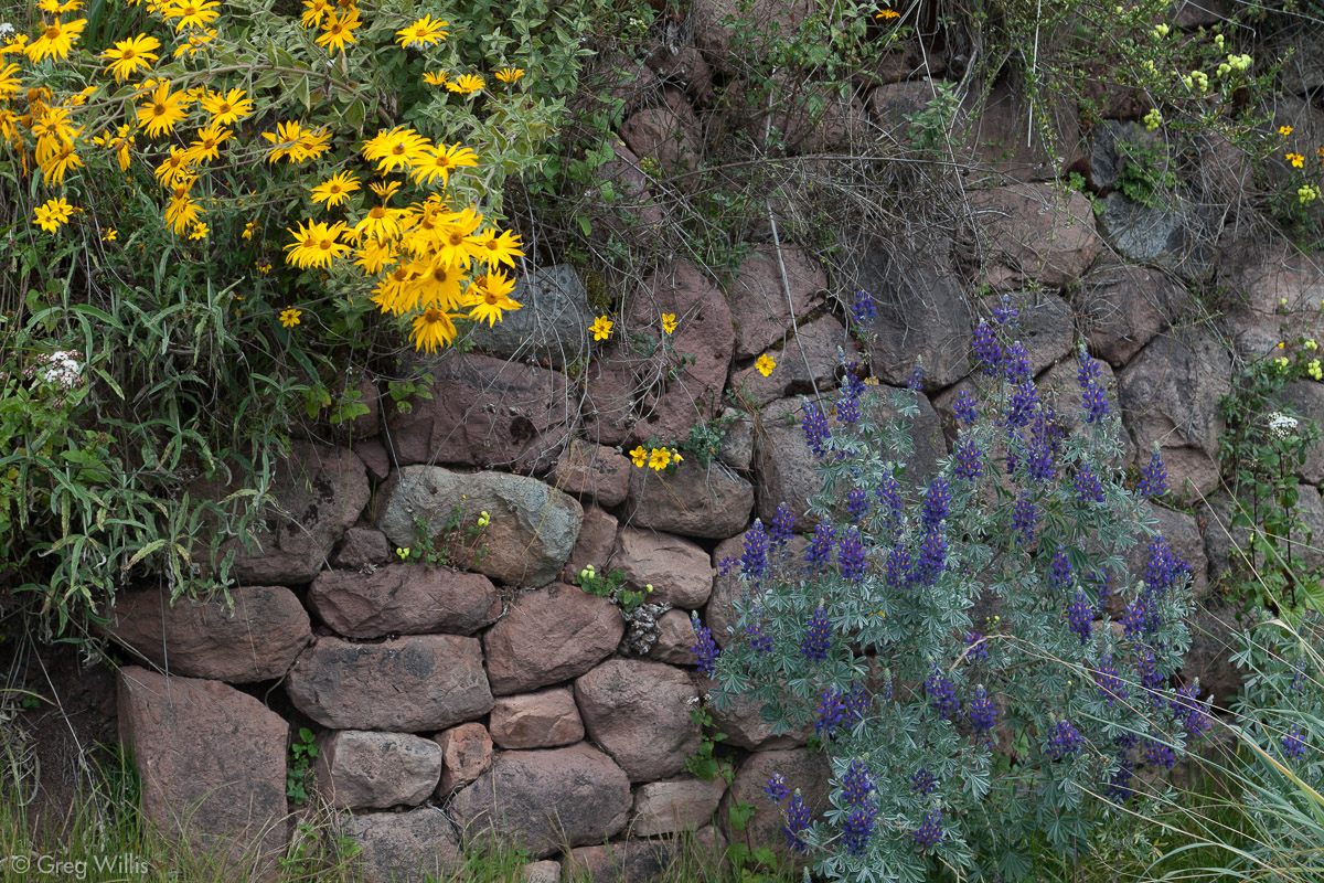
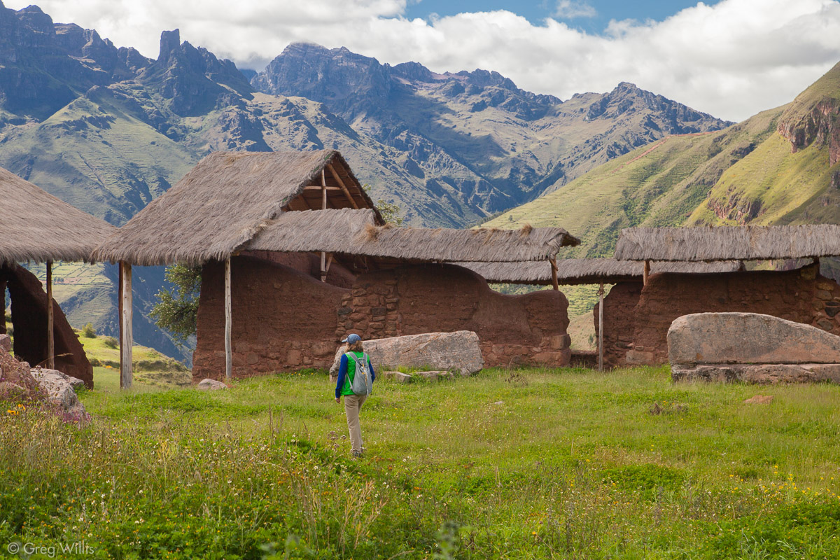
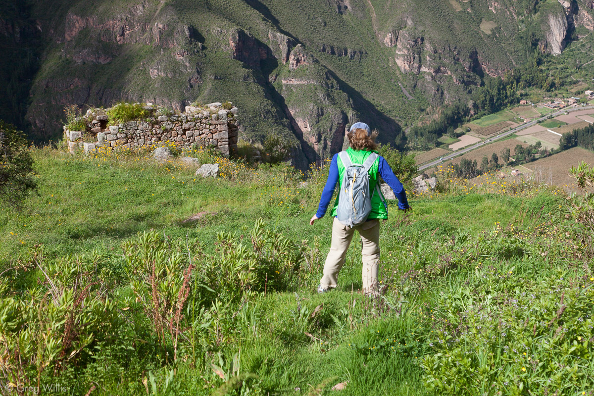
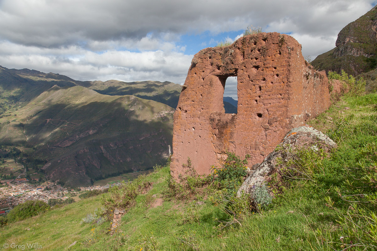
Situated right where the switchbacks level out, Warq’ana is the first set of ruins we encountered. Warq’ana had been continuously occupied for a long time, way before Inca, starting in the Early Horizon (900 – 200 BCE). Its well-watered lands and dominating position in the valley made it a plum settlement pick. Warq’ana doesn’t have a lot to see ruins-wise and it’s a bit tumbledown and overgrown. The structures are Killke (900-1200 CE) and Inca construction, but there’s nothing fancy here — mainly common dwellings as well as some protected adobe walls that flank the entrance. The fancy, however, comes from the backdrop of the valley.
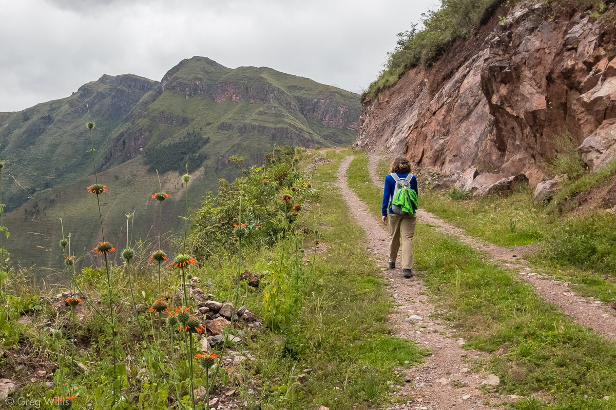
Trail between Warq’ana and Huchoy Qosqo 


From its northern end the panorama takes in the Sacred Valley from Calca (where we started) to Lamay (where we would end).
Viracocha (or Wiraqucha) Inca was the eighth Inca king. He had ruled from Cusco for around 18 years when in 1438 the Inca went to war with the nearby Chanca. During the war, Viracocha Inca withdrew from Cusco. His son Pachacutec refused to abandon Cusco, fought the Chanca, and eventually conquered them. Pachacutec then declared himself emperor, which was awkward because Viracocha Inca was still alive.
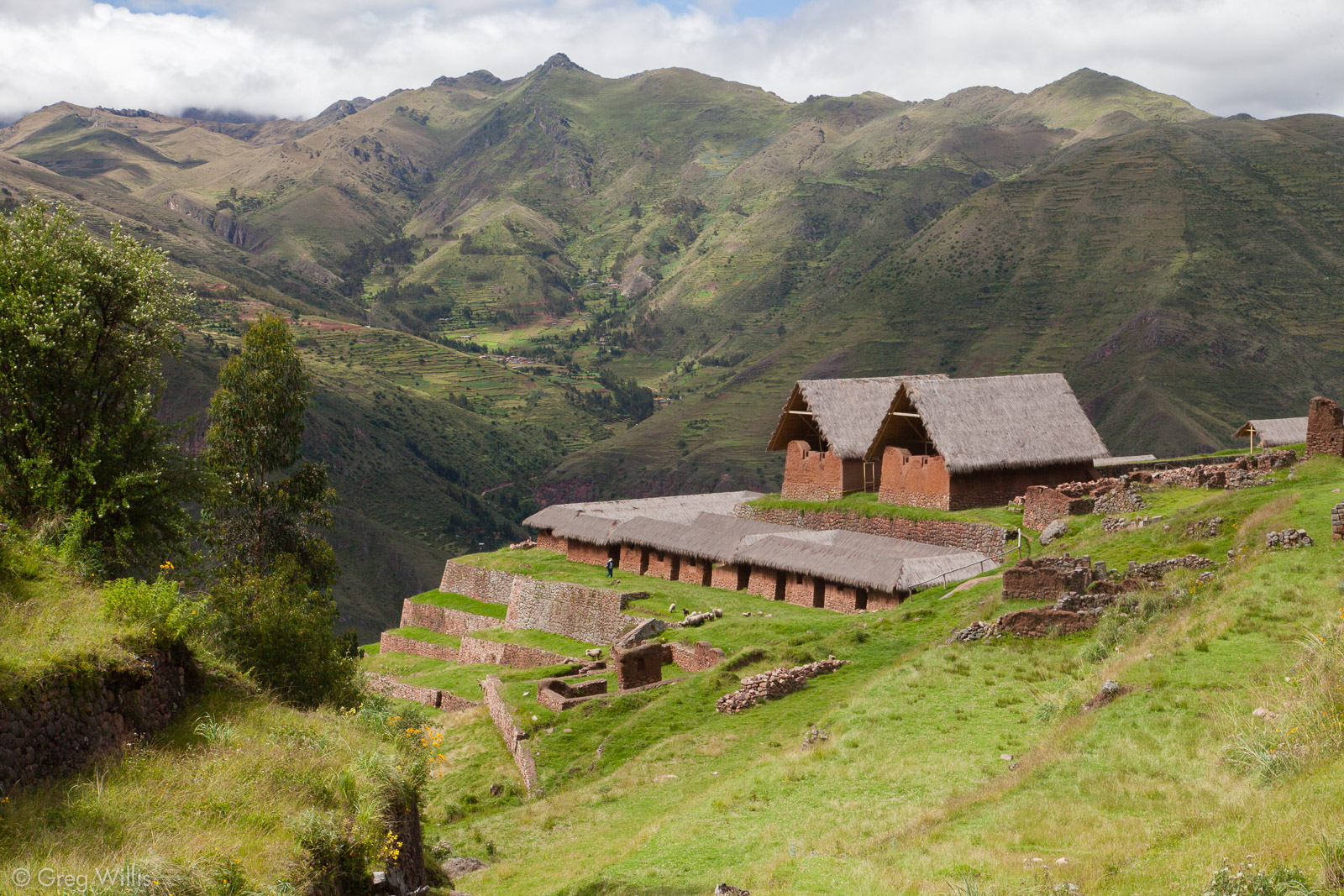
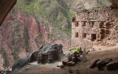
Viracocha Inca had started building Huchuy Qosqo (originally Caquia Xaquixaguana) as one of his royal estates before the war, and it was to here that he retreated. The two must have struck a deal because Pachacutec remained emperor and Viracocha Inca remained alive. The expansion of Huchuy Qosqo seems to be part of that deal: part retirement village, part prison. Pachacutec even sent workmen from Cusco to help enlarge the royal estate. Once this work had begun, the center of activity on this high plateau shifted from the terraces & farm buildings of Warq’ana to the royal estate of Huchuy Qosqo.
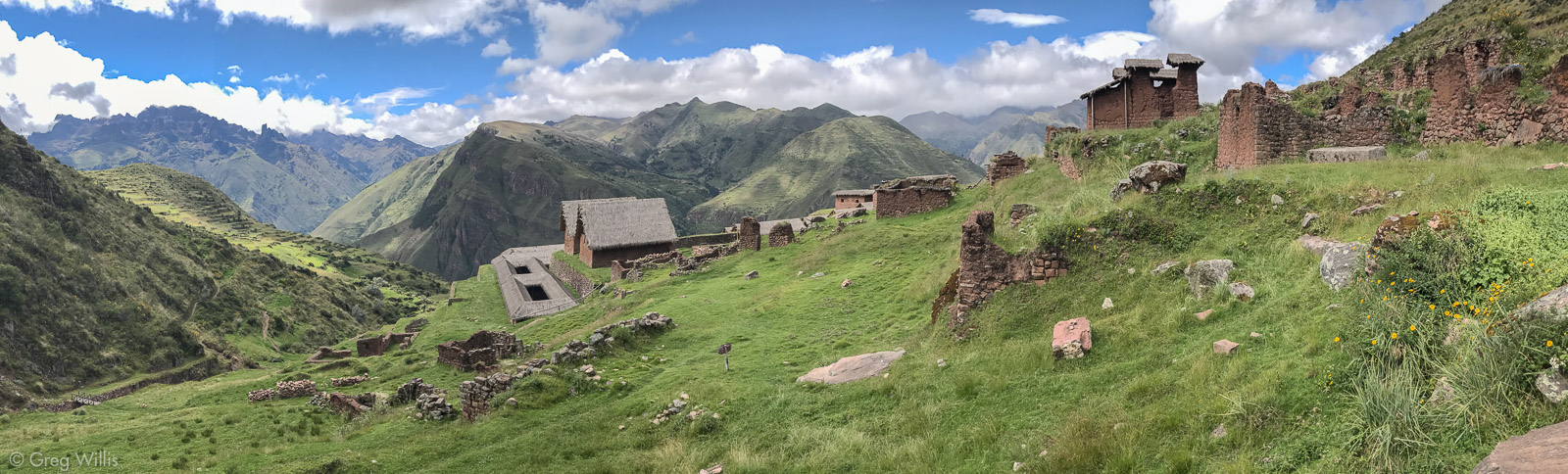
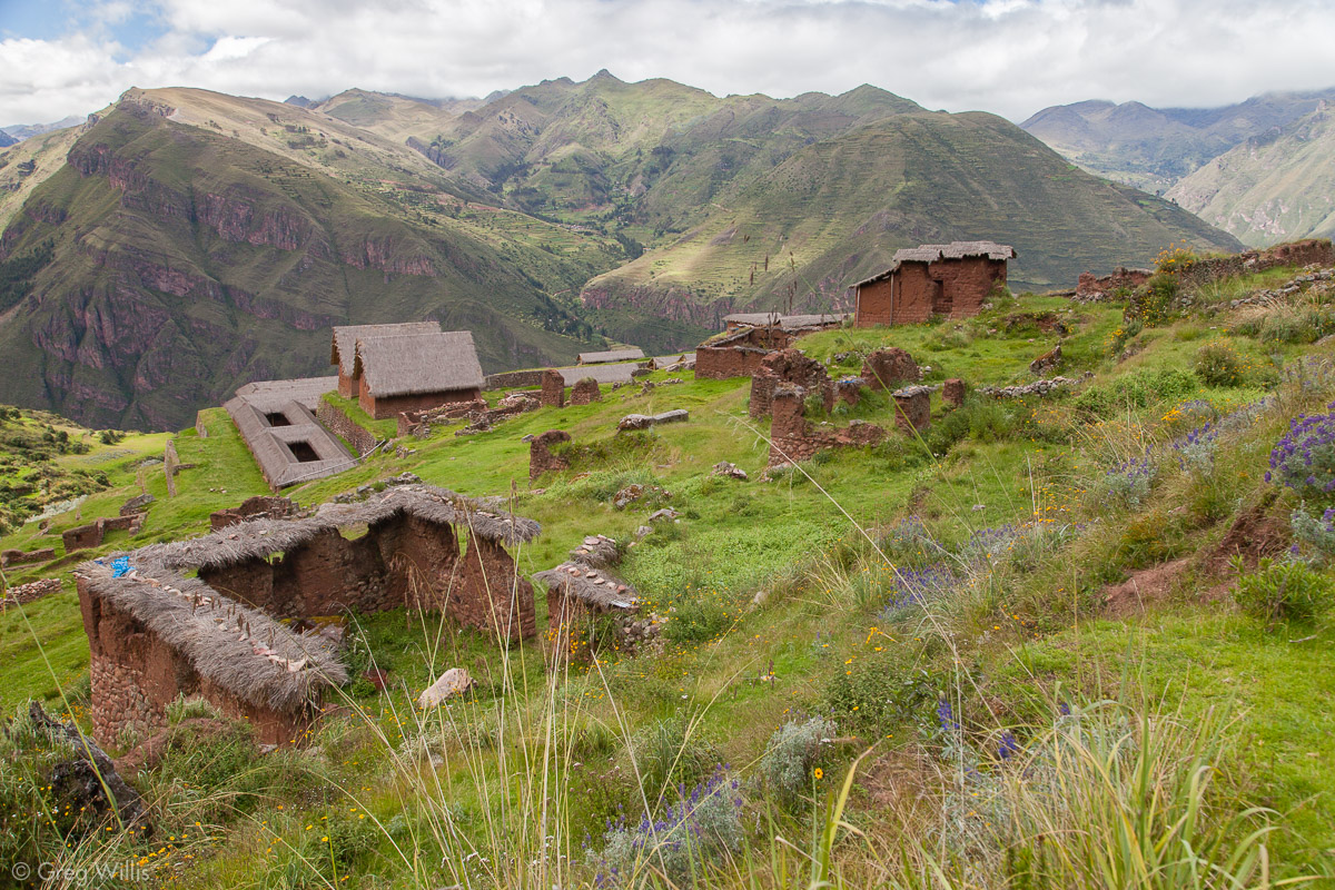
Huchuy Qosqo
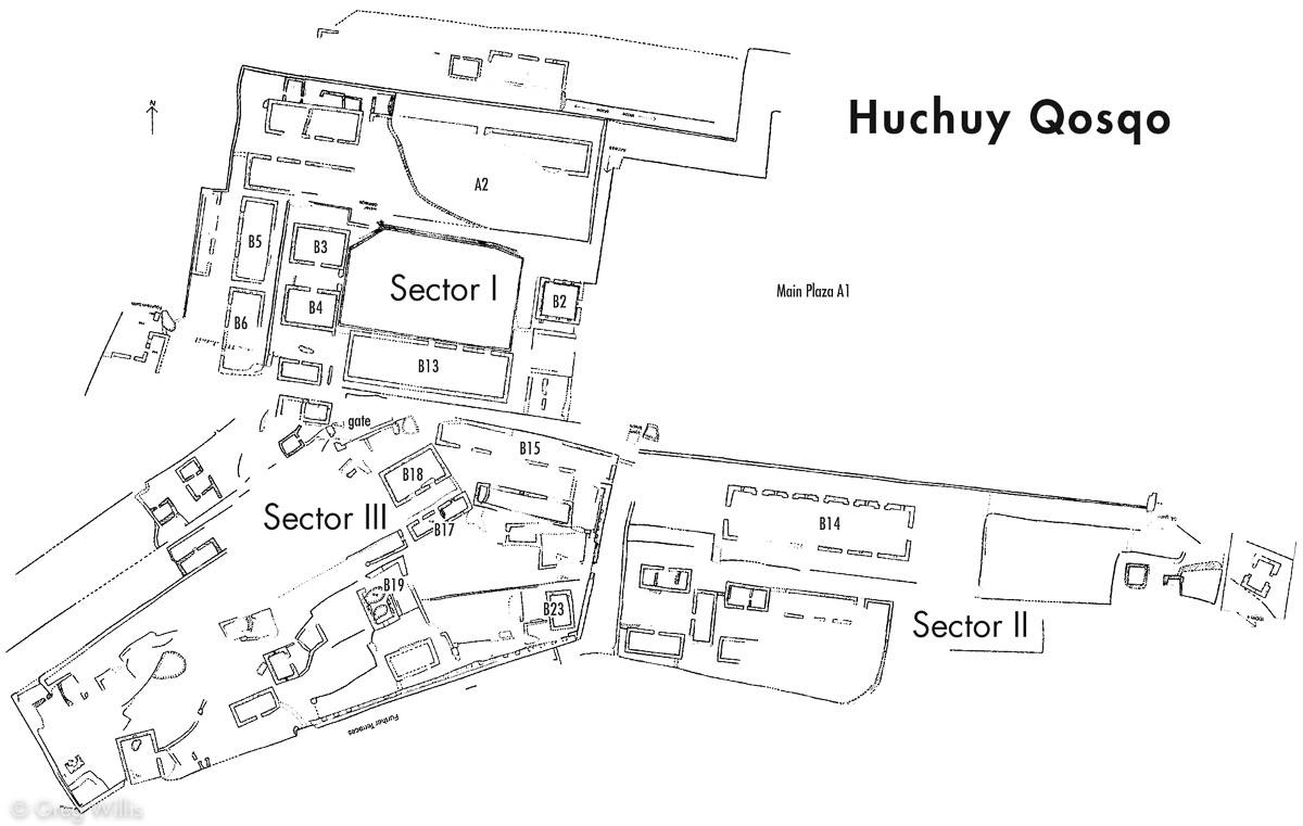
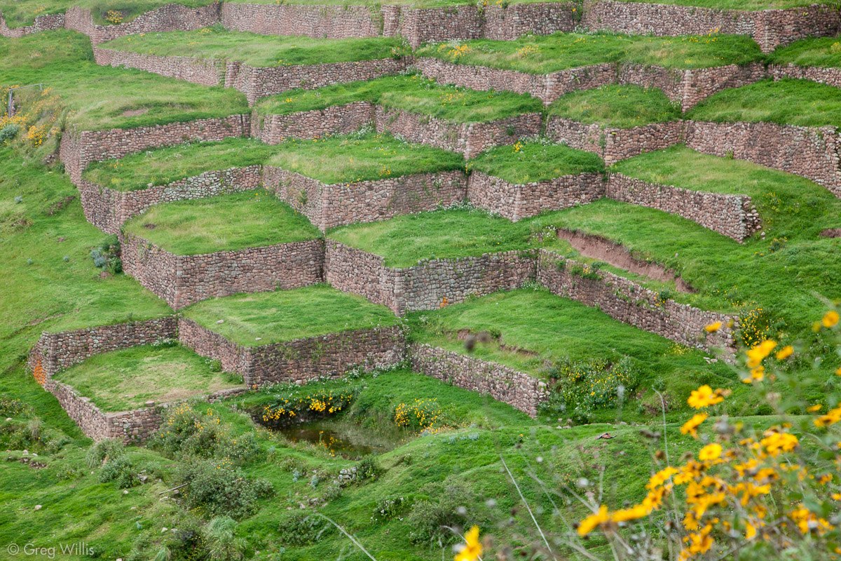
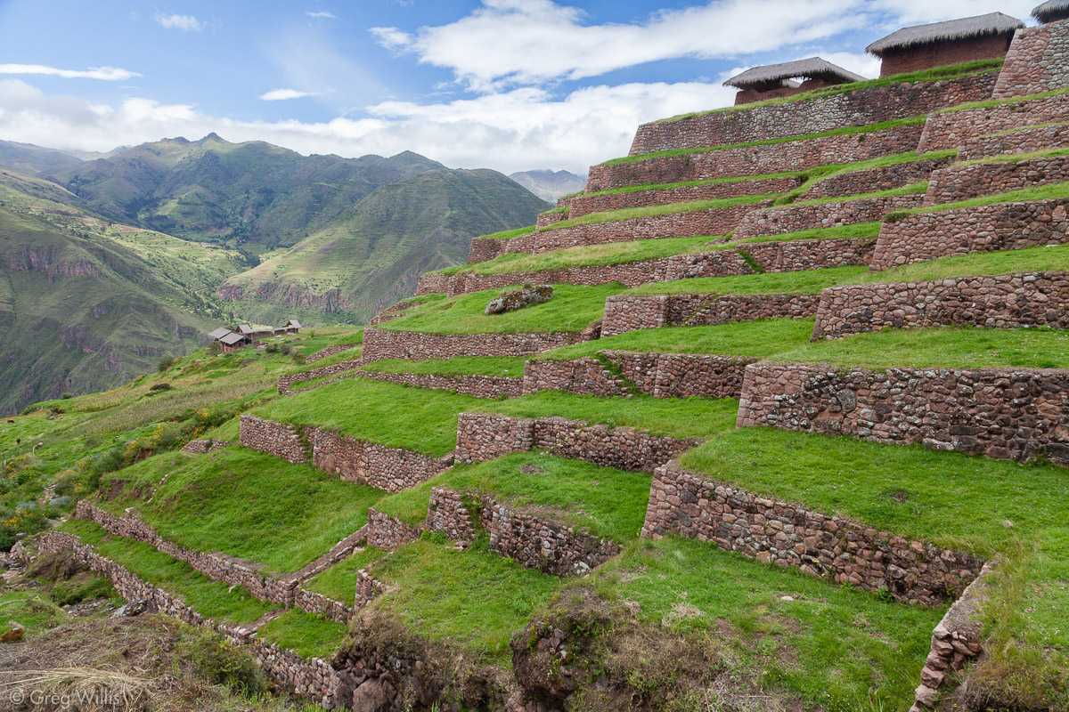
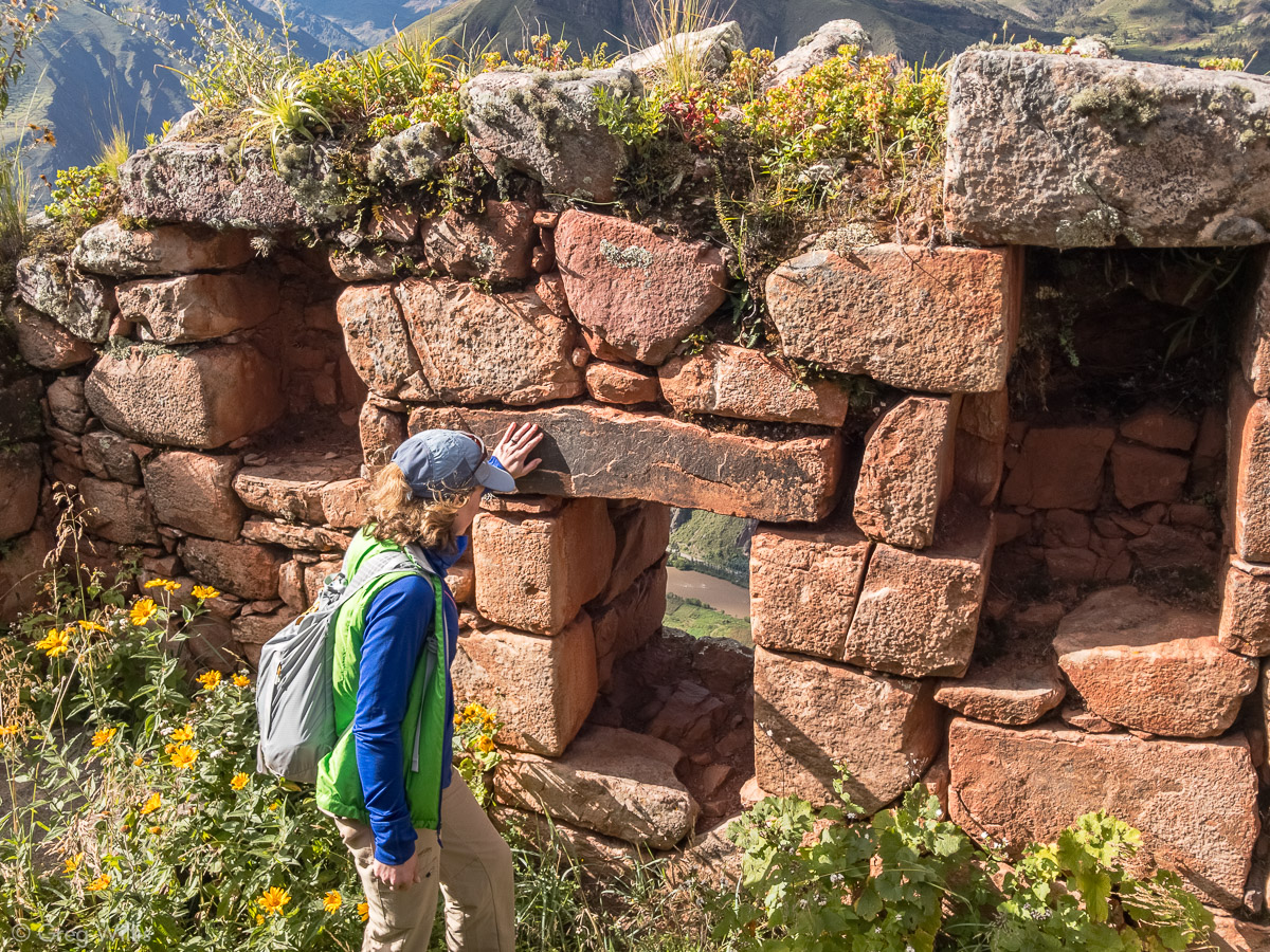
The high & remote ruins of Huchuy Qosqo might be my favorite of the whole trip. From Warq’ana we walked for about a mile through fields and by houses. In addition to the terraces the site can be divided into three obvious sections: Sector I, the palace and associated buildings; Sector II, a residential sector for nobles and/or descendants of Viracocha Inca; and Sector III – oldest part of the site that has a mishmash of important and mundane structures.
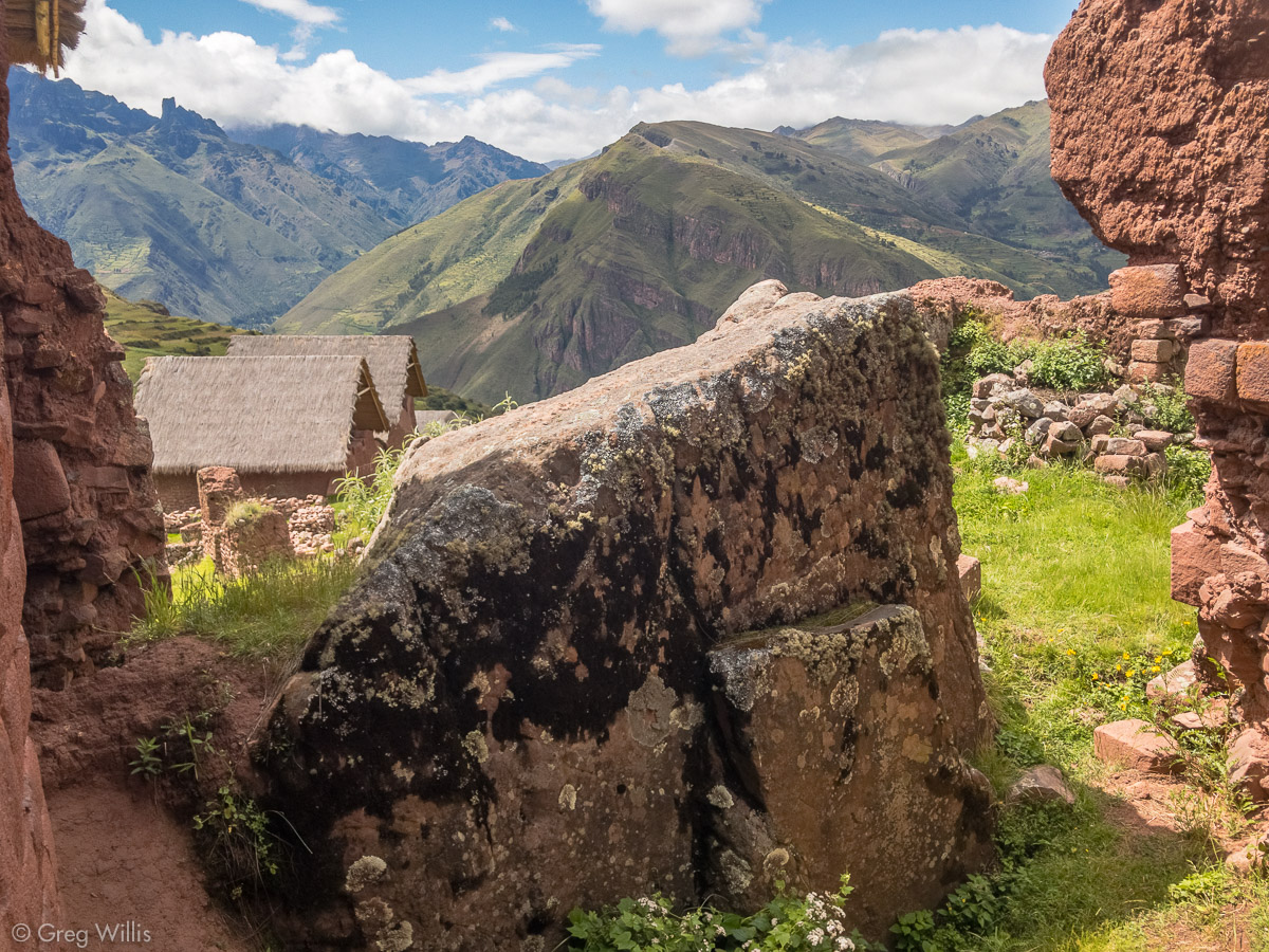
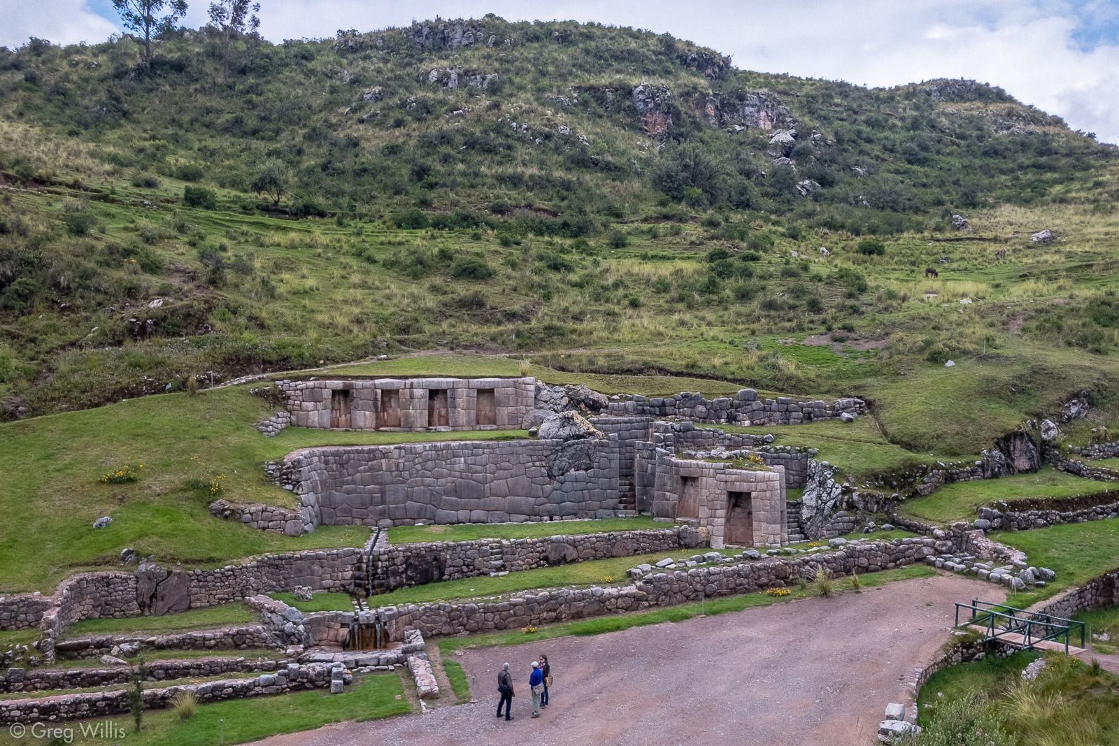
We walked up the terraces and had lunch in Sector III, right by building B19. The fine stonework and enclosed wak’a (carved boulders) showed that this building was important. It might have been the centre of a cult and possibly the burial place of an important Inca — maybe Viracocha Inca himself. The northwest wall had been torn down, perhaps to remove the mummy or the ashes of Viracocha Inca.

Huchoy Qosqo Terraces 
Huchoy Qosqo and Rozascancha 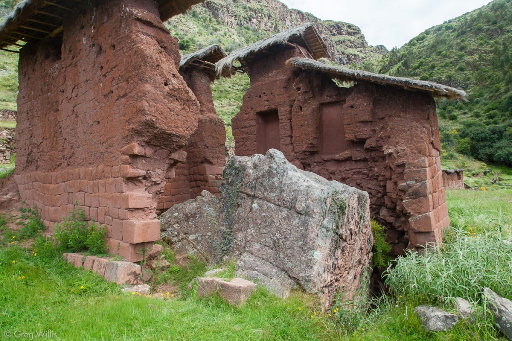
Huchoy Qosqo Old Temple (B19) 
View from Huchoy Qosqo Old Temple (B19)

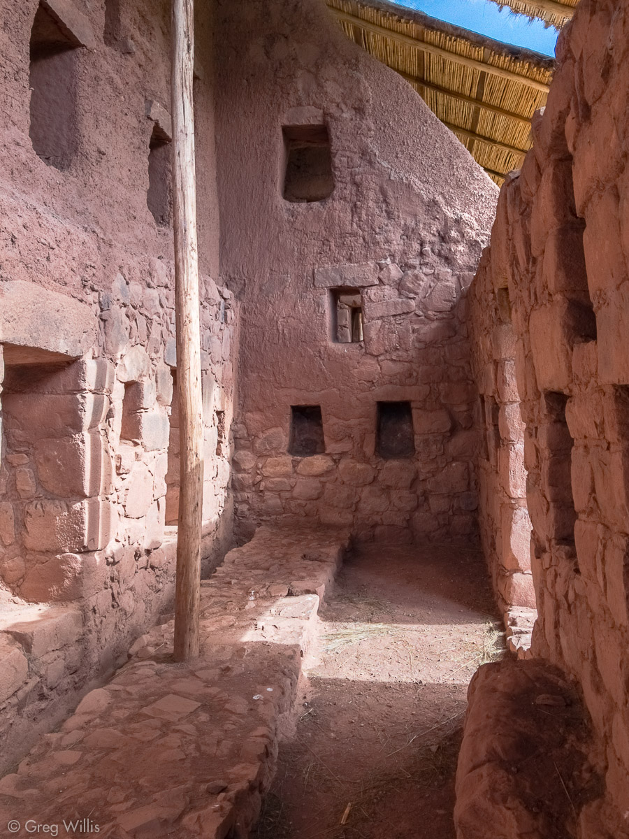
I had done some research so our lack of a guide was not a problem. And maps (see below) helped me find things. I had thought that Sector III would be the least interesting part of the ruin, but I’d been mistaken. It had no grand buildings but numerous smaller ones with walls mostly intact. We explored this cozy, overgrown area the most. I went uphill to find the water source and H found a three-part fountain to where the water flowed.
Huchoy Qosqo Wall in Sector III 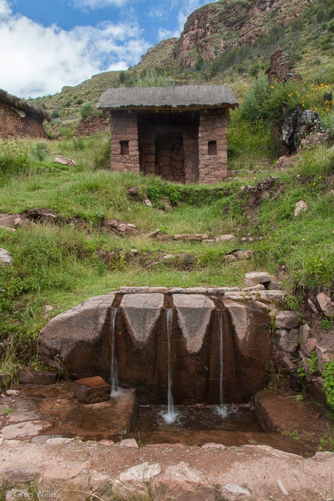
Huchoy Qosqo Fountains 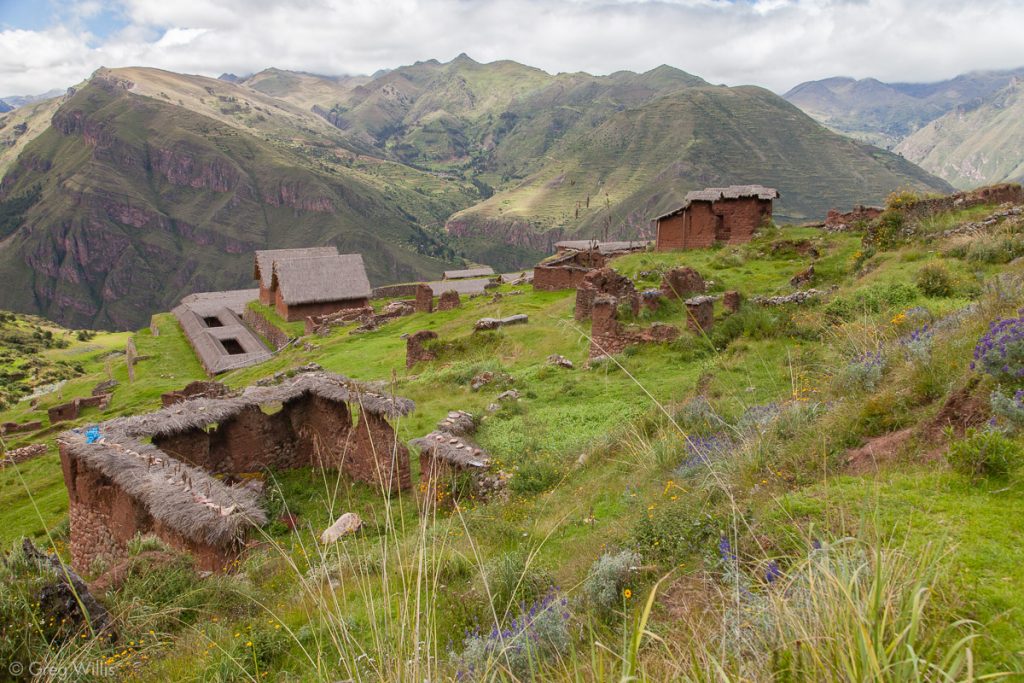
Huchoy Qosqo, View from Sector III

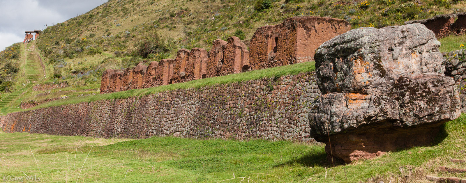
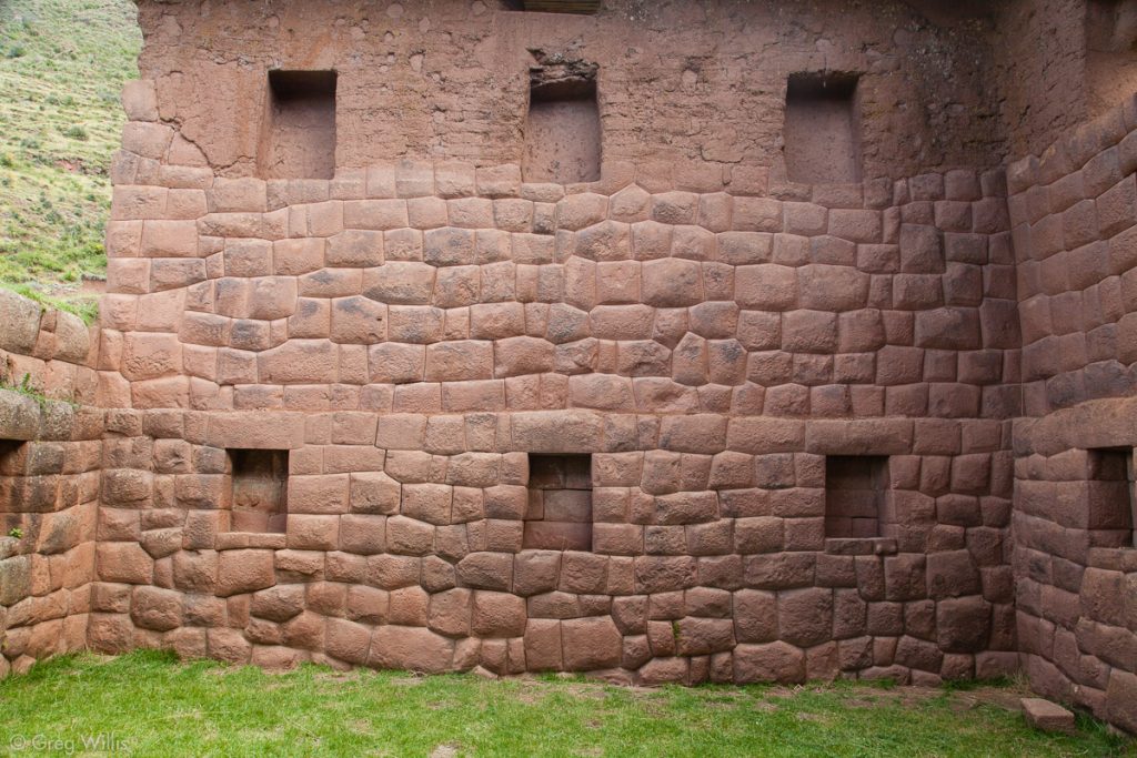
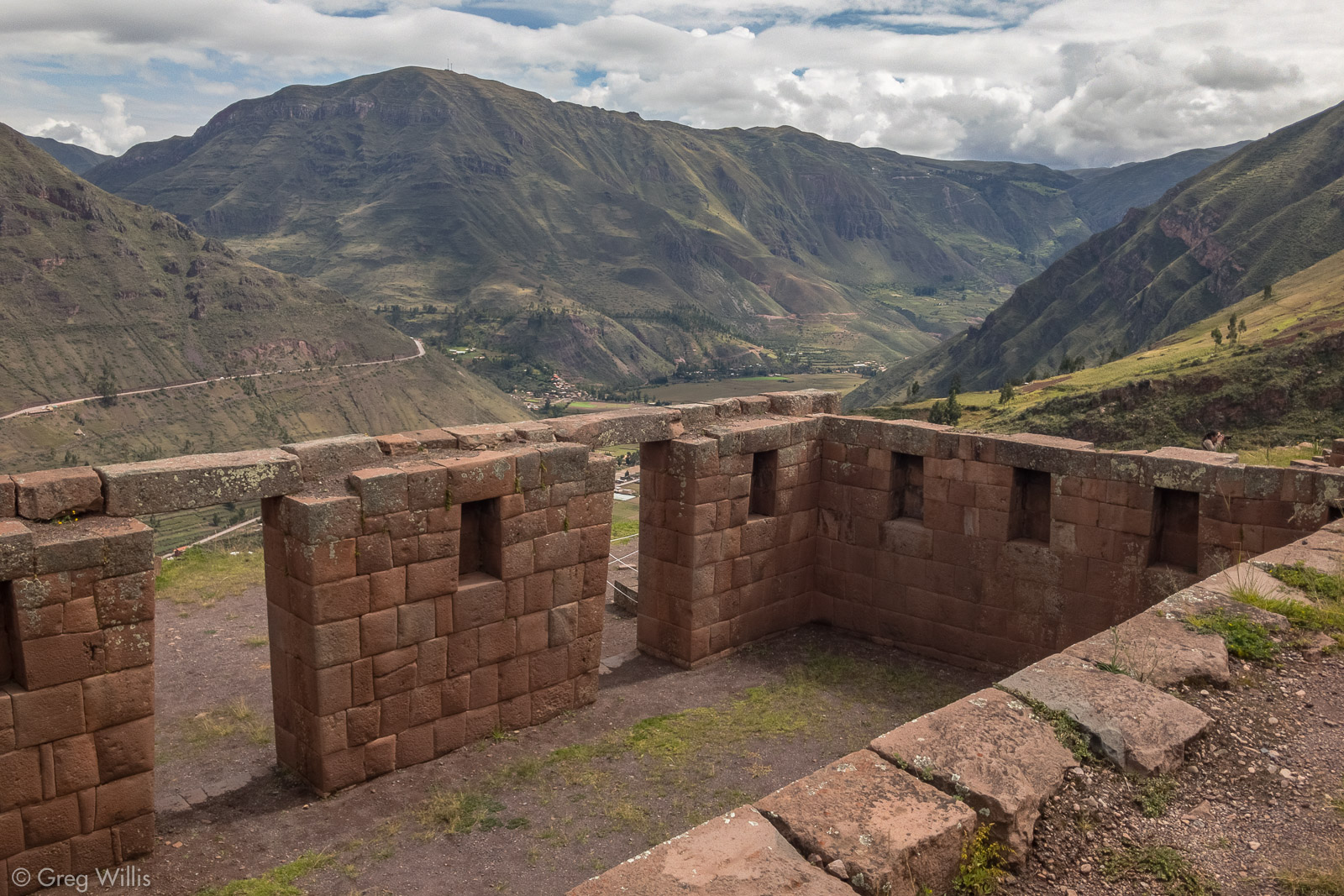
A large kallanka, large roofed community hall, sat on a long terrace in front of the large main plaza in Sector II. And Sector I buildings had the fine masonry indicating its status as the heart of the royalty.
Huchoy Qosqo Sector I Palace (B2) 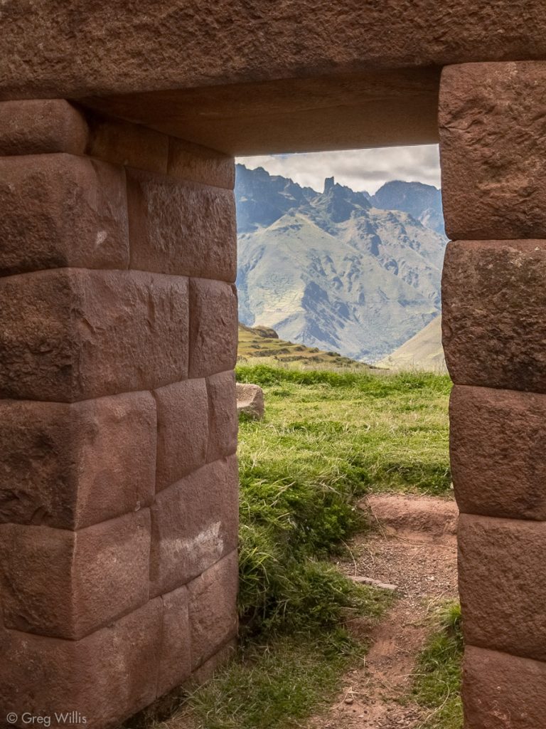
Huchoy Qosqo View from Sector I Palace (B2) 
Sunken Plaza and Buildings in Huchoy Qosqo Sector I 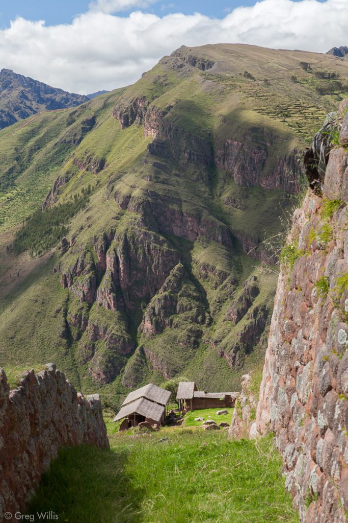
Rozascancha and the Sacred Valley from Huchoy Qosqo


Rozascancha
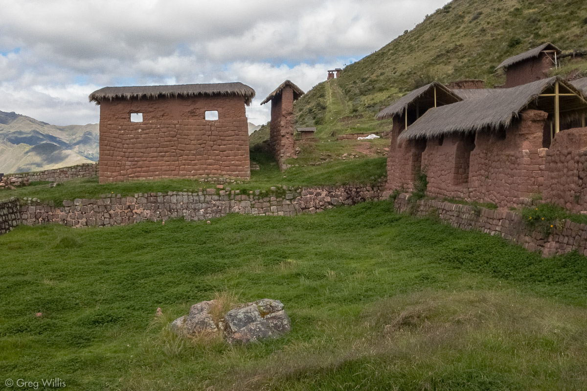
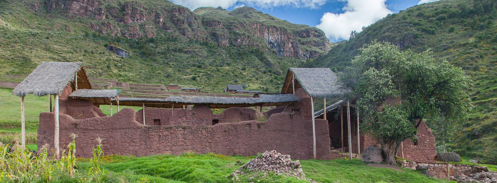
We made our way through the many terraces heading downward and north to the temple area called Rozascancha. The buildings here had been covered with protective roofing and were easily spotted as we walked. Rozascancha has a plaza with wak’a with temples on the north and west sides. The temples, unusually, had two stories with niches and doorways high up. The floors were gone. They also had water channels in the floor of the northwest temple.

Rozascancha 
Rozascancha Temple (B38) Interior 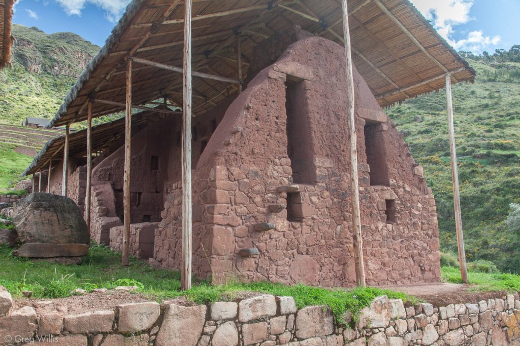
Rozascancha Temple (B38) Exterior 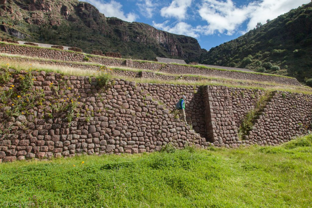
Descending Huchoy Qosqo Terraces


Chincana
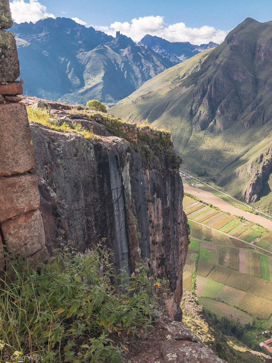
The last site for the day was the Chincana, a small temple located on a cliff. The Rozascancha was easily spotted and had a relatively clear path to get there. All I knew about the Chincana was that it was on a cliff to the north — if you fall off you’ve gone too far. There’s no signage, no clear trail. We just kind of felt our way through the boggy fields of grass, downward & northward. We passed and displeased a very vocal horse. Finally we saw an outcrop of rock and a small stone wall.

Our effort paid off. The temple is indeed perched right on the edge of a 1,700′ drop-off — with maybe 2 feet between the edge and a large niche outside the eastern door. That eastern door also seemed aligned not only with the east and the rising sun in general, but it seemed pointed to a dip in a far off mountain where the sun could rise through. And a central window framed the Rio Vilcanota as it flowed below. The Inca sure could pick there spots — this was sublime and not a little frightening.
H Descending to Chincana 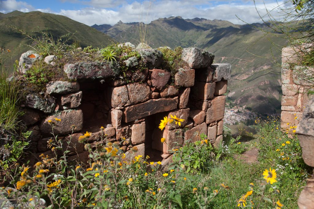
Chincana, Temple Interior 
H Looking at the Rio Vilcanota from the Chincana Temple 
View from Doorway of the Chincana Temple 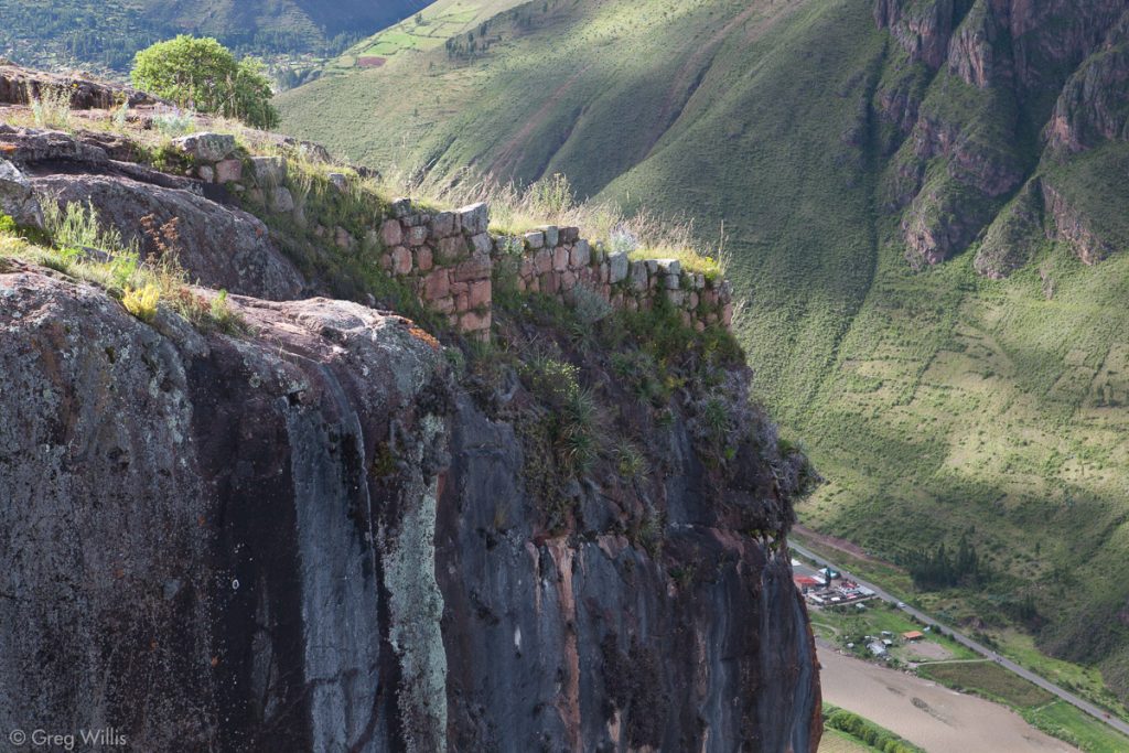
Chincana Cliffside Walls 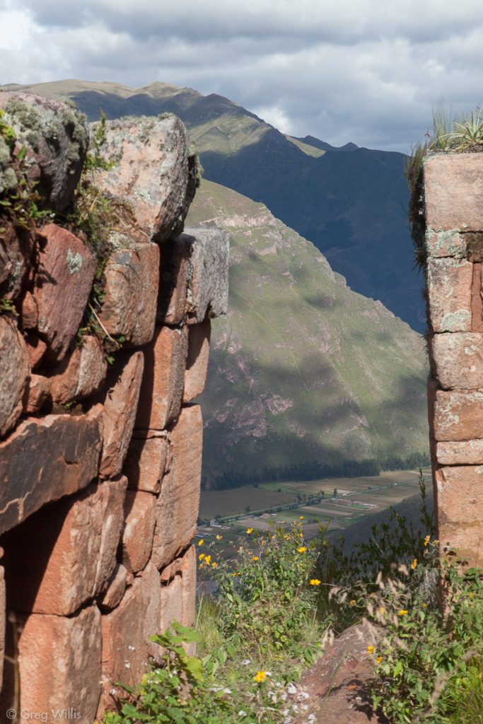
Eastern Doorway of Chincana Temple with Mountain Notch


We had to climb up a bit to catch the main trail down, passing the rarely visited Q’awinayoq group on the way. It has a few buildings and a pleasing curved wall.

Q’awinayoq and the town of Lamay 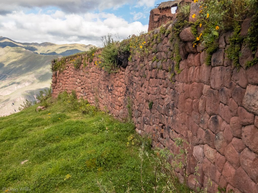
Q’awinayoq Curved Terrace Wall 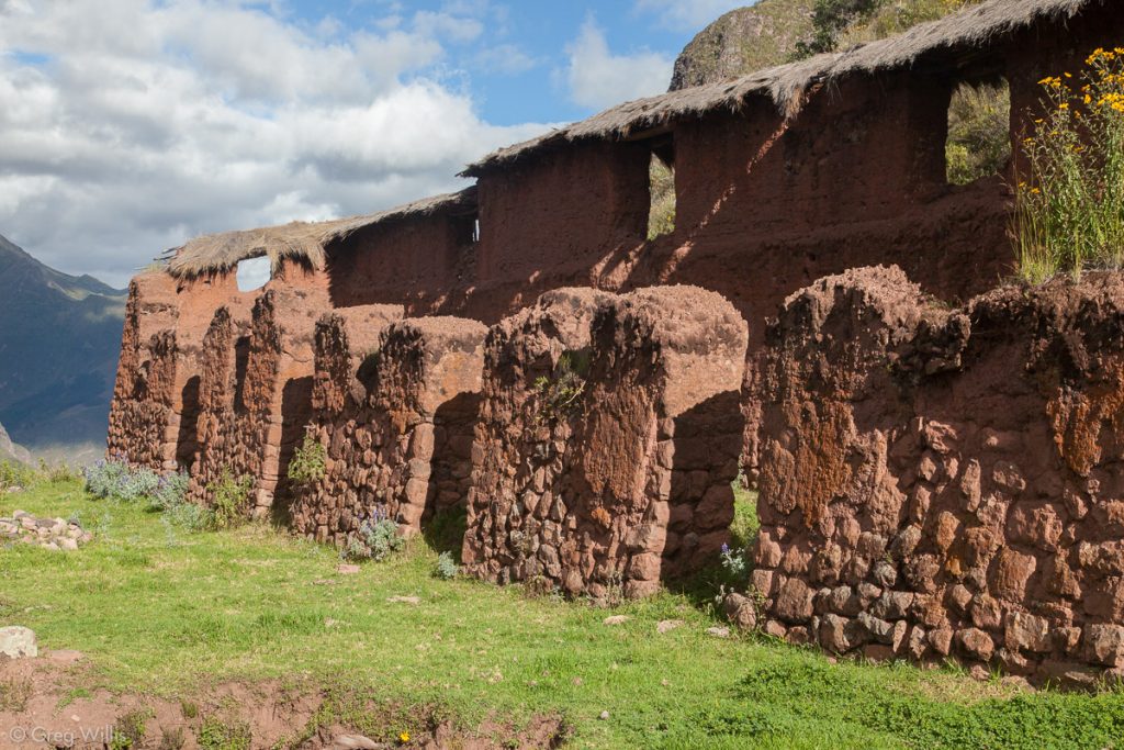
Q’awinayoq Building 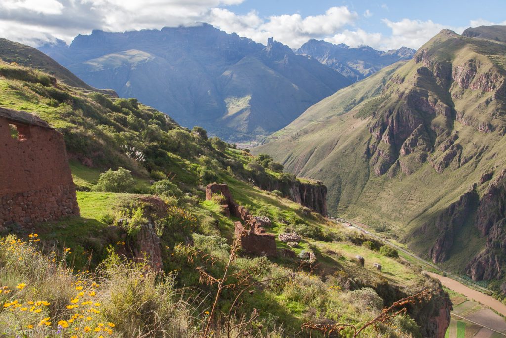
Q’awinayoq and the Sacred Valley


The descent to Lamay was precipitous: 2,200′ in 2 miles and in 1:15.

We had taken our time amid the ruins and tt was getting later in the afternoon than I would have liked. So we caught a cab in Lamay back to Calca. We said a tired and quick farewell to our friends at Casa de Aida, and headed to Ollantaytambo for the night.
I cannot say enough good things about this hike. The ruins are extensive and well-preserved, the views of the Sacred Valley and the surrounding mountains are unequalled, and the crowds are nonexistent. Seriously, we saw 6 other tourists the whole hike. It’s certainly the equivalent with Pisac and Ollantaytambo, the other royal estates in the Sacred Valley. It just takes a considerable amount of effort to get to. We heard rumors of building a cable car to bring tourists up there. But if you’ve got the legs and the time, go now.
Because of the lack of day-hike accounts, I didn’t really know how long the whole thing would take. Eight hours, turns out. If I knew then what I know now, I would have caught a tuk-tuk from Calca to as far as you can on the path. The road by the river is not worth the time it takes.
I made a small guide to help with finding and explaining the ruins: download Huchuy Qosqo guide here. Print it on 5″x15″ paper and fold it in 5 sections so the final form is 3″x5″. And the academic paper I used is this: Kendall, A., Early, R., Sillar, B. Investigating Early Inca Architecture at Juchuy Cosco and Warq’ana, 1992. You should be able to find a pdf via a search engine of your choice. It’s dated and a bit too detailed for a causal hiker, but it’s the only thing I could find that wasn’t just a vague paragraph. And the GPS coordinates for the Chicana is Lat -13.362222, Lon -71.941389 — make your way down there, it’s worth it.
Stats
- Distance: 13 miles
- Time walking: 8:00
- Elevation: 2,600′

Thank you for this.
I’m planning on hiking from Patabamba to Sihua to Huchuy Qosqo and then end at Lamay.
The maps are really helpful!
This is just fantastic! Thank you so much!