Contents
The Grand Gulch is a normally dry creek that goes from near Natural Bridges National Park all the way to the San Juan River — about 25 miles as the crow flies. But because of the meandering canyons, the actual hiking distance is almost double that. And we were just hiking the upper part, going in at Kane Gulch & out Bullet Canyon, Oops.. The hike itself is not technically difficult — it’s just walking on the bottom of a dry canyon. The tricks are 1) the distance, 2) the water, & 3) the wayfinding. We were staying 2 nights which gave us 3 days to explore without rushing. The ranger station lets you know where the springs are so you can filter as you go. And a map and a good sense of direction, not to mention a GPS, comes in handy so you can go up the correct canyon. This is wilderness and there are no signs at all along the way.
Why hike Upper Grand Gulch?
So what’s it all about? Ruins, artifacts, canyons, petroglyphs, & pictographs — all without the usual boundaries or crowds you find at more accessible parks like, say, Mesa Verde.
The earliest people in Cedar Mesa were the Basketmakers, from 500 BCE to 750 CE. As you can probably guess, they were pretty good at making baskets. But not so good at making pottery. Drought forced them to move elsewhere, and the folks who resettled this area in 1050 CE had developed into the Pueblo culture, also found in Chaco Canyon and Mesa Verde. They were down with the pottery, as well as weaving & masonry. And by the late 1200 CE, change in the climate again forced them to move into Arizona and the Rio Grande valley in New Mexico.
So the human creations you see in the Grand Gulch are at least 800 years old and possibly as old as 2,500 years old.
Even though archaeological expeditions in the late 1800s stripped away the largest and most important artifacts, the stuff they didn’t take is still there. Pottery shards, grinding stones, even their corn cobs litter the ground around the ruins. And these intimate items that you can pick up and touch without supervision that makes the Grand Gulch so unique and special to visit.
Unfortunately, in such remote conditions bad people will take and loot. And what they take is not only the artifact, but all the future experiences that you & I could have discovering these precious links with the past.
And this is why the inclusion of the Grand Gulch into the new Bears Ears National Monument is so important. When we hiked, this was Bureau of Land Management (BLM) land. The BLM does not have the resources nor the expertise to protect a place as important as this. The National Park Service does. [end soapbox]
Planning a hike in Upper Grand Gulch
As I mentioned, we were going in at Kane Gulch & out at Bullet Canyon. The problem? The 8.2 mi / 13.2 km between where we would get out and where the car was parked.
There are three solutions to this. 1) Take two cars and shuttle. Nope. Taking two cars just didn’t make sense for the rest of the trip. 2) Walk it. Exit the canyon, drop the packs, and hoof it on the road. Nope. At a good pace that’s almost three hours — three hours we could be drinking beer in Moab.
3) Bike drop. Winner. Exit the canyon, ride the bike to the car. Fast & easy.
The other planning was nothing big. I used Mike Kelsey’s Non-Technical Canyon Hiking Guide to the Colorado Plateau as a guide to the ruins and made sure to mark the ruins on a topo map. And the ranger station will clue you in for the active springs.
Kane Gulch to Grand Gulch – Day 1
Years before, we were making up time on Utah Hwy 261. Our drive over the Abajo Mountains and Bears Ears took longer than I’d thought, and we were behind schedule getting to Chinle AZ for the night. All I remember from Cedar Mesa was the cedars and the mesa. There’s miles of cedar forest spread out on this flat-topped space before you start your scenic descent at Moki Dugway. At the time I was new to the west and assumed that this was just another one of Utah’s desolate landscapes: rich in views but sparse in history. I was very wrong. As we sped along the top on that highway, behind the cedars & down in the canyons dozens of sites — each rich in history — laid within walking distance of our car.
Over a decade later, we finally parked the car and set off walking to see the history.
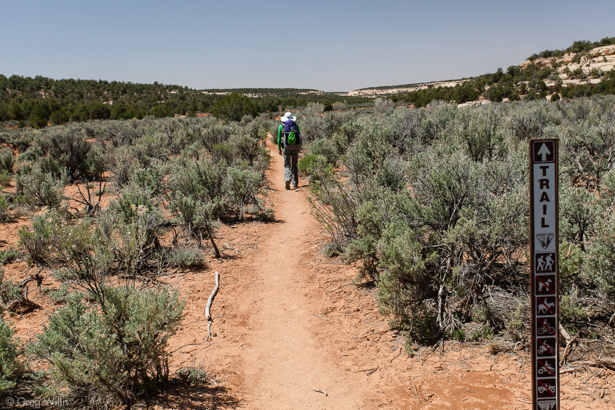
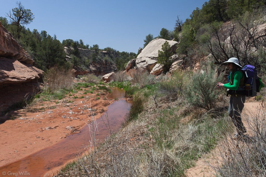
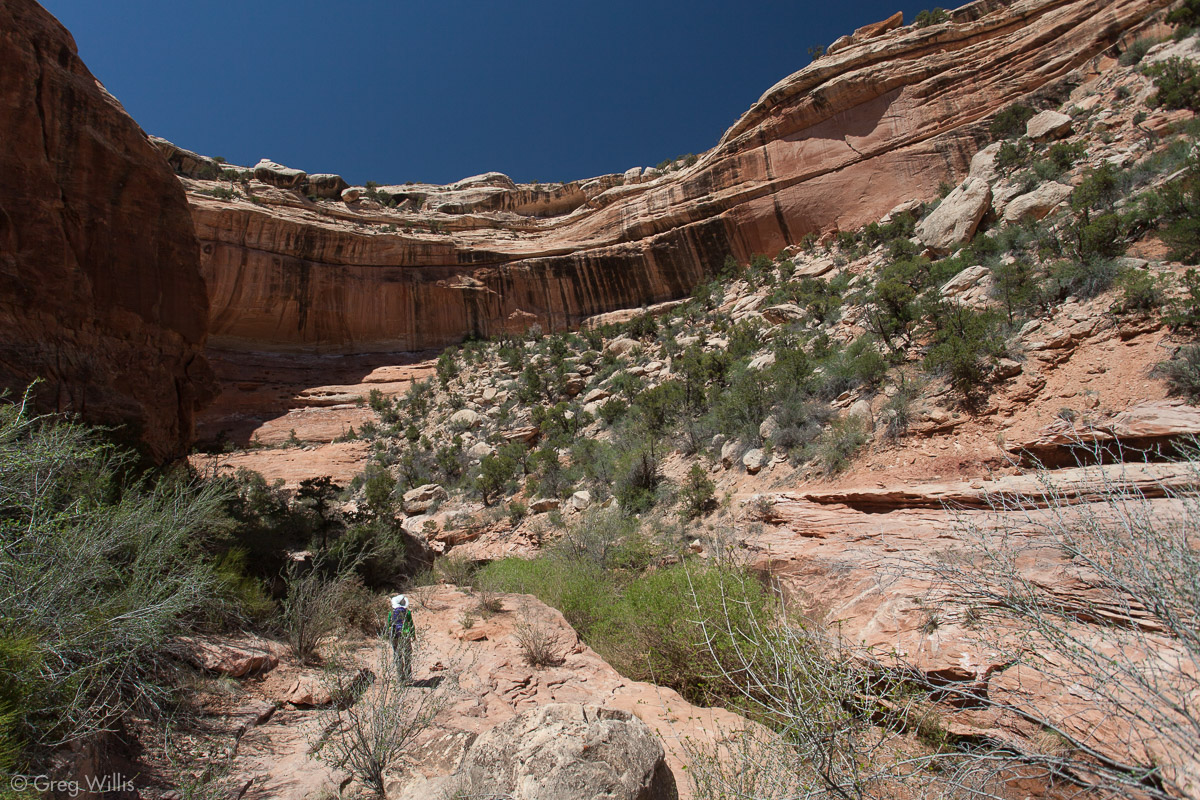
By 12:30 we had dropped the bike, parked the car at the Kane Creek ranger station, picked up our overnight permits, and set off into Kane Gulch. The flat sagebrush trail soon finds the creek and the creek soon finds the sandstone. And in an hour or so we’d found the canyon rising around us.
Kane Gulch 
In Kane Gulch near the junction with Grand Gulch

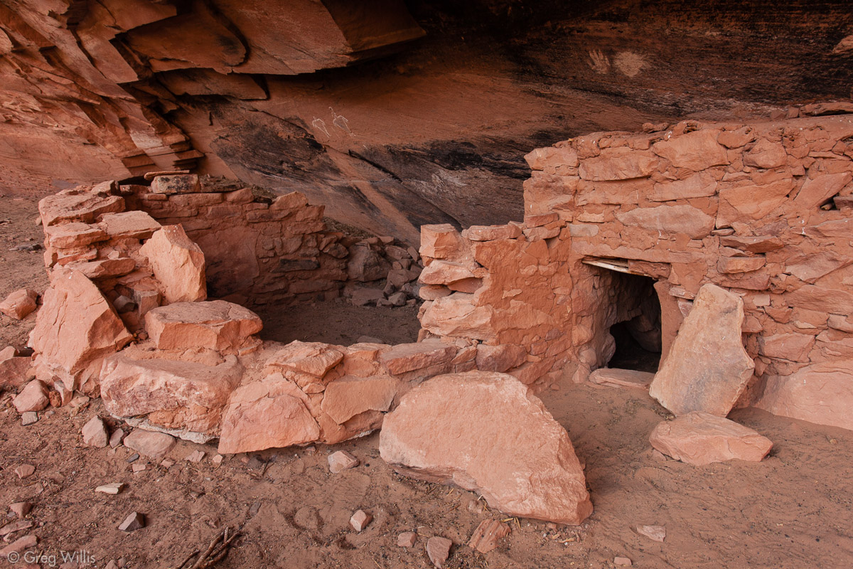
Junction Ruin
Where Kane Creek meets the Grand Gulch lies the appropriately named Junction Ruin. This one has a couple of kiva structures, circular in-the-ground buildings, the kind still in use today in the Pueblo culture. The roofs had long gone so you could see the interiors. It also has rock art and artifacts. This is a popular ruin, as its short distance from the ranger station makes it a rewarding day-hike.

Junction Ruin 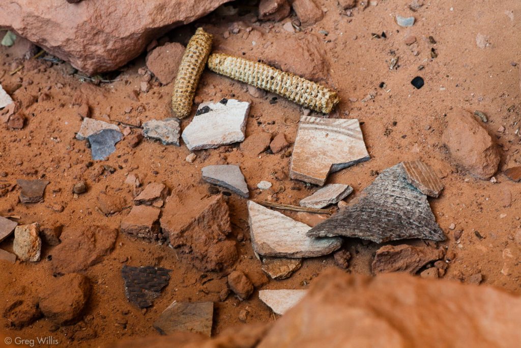
Junction Ruin Various Artifacts 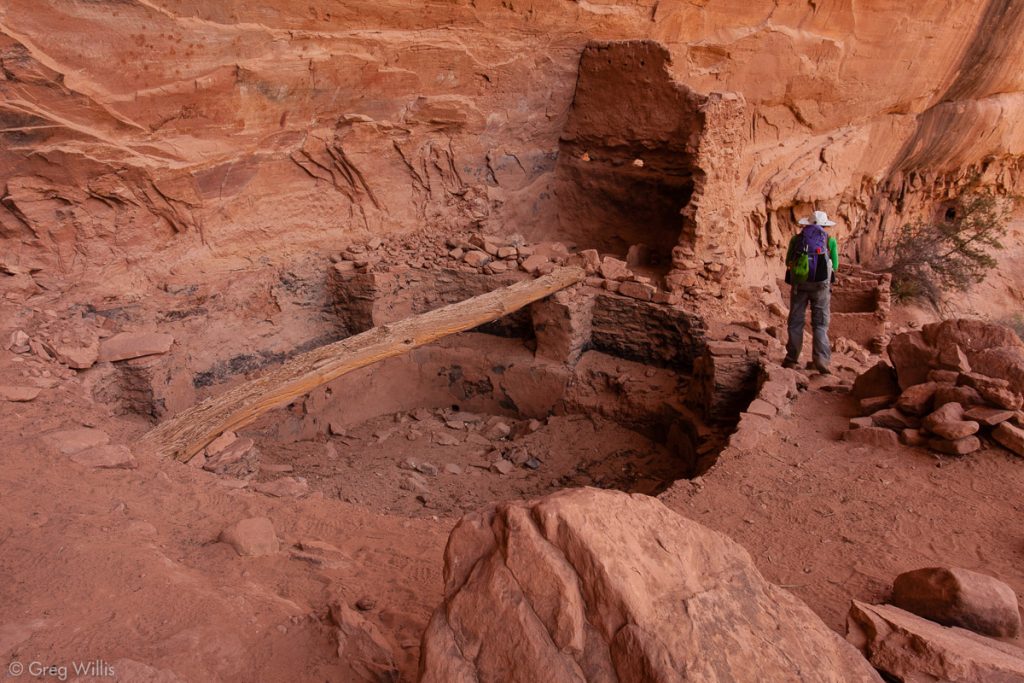
Junction Ruin Kiva 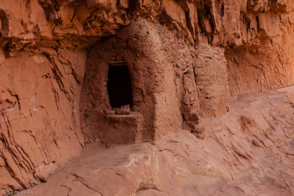
Junction Ruin 
Junction Ruin Kiva


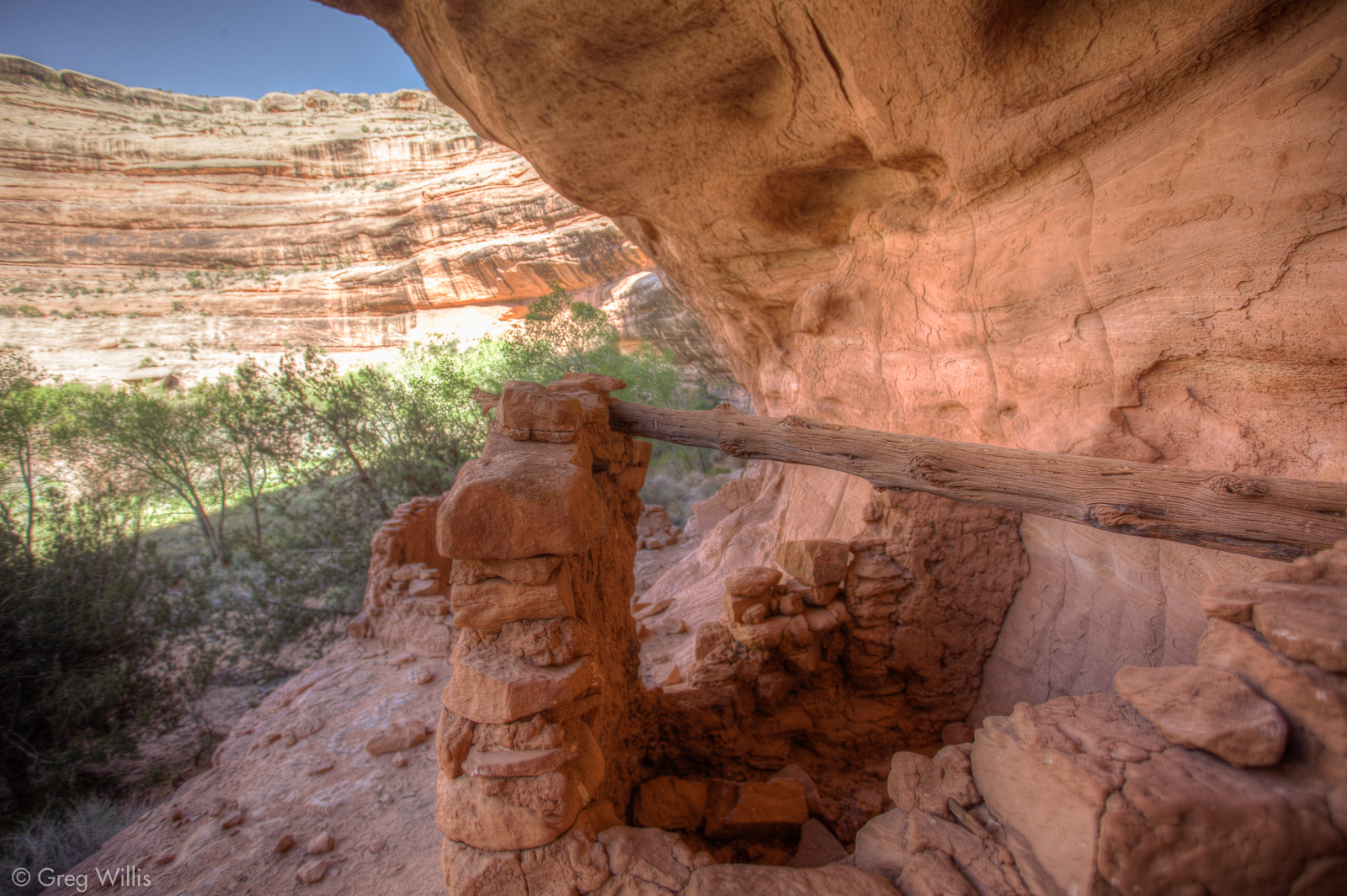
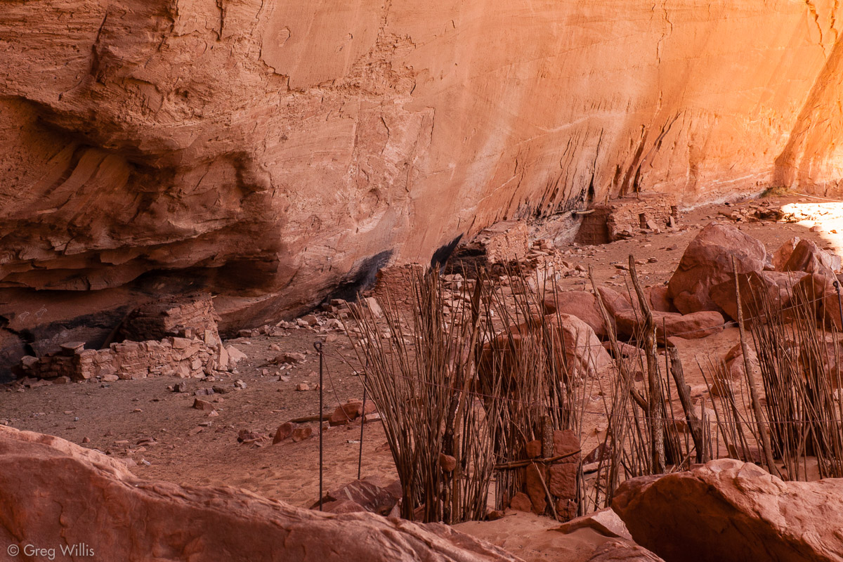
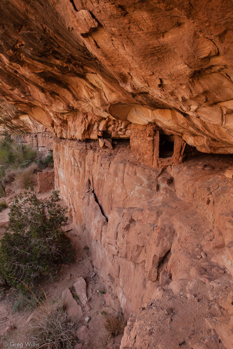
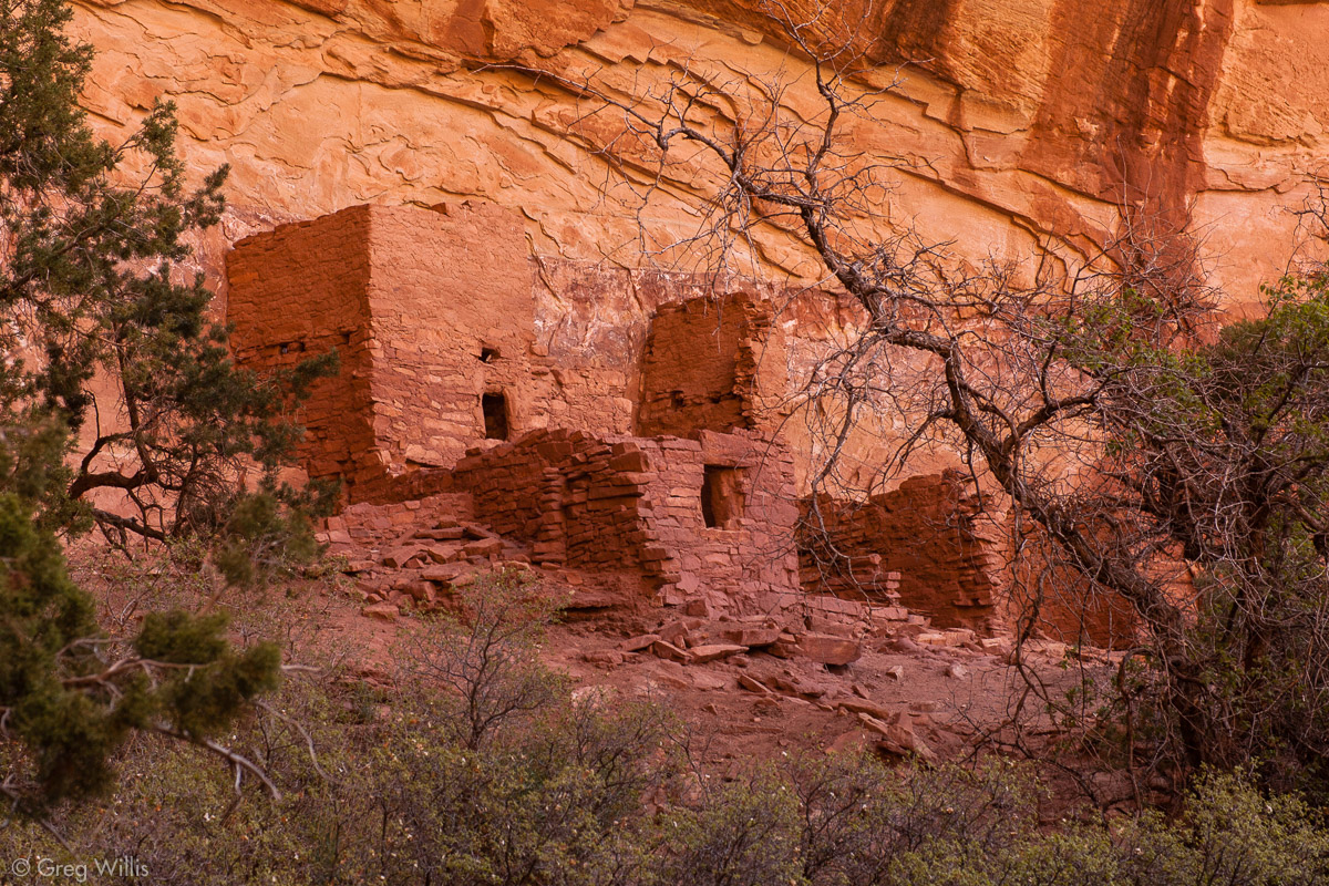
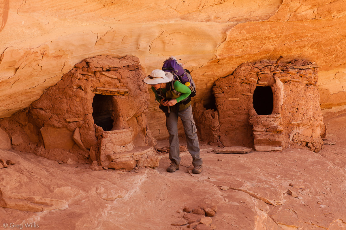
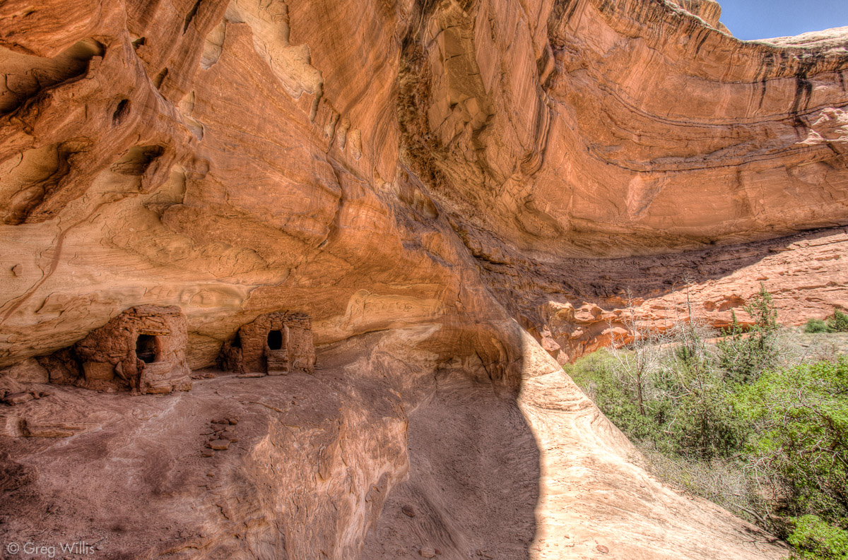
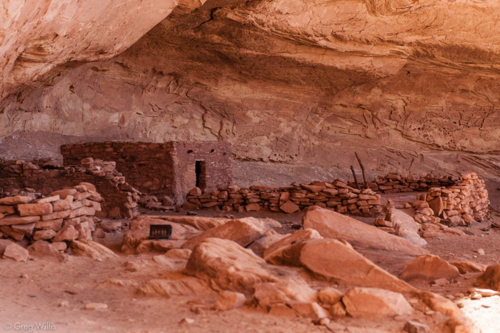
Turkey Pen Ruin
A bend or two of the canyon and we come upon Turkey Pen Ruin. The structure that it is named after is, unfortunately, not a turkey pen. The small stand of sticks — the pen for the imagined turkeys — is the internal support for the adobe that used to make up the walls. Most of the ruins in the canyon are in south facing alcoves. The cliff overhang gives shelter from the occasional rain and the orientation lets the low winter sun warm up the area.

Turkey Pen Ruin 
With the Turkey Pen in the foreground
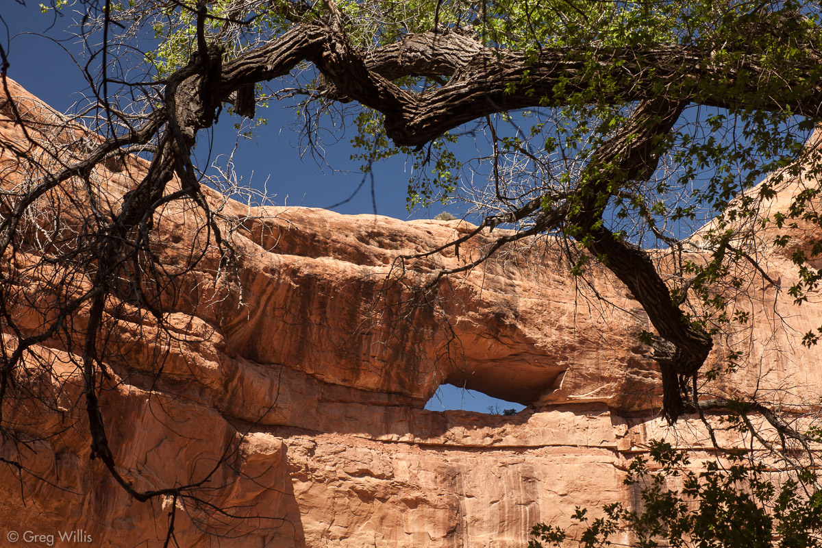
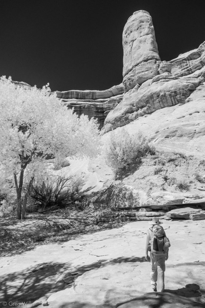
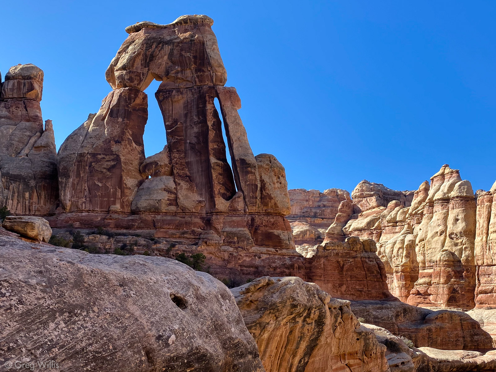
Amid the ancient culture, this is still canyon country. At the next bend looked back and spotted Stimper Arch high up in the sandstone.
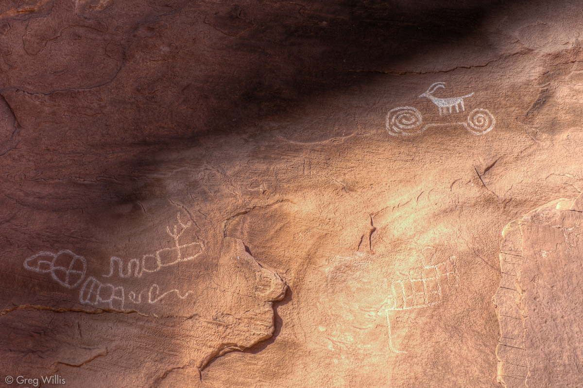
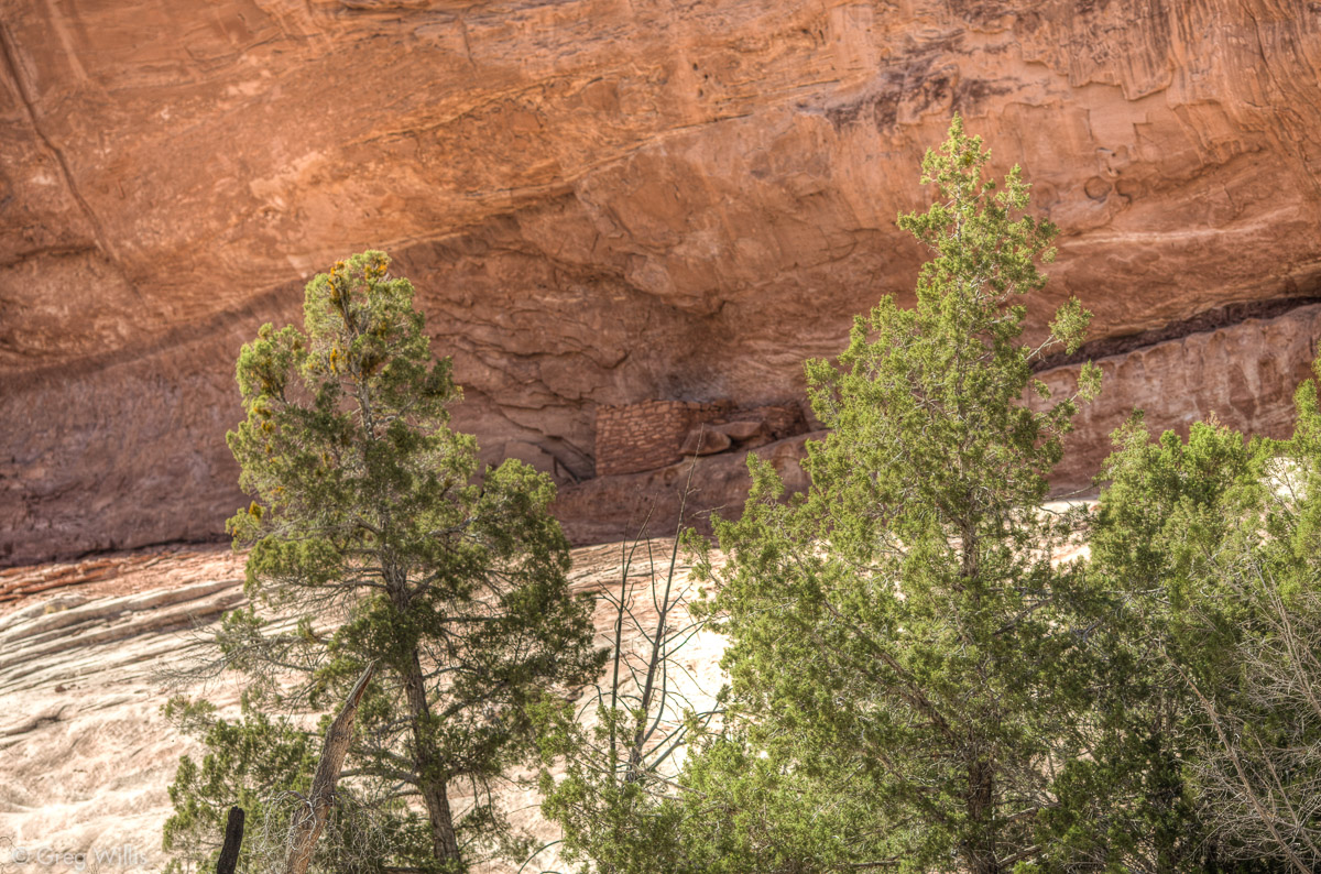
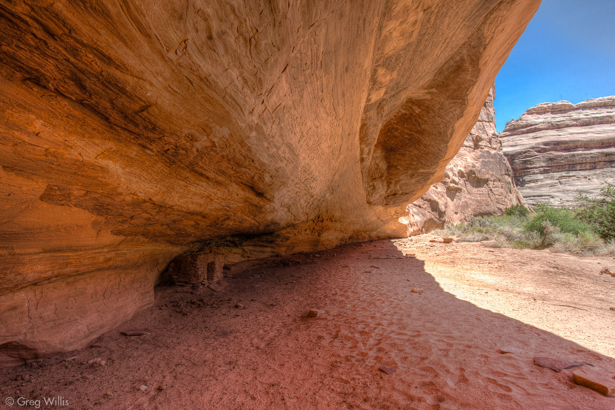
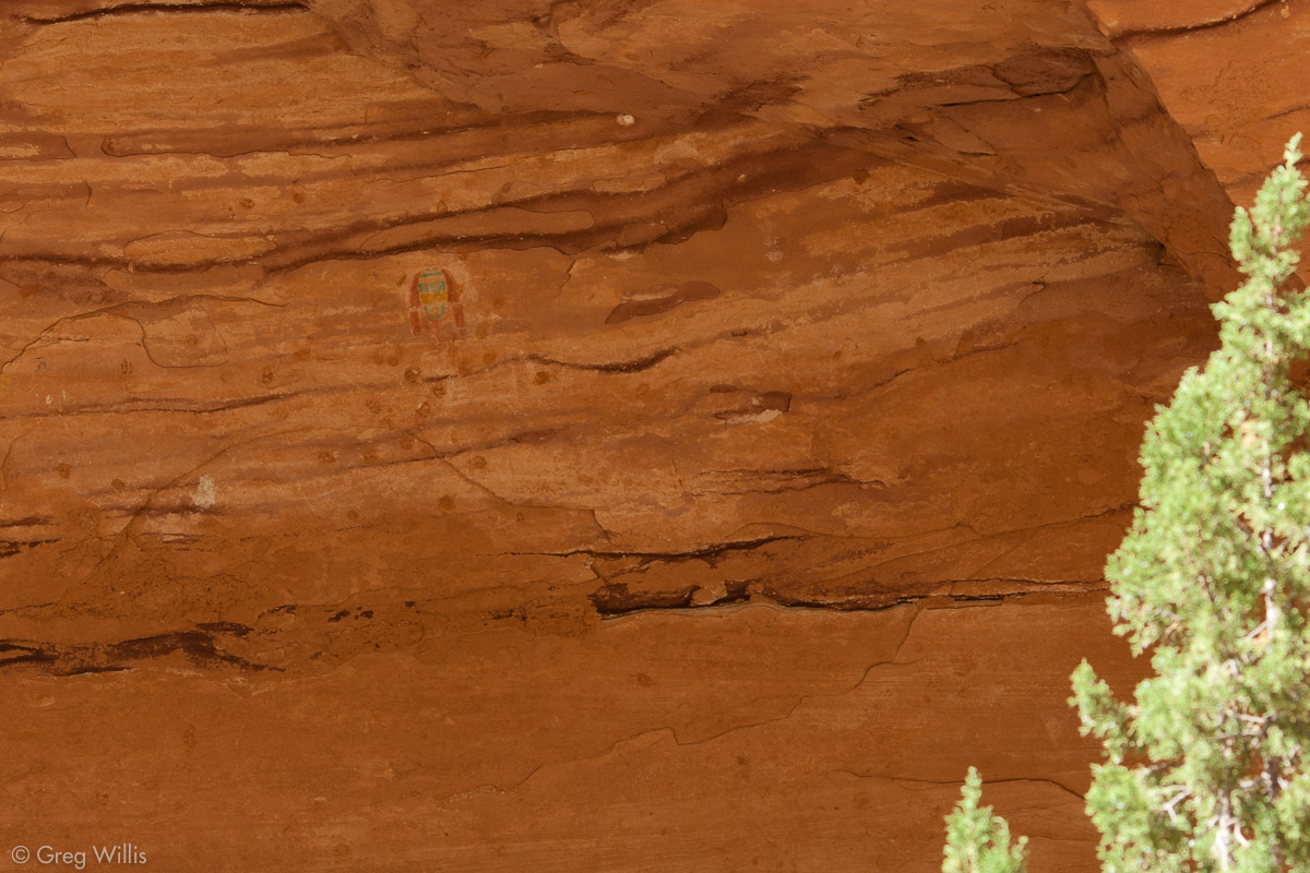
The next ruin we found I can find no name for except ‘unnamed.’ But from what I’ve read, it’s referred to as the Sheep on a Bicycle Ruin. When you find this small group of buildings — nothing as impressive as the previous two ruins — and see the pictograph on the right, you’ll have no doubt what this should be called.

Sheep on a Bicycle Pictograph 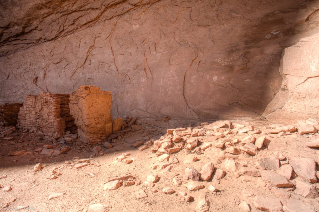
Sheep on a Bicycle Ruin

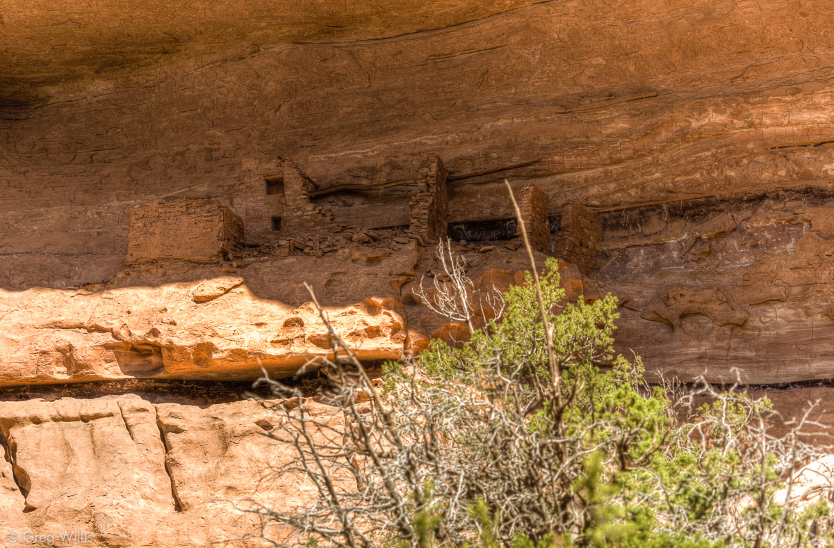
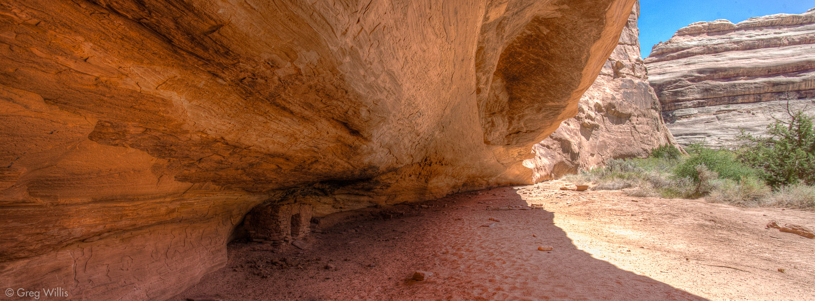
For the most part I’m showing photos of ruins that you can walk up into, the dwelling sites. But throughout the canyon high up on the walls the sharp-eyed can find the stacked masonry of the granaries. The people who lived here used these structures for safe storage, far above the canyon floor.
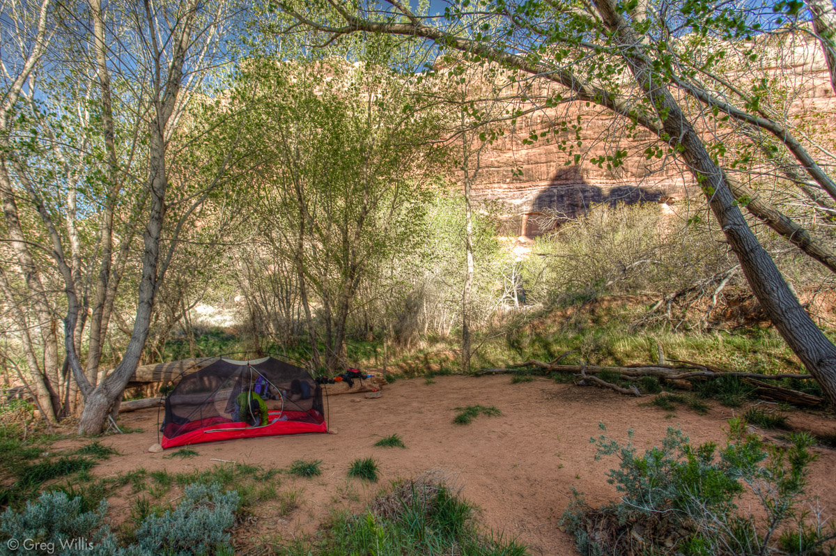
We arrived at the entrance to Todie Canyon around 17:00 and set up camp on Todie Creek not far from a water source.
Grand Gulch – Day 2
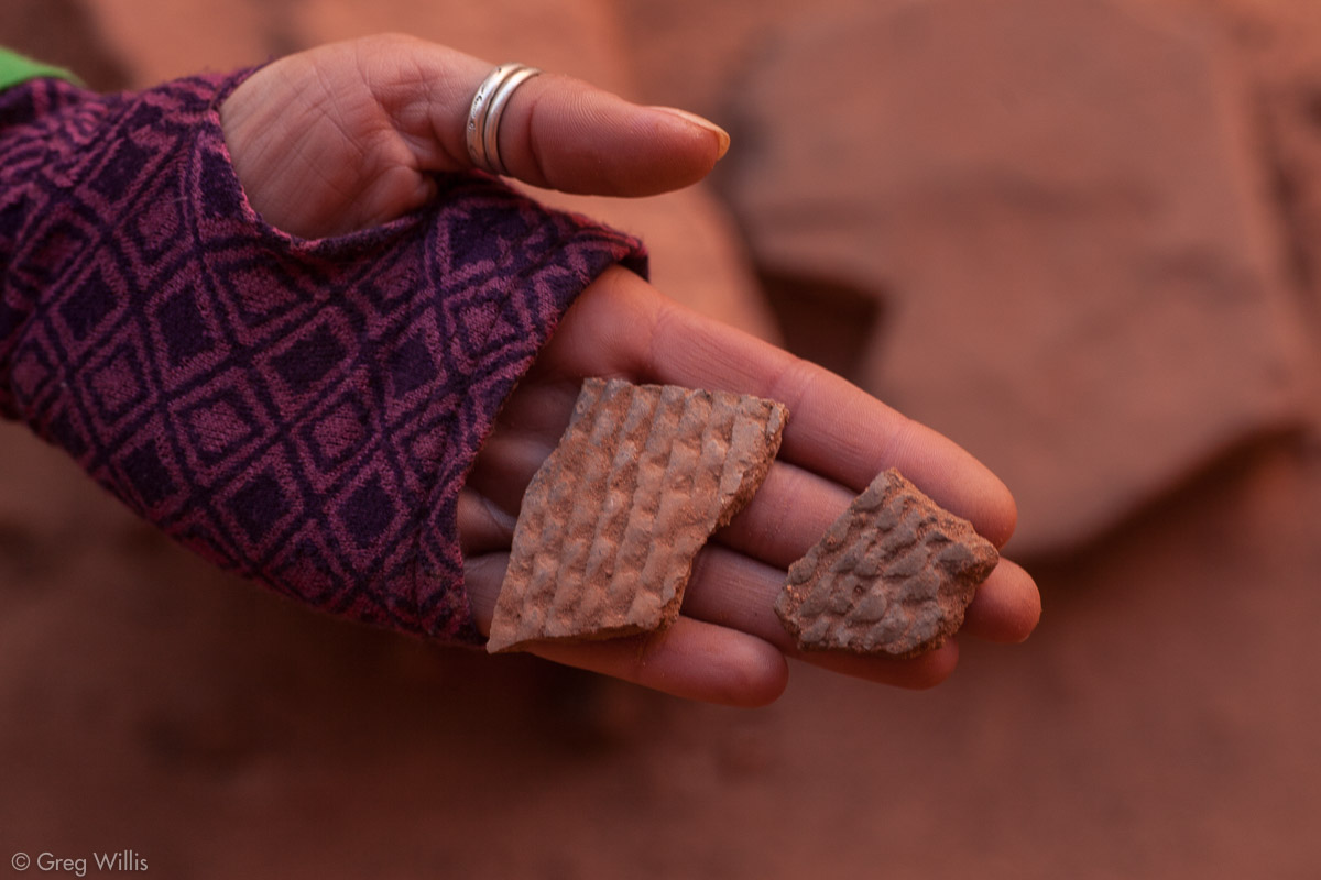
Today we would be right in the heart of the north part of Grand Gulch — plenty of ruins to find and only the most hardy backpackers to encounter. We’d barely started walking this morning when we found an unnamed ruin right across from Todie Canyon.
Unnamed Ruin 
Unnamed Ruin Pottery Shards 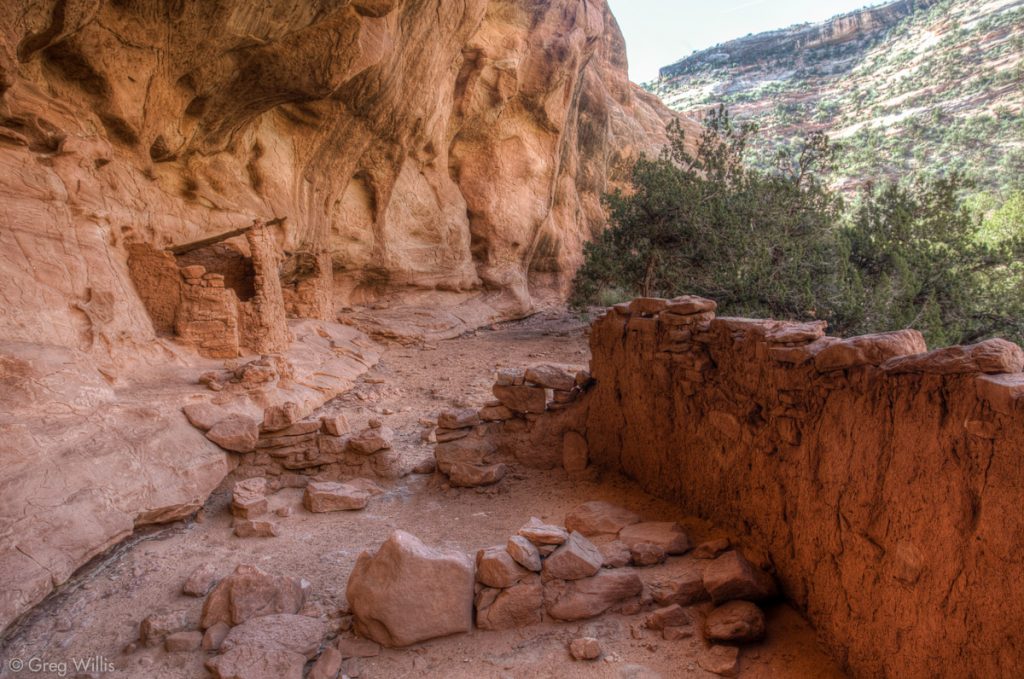
Unnamed Ruin 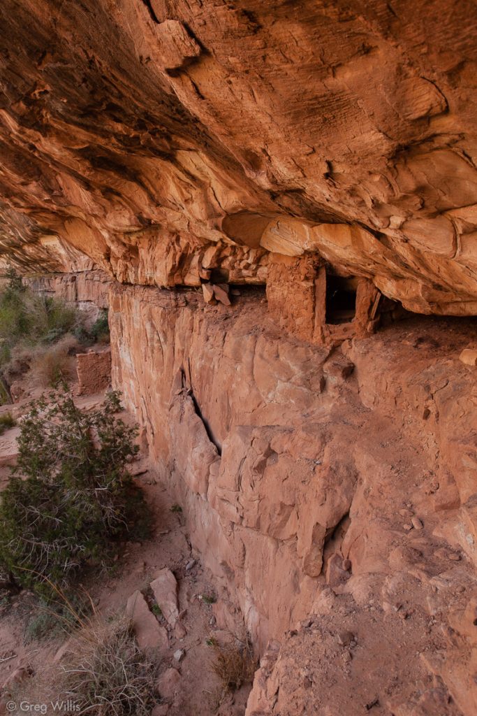
Unnamed Ruin 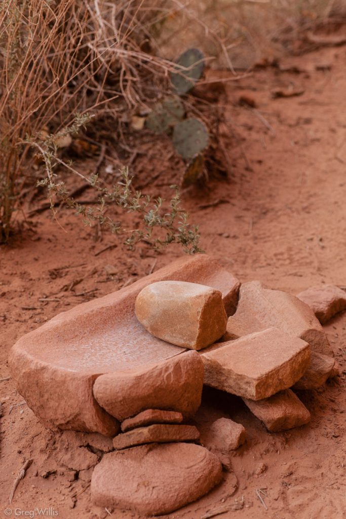
Unnamed Ruin Metate


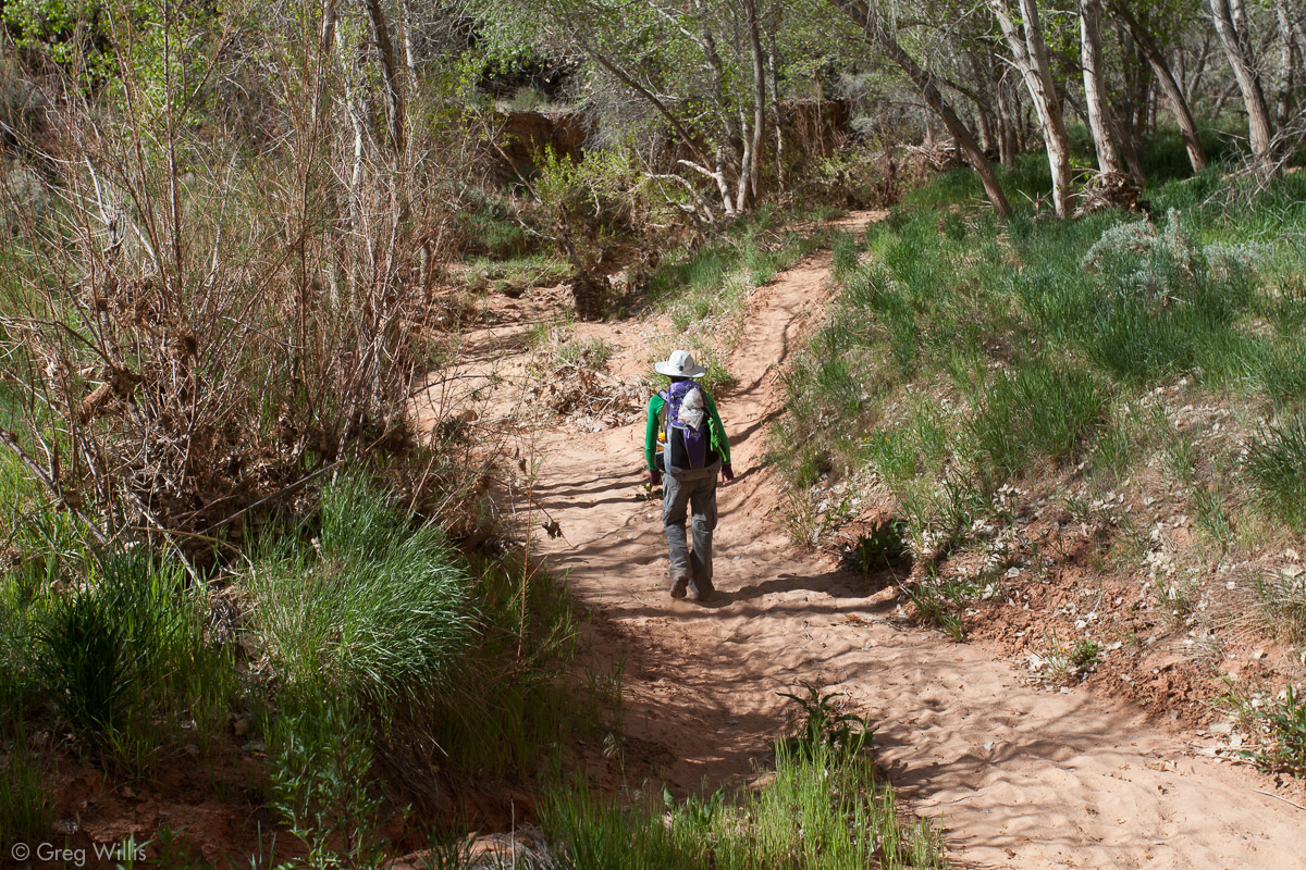
Once down in the canyon, the trail did not prove much of a challenge. It was a well-defined sandy path over flat terrain, occasionally going up and down the dry banks.
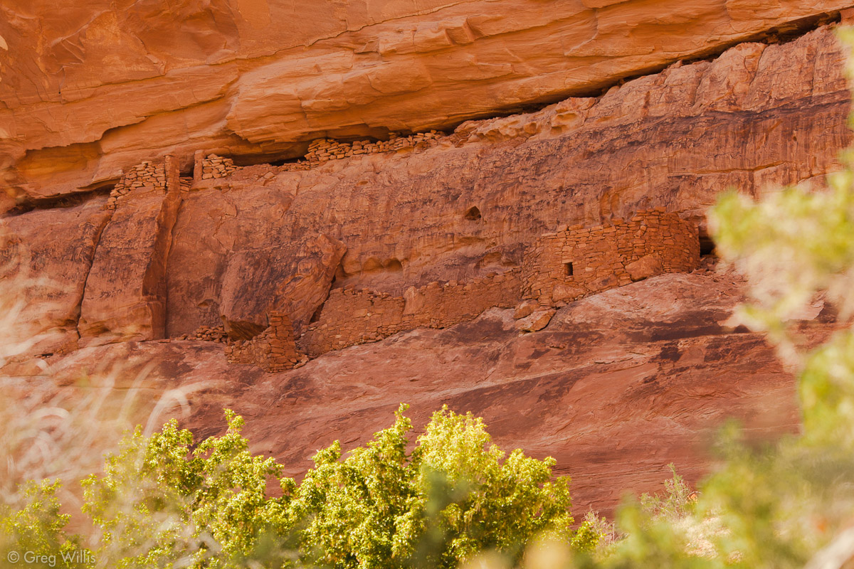
Two Level Ruin
In my trip research I’d marked on a USGS topo map where the major ruins were located. The canyon walls, of course, played havoc with my GPS reliability. So I would count the alcoves as we hiked downstream. Nothing is signed and the ruins stand enough above the dry creek bed that you can easily just walk right on by, oblivious to what you are missing. Two Level Ruin was an easy one, just the next alcove down from the last.

Approaching Two Levels Ruin 
Two Levels Ruin 
Two Levels Ruin 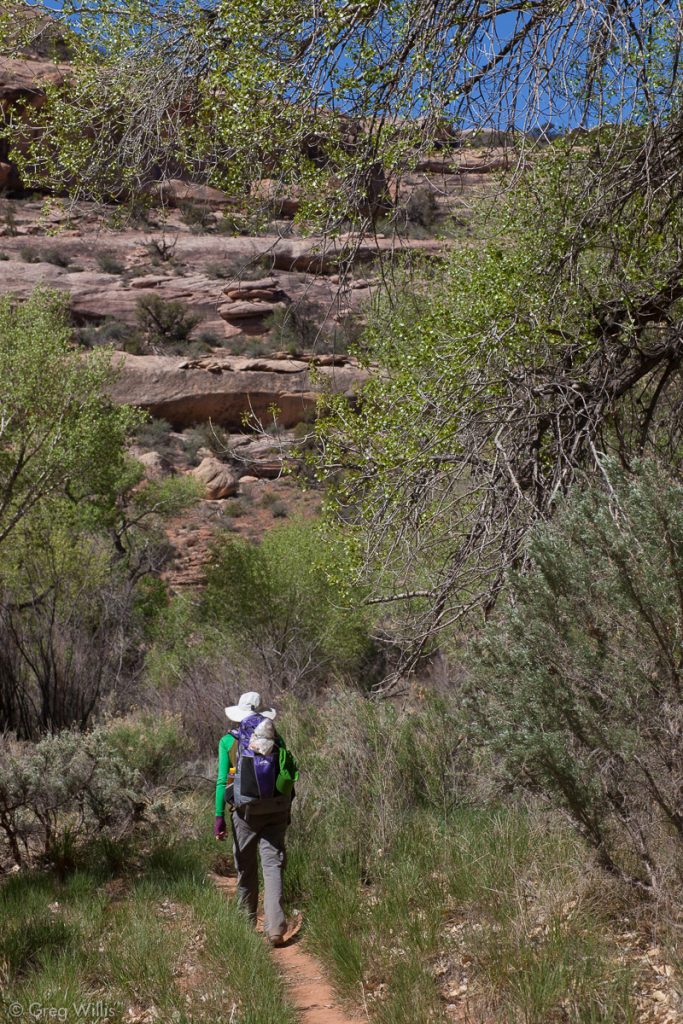
Grand Gulch Trail 
Lion Track Ruin 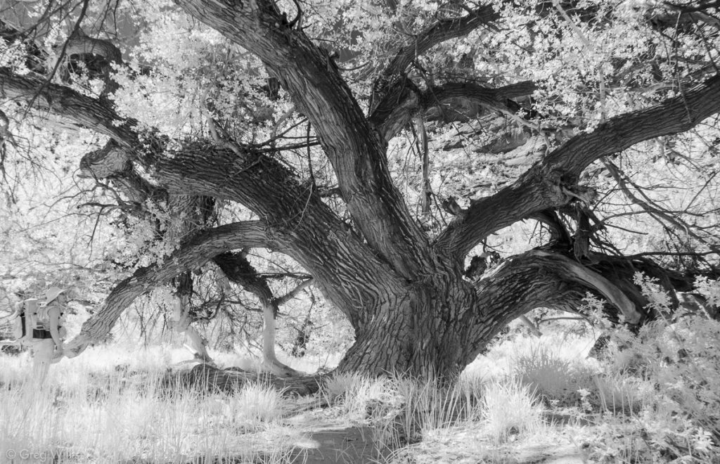
Tree


Split Level Ruin
Split Level Ruin was a few more bends down.

Split Level Ruins 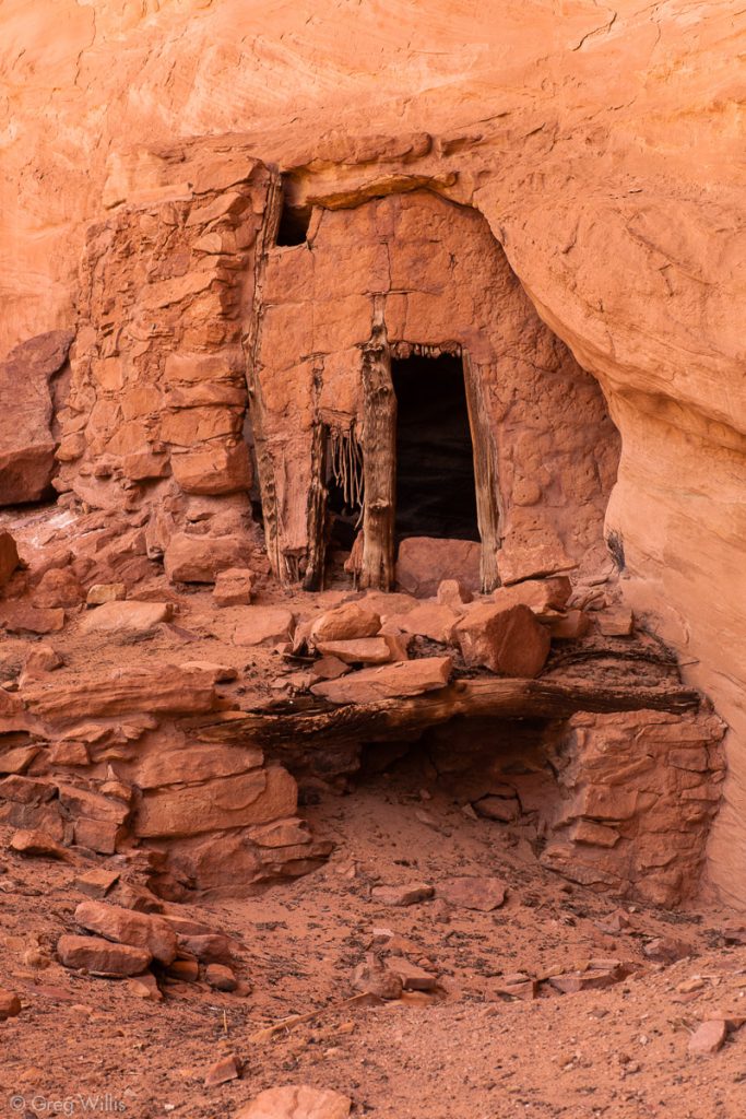
Split Level Ruins Doorway 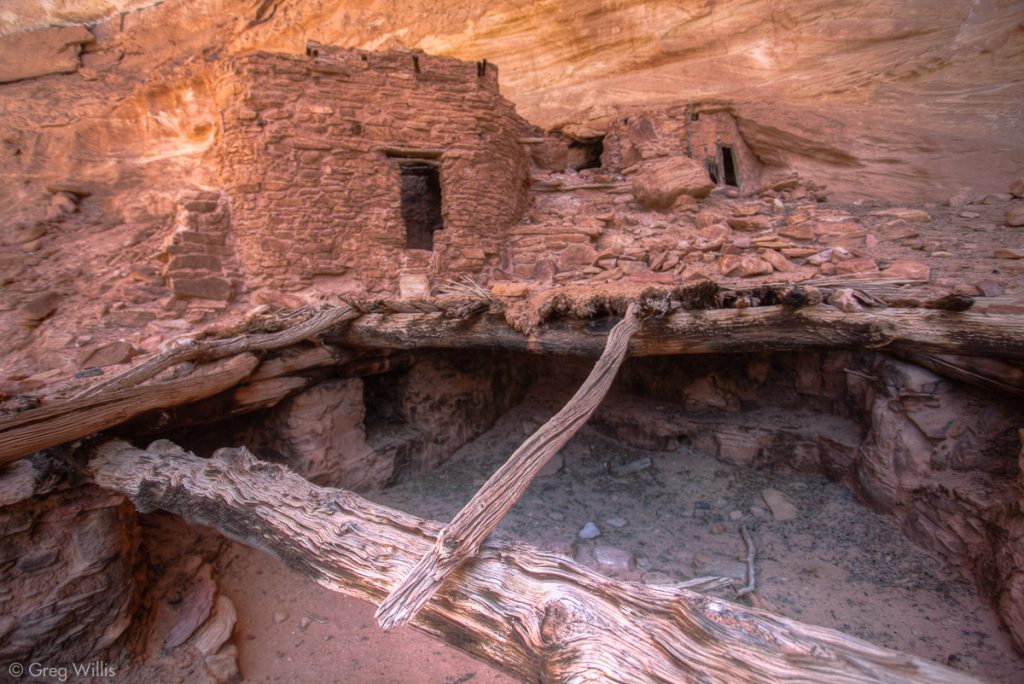
Split Level Ruins Detail 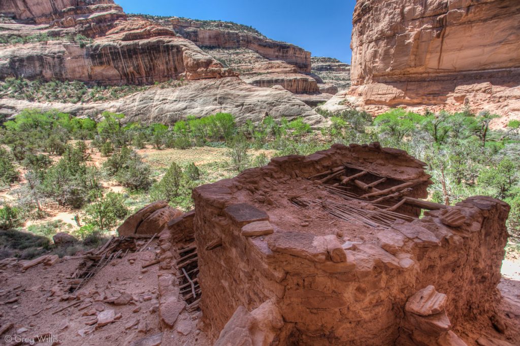
Split Level Ruins


The next two had no names that I was aware of, the first of which lay sheltered far inside a large alcove.
And the second was two small rooms perched up on a ledge.
Unnamed Ruins under a Ledge 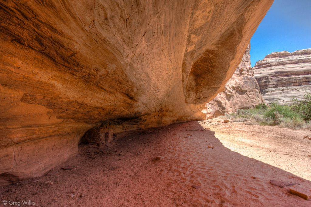
Unnamed Ruins 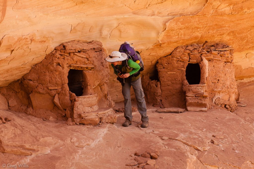
Unnamed Ruins 
Unnamed Ruins

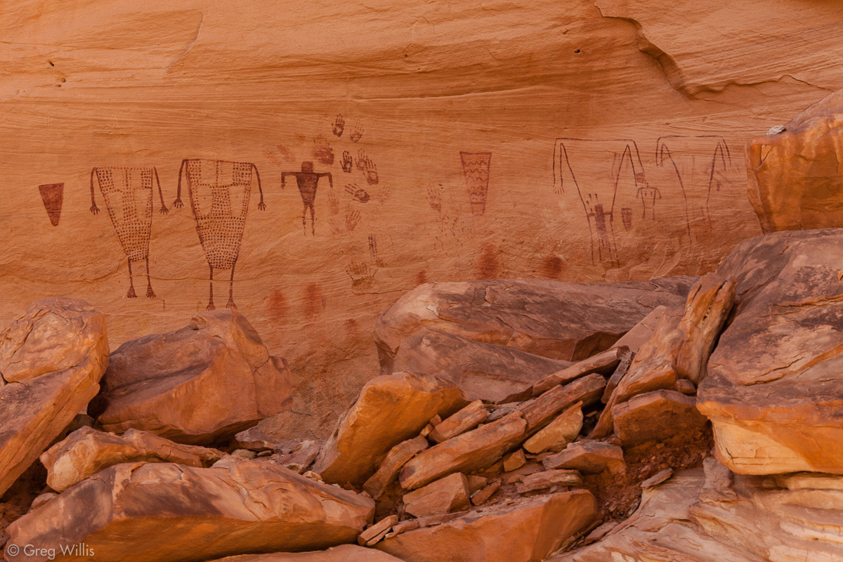
Just beyond a sandstone monument called The Thumb, Sheik’s Canyon held two things for us: rock art and water. We weren’t dry, but it was time to fill up on some water at Green Mask Spring. And as you might expect, there’s a green mask as part of the rock art here. It is not very large and it took us a while to locate it.
The Thumb 
Green Mask Ruins Pictographs 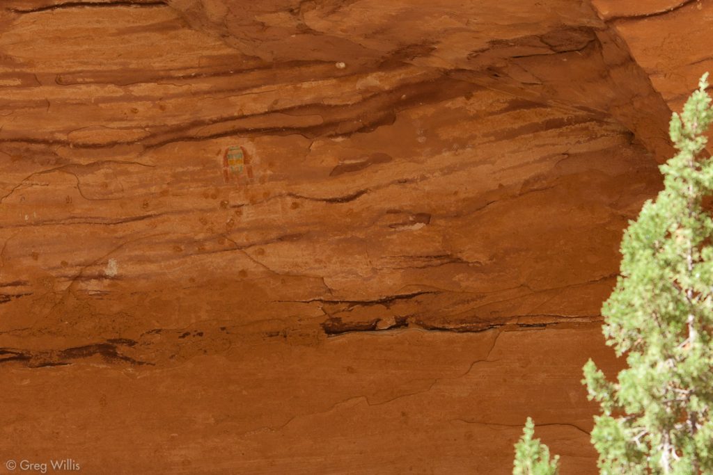
Green Mask Pictograph

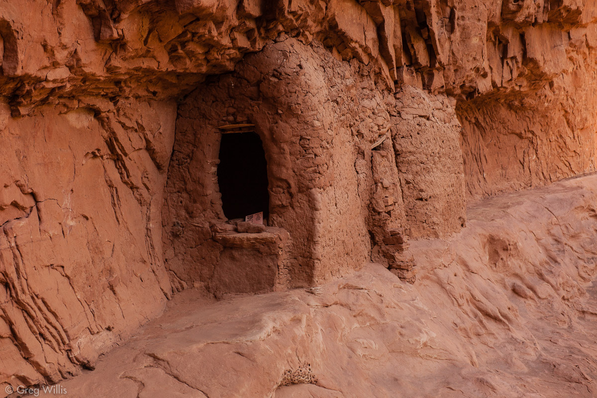
For our last ruin of the day we scampered up to visit Wall Ruin.
After this we left the Grand Gulch to its journey to the San Juan, turning left up Bullet Canyon and our second night’s campsite near Jailhouse Ruin. We might have seen five other hikers during the day, and no one camped in the area this night.
Grand Gulch – Bullet Canyon – Day 3
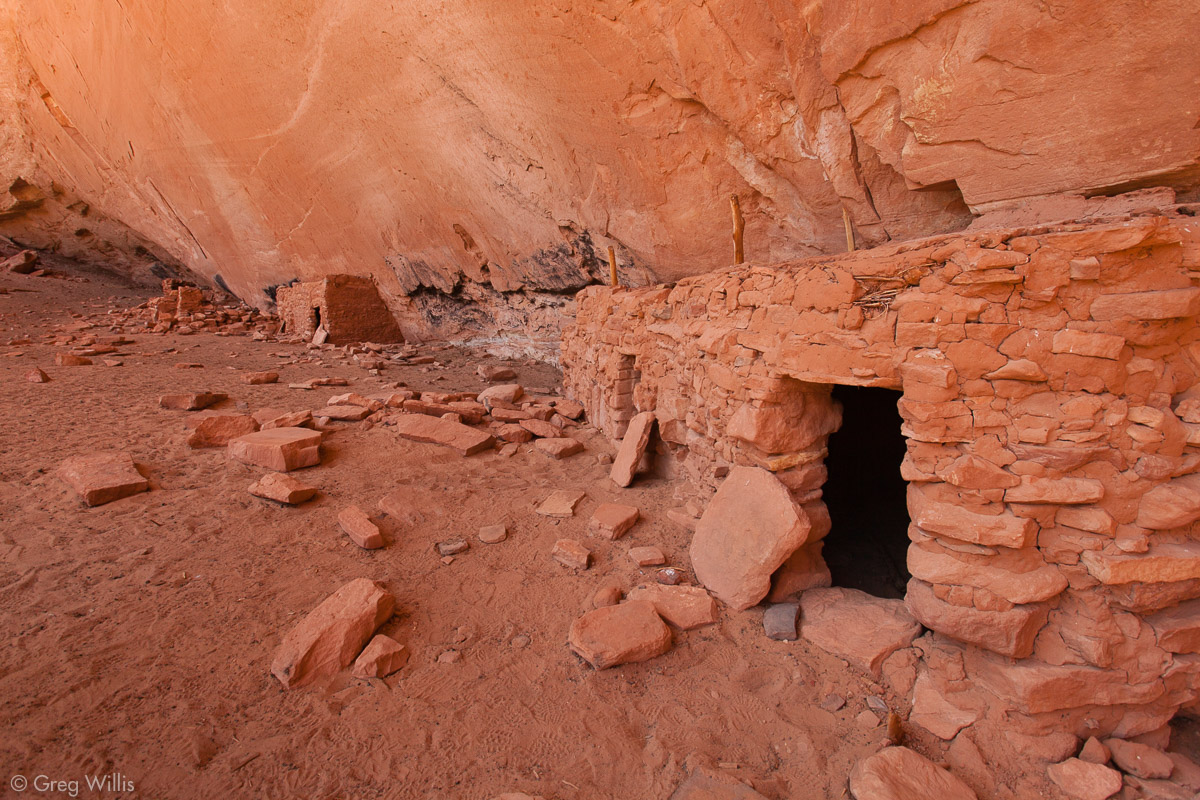
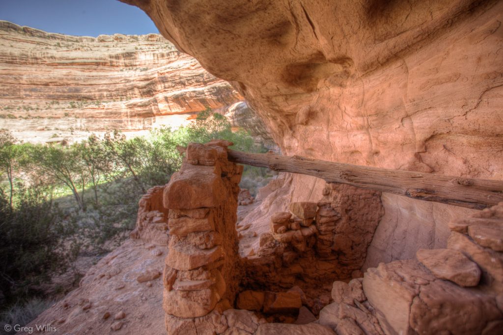
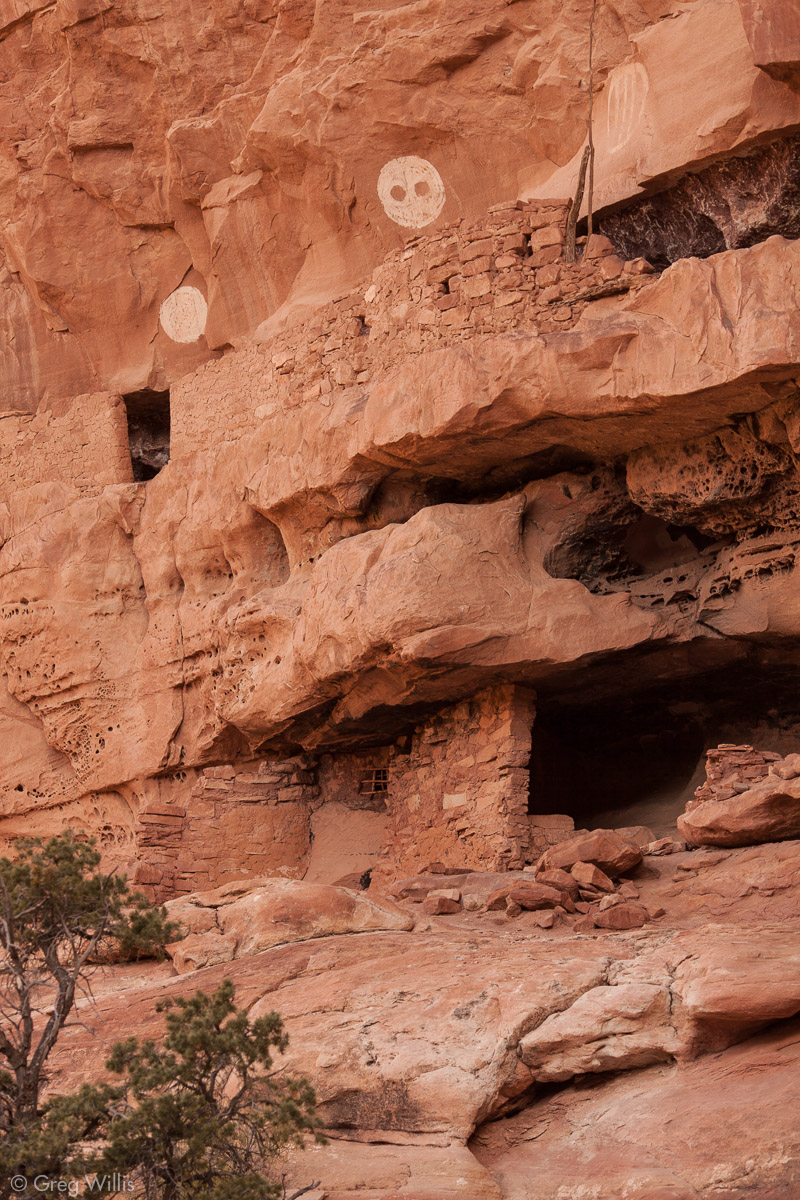
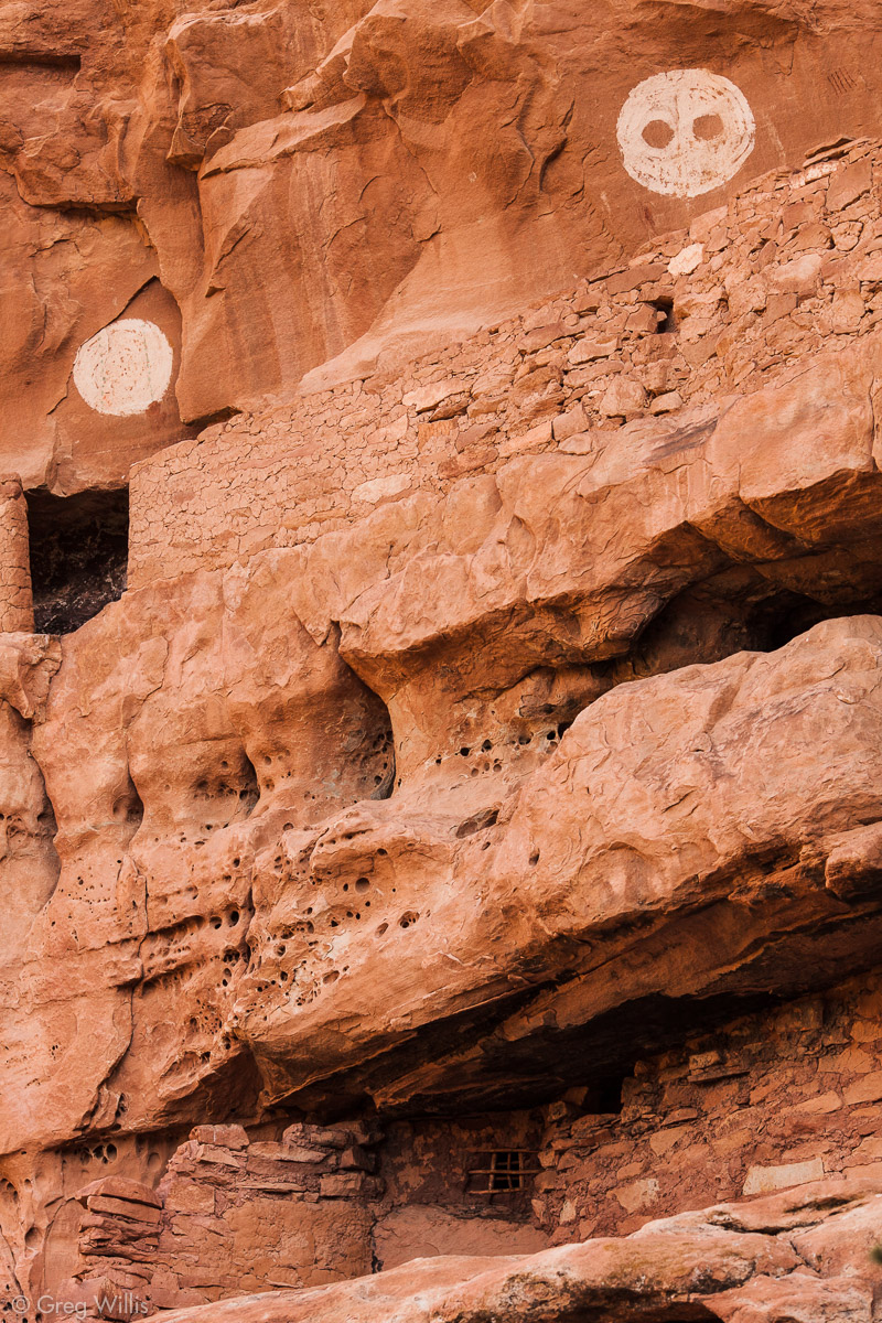
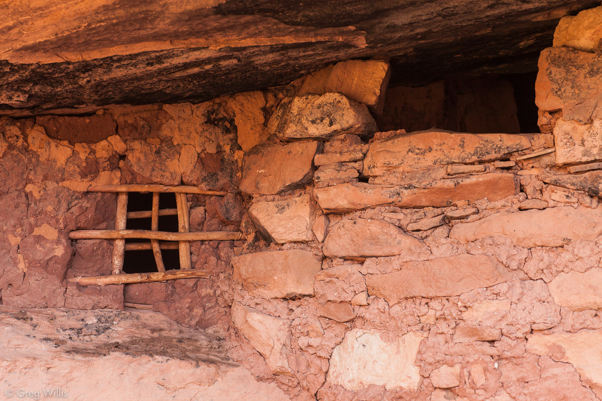
Jailhouse Ruin
Jailhouse Ruin feels a bit mysterious. Maybe it was spending the whole night with the white disks, one with eyes, peering into our tent. Or maybe it’s the darkness behind the barred window that gives this ruin its name. Undoubtedly this was my favorite of all the ones we saw.
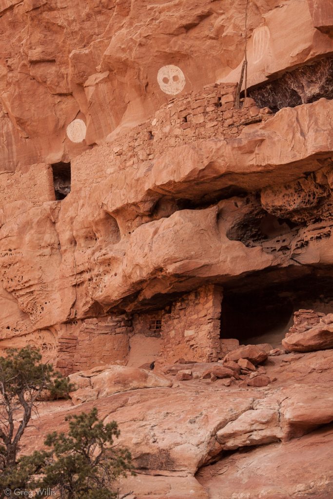
Jailhouse Ruin 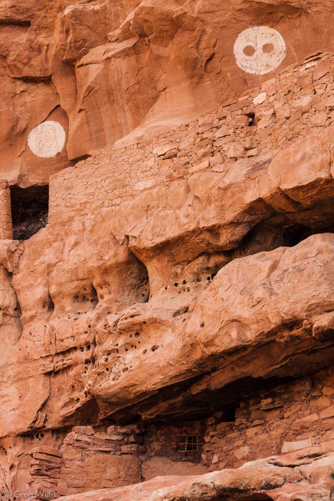
Jailhouse Ruin 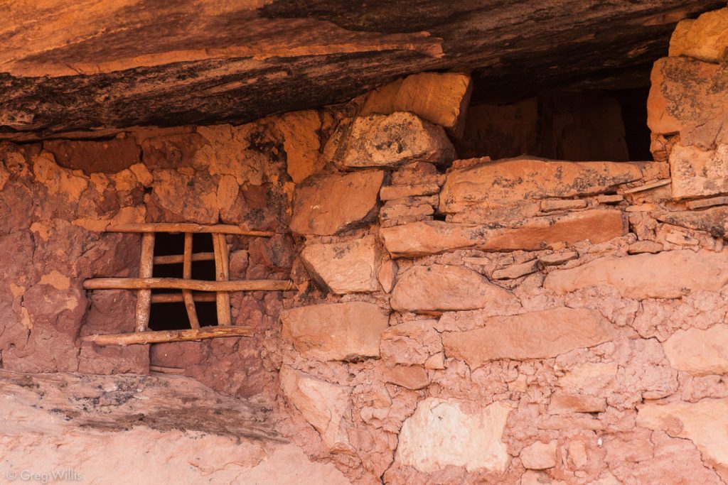
Jailhouse Ruin Window 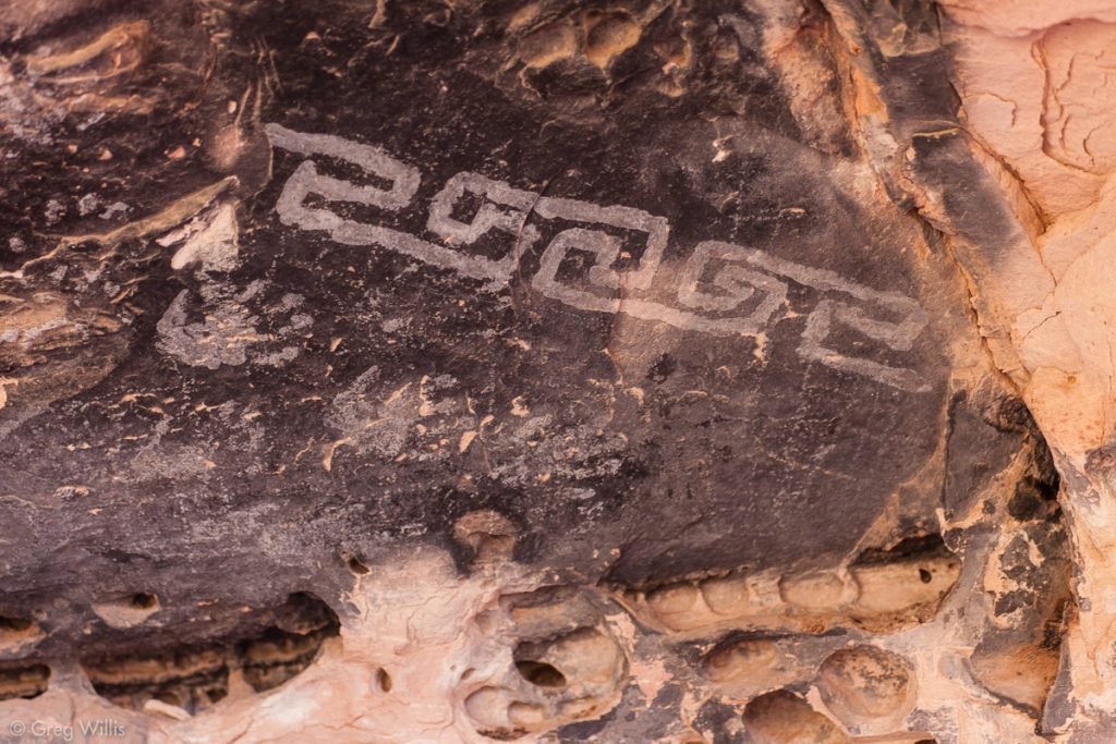
Decorative Pattern in Jailhouse Ceiling 
View of Bullet Canyon

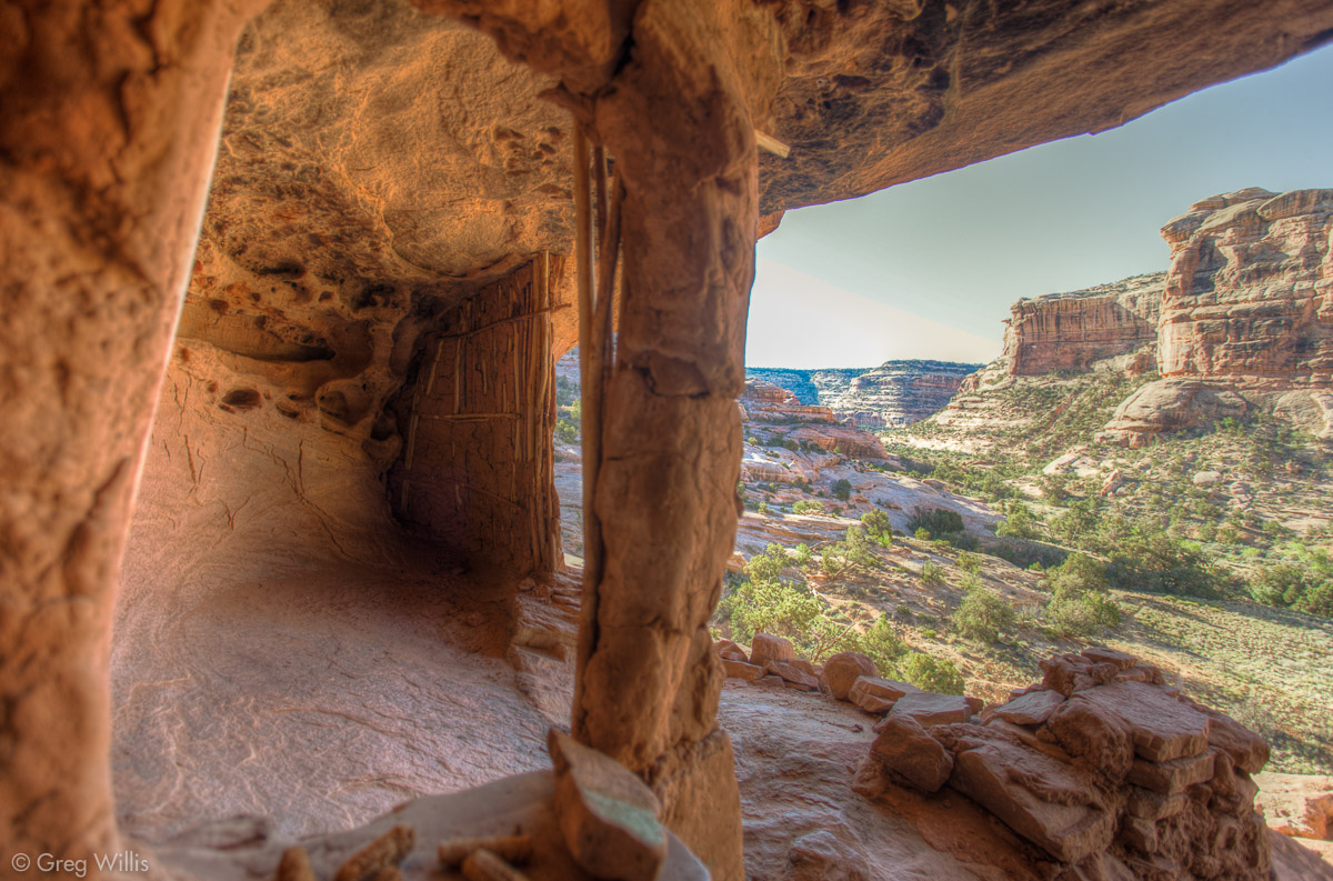
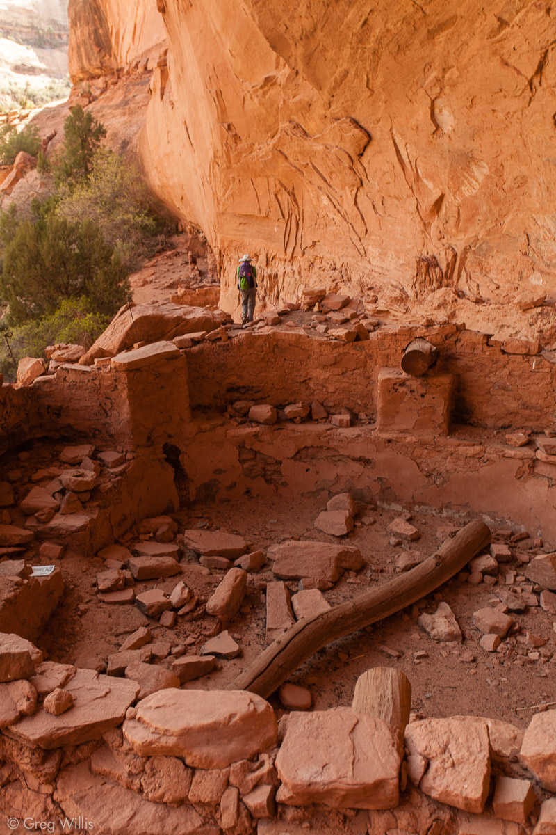
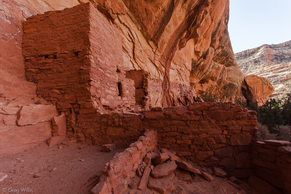
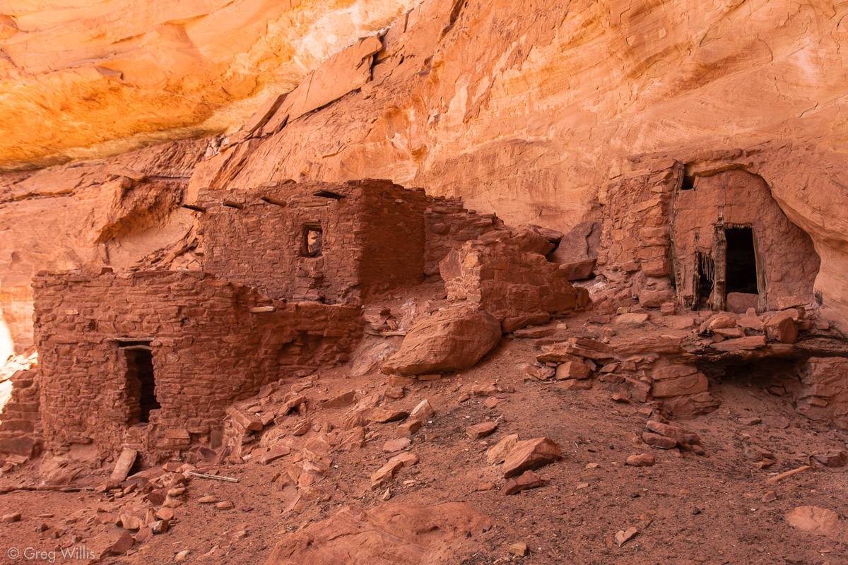
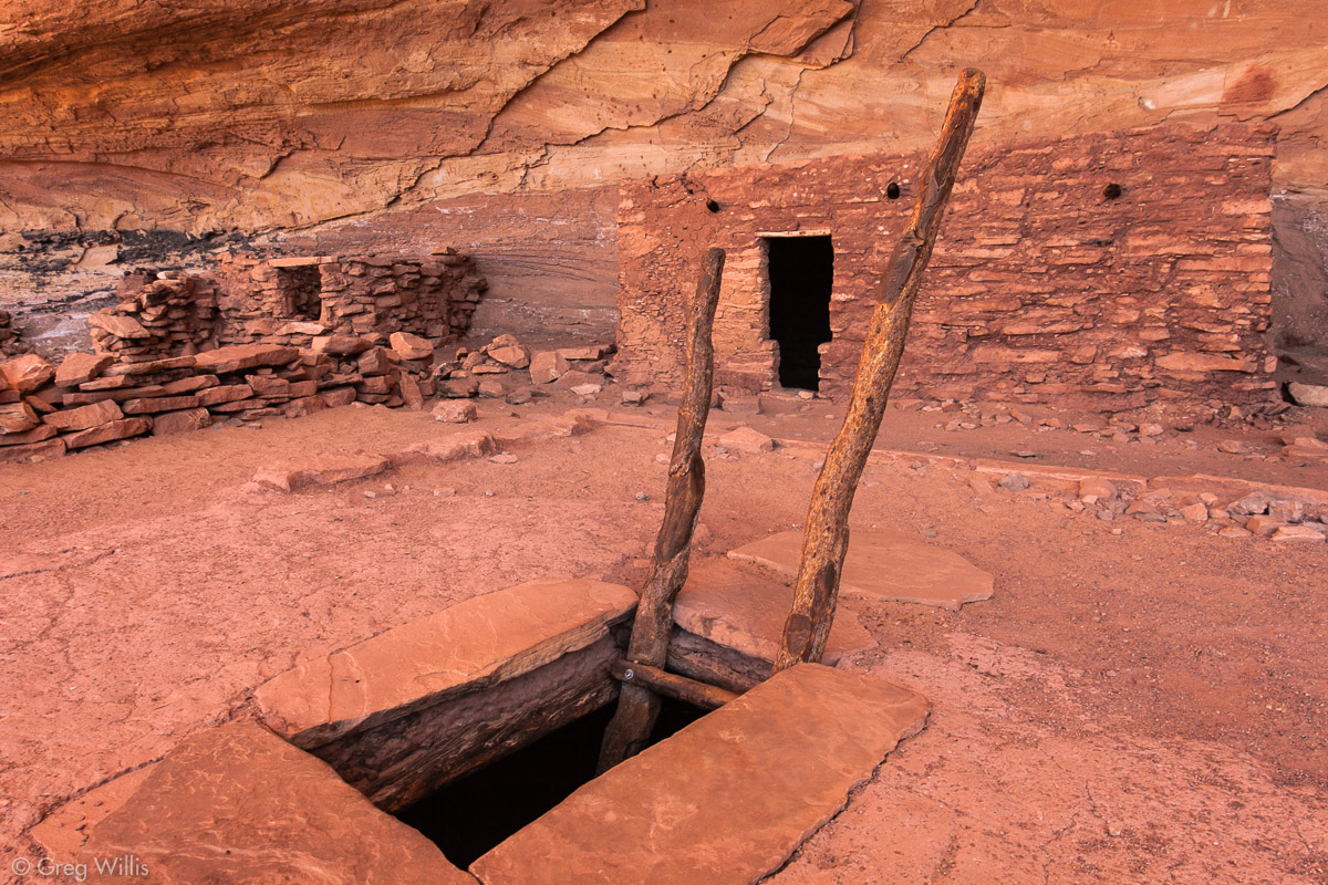
Perfect Kiva Ruin
Even though Perfect Kiva Ruin has been repaired, is was not reconstructed. Which is to say that when the expeditions in the late 1800s found it, it looked like it does now — its kiva complete with a roof that you could climb down through and into the space below. The other buildings looked like a movie set they were in such good condition. Its easy to imagine that the Pueblo people who lived here have just stepped out for a hunt and were returning shortly.
Perfect Kiva Ruin 
Perfect Kiva Entrance 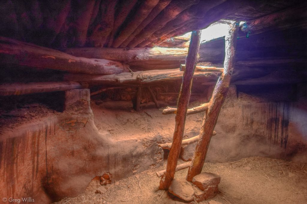
Inside the Perfect Kiva


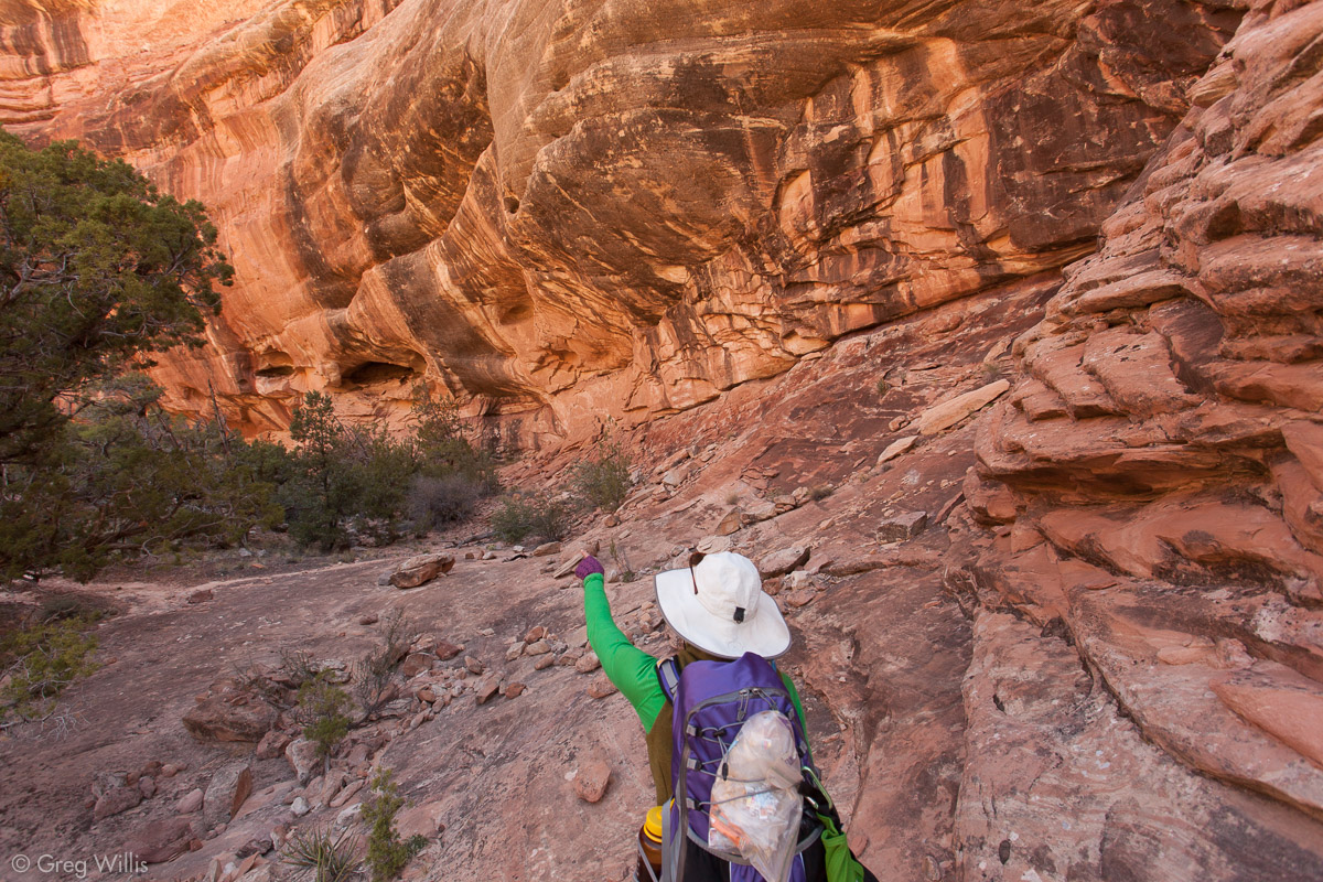
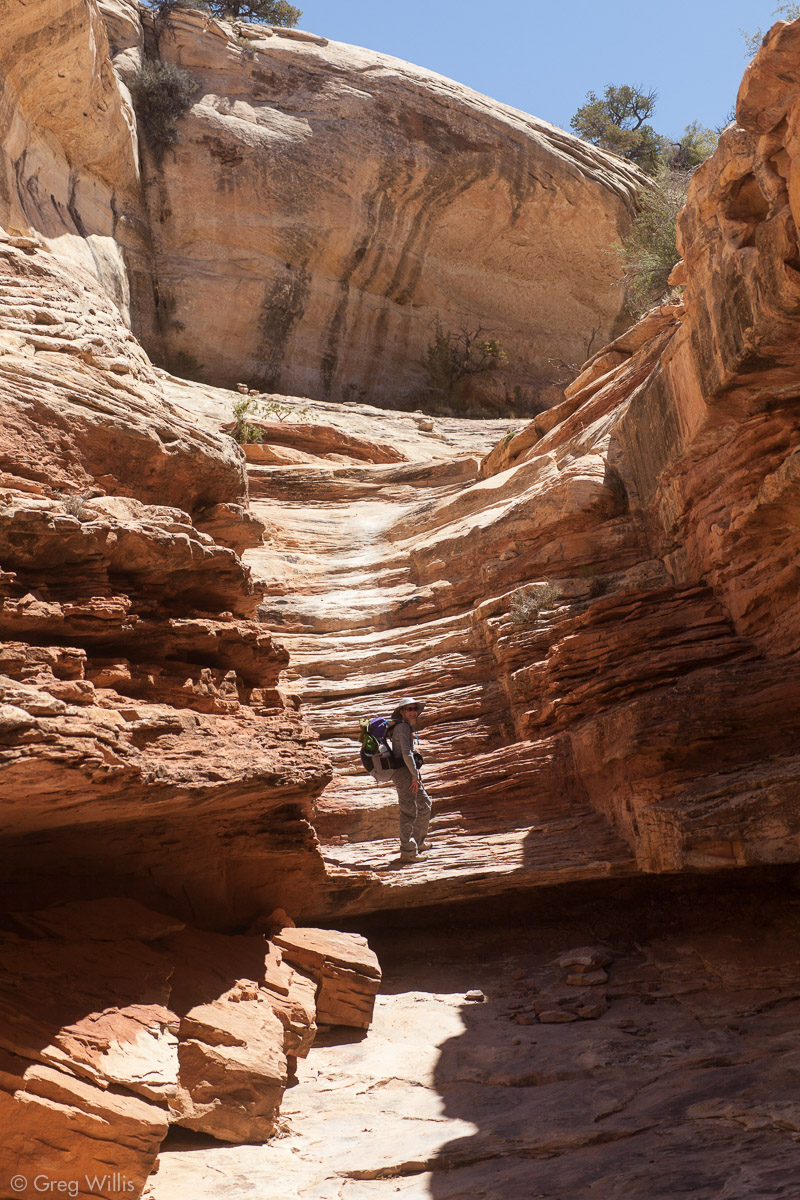
Perfect Kiva was the final ruin of our hike, but we still had to wend our way out of Bullet Canyon. It had more rock than Kane Gulch, and was more interesting to walk.
The bike we stashed at the Bullet Canyon trailhead was still there (yay!), so I left H with the gear and rode the 8.2 mi / 13.2 km back to the ranger’s station to fetch the car. Showers and beers beckoned, as they do, so after I picked up H we sped along that same stretch of highway 261 we drove years ago. This time knowing how deep the history was that lay on either side of the road.
- When: 1-3 May 2013
- Start Trailhead: Kane Gulch
- End Trailhead: Bullet Canyon
- Distance: 23.0 mi / 37.0 km
- Total Time: 8:15 hrs
- Ruins Visited: 9
- Total Ruins Seen: at least 20

2 Comments