Lipan Point to Tanner Rapids via Tanner Trail
- Grand Canyon Escalante Route: Part 1
- Grand Canyon Escalante Route: Part 2
- Grand Canyon Escalante Route: Part 3
5 May 2019
We loaded our packs then ourselves into the taxi in the parking lot of Grandview Point, where we left our car. At 08:00 the taxi dropped us at Lipan Point, a few miles to the east. Our problem for the next 5 days would be getting back to the car via the bottom of the canyon.
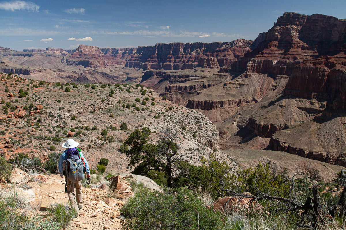
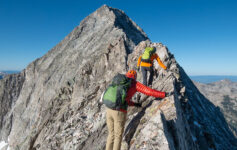
Pretty much the only item on our to-do list for this first day was to get to the Colorado River. We were taking the Tanner Trail down Tanner Canyon to Tanner Beach right next to Tanner Rapids. The trail wastes no time at all getting down to the business of getting down — losing around 2,000 feet in less than 1.5 miles. Footing wasn’t bad and there’s a rock-fall field to work your way through to keep it interesting.
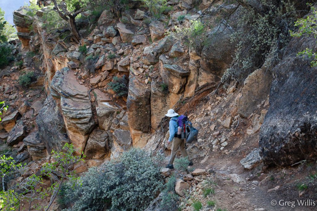
H descending the Coconino sandstone 
Near the Seventyfive Mile Canyon Saddle 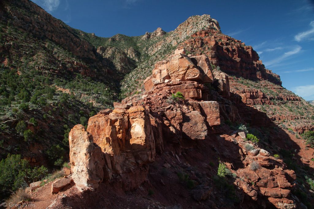
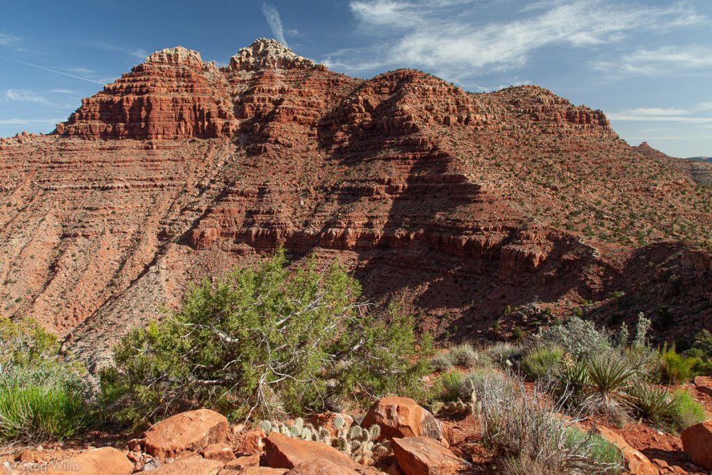
Looking Up to Lipan Point 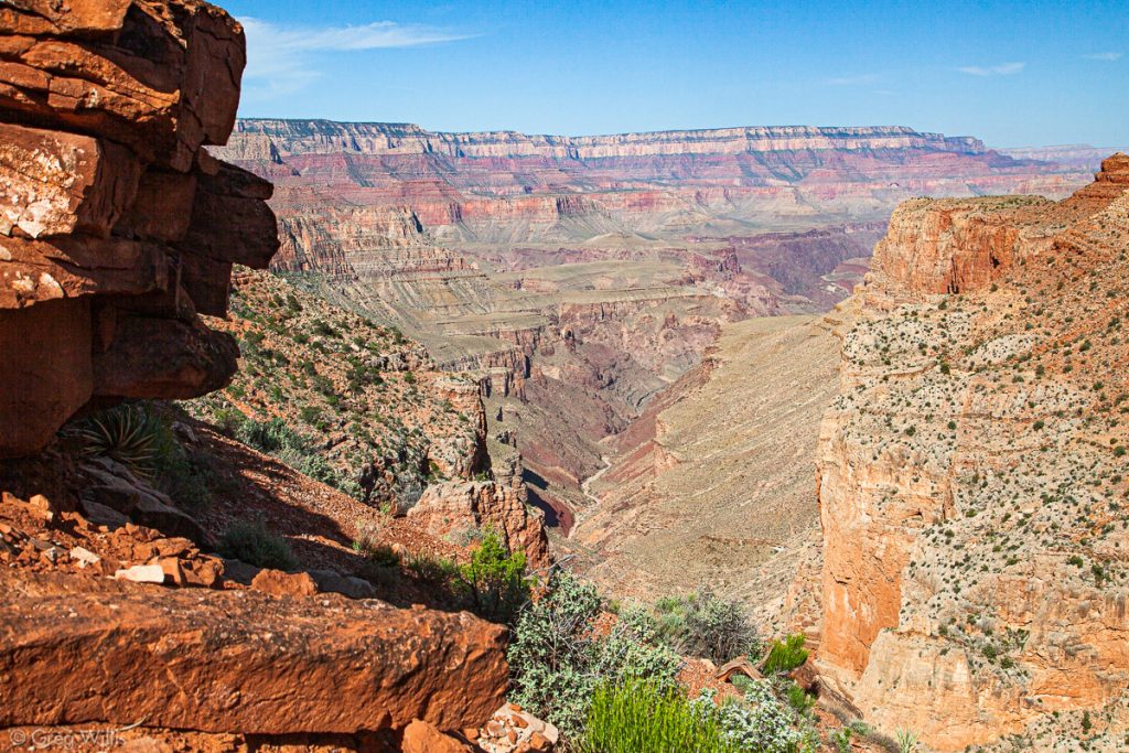
Seventyfive Mile Canyon 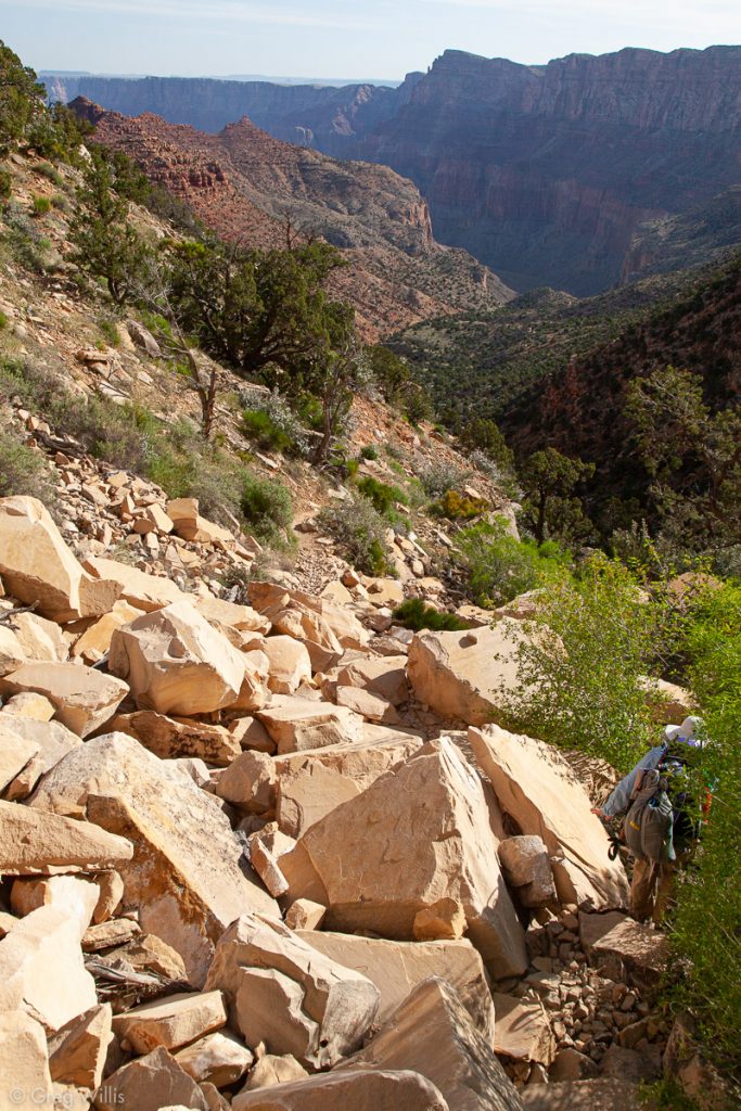
Rock-fall on Trail

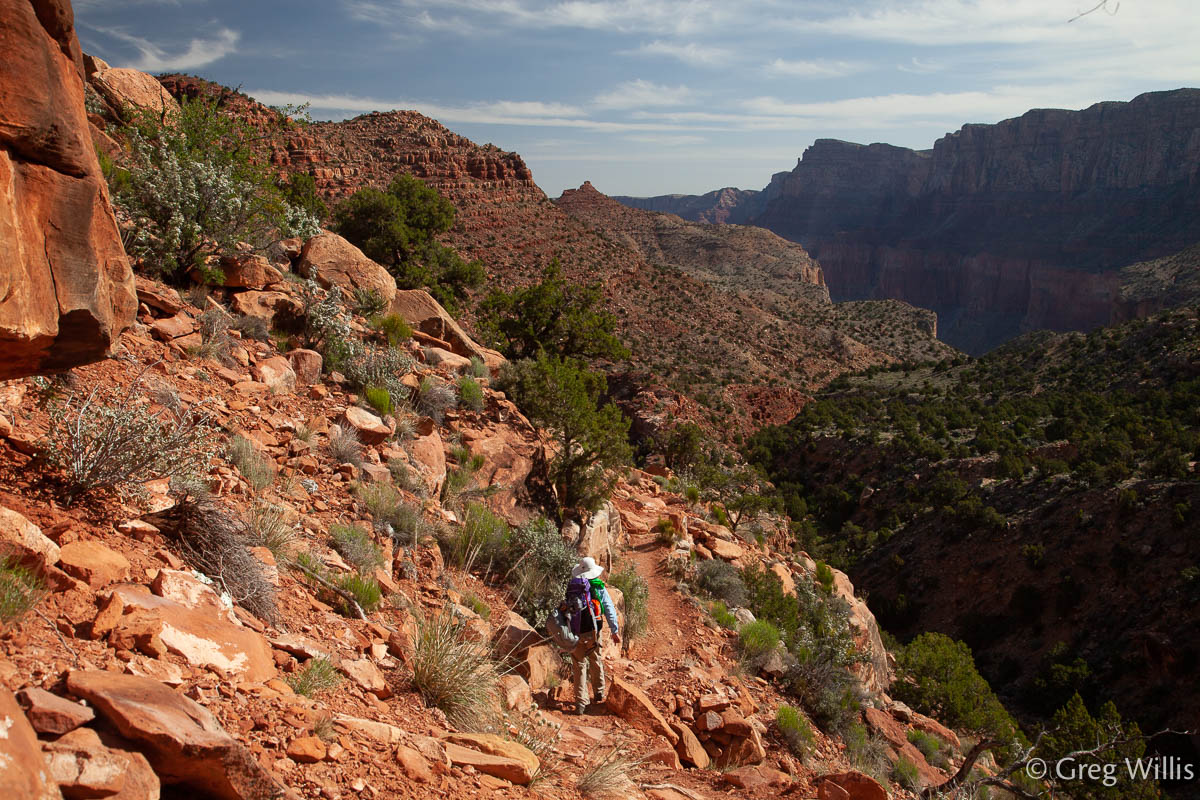
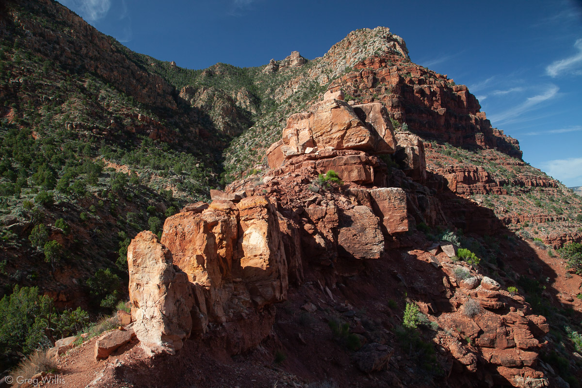


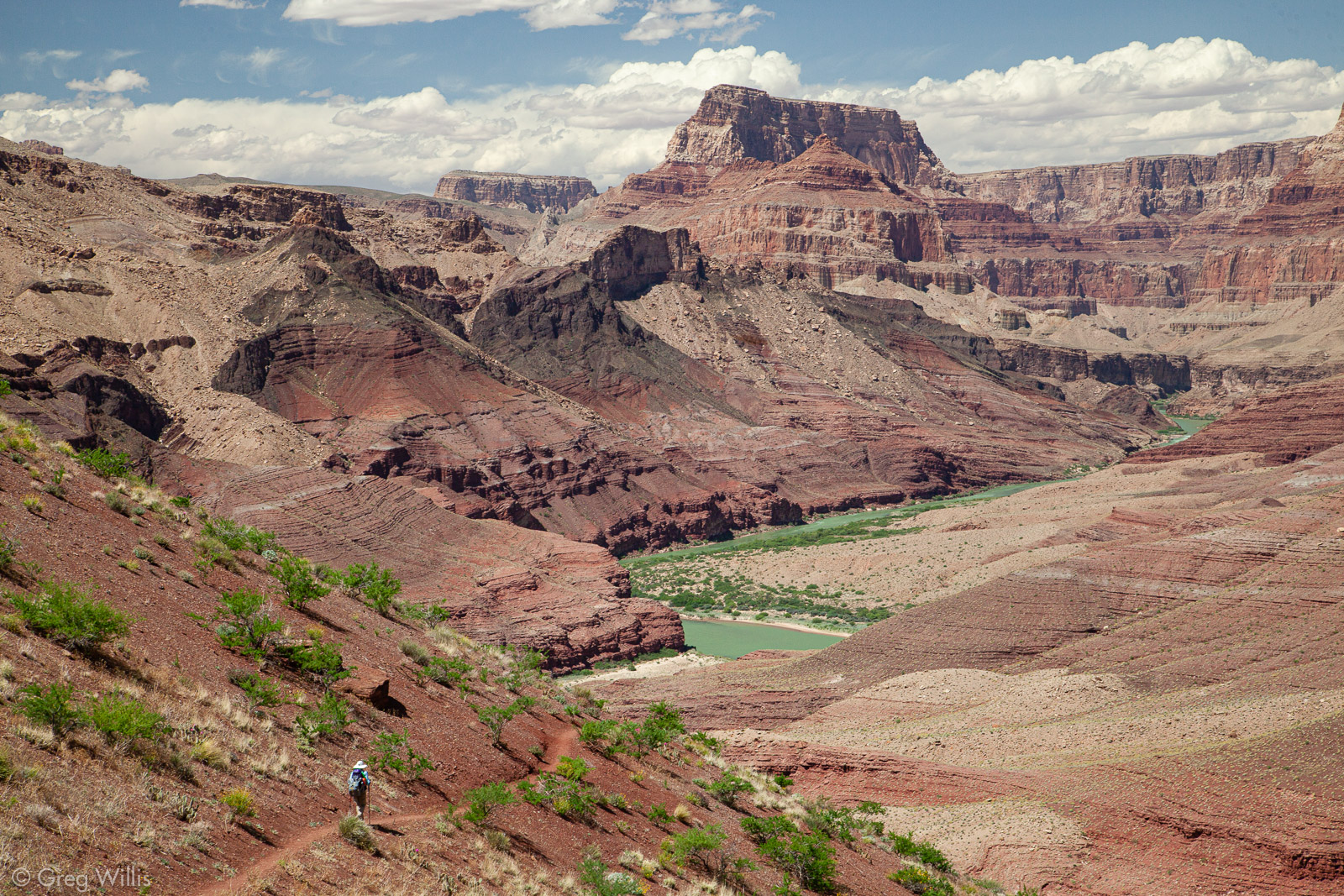
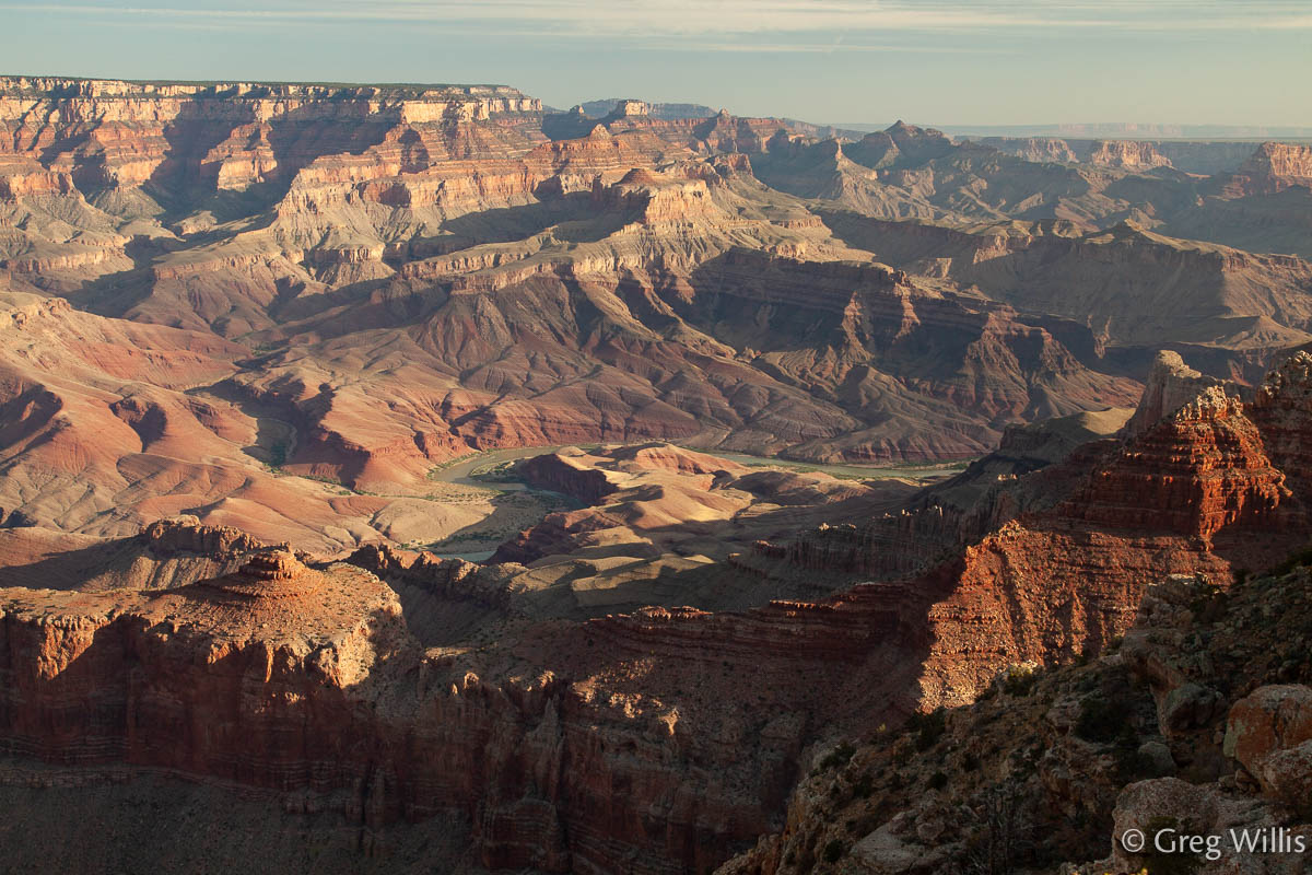
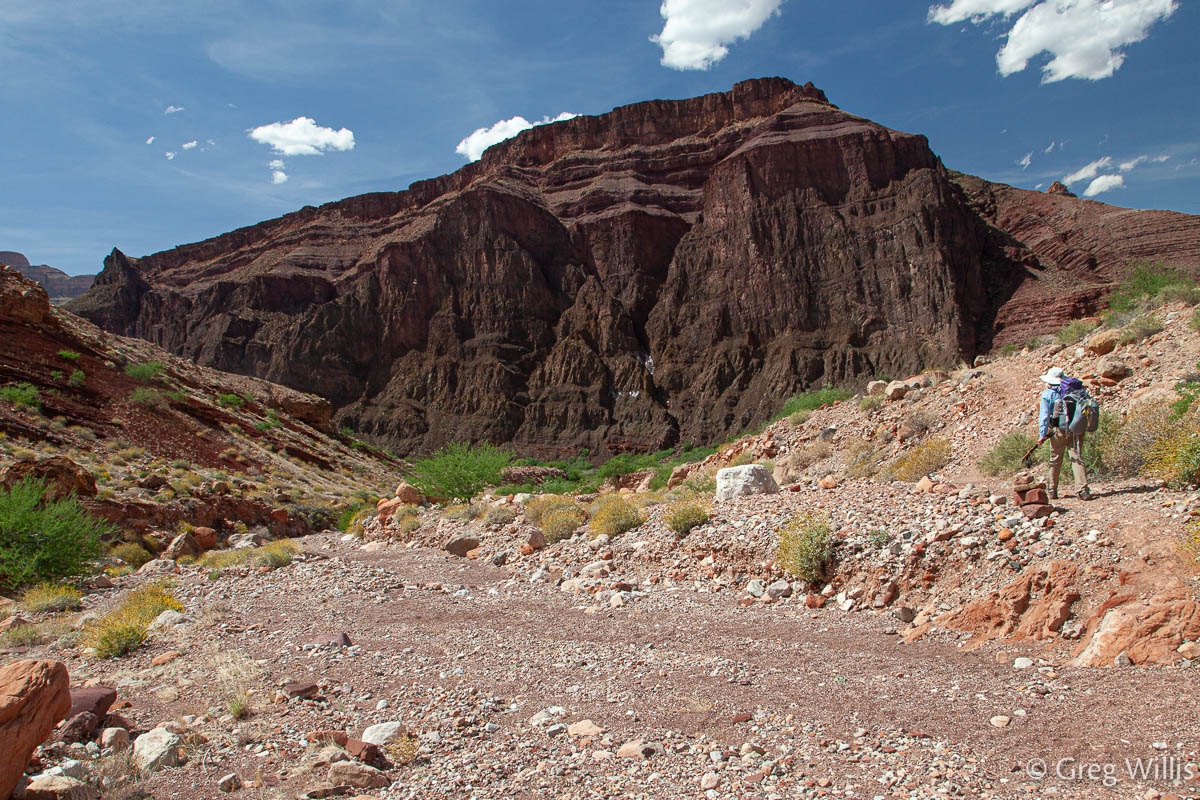
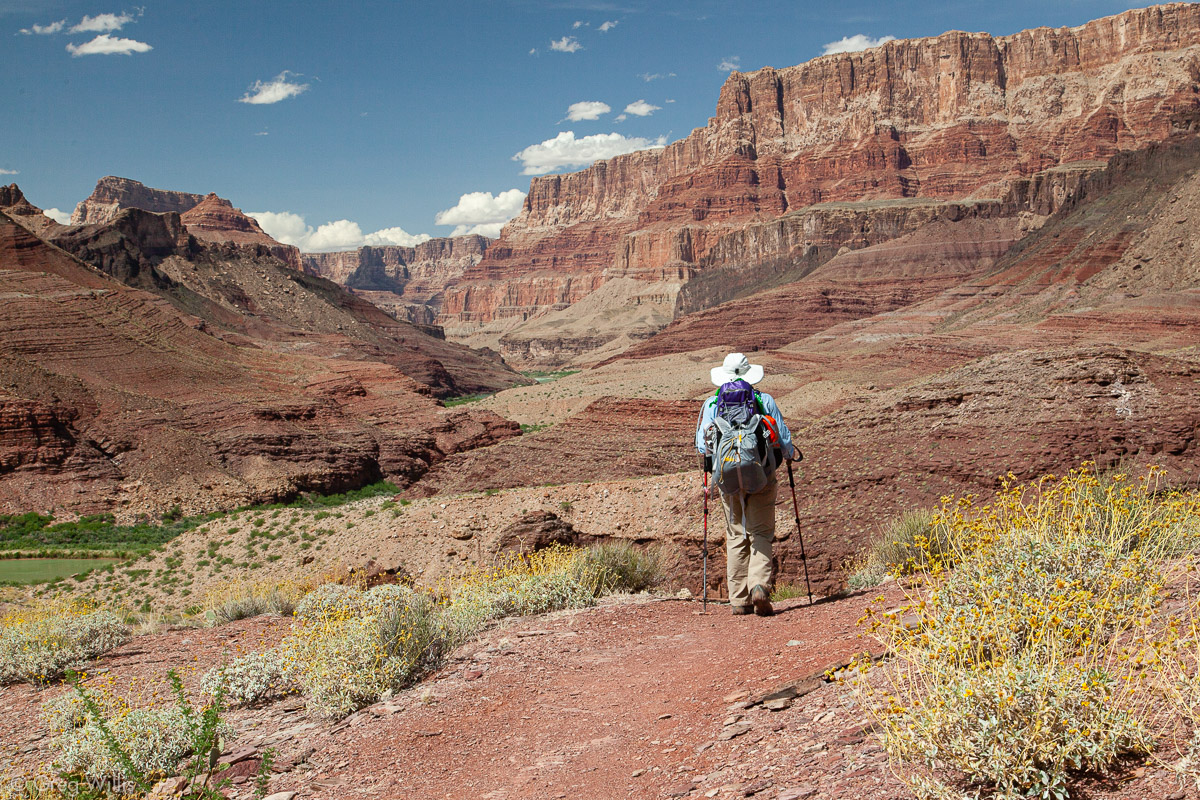
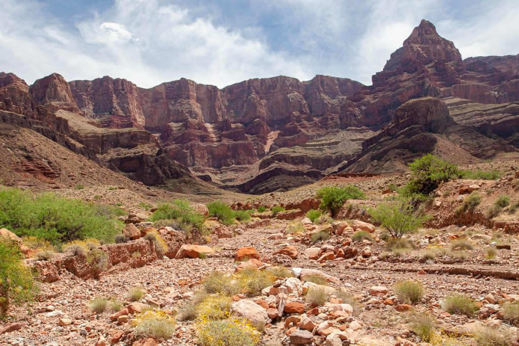
At the saddle above the head of Seventy-five Mile Canyon the trail eases, and for the next 2.5 miles the trail stays pretty even as is winds around Escalante and Cardenas Buttes. We arrived at an overlook at the end of this flat section around 11:30, and took a break for lunch. This was the first time since Lipan Point where we could see the river — and it was both much closer than before yet still so far away. And after being hidden by the buttes, the expanse of the canyon finally opened itself to us.
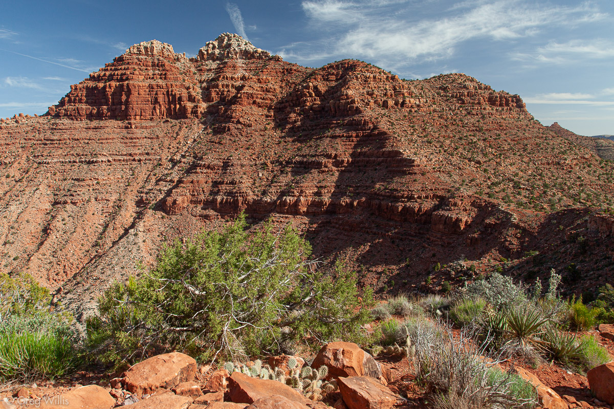
Escalante Butte 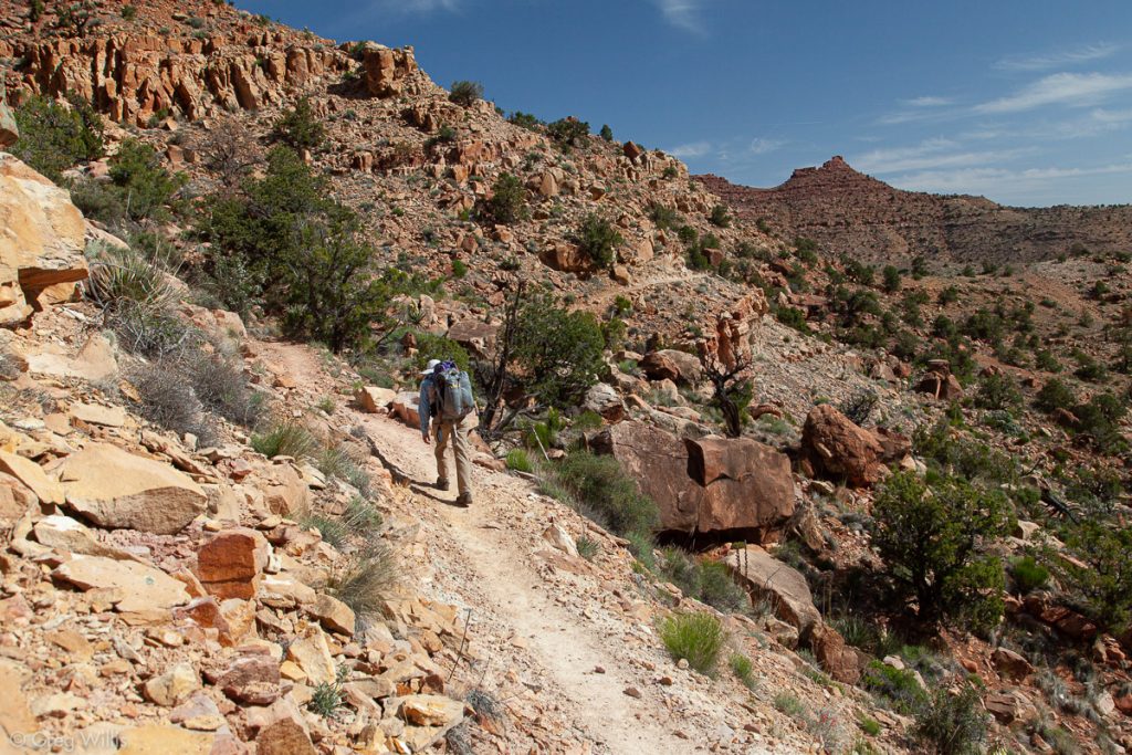
Trail around the Buttes 
Tanner Trail 
Colorado River 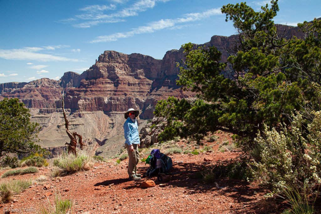
Shade for the Lunch Break

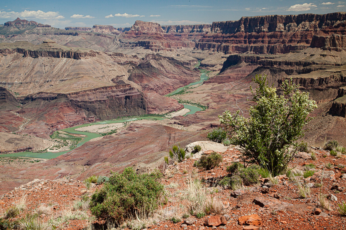

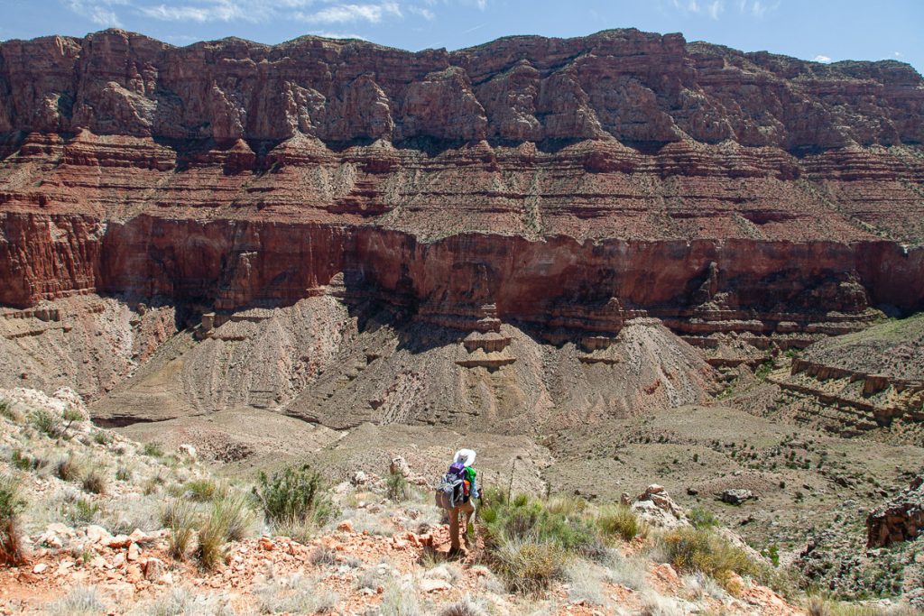
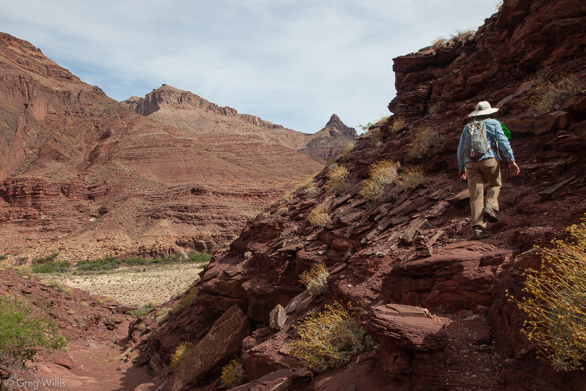
It was a nice break, that flat section around the buttes. But the river wasn’t going to come up to us, so we started down the last 3,000 feet. This section had steeper parts and not-as-steep parts, but it all went relentlessly downward. The rim grew more distant as we made our way through the layers of rock.
Palisades of the Desert 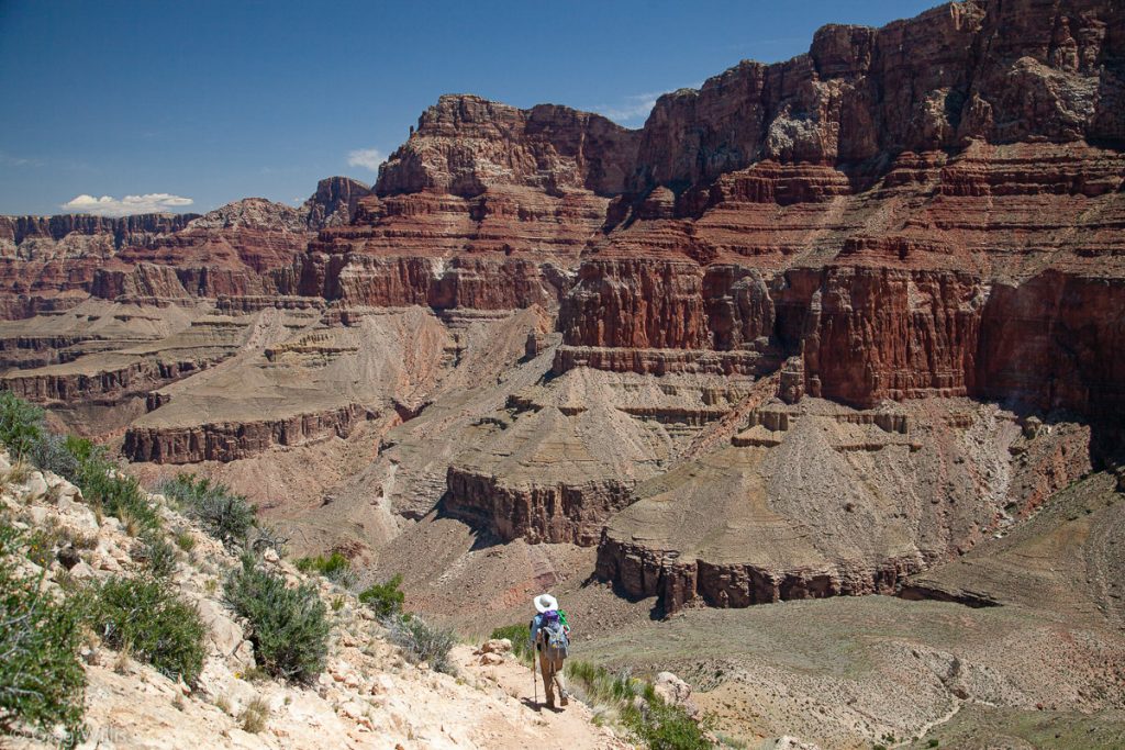
Palisades of the Desert 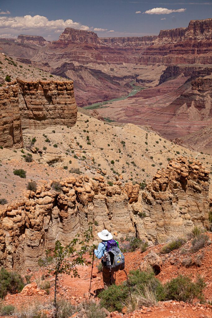
Tanner Trail 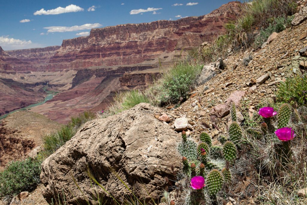
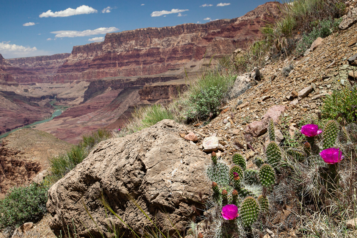
Cactus Flowers 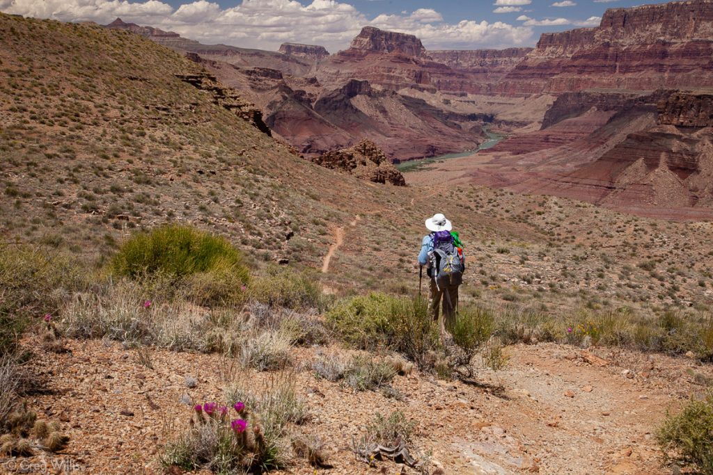
Trail Keep Heading Down


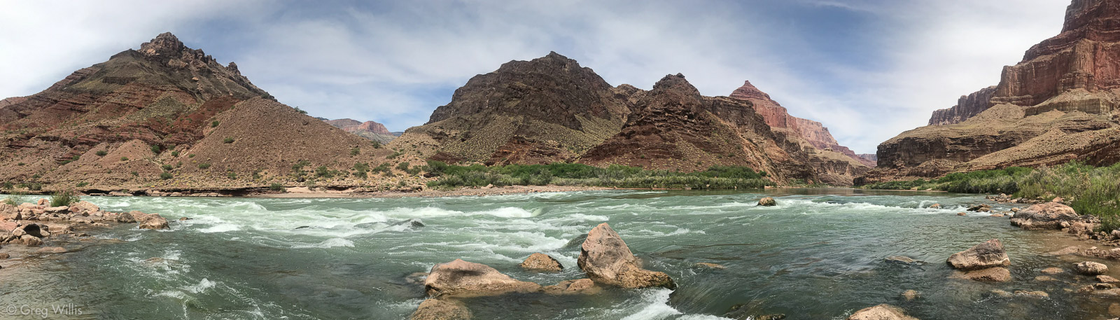
The lower we got the hotter it became, and the lack of shade made the four hours feel a lot longer. And full packs on a mile descent didn’t make our legs feel any better. But eventually the roar of the rapids grew louder, then after a couple of turns, there we were. We found an excellent campsite right by the rapids with a dramatic view of Comanche Point. And our day was over.

Tanner Creek Crossing 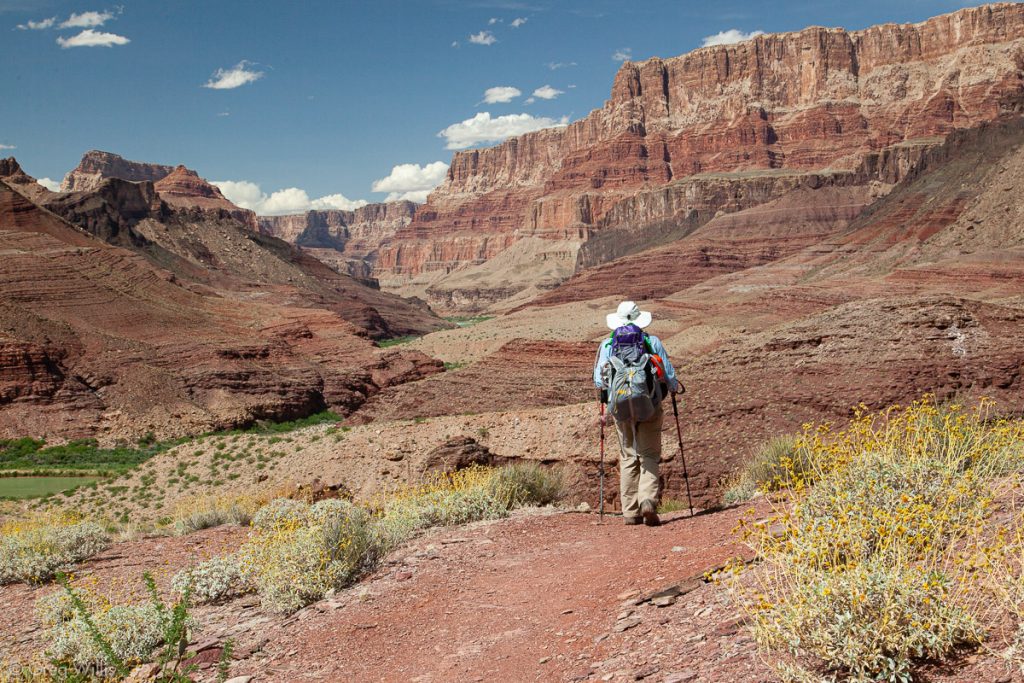
Tanner Trail, Nearing the River 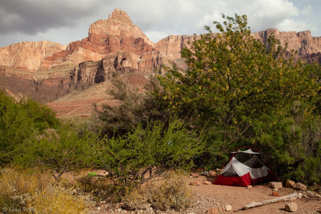
Tanner Rapids Campsite

- When: 5 May 2019
- Distance: 8.0 mi
- Elevation: -4,760′
- Time: 8:00 hrs
- Others on the Trail: 10
Lava Falls and back via Beamer Trail
6 May 2019
This day was a recovery day, of sorts. We felt every foot of the previous day’s mile descent, so this day was a fairly level jaunt upriver to Lava Falls. We left our big packs behind, only taking little day bags with water and essential supplies.
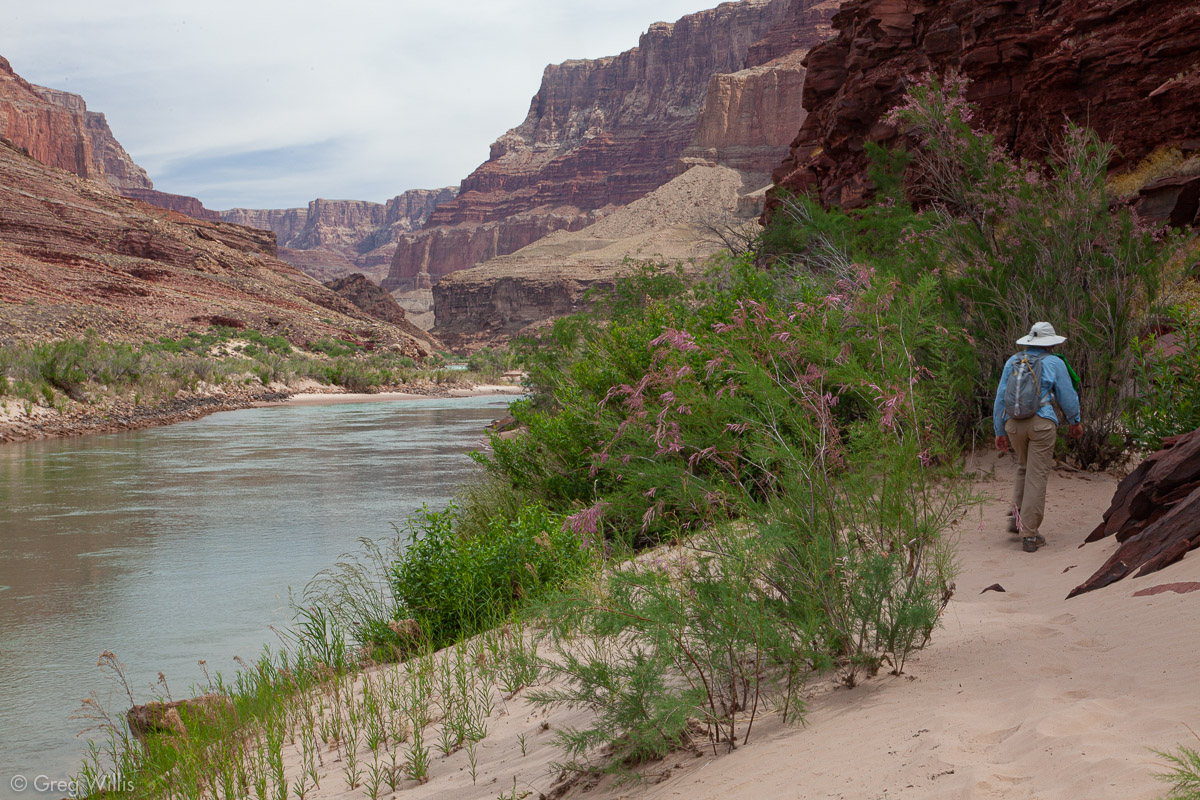
Upstream from Tanner Rapids & camp, the river takes a hard bend against some cliffy rock. The trail, of course, goes over this rock so the start and end of our day hike had some ups and downs maneuvering over this landscape. But beyond, the trail followed beside the Colorado making this one of the few stretches of our trip that we simply walked along the river.

Climbing up from Tanner Rapids 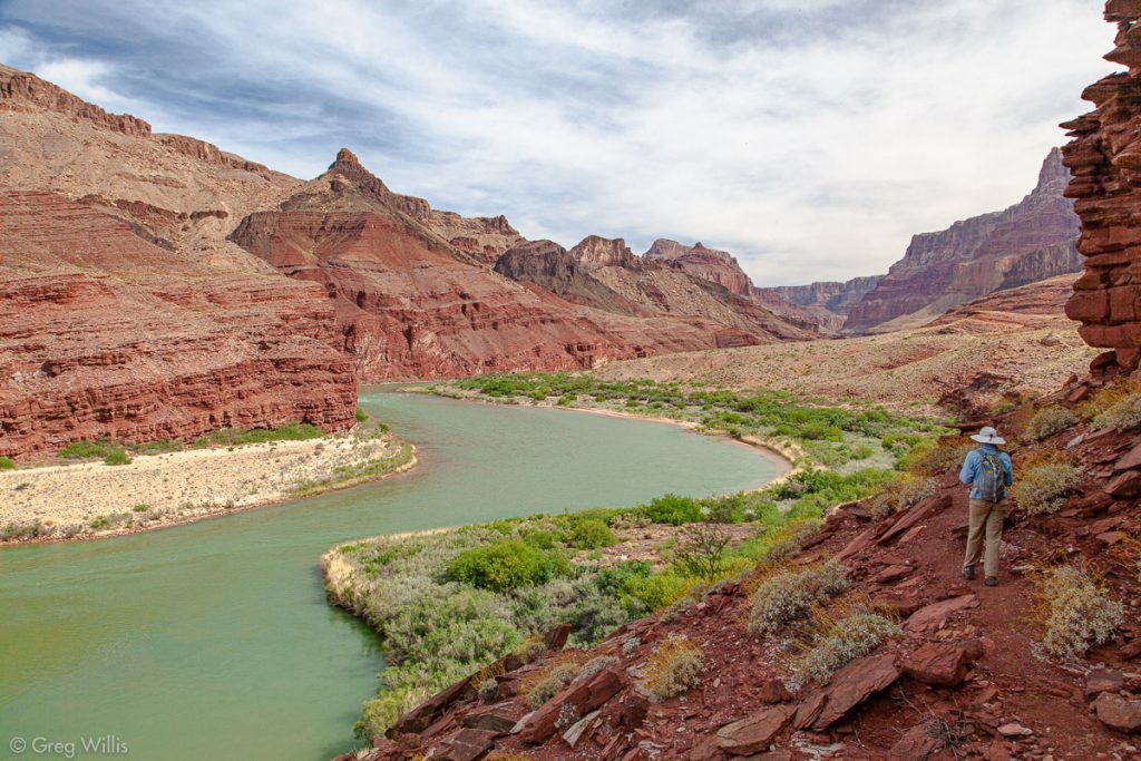
Beamer Trail 
Heading to Lava Falls 
Lava Canyon Rapids

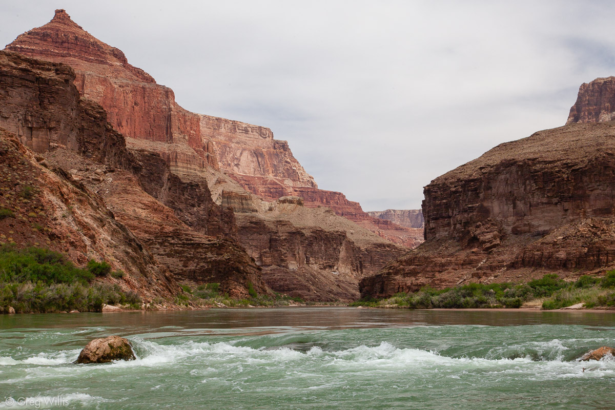
When we got to Lava Falls, we could see a bit into the Marble Canyon in the north, but this was as far as our hike went today. We propped ourselves on a rock had lunch.
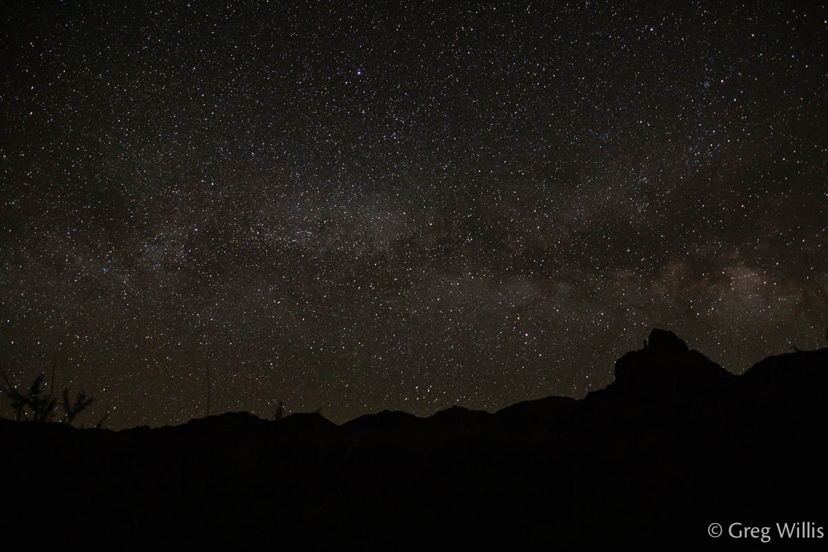
The light was just great on the way back. The early end of the day gave up plenty of time to get gear & supplies ready for tomorrow, as well as chilling in the shade and watching the boats go downriver. I was even inspired to get up in the middle of the night to get a photo of the Milky Way rising over Comanche Point.
Palisades of the Desert with Comanche Point 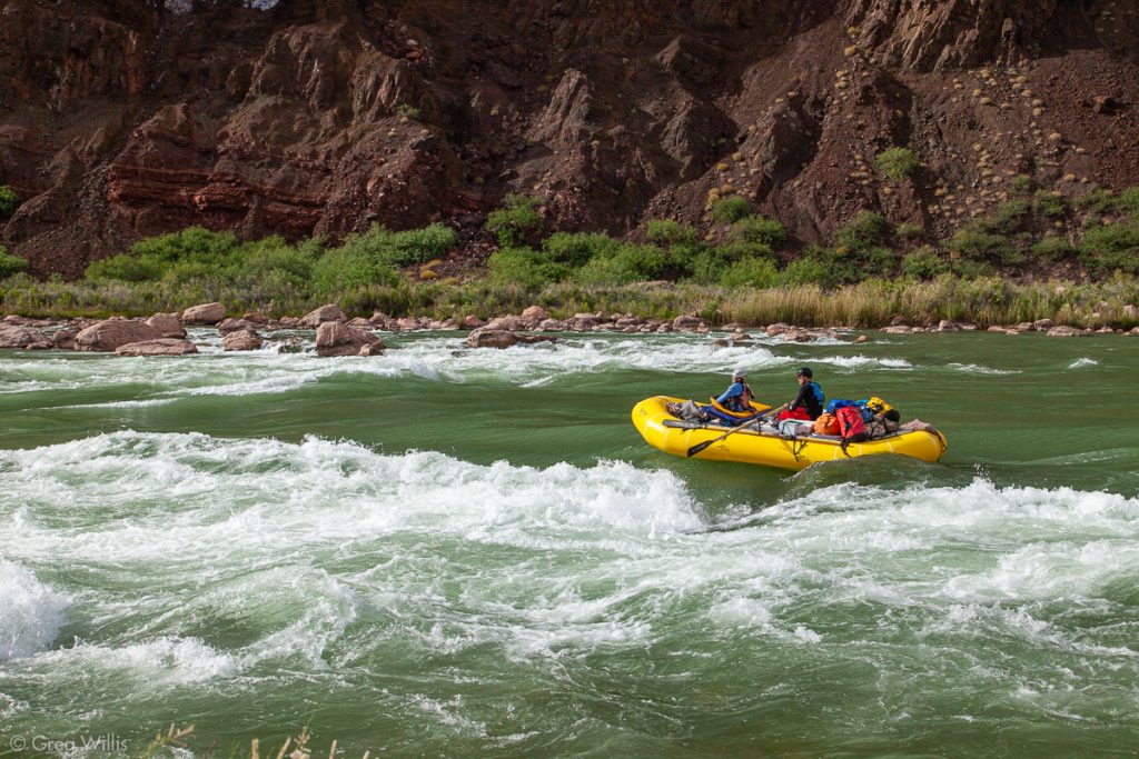
Boat in Tanner Rapids 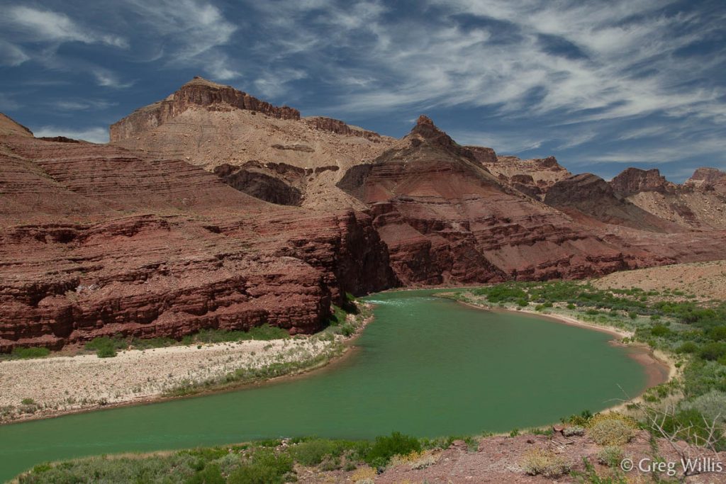
Colorado River Upstream from Camp 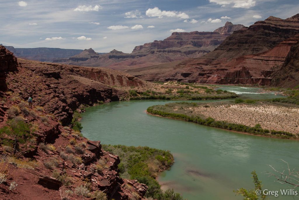
Colorado River w/ H on Trail 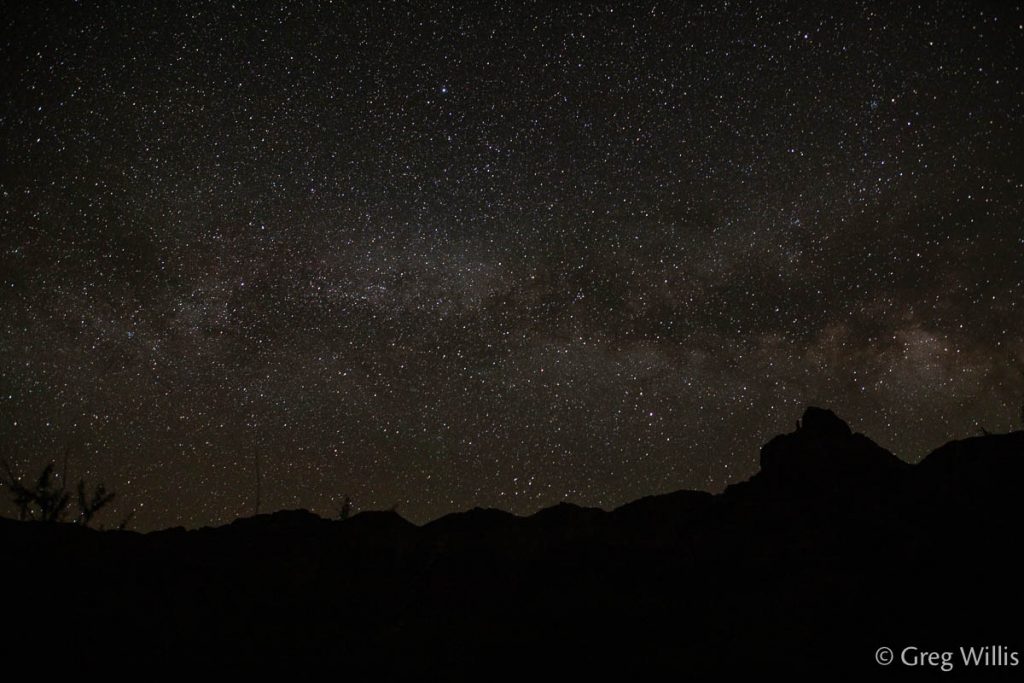
Milky Way Rising above Comanche Point


Our two nights at Tanner Rapids were actually relaxing, which was good. The next couple of days were going to be difficult.
- When: 6 May 2019
- Distance: 7.0 mi
- Elevation: 200′
- Time: 4:15 hrs
- Others on the Trail: 0

1 Comment