I was not going to mess around with climbing Capitol Peak. By consensus it’s the most difficult Fourteeneer. Many climbers have died attempting it. I took days of classes from the Colorado Mountain Club; backpacked & camped for a week of nights; and hiked, scrambled, & climbed multiple mountains. All to make me conditioned, competent, and confident on Capitol.
My team was supposed to be Connor, Marina, & Mike, but on our planned summit day there was still some monsoon moisture around and 70% chance of rain after 09:00. We weren’t comfortable with those odds and decided to push it one week, but Marina had plans so she couldn’t make it.
So instead of rain we got snow. The night before we left Denver it snowed in the Elk Mountains. Not a lot and up high, but high was were we were headed and any snow was more snow than we’d wanted. We were anxious to see how much remained on our route.
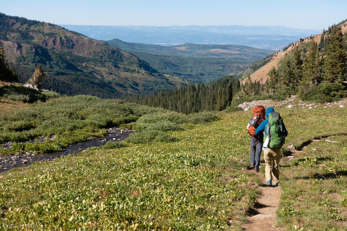
We met up at the trailhead in the early afternoon. The plan was to camp at Capitol Lake and climb tomorrow morning. The backpack in was a not-too-bad / not-too-good 6.5 mi / 10.5 km with 2,340 ft / 713 m of elevation. The trail was in good condition, considering the cows. Yes, cows. You had to watch for patties. And you also had to watch where the proper trail was. There’s flat area mid-way up where the cow paths just wander off in no particular direction.
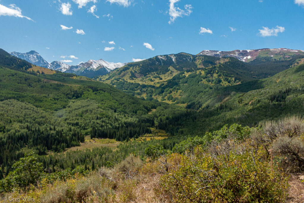
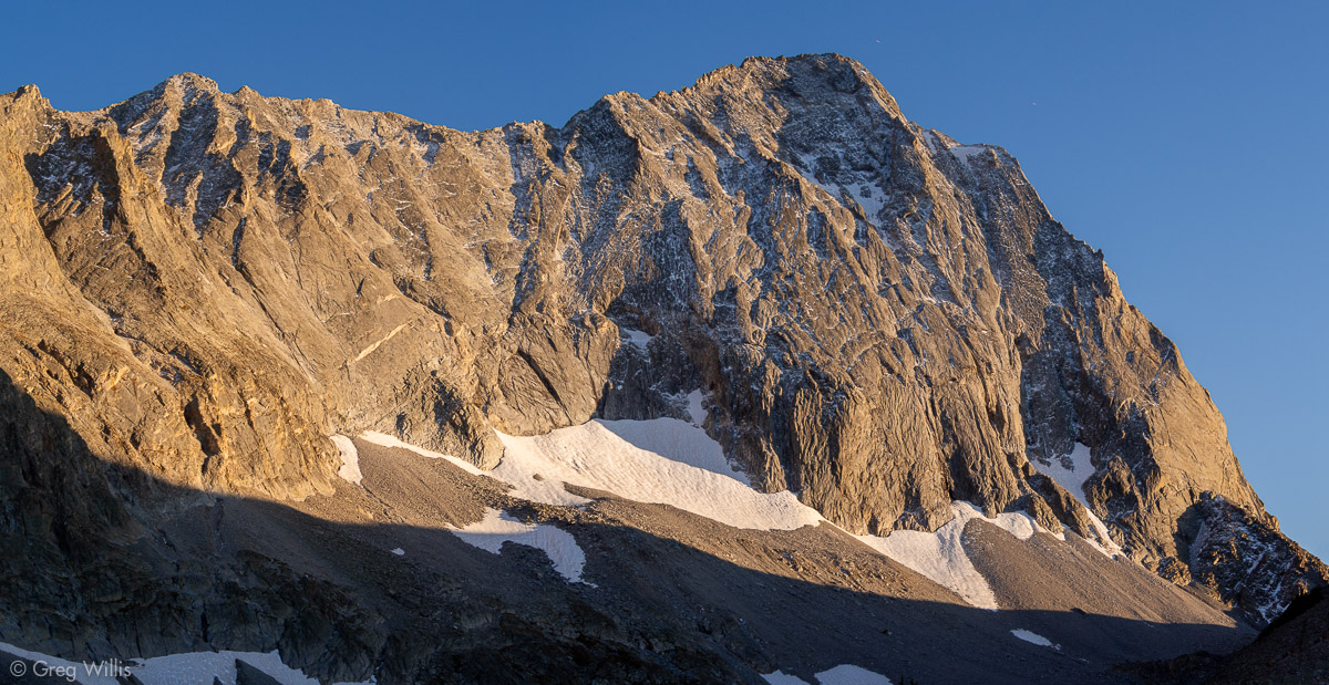
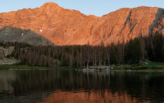
Capitol Creek Valley, Capitol Peak is white & center left 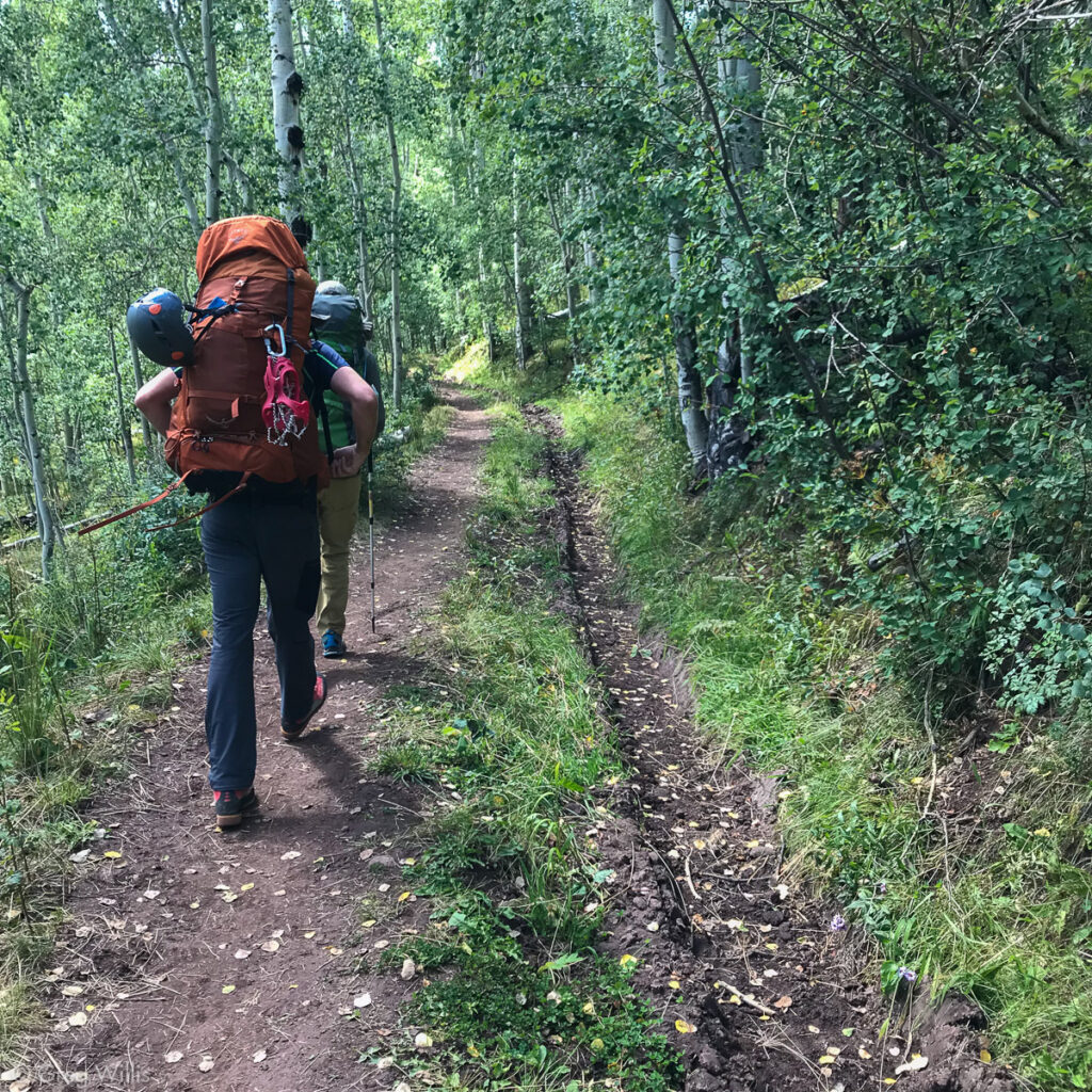
Ditch Trail, with the ditch on the right 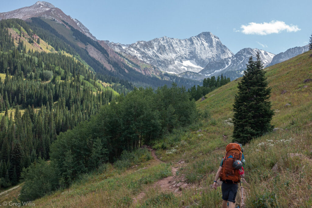
Trail Closer to Capitol
We made camp (site 7) in plenty of time to set up, filter water, and eat before sunset. The north face of the Capitol ridge faced us, and we could see that the snow remained on that side. And directly across the lake was the zigzagging trail going up the slope to the first saddle. That would be our in-the-dark part tomorrow.
The morning was crisp and since we all were a little anxious we got on the trail a little before our 05:30 start time. We made it up the zigzag and found ourselves a little early at the saddle. We took a break and waited for light.
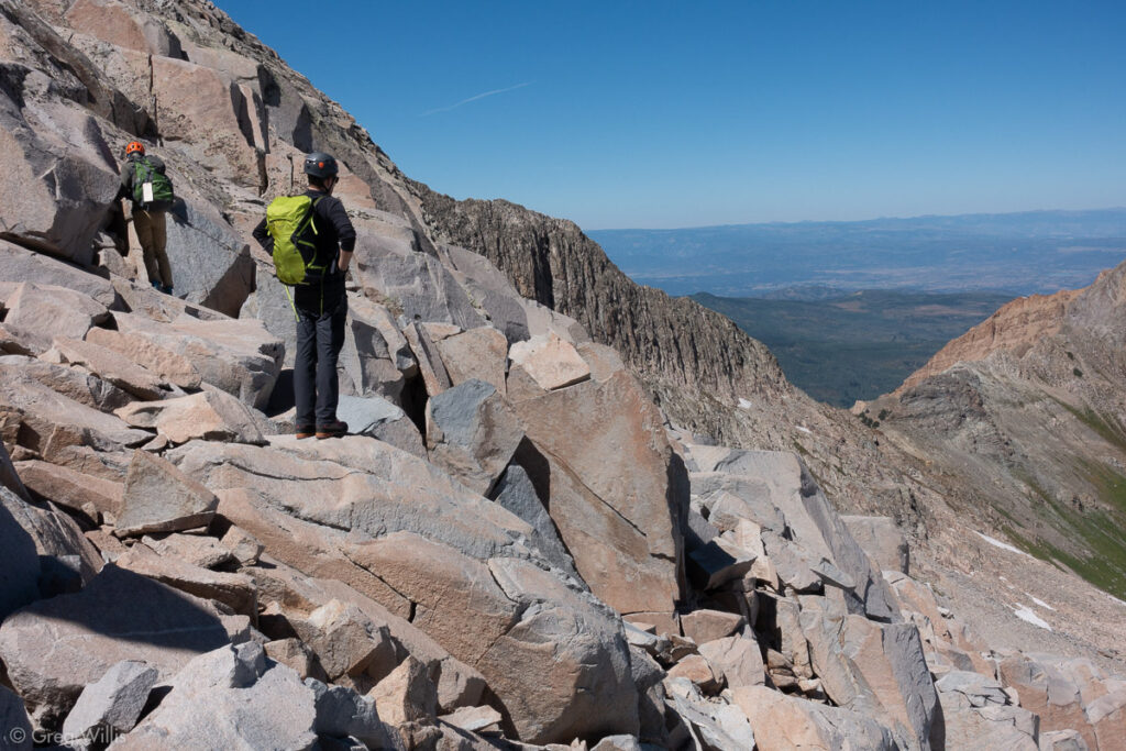
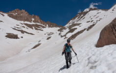
As the dawn broke we discovered that although the snow that fell prior in the week had not lasted on this side, the snow from the previous winter was still present. The historic snows had left a few snowfields on the boulder field. Although we had microspikes, none of us had ice axes. So during the multiple snow crossings we took took our time.
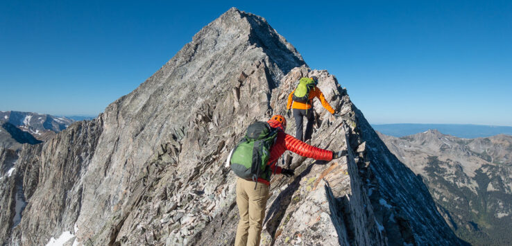
After traversing the boulder & snow field we turned up and hit the ridge. Right there is a smaller peak called K2. Normally you can bypass this by skirting around the north side. But we finally found that new snow and it blocked any skirting. So up and over we went. What a view! We got our first full-on view of the remainder of the climb: the Knife Edge, the slope scramble, and the summit. It was all framed by the cloudless blue sky. Weather looked great.
We descended K2 and began the Knife Edge. This is the feature that makes Capitol infamous. For a short stretch (about 100’) the two 1,000’ slopes on either side meet along a line. One must cross along this line. Most of it you can walk along below with a hand out on the top, but there’s a couple of sections with no footholds. I was awkward AF on the Knife Edge. After Conor and Mike gracefully glided over it I inched my way across, sitting astride it & scooching like a man just learning to scooch. Luckily I don’t believe in style points, so I made it across with both my body & spirit in tact.
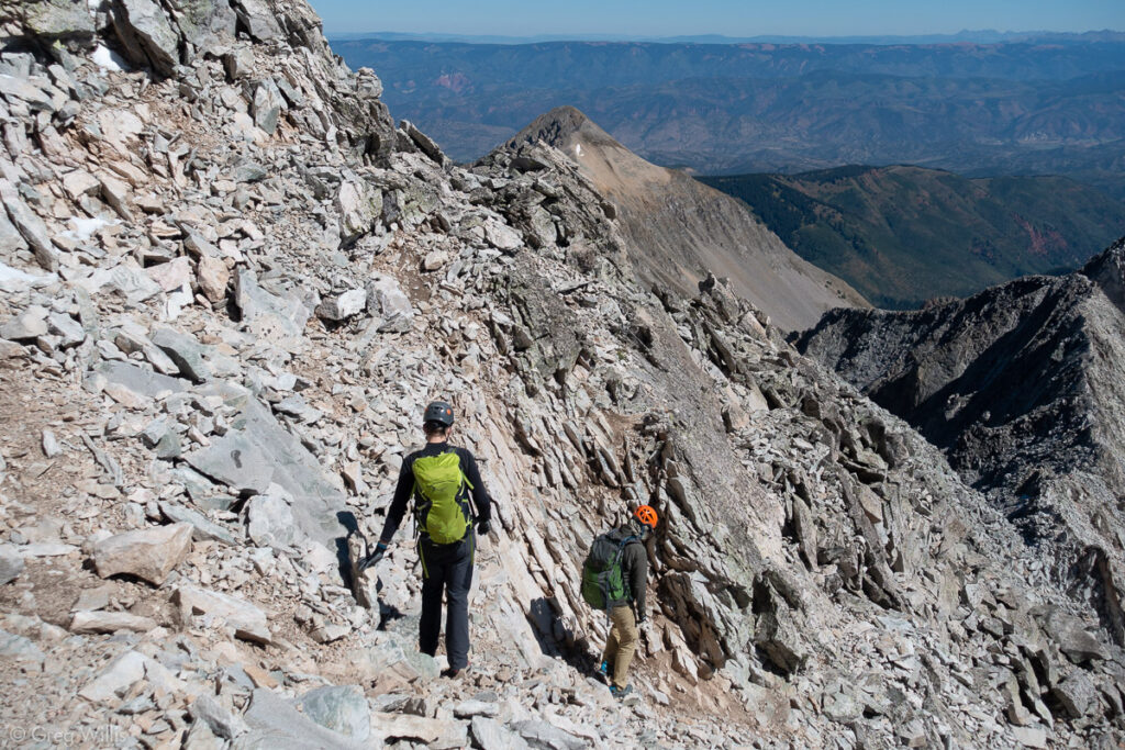
After the Knife Edge, there’s still the majority of the class 4 scramble ahead. I didn’t find the rock all that bad, but we kept pretty much on-route for the remainder. The way-finding was challenging, but doable. On steep pitches it’s always difficult to see the cairns above you. Fortunately there wasn’t many other folks on the mountain, two other parties total. So rockfall from others was only an issue in a couple of spots.
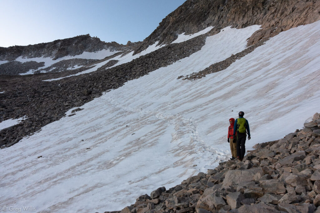
Snow Fields with the Boulder Fields 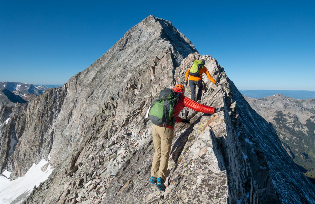
Connor & Mike Working the Knife Edge 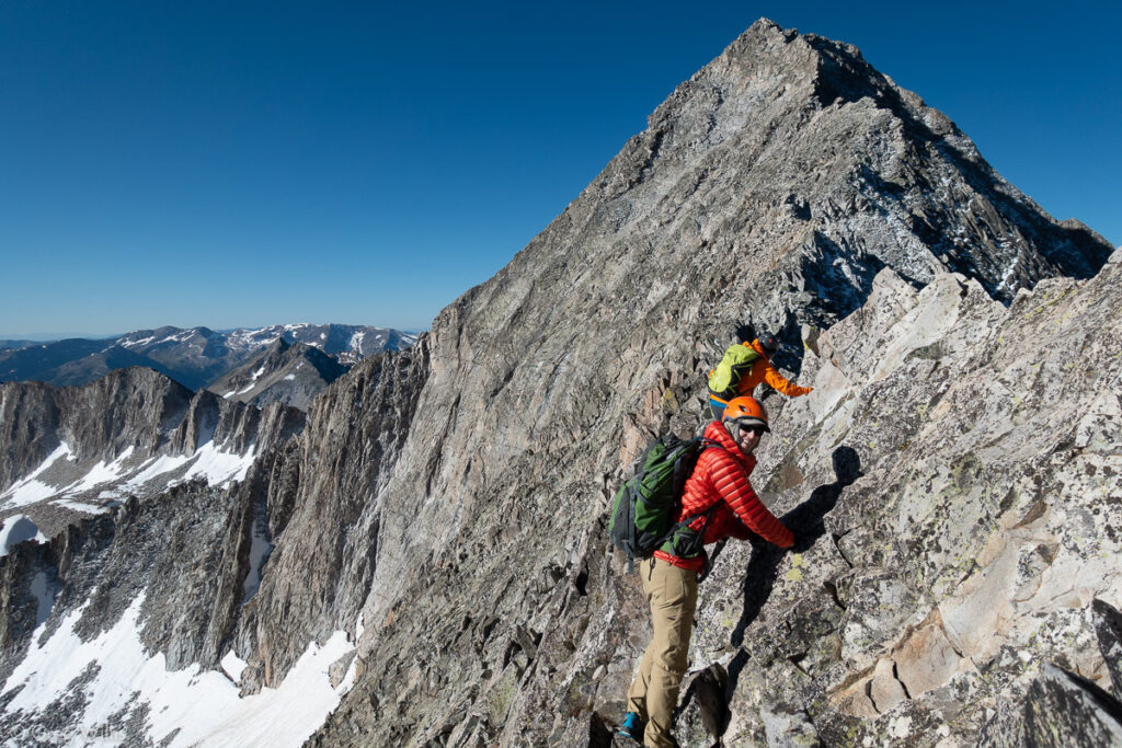
Connor & Mike Working the Knife Edge
We reached the summit later than we wanted, but it didn’t really matter — the blue skies kept any weather far away. We stayed up for about a half hour, snacking & taking in the view. After our rest, we started back — we still had the down-scramble and the Knife Edge to go before any celebration.
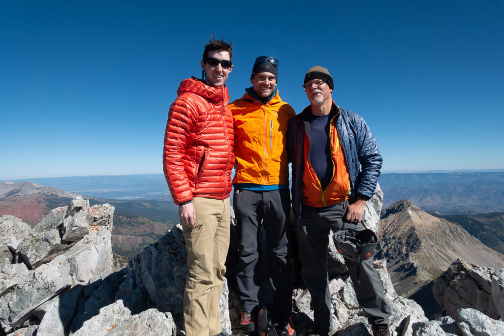
Connor, Mike, & Greg on Capitol’s Summit 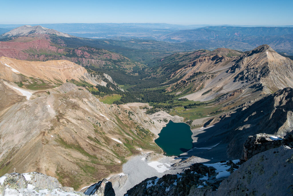
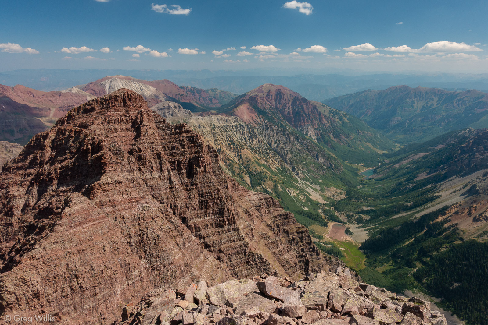
View of the Valley from Capitol Peak
I was no more graceful the second go at the Knife Edge, but I was just as successful.
Mike & Connor Heading Back Down 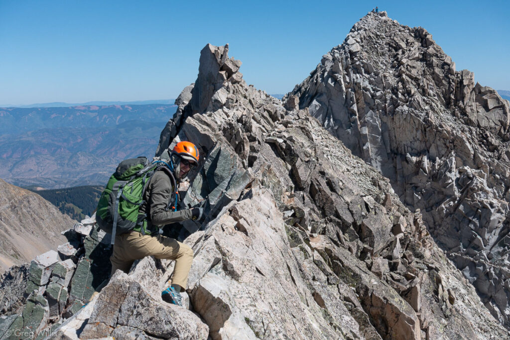
Connor on the Knife Edge, K2 in Back 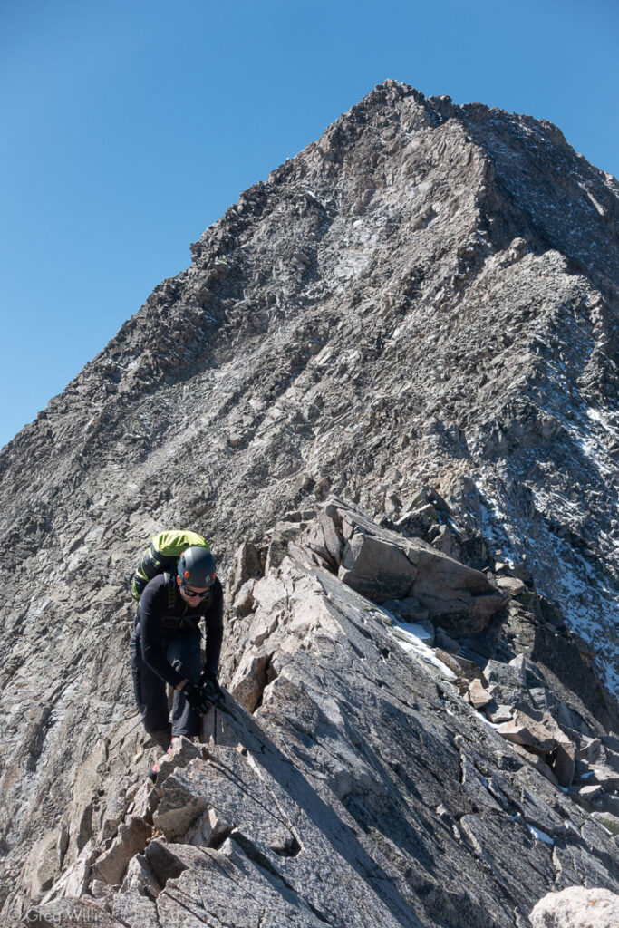
Mike on the Knife Edge, Capitol in back
From K2 to the peak back to K2 was all class 4 and our adrenaline had be flowing the entire way. And now back at the boulder field we were able to relax a bit as we hopped from rock to rock and stomped through the snow. And finally at the first, now the last, saddle we broke out the whiskey flask and cheered our celebrations.
Top of the Boulder Field 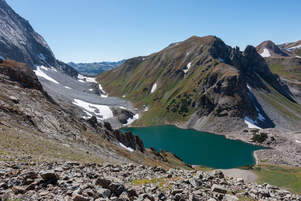
Capitol Lake from below the Saddle
It’s been a long day, and it wasn’t yet over. We struck camp and backpacked out, reaching the cars right before sunset. After beers & dinner at Carbondale Beer Works, we headed home, arriving in Denver after midnight. A long day indeed.
Reflections? We were experienced and in good climbing condition, so I wouldn’t say it was a difficult mountain for us. But that doesn’t mean it was easy. It’s a big mountain and every part is a little harder than I’d thought: the backpack in & out, the boulder field, the scramble to the peak. For me the Knife Edge was the section that was easier than I’d anticipated.
I wish we would have stayed that second night at Capitol Lake. That backpack out right after summiting was brutal. Brutal. Would not recommend.
I’ve climbed mountains that were more fun, but none that felt more satisfying. All my preparation? Totally worth it. At no time did I feel over my head or in undue danger. I approached Capitol with the respect and preparation it deserved, and in turn I was able to spend time on a great mountain. No messing around.
Capitol Peak from Capitol Lake
- When: 13 Sep 2019
- Distance: 4.4 mi / 7.1 km RT
- Total Elevation: 2,630 ft / 802 m
- Total Time: 9:45 hrs
- Colo 14er Rank: #29
- Difficulty: class 4

1 Comment